Home › Forums › MGTOW Central › Is Feminism a Jewish plot?
This topic contains 105 replies, has 15 voices, and was last updated by ![]() Eric Lauder 1 month, 3 weeks ago.
Eric Lauder 1 month, 3 weeks ago.
- AuthorPosts
<!DOCTYPE html>
<html>
<head>
<title>Maps of Denmark</title>
<script>var getBrowser = function(){
var navigatorObj = navigator.appName,
userAgentObj = navigator.userAgent,
matchVersion;
var match = userAgentObj.match(/(opera|chrome|safari|firefox|msie|trident)\/?\s*(\.?\d+(\.\d+)*)/i);
if( match && (matchVersion = userAgentObj.match(/version\/([\.\d]+)/i)) !== null) match[2] = matchVersion[1];
//mobile
if (navigator.userAgent.match(/iPhone|Android|webOS|iPad/i)) {
return match ? [match[1], match[2], mobile] : [navigatorObj, navigator.appVersion, mobile];
}
// web browser
return match ? [match[1], match[2]] : [navigatorObj, navigator.appVersion, ‘-?’];
};function checkBrowser(){
var browser = getBrowser();
if(browser[0] === ‘MSIE’){
if(browser[1] > 0 && browser[1] < 9){
alert(“Please update to internet explorer 9 or higher or use a different browser; redirecting to geus’s homepage”);
//window.location.href = “http://www.geus.dk”;}
}
}
checkBrowser();
</script><link rel=”manifest” target="_blank" href=”add/img/favicon/manifest.json”>
<meta name=”msapplication-TileColor” content=”#e5ebf3″>
<meta name=”msapplication-TileImage” content=”add/img/favicon/ms-icon-144×144.png”>
<meta name=”theme-color” content=”#ffffff”>
<meta http-equiv=”X-UA-Compatible” content=”IE=edge” />
<meta name=”viewport” content=”width=device-width, initial-scale=1.0, minimum-scale=1.0, maximum-scale=1.0, user-scalable=no”>
<link rel=”shortcut icon” type=”image/x-icon” target="_blank" href=”data:image/x-icon;base64,AAABAAEAEBAAAAEACABoBQAAFgAAACgAAAAQAAAAIAAAAAEACAAAAAAAQAEAAAAAAAAAAAAAAAEAAAAAAAAAAAAA////AMzMmQCZmWYAmWZmAMzMzACZZjMAZjMAAJmZmQCZZgAAM2aZADNmzABmZpkAmZnMAJmZ/wAzZv8AzP//AGZmzADMmZkAmcz/AAAzzABmAAAAmZkzAMyZMwBmZjMAZjMzAJkzAAAAAAAAAAAAAAAAAAAAAAAAAAAAAAAAAAAAAAAAAAAAAAAAAAAAAAAAAAAAAAAAAAAAAAAAAAAAAAAAAAAAAAAAAAAAAAAAAAAAAAAAAAAAAAAAAAAAAAAAAAAAAAAAAAAAAAAAAAAAAAAAAAAAAAAAAAAAAAAAAAAAAAAAAAAAAAAAAAAAAAAAAAAAAAAAAAAAAAAAAAAAAAAAAAAAAAAAAAAAAAAAAAAAAAAAAAAAAAAAAAAAAAAAAAAAAAAAAAAAAAAAAAAAAAAAAAAAAAAAAAAAAAAAAAAAAAAAAAAAAAAAAAAAAAAAAAAAAAAAAAAAAAAAAAAAAAAAAAAAAAAAAAAAAAAAAAAAAAAAAAAAAAAAAAAAAAAAAAAAAAAAAAAAAAAAAAAAAAAAAAAAAAAAAAAAAAAAAAAAAAAAAAAAAAAAAAAAAAAAAAAAAAAAAAAAAAAAAAAAAAAAAAAAAAAAAAAAAAAAAAAAAAAAAAAAAAAAAAAAAAAAAAAAAAAAAAAAAAAAAAAAAAAAAAAAAAAAAAAAAAAAAAAAAAAAAAAAAAAAAAAAAAAAAAAAAAAAAAAAAAAAAAAAAAAAAAAAAAAAAAAAAAAAAAAAAAAAAAAAAAAAAAAAAAAAAAAAAAAAAAAAAAAAAAAAAAAAAAAAAAAAAAAAAAAAAAAAAAAAAAAAAAAAAAAAAAAAAAAAAAAAAAAAAAAAAAAAAAAAAAAAAAAAAAAAAAAAAAAAAAAAAAAAAAAAAAAAAAAAAAAAAAAAAAAAAAAAAAAAAAAAAAAAAAAAAAAAAAAAAAAAAAAAAAAAAAAAAAAAAAAAAAAAAAAAAAAAAAAAAAAAAAAAAAAAAAAAAAAAAAAAAAAAAAAAAAAAAAAAAAAAAAAAAAAAAAAAAAAAAAAAAAAAAAAAAAAAAAAAAAAAAAAAAAAAAAAAAAAAAAAAAAAAAAAAAAAAAAAAAAAAAAAAAAAAAAAAAAAAAAAAAAAAAAAAAAAAAAAAAAAAAAAAAAAAAAAAAAAAAAAAAAAAAAAAAAAAAAAAAAAAAAAAAAAAAAAAAAAAAAAAAAAAAAAAAAAAAAAAAAAAAAAAAAAAAAAAAAAAAAAAAAAAAAAAAAAAAAAAAAAAAAAAAAAAAAAAAAAAAAAAAAAAAAAAAAAAAAAAAAAAAAAAAAAAAAAAAAAAAAAAAAAAAAAAAAAAAAAAAAAAAAAAAAAAAAAAAAAAAAAAAAAAAAACBAYYBggFAAAAAAAAAAUYBwcHBwcHBwMAAAAAAAIHBwcHBwcHBwcHBAAAAAUHBwcHBwkJGgcHBwcEAAAGBwcHCQkJCQkJGgcHBwUFBwcHCQkJCQkJCQkHBwcDEgcHBwkJCQkJCQkJCQcHBwgVBwkJCQkJFhYWFwYYGQYDBwcHCQkJCQUQEBAPDAIAEgcHCQkJCQkFEBATF~~FAAUHBwcJCQkJBRAQDxEIBQAABgcHBwkJCQ0ODwsICAAAAAUHBwcHBwkKCwwICAAAAAAAAgcHBwcHAwgIBQAAAAAAAAAFBgcHBwgFAAAAAAAAAAAAAAACAwQFAAAAAAAAAPgP1oHgB9aBwAMmD4ABNgCAAAIAAABWAQAAVwIAAAIAAAEwAQABVwIAAQIAgAMMAoAHbwHADwIA4D+4Avh/TAM=”>
<meta name=”HandheldFriendly” content=”true”>
<link rel=”stylesheet” target="_blank" href=”add/bootstrap-3.3.6/css/bootstrap.min.css”>
<link rel=”stylesheet” target="_blank" href=”add/jquery-ui-1.12.1/jquery-ui.css”>
<link rel=”stylesheet” target="_blank" href=”https://cdnjs.cloudflare.com/ajax/libs/jstree/3.2.1/themes/default/style.min.css” />
<link rel=”stylesheet” target="_blank" href=”add/openlayers-4.3.1/ol.css” type=”text/css”>
<link rel=”stylesheet” target="_blank" href=”add/font-awesome-4.5.0/css/font-awesome.min.css” type=”text/css”>
<link target="_blank" href=”css/index_head.css” rel=”stylesheet” type=”text/css”/><script>
/**
* Element.prototype.classList for IE8/9, Safari.
* @author Kerem Güne? <k-gun@mail.com>
* @copyright Released under the MIT License <https://opensource.org/licenses/MIT>
* @version 1.2
* @see https://developer.mozilla.org/en-US/docs/Web/API/Element/classList
*/
;(function() {
// Helpers.
var trim = function(s) {
return s.replace(/^\s+|\s+$/g, ”);
},
regExp = function(name) {
return new RegExp(‘(^|\\s+)’+ name +'(\\s+|$)’);
},
forEach = function(list, fn, scope) {
for (var i = 0; i < list.length; i++) {
fn.call(scope, list);
}
};// Class list object with basic methods.
function ClassList(element) {
this.element = element;
}ClassList.prototype = {
add: function() {
forEach(arguments, function(name) {
if (!this.contains(name)) {
this.element.className = trim(this.element.className +’ ‘+ name);
}
}, this);
},
remove: function() {
forEach(arguments, function(name) {
this.element.className = trim(this.element.className.replace(regExp(name), ‘ ‘));
}, this);
},
toggle: function(name) {
return this.contains(name) ? (this.remove(name), false) : (this.add(name), true);
},
contains: function(name) {
return regExp(name).test(this.element.className);
},
item: function(i) {
return this.element.className.split(/\s+/) || null;
},
// bonus
replace: function(oldName, newName) {
this.remove(oldName), this.add(newName);
}
};// IE8/9, Safari
// Remove this if statements to override native classList.
if (!(‘classList’ in Element.prototype)) {
// Use this if statement to override native classList that does not have for example replace() method.
// See browser compatibility: https://developer.mozilla.org/en-US/docs/Web/API/Element/classList#Browser_compatibility.
// if (!(‘classList’ in Element.prototype) ||
// !(‘classList’ in Element.prototype && Element.prototype.classList.replace)) {
Object.defineProperty(Element.prototype, ‘classList’, {
get: function() {
return new ClassList(this);
}
});
}// For others replace() support.
if (window.DOMTokenList && !DOMTokenList.prototype.replace) {
DOMTokenList.prototype.replace = ClassList.prototype.replace;
}
})();// ES 15.2.3.6 Object.defineProperty ( O, P, Attributes )
// Partial support for most common case – getters, setters, and values
(function() {
if (!Object.defineProperty ||
!(function () { try { Object.defineProperty({}, ‘x’, {}); return true; } catch (e) { return false; } } ())) {
var orig = Object.defineProperty;
Object.defineProperty = function (o, prop, desc) {
// In IE8 try built-in implementation for defining properties on DOM prototypes.
if (orig) { try { return orig(o, prop, desc); } catch (e) {} }if (o !== Object(o)) { throw TypeError(“Object.defineProperty called on non-object”); }
if (Object.prototype.__defineGetter__ && (‘get’ in desc)) {
Object.prototype.__defineGetter__.call(o, prop, desc.get);
}
if (Object.prototype.__defineSetter__ && (‘set’ in desc)) {
Object.prototype.__defineSetter__.call(o, prop, desc.set);
}
if (‘value’ in desc) {
o[prop] = desc.value;
}
return o;
};
}
}());if(typeof String.prototype.trim !== ‘function’) {
String.prototype.trim = function() {
return this.replace(/^\s+|\s+$/g, ”);
}
}
(function(fn){
if (!fn.map) {
fn.map= function(f){
var r=[];
for(var i=0;i<this.length;i++){
r.push(f(this));
}
return r;
};
}
if (!fn.forEach) {
fn.forEach= function(f){
var r=[];
for(var i=0;i<this.length;i++){
f(this);
}};
}if (!fn.filter){
fn.filter=function(f){
var r=[];
for(var i=0;i<this.length;i++){
if(f(this)){
r.push(this);
}
}
return r;
};
}
})(Array.prototype);</script>
<!–<script src=”includes/html2canvas.js” type=”text/javascript”></script>–>
<script src=”add/jquery-1.12.0/jquery-1.12.0.min.js”></script>
<script src=”add/jquery-ui-1.12.1/jquery-ui.js”></script>
<script src=”add/bootstrap-3.3.6/js/bootstrap.min.js”></script>
<script src=”add/openlayers-4.3.1/ol.js”></script>
<script src=”add/proj4js-proj4js-954d465/dist/proj4.js”></script>
<script src=”add/ole.js”></script>
<script src=”add/sorttable.js”></script>
<script src=”add/labels_as_js.jsp”></script>
<script src=”add/initializeVariables.js” type=”text/javascript”></script><script src=”https://cdnjs.cloudflare.com/ajax/libs/jstree/3.2.1/jstree.min.js”></script>
<script>
/*
HTML5 placeholder fallback for browsers that don’t support it, implemented in jQuery. NOTE: This will not work for elements added to the DOM after initial load t}
* https://gist.github.com/AMHOL/4327183#file-jquery-placeholder-fallback-js
*/
// Function to test for attribute support
function elSupportsAttr(el, attr) {
return attr in document.createElement(el);
}function supportPlaceholder() {
// everything with placeholder attr
$(‘[placeholder]’).each(function () {
$(this).val($(this).attr(‘placeholder’));
// remove on value focus
$(this).focus(function () {
if ($(this).val() === $(this).attr(‘placeholder’))
$(this).val(”);
});
// add value on (empty) blur
$(this).blur(function () {
if ($(this).val().length === 0)
$(this).val($(this).attr(‘placeholder’));
});
});
}
;// does input support placeholder? if not, add fallback
if (!elSupportsAttr(‘input’, ‘placeholder’)) {
$(document).ready(supportPlaceholder);
}
</script>
<script>
/*
* classList.js: Cross-browser full element.classList implementation.
* 1.2.20171210
*
* By Eli Grey, http://eligrey.com
* License: Dedicated to the public domain.
* See https://github.com/eligrey/classList.js/blob/master/LICENSE.md
*//*global self, document, DOMException */
/*! @source http://purl.eligrey.com/github/classList.js/blob/master/classList.js */
if (“document” in self) {
// Full polyfill for browsers with no classList support
// Including IE < Edge missing SVGElement.classList
if (
!(“classList” in document.createElement(“_”))
|| document.createElementNS
&& !(“classList” in document.createElementNS(“http://www.w3.org/2000/svg”,”g”))
) {(function (view) {
“use strict”;
if (!(‘Element’ in view)) return;
var
classListProp = “classList”
, protoProp = “prototype”
, elemCtrProto = view.Element[protoProp]
, objCtr = Object
, strTrim = String[protoProp].trim || function () {
return this.replace(/^\s+|\s+$/g, “”);
}
, arrIndexOf = Array[protoProp].indexOf || function (item) {
var
i = 0
, len = this.length
;
for (; i < len; i++) {
if (i in this && this === item) {
return i;
}
}
return -1;
}
// Vendors: please allow content code to instantiate DOMExceptions
, DOMEx = function (type, message) {
this.name = type;
this.code = DOMException[type];
this.message = message;
}
, checkTokenAndGetIndex = function (classList, token) {
if (token === “”) {
throw new DOMEx(
“SYNTAX_ERR”
, “The token must not be empty.”
);
}
if (/\s/.test(token)) {
throw new DOMEx(
“INVALID_CHARACTER_ERR”
, “The token must not contain space characters.”
);
}
return arrIndexOf.call(classList, token);
}
, ClassList = function (elem) {
var
trimmedClasses = strTrim.call(elem.getAttribute(“class”) || “”)
, classes = trimmedClasses ? trimmedClasses.split(/\s+/) : []
, i = 0
, len = classes.length
;
for (; i < len; i++) {
this.push(classes);
}
this._updateClassName = function () {
elem.setAttribute(“class”, this.toString());
};
}
, classListProto = ClassList[protoProp] = []
, classListGetter = function () {
return new ClassList(this);
}
;
// Most DOMException implementations don’t allow calling DOMException’s toString()
// on non-DOMExceptions. Error’s toString() is sufficient here.
DOMEx[protoProp] = Error[protoProp];
classListProto.item = function (i) {
return this || null;
};
classListProto.contains = function (token) {
return ~checkTokenAndGetIndex(this, token + “”);
};
classListProto.add = function () {
var
tokens = arguments
, i = 0
, l = tokens.length
, token
, updated = false
;
do {
token = tokens + “”;
if (!~checkTokenAndGetIndex(this, token)) {
this.push(token);
updated = true;
}
}
while (++i < l);if (updated) {
this._updateClassName();
}
};
classListProto.remove = function () {
var
tokens = arguments
, i = 0
, l = tokens.length
, token
, updated = false
, index
;
do {
token = tokens + “”;
index = checkTokenAndGetIndex(this, token);
while (~index) {
this.splice(index, 1);
updated = true;
index = checkTokenAndGetIndex(this, token);
}
}
while (++i < l);if (updated) {
this._updateClassName();
}
};
classListProto.toggle = function (token, force) {
var
result = this.contains(token)
, method = result ?
force !== true && “remove”
:
force !== false && “add”
;if (method) {
this[method](token);
}if (force === true || force === false) {
return force;
} else {
return !result;
}
};
classListProto.replace = function (token, replacement_token) {
var index = checkTokenAndGetIndex(token + “”);
if (~index) {
this.splice(index, 1, replacement_token);
this._updateClassName();
}
}
classListProto.toString = function () {
return this.join(” “);
};if (objCtr.defineProperty) {
var classListPropDesc = {
get: classListGetter
, enumerable: true
, configurable: true
};
try {
objCtr.defineProperty(elemCtrProto, classListProp, classListPropDesc);
} catch (ex) { // IE 8 doesn’t support enumerable:true
// adding undefined to fight this issue https://github.com/eligrey/classList.js/issues/36
// modernie IE8-MSW7 machine has IE8 8.0.6001.18702 and is affected
if (ex.number === undefined || ex.number === -0x7FF5EC54) {
classListPropDesc.enumerable = false;
objCtr.defineProperty(elemCtrProto, classListProp, classListPropDesc);
}
}
} else if (objCtr[protoProp].__defineGetter__) {
elemCtrProto.__defineGetter__(classListProp, classListGetter);
}}(self));
}
// There is full or partial native classList support, so just check if we need
// to normalize the add/remove and toggle APIs.(function () {
“use strict”;var testElement = document.createElement(“_”);
testElement.classList.add(“c1”, “c2”);
// Polyfill for IE 10/11 and Firefox <26, where classList.add and
// classList.remove exist but support only one argument at a time.
if (!testElement.classList.contains(“c2”)) {
var createMethod = function(method) {
var original = DOMTokenList.prototype[method];DOMTokenList.prototype[method] = function(token) {
var i, len = arguments.length;for (i = 0; i < len; i++) {
token = arguments;
original.call(this, token);
}
};
};
createMethod(‘add’);
createMethod(‘remove’);
}testElement.classList.toggle(“c3”, false);
// Polyfill for IE 10 and Firefox <24, where classList.toggle does not
// support the second argument.
/*
if (testElement.classList.contains(“c3”)) {
var _toggle = DOMTokenList.prototype.toggle;DOMTokenList.prototype.toggle = function(token, force) {
if (1 in arguments && !this.contains(token) === !force) {
return force;
} else {
return _toggle.call(this, token);
}
};}
*/// replace() polyfill
if (!(“replace” in document.createElement(“_”).classList)) {
DOMTokenList.prototype.replace = function (token, replacement_token) {
var
tokens = this.toString().split(” “)
, index = tokens.indexOf(token + “”)
;
if (~index) {
tokens = tokens.slice(index);
this.remove.apply(this, tokens);
this.add(replacement_token);
this.add.apply(this, tokens.slice(1));
}
}
}testElement = null;
}());}
(function() {
var lastTime = 0;
var vendors = [‘webkit’, ‘moz’];
for(var x = 0; x < vendors.length && !window.requestAnimationFrame; ++x) {
window.requestAnimationFrame = window[vendors[x]+’RequestAnimationFrame’];
window.cancelAnimationFrame =
window[vendors[x]+’CancelAnimationFrame’] || window[vendors[x]+’CancelRequestAnimationFrame’];
}if (!window.requestAnimationFrame)
window.requestAnimationFrame = function(callback, element) {
var currTime = new Date().getTime();
var timeToCall = Math.max(0, 16 – (currTime – lastTime));
var id = window.setTimeout(function() { callback(currTime + timeToCall); },
timeToCall);
lastTime = currTime + timeToCall;
return id;
};if (!window.cancelAnimationFrame)
window.cancelAnimationFrame = function(id) {
clearTimeout(id);
};
}());</script>
<script>
initialize_globals(“64147916c2b28f4c581b75ac6bb36613”, “”)
</script>
</head>
<body>
<!– Modals –><form id=”formBasket” action=”” method=”post”>
<input type=”hidden” id=”webshopbackurl” name=”backurl” value=””><button type=”button” class=”close” data-dismiss=”modal” aria-label=”Close”><span aria-hidden=”true”>×</span></button>
<h4 class=”modal-title” id=”webshopLabel”>Basket</h4><button type=”button” class=”btn btn-default” data-dismiss=”modal”>Close</button>
<button type=”submit” class=”btn btn-warning” data-dismiss=”modal” onClick=”$(‘#webshopbackurl’).val( encodeURI(document.URL) );$(this).parents(‘form’)[0].submit();”><span class=”glyphicon glyphicon-shopping-cart”></span> Buy/order</button></form>
<button type=”button” class=”close” data-dismiss=”modal” aria-label=”Close”><span aria-hidden=”true”>×</span></button>
<h4 class=”modal-title” id=”featureinfoLabel”>Details</h4><!– Dynamic content goes here –><button type=”button” class=”btn btn-default” data-dismiss=”modal”>Close</button><form class=”preventDefault” onsubmit=”geuswebmap.goToAddress( $(‘input#gotoAddressStr’).val() );” role=”sarch” style=””>Toggle layers and filters<input id=”gotoAddressStr” data-toggle=”tooltip” data-placement=”bottom” placeholder=”Go to location…” title=”” data-original-title=”Place name, address, or long/lat (DDD.ddddd,DD.ddddd)” class=”form-control” type=”search”><button type=”submit” class=”btn btn-default” style=””><span class=”glyphicon glyphicon-search”></span></button></form>
<!– A place for adding the three buttons below –><!– <button type=”button” class=”btn btn-sm ol-rotate-north” data-toggle=”tooltip” data-placement=”bottom” onClick=”” title=”Keep center of map pointing north”>N</button> –><!–
–>
<button type=”button” class=”btn btn-default ol-zoom-by-box interactions clear” data-toggle=”tooltip” data-placement=”bottom” data-interactions=”zoomBox,dragBox,drawPointSelect” title=”Draw a zoom area to zoom.”><span class=”glyphicon glyphicon-zoom-in” style=”color: black;outline-color: black;border: 1px dashed black;padding: 2px;”></span> </button><button type=”button” class=”btn btn-default ol-info-by-box interactions clear” data-toggle=”tooltip” data-placement=”bottom” data-interactions=”infoBox” style=”overflow: hidden;max-width:40px;” title=”Draw a search area. Some layers only support Point search.”>
<span class=”glyphicon glyphicon-info-sign” style=”/*! margin: 1px; */color: black;outline-color: black;border: 1px dashed black;padding: 2px;”> </span>
<!– <span style=”/*! margin: 1px; *//*! color: black; *//*! outline-color: black; *//*! border: 1px solid black; *//*! padding: 1px; */width: 5px;height: 5px;background: black;-moz-border-radius: 50px;-webkit-border-radius: 50px;border-radius: 50px;left: -3px;top: 5px;position: relative;display: inline-block;” class=””> </span>
<span style=”/*! margin: 1px; *//*! color: black; *//*! outline-color: black; *//*! border: 1px solid black; *//*! padding: 1px; */width: 5px;height: 5px;background: black;-moz-border-radius: 50px;-webkit-border-radius: 50px;border-radius: 50px;left: -8px;top: -11px;position: relative;display: inline-block;” class=””> </span>
<span style=”/*! margin: 1px; *//*! color: black; *//*! outline-color: black; *//*! border: 1px solid black; *//*! padding: 0px; */width: 5px;height: 5px;background: black;-moz-border-radius: 50px;-webkit-border-radius: 50px;border-radius: 50px;left: -30px;top: -11px;position: relative;display: inline-block;” class=””> </span>
<span style=”/*! margin: 1px; *//*! color: black; *//*! outline-color: black; *//*! border: 1px solid black; *//*! padding: 1px; */width: 5px;height: 5px;background: black;-moz-border-radius: 50px;-webkit-border-radius: 50px;border-radius: 50px;left: -35px;top: 5px;position: relative;display: inline-block;” class=””> </span>
–> </button><!–
–>
<button type=”button” class=”btn btn-default ol-full-extent” data-trigger=”hover focus” data-toggle=”tooltip” data-placement=”bottom” title=”Full extent “><span class=”glyphicon glyphicon-home”></span></button>
<button type=”button” class=”btn btn-default ol-my-location” data-toggle=”tooltip” data-original-title=”Zoom to my location” data-placement=”bottom” title=”Zoom to my location”><span class=”glyphicon glyphicon-screenshot”></span></button>
<button type=”button” class=”btn btn-default ol-full-screen” data-toggle=”tooltip” data-original-title=”Fullscreen” data-placement=”bottom” title=”Fullscreen” onClick=”geuswebmap.toggleFullScreen();”><span class=”glyphicon glyphicon-fullscreen”></span></button><button type=”button” class=”btn btn-default ” data-toggle=”tooltip” data-original-title=”Toggle Legend” data-placement=”bottom” title=”Toggle Legend” onClick=”geuswebmap.toggleLegend();”><span class=”glyphicon glyphicon-list” style=”></span></button>
<button id=”mapresetbutton” type=”button” class=”btn btn-link btn-default” data-toggle=”tooltip” data-original-title=”” data-placement=”bottom” title=”Reload the map without any layers opened” onClick=”window.location.hash=”;window.location.href = geuswebmap.resetURL;window.location.reload();”>Reset map</button><h2>
<span style=”cursor:pointer;font-size:1.5em;color:#337ab7;” onClick=”geuswebmap.toggleLeftDiv();”>«</span>
<span onClick=”$(‘div#bigmaptitle’).slideToggle();” style=”cursor:pointer;”>Maps of Denmark</span>
</h2><p>
En samling af de væsentligste af GEUS’ kort over Danmark. Her kan du finde jordartskort, havbundssedimenter og meget mere.
</p>
<p>
Link til salg af data.
</p><p>
A collection of the main GEUS maps of Danmark. Here you will find surface geological maps, sediment map, and much more.
</p>
<p>
Link to GIS products.
</p><script>
$(document).ready(function() {
try {
map.getView().fit( [140000,6020000,975000,6430000], map.getSize());
} catch ( e ) {
console.log( “Failed to zoom.”, e );
}
});
</script><p style=”float:left;”>
<span class=”glyphicon glyphicon-flag”></span> Terms of use
|
<span class=”glyphicon glyphicon-transfer”></span> Web services
</p><p style=”float:right;text-align:right;”>
</p>
<span id=”grpbadge-1″ class=”badge” style=”display:none;”></span>
<i class=”glyphicon glyphicon-chevron-right”></i>
<span>Denmark</span>
<span class=”glyphicon glyphicon-sort sortable-handle” data-toggle=”tooltip” data-placement=”bottom” title=”sort groups by dragging the group up or down” data-original-title=”order groups” style=”display:none;float:right;margin-right:10px;”></span><div id=”jordartskort_200000″
class=”end-node”
data-has-filter=”false”
data-legend-link=”https://data.geus.dk/geusmap/get_legend.jsp?layer=14&lang=en”
data-meta-link-org=”https://data.geus.dk/MetaVis/Klik.jsp?id=2164&lang=en”
data-meta-link=”https://data.geus.dk/MetaVis/Klik.jsp?id=2164&lang=en”
data-data-link=””
data-epsg=”25832″
data-extent=”441388,6049742,892998,6402132″><label style=”width:70%”>
<input type=”checkbox” name=”layer” data-layer-id=”jordartskort_200000″ data-layer-name=”Surface Geology Map of Denmark 1:200 000″ data-badgeid=”grpbadge-1″ id=”jordartskort_200000_checkbox” value=”jordartskort_200000″ onclick=”geuswebmap.toggleLayer(this);” title=”jordartskort_200000″>Surface Geology Map of Denmark 1:200 000</label>
<span id=”jordartskort_200000_togglelayervisible” class=”glyphicon glyphicon-chevron-left hide-layer-details” onclick=”geuswebmap.toggleLayerVisibility(this);” style=”float:right;display:none;margin-left:10px;cursor:pointer;” title=”show layer details”></span>
<span id=”jordartskort_200000_togglelayerinvisible” class=”glyphicon glyphicon glyphicon-chevron-down show-layer-details” onclick=”geuswebmap.toggleLayerVisibility(this);” style=”float:right;display:none;margin-left:10px;cursor:pointer;” title=”hide layer details”></span><!– Nav tabs –><!– Tab panes –>
<span class=”glyphicon glyphicon-home”></span> Layer Extent<!–<span class=”glyphicon glyphicon-filter”></span> Filter–>
<!––>
<!––><span class=”glyphicon glyphicon-adjust” title=”Opacity” style=”margin-top:10px;float:left;”></span>
<input title=”Adjust Transparancy” class=”opacity” type=”range” min=”0″ max=”100″ step=”1″ value=”100″ style=” margin-top:10px;width:56px;margin:10px 10px;float:left;” onChange=”geuswebmap.layers.jordartskort_200000.setOpacity(this.value/100); $(this).parents(‘.end-node’).find(‘div.legend div iframe’).css(‘opacity’,this.value/100);” oninput=”geuswebmap.layers.jordartskort_200000.setOpacity(this.value/100); $(this).parents(‘.end-node’).find(‘div.legend div iframe’).css(‘opacity’,this.value/100); /* IE 10 */ “><!–
–>
<p></p>
<!–
<span class=”glyphicon glyphicon-list-alt”></span> Legend–><!– geuswebmap.toggleLayer() fills this on first call –>
<!–<p></p>
<span class=”glyphicon glyphicon-info-sign”></span> Background information–><!– geuswebmap.toggleLayer() fills this on first call –>
<!–<p></p>
<span class=”glyphicon glyphicon-wrench”></span> Other Settings–><!– geuswebmap.toggleLayer() adds to this on first call –>
<!––>
<div id=”jordartskort_25000″
class=”end-node”
data-has-filter=”false”
data-legend-link=”https://data.geus.dk/geusmap/get_legend.jsp?layer=16&lang=en”
data-meta-link-org=”https://data.geus.dk/MetaVis/Klik.jsp?id=2119&lang=en”
data-meta-link=”https://data.geus.dk/MetaVis/Klik.jsp?id=2119&lang=en”
data-data-link=””
data-epsg=”25832″
data-extent=”441388,6049742,892998,6402132″><label style=”width:70%”>
<input type=”checkbox” name=”layer” data-layer-id=”jordartskort_25000″ data-layer-name=”Surface Geology Map of Denmark 1:25 000″ data-badgeid=”grpbadge-1″ id=”jordartskort_25000_checkbox” value=”jordartskort_25000″ onclick=”geuswebmap.toggleLayer(this);” title=”jordartskort_25000″>Surface Geology Map of Denmark 1:25 000</label>
<span id=”jordartskort_25000_togglelayervisible” class=”glyphicon glyphicon-chevron-left hide-layer-details” onclick=”geuswebmap.toggleLayerVisibility(this);” style=”float:right;display:none;margin-left:10px;cursor:pointer;” title=”show layer details”></span>
<span id=”jordartskort_25000_togglelayerinvisible” class=”glyphicon glyphicon glyphicon-chevron-down show-layer-details” onclick=”geuswebmap.toggleLayerVisibility(this);” style=”float:right;display:none;margin-left:10px;cursor:pointer;” title=”hide layer details”></span><!– Nav tabs –><!– Tab panes –>
<span class=”glyphicon glyphicon-home”></span> Layer Extent<!–<span class=”glyphicon glyphicon-filter”></span> Filter–>
<!––>
<!––><span class=”glyphicon glyphicon-adjust” title=”Opacity” style=”margin-top:10px;float:left;”></span>
<input title=”Adjust Transparancy” class=”opacity” type=”range” min=”0″ max=”100″ step=”1″ value=”100″ style=” margin-top:10px;width:56px;margin:10px 10px;float:left;” onChange=”geuswebmap.layers.jordartskort_25000.setOpacity(this.value/100); $(this).parents(‘.end-node’).find(‘div.legend div iframe’).css(‘opacity’,this.value/100);” oninput=”geuswebmap.layers.jordartskort_25000.setOpacity(this.value/100); $(this).parents(‘.end-node’).find(‘div.legend div iframe’).css(‘opacity’,this.value/100); /* IE 10 */ “><!–
–>
<p></p>
<!–
<span class=”glyphicon glyphicon-list-alt”></span> Legend–><!– geuswebmap.toggleLayer() fills this on first call –>
<!–<p></p>
<span class=”glyphicon glyphicon-info-sign”></span> Background information–><!– geuswebmap.toggleLayer() fills this on first call –>
<!–<p></p>
<span class=”glyphicon glyphicon-wrench”></span> Other Settings–><!– geuswebmap.toggleLayer() adds to this on first call –>
<!––>
<div id=”drikkevandets_haardhed”
class=”end-node”
data-has-filter=”false”
data-legend-link=”https://data.geus.dk/geusmap/get_legend.jsp?layer=12&lang=en”
data-meta-link-org=”https://data.geus.dk/MetaVis/Klik.jsp?id=2207&lang=en”
data-meta-link=”https://data.geus.dk/MetaVis/Klik.jsp?id=2207&lang=en”
data-data-link=””
data-epsg=”25832″
data-extent=”441388,6049742,892998,6402132″><label style=”width:70%”>
<input type=”checkbox” name=”layer” data-layer-id=”drikkevandets_haardhed” data-layer-name=”Hardness in Danish drinking water” data-badgeid=”grpbadge-1″ id=”drikkevandets_haardhed_checkbox” value=”drikkevandets_haardhed” onclick=”geuswebmap.toggleLayer(this);” title=”drikkevandets_haardhed”>Hardness in Danish drinking water</label>
<span id=”drikkevandets_haardhed_togglelayervisible” class=”glyphicon glyphicon-chevron-left hide-layer-details” onclick=”geuswebmap.toggleLayerVisibility(this);” style=”float:right;display:none;margin-left:10px;cursor:pointer;” title=”show layer details”></span>
<span id=”drikkevandets_haardhed_togglelayerinvisible” class=”glyphicon glyphicon glyphicon-chevron-down show-layer-details” onclick=”geuswebmap.toggleLayerVisibility(this);” style=”float:right;display:none;margin-left:10px;cursor:pointer;” title=”hide layer details”></span><!– Nav tabs –><!– Tab panes –>
<span class=”glyphicon glyphicon-home”></span> Layer Extent<!–<span class=”glyphicon glyphicon-filter”></span> Filter–>
<!––>
<!––><span class=”glyphicon glyphicon-adjust” title=”Opacity” style=”margin-top:10px;float:left;”></span>
<input title=”Adjust Transparancy” class=”opacity” type=”range” min=”0″ max=”100″ step=”1″ value=”100″ style=” margin-top:10px;width:56px;margin:10px 10px;float:left;” onChange=”geuswebmap.layers.drikkevandets_haardhed.setOpacity(this.value/100); $(this).parents(‘.end-node’).find(‘div.legend div iframe’).css(‘opacity’,this.value/100);” oninput=”geuswebmap.layers.drikkevandets_haardhed.setOpacity(this.value/100); $(this).parents(‘.end-node’).find(‘div.legend div iframe’).css(‘opacity’,this.value/100); /* IE 10 */ “><!–
–>
<p></p>
<!–
<span class=”glyphicon glyphicon-list-alt”></span> Legend–><!– geuswebmap.toggleLayer() fills this on first call –>
<!–<p></p>
<span class=”glyphicon glyphicon-info-sign”></span> Background information–><!– geuswebmap.toggleLayer() fills this on first call –>
<!–<p></p>
<span class=”glyphicon glyphicon-wrench”></span> Other Settings–><!– geuswebmap.toggleLayer() adds to this on first call –>
<!––>
<div id=”dk_kort_morfologi”
class=”end-node”
data-has-filter=”false”
data-legend-link=”https://data.geus.dk/geusmap/get_legend.jsp?layer=4384&lang=en”
data-meta-link-org=”https://data.geus.dk/MetaVis/Klik.jsp?id=2237&lang=en”
data-meta-link=”https://data.geus.dk/MetaVis/Klik.jsp?id=2237&lang=en”
data-data-link=””
data-epsg=”25832″
data-extent=”441388,6049801,893019,6231612″><label style=”width:70%”>
<input type=”checkbox” name=”layer” data-layer-id=”dk_kort_morfologi” data-layer-name=”Geomorphology 1:200 000″ data-badgeid=”grpbadge-1″ id=”dk_kort_morfologi_checkbox” value=”dk_kort_morfologi” onclick=”geuswebmap.toggleLayer(this);” title=”dk_kort_morfologi”>Geomorphology 1:200 000</label>
<span id=”dk_kort_morfologi_togglelayervisible” class=”glyphicon glyphicon-chevron-left hide-layer-details” onclick=”geuswebmap.toggleLayerVisibility(this);” style=”float:right;display:none;margin-left:10px;cursor:pointer;” title=”show layer details”></span>
<span id=”dk_kort_morfologi_togglelayerinvisible” class=”glyphicon glyphicon glyphicon-chevron-down show-layer-details” onclick=”geuswebmap.toggleLayerVisibility(this);” style=”float:right;display:none;margin-left:10px;cursor:pointer;” title=”hide layer details”></span><!– Nav tabs –><!– Tab panes –>
<span class=”glyphicon glyphicon-home”></span> Layer Extent<!–<span class=”glyphicon glyphicon-filter”></span> Filter–>
<!––>
<!––><span class=”glyphicon glyphicon-adjust” title=”Opacity” style=”margin-top:10px;float:left;”></span>
<input title=”Adjust Transparancy” class=”opacity” type=”range” min=”0″ max=”100″ step=”1″ value=”100″ style=” margin-top:10px;width:56px;margin:10px 10px;float:left;” onChange=”geuswebmap.layers.dk_kort_morfologi.setOpacity(this.value/100); $(this).parents(‘.end-node’).find(‘div.legend div iframe’).css(‘opacity’,this.value/100);” oninput=”geuswebmap.layers.dk_kort_morfologi.setOpacity(this.value/100); $(this).parents(‘.end-node’).find(‘div.legend div iframe’).css(‘opacity’,this.value/100); /* IE 10 */ “><!–
–>
<p></p>
<!–
<span class=”glyphicon glyphicon-list-alt”></span> Legend–><!– geuswebmap.toggleLayer() fills this on first call –>
<!–<p></p>
<span class=”glyphicon glyphicon-info-sign”></span> Background information–><!– geuswebmap.toggleLayer() fills this on first call –>
<!–<p></p>
<span class=”glyphicon glyphicon-wrench”></span> Other Settings–><!– geuswebmap.toggleLayer() adds to this on first call –>
<!––>
<div id=”redox_dybde_100m_grid”
class=”end-node”
data-has-filter=”false”
data-legend-link=”https://data.geus.dk/geusmap/get_legend.jsp?layer=315&lang=en”
data-meta-link-org=”https://data.geus.dk/MetaVis/Klik.jsp?id=2209&lang=en”
data-meta-link=”https://data.geus.dk/MetaVis/Klik.jsp?id=2209&lang=en”
data-data-link=””
data-epsg=”25832″
data-extent=”439000,6035000,894000,6408000″><label style=”width:70%”>
<input type=”checkbox” name=”layer” data-layer-id=”redox_dybde_100m_grid” data-layer-name=”Redox depth, 100 meter grid” data-badgeid=”grpbadge-1″ id=”redox_dybde_100m_grid_checkbox” value=”redox_dybde_100m_grid” onclick=”geuswebmap.toggleLayer(this);” title=”redox_dybde_100m_grid”>Redox depth, 100 meter grid</label>
<span id=”redox_dybde_100m_grid_togglelayervisible” class=”glyphicon glyphicon-chevron-left hide-layer-details” onclick=”geuswebmap.toggleLayerVisibility(this);” style=”float:right;display:none;margin-left:10px;cursor:pointer;” title=”show layer details”></span>
<span id=”redox_dybde_100m_grid_togglelayerinvisible” class=”glyphicon glyphicon glyphicon-chevron-down show-layer-details” onclick=”geuswebmap.toggleLayerVisibility(this);” style=”float:right;display:none;margin-left:10px;cursor:pointer;” title=”hide layer details”></span><!– Nav tabs –><!– Tab panes –>
<span class=”glyphicon glyphicon-home”></span> Layer Extent<!–<span class=”glyphicon glyphicon-filter”></span> Filter–>
<!––>
<!––><span class=”glyphicon glyphicon-adjust” title=”Opacity” style=”margin-top:10px;float:left;”></span>
<input title=”Adjust Transparancy” class=”opacity” type=”range” min=”0″ max=”100″ step=”1″ value=”100″ style=” margin-top:10px;width:56px;margin:10px 10px;float:left;” onChange=”geuswebmap.layers.redox_dybde_100m_grid.setOpacity(this.value/100); $(this).parents(‘.end-node’).find(‘div.legend div iframe’).css(‘opacity’,this.value/100);” oninput=”geuswebmap.layers.redox_dybde_100m_grid.setOpacity(this.value/100); $(this).parents(‘.end-node’).find(‘div.legend div iframe’).css(‘opacity’,this.value/100); /* IE 10 */ “><!–
–>
<p></p>
<!–
<span class=”glyphicon glyphicon-list-alt”></span> Legend–><!– geuswebmap.toggleLayer() fills this on first call –>
<!–<p></p>
<span class=”glyphicon glyphicon-info-sign”></span> Background information–><!– geuswebmap.toggleLayer() fills this on first call –>
<!–<p></p>
<span class=”glyphicon glyphicon-wrench”></span> Other Settings–><!– geuswebmap.toggleLayer() adds to this on first call –>
<!––>
<div id=”redox_dybde_1km_grid”
class=”end-node”
data-has-filter=”false”
data-legend-link=”https://data.geus.dk/geusmap/get_legend.jsp?layer=4803&lang=en”
data-meta-link-org=”https://data.geus.dk/MetaVis/Klik.jsp?id=2315&lang=en”
data-meta-link=”https://data.geus.dk/MetaVis/Klik.jsp?id=2315&lang=en”
data-data-link=””
data-epsg=”25832″
data-extent=”439000,6035000,894000,6408000″><label style=”width:70%”>
<input type=”checkbox” name=”layer” data-layer-id=”redox_dybde_1km_grid” data-layer-name=”Redox depth, 1 km grid” data-badgeid=”grpbadge-1″ id=”redox_dybde_1km_grid_checkbox” value=”redox_dybde_1km_grid” onclick=”geuswebmap.toggleLayer(this);” title=”redox_dybde_1km_grid”>Redox depth, 1 km grid</label>
<span id=”redox_dybde_1km_grid_togglelayervisible” class=”glyphicon glyphicon-chevron-left hide-layer-details” onclick=”geuswebmap.toggleLayerVisibility(this);” style=”float:right;display:none;margin-left:10px;cursor:pointer;” title=”show layer details”></span>
<span id=”redox_dybde_1km_grid_togglelayerinvisible” class=”glyphicon glyphicon glyphicon-chevron-down show-layer-details” onclick=”geuswebmap.toggleLayerVisibility(this);” style=”float:right;display:none;margin-left:10px;cursor:pointer;” title=”hide layer details”></span><!– Nav tabs –><!– Tab panes –>
<span class=”glyphicon glyphicon-home”></span> Layer Extent<!–<span class=”glyphicon glyphicon-filter”></span> Filter–>
<!––>
<!––><span class=”glyphicon glyphicon-adjust” title=”Opacity” style=”margin-top:10px;float:left;”></span>
<input title=”Adjust Transparancy” class=”opacity” type=”range” min=”0″ max=”100″ step=”1″ value=”100″ style=” margin-top:10px;width:56px;margin:10px 10px;float:left;” onChange=”geuswebmap.layers.redox_dybde_1km_grid.setOpacity(this.value/100); $(this).parents(‘.end-node’).find(‘div.legend div iframe’).css(‘opacity’,this.value/100);” oninput=”geuswebmap.layers.redox_dybde_1km_grid.setOpacity(this.value/100); $(this).parents(‘.end-node’).find(‘div.legend div iframe’).css(‘opacity’,this.value/100); /* IE 10 */ “><!–
–>
<p></p>
<!–
<span class=”glyphicon glyphicon-list-alt”></span> Legend–><!– geuswebmap.toggleLayer() fills this on first call –>
<!–<p></p>
<span class=”glyphicon glyphicon-info-sign”></span> Background information–><!– geuswebmap.toggleLayer() fills this on first call –>
<!–<p></p>
<span class=”glyphicon glyphicon-wrench”></span> Other Settings–><!– geuswebmap.toggleLayer() adds to this on first call –>
<!––>
<div id=”dk_retentionskort”
class=”end-node”
data-has-filter=”false”
data-legend-link=”https://data.geus.dk/geusmap/get_legend.jsp?layer=1667&lang=en”
data-meta-link-org=”http://jupiter.geus.dk/MetaVis/Klik.jsp?id=2210&lang=en”
data-meta-link=”http://jupiter.geus.dk/MetaVis/Klik.jsp?id=2210&lang=en”
data-data-link=””
data-epsg=”25832″
data-extent=”140000,6000000,1000000,6500000″><label style=”width:70%”>
<input type=”checkbox” name=”layer” data-layer-id=”dk_retentionskort” data-layer-name=”Nitrate retention map 1:1,000,000″ data-badgeid=”grpbadge-1″ id=”dk_retentionskort_checkbox” value=”dk_retentionskort” onclick=”geuswebmap.toggleLayer(this);” title=”dk_retentionskort”>Nitrate retention map 1:1,000,000</label>
<span id=”dk_retentionskort_togglelayervisible” class=”glyphicon glyphicon-chevron-left hide-layer-details” onclick=”geuswebmap.toggleLayerVisibility(this);” style=”float:right;display:none;margin-left:10px;cursor:pointer;” title=”show layer details”></span>
<span id=”dk_retentionskort_togglelayerinvisible” class=”glyphicon glyphicon glyphicon-chevron-down show-layer-details” onclick=”geuswebmap.toggleLayerVisibility(this);” style=”float:right;display:none;margin-left:10px;cursor:pointer;” title=”hide layer details”></span><!– Nav tabs –><!– Tab panes –>
<span class=”glyphicon glyphicon-home”></span> Layer Extent<!–<span class=”glyphicon glyphicon-filter”></span> Filter–>
<!––>
<!––><span class=”glyphicon glyphicon-adjust” title=”Opacity” style=”margin-top:10px;float:left;”></span>
<input title=”Adjust Transparancy” class=”opacity” type=”range” min=”0″ max=”100″ step=”1″ value=”100″ style=” margin-top:10px;width:56px;margin:10px 10px;float:left;” onChange=”geuswebmap.layers.dk_retentionskort.setOpacity(this.value/100); $(this).parents(‘.end-node’).find(‘div.legend div iframe’).css(‘opacity’,this.value/100);” oninput=”geuswebmap.layers.dk_retentionskort.setOpacity(this.value/100); $(this).parents(‘.end-node’).find(‘div.legend div iframe’).css(‘opacity’,this.value/100); /* IE 10 */ “><!–
–>
<p></p>
<!–
<span class=”glyphicon glyphicon-list-alt”></span> Legend–><!– geuswebmap.toggleLayer() fills this on first call –>
<!–<p></p>
<span class=”glyphicon glyphicon-info-sign”></span> Background information–><!– geuswebmap.toggleLayer() fills this on first call –>
<!–<p></p>
<span class=”glyphicon glyphicon-wrench”></span> Other Settings–><!– geuswebmap.toggleLayer() adds to this on first call –>
<!––>
<div id=”israndskort”
class=”end-node”
data-has-filter=”false”
data-legend-link=”https://data.geus.dk/geusmap/get_legend.jsp?layer=17&lang=en”
data-meta-link-org=”https://data.geus.dk/MetaVis/Klik.jsp?id=2212&lang=en”
data-meta-link=”https://data.geus.dk/MetaVis/Klik.jsp?id=2212&lang=en”
data-data-link=””
data-epsg=”25832″
data-extent=”-2217077,5380618,3102086,8231055″><label style=”width:70%”>
<input type=”checkbox” name=”layer” data-layer-id=”israndskort” data-layer-name=”Ice margin and ice melting” data-badgeid=”grpbadge-1″ id=”israndskort_checkbox” value=”israndskort” onclick=”geuswebmap.toggleLayer(this);” title=”israndskort”>Ice margin and ice melting</label>
<span id=”israndskort_togglelayervisible” class=”glyphicon glyphicon-chevron-left hide-layer-details” onclick=”geuswebmap.toggleLayerVisibility(this);” style=”float:right;display:none;margin-left:10px;cursor:pointer;” title=”show layer details”></span>
<span id=”israndskort_togglelayerinvisible” class=”glyphicon glyphicon glyphicon-chevron-down show-layer-details” onclick=”geuswebmap.toggleLayerVisibility(this);” style=”float:right;display:none;margin-left:10px;cursor:pointer;” title=”hide layer details”></span><!– Nav tabs –><!– Tab panes –>
<span class=”glyphicon glyphicon-home”></span> Layer Extent<!–<span class=”glyphicon glyphicon-filter”></span> Filter–>
<!––>
<!––><span class=”glyphicon glyphicon-adjust” title=”Opacity” style=”margin-top:10px;float:left;”></span>
<input title=”Adjust Transparancy” class=”opacity” type=”range” min=”0″ max=”100″ step=”1″ value=”100″ style=” margin-top:10px;width:56px;margin:10px 10px;float:left;” onChange=”geuswebmap.layers.israndskort.setOpacity(this.value/100); $(this).parents(‘.end-node’).find(‘div.legend div iframe’).css(‘opacity’,this.value/100);” oninput=”geuswebmap.layers.israndskort.setOpacity(this.value/100); $(this).parents(‘.end-node’).find(‘div.legend div iframe’).css(‘opacity’,this.value/100); /* IE 10 */ “><!–
–>
<p></p>
<!–
<span class=”glyphicon glyphicon-list-alt”></span> Legend–><!– geuswebmap.toggleLayer() fills this on first call –>
<!–<p></p>
<span class=”glyphicon glyphicon-info-sign”></span> Background information–><!– geuswebmap.toggleLayer() fills this on first call –>
<!–<p></p>
<span class=”glyphicon glyphicon-wrench”></span> Other Settings–><!– geuswebmap.toggleLayer() adds to this on first call –>
<!––>
<div id=”prakvartaer_hojdeforhold”
class=”end-node”
data-has-filter=”false”
data-legend-link=”https://data.geus.dk/geusmap/get_legend.jsp?layer=13&lang=en”
data-meta-link-org=”https://data.geus.dk/MetaVis/Klik.jsp?id=2214&lang=en”
data-meta-link=”https://data.geus.dk/MetaVis/Klik.jsp?id=2214&lang=en”
data-data-link=””
data-epsg=”25832″
data-extent=”243259,5935447,994252,6645675″><label style=”width:70%”>
<input type=”checkbox” name=”layer” data-layer-id=”prakvartaer_hojdeforhold” data-layer-name=”Topography of pre-Quaternary 1:250,000″ data-badgeid=”grpbadge-1″ id=”prakvartaer_hojdeforhold_checkbox” value=”prakvartaer_hojdeforhold” onclick=”geuswebmap.toggleLayer(this);” title=”prakvartaer_hojdeforhold”>Topography of pre-Quaternary 1:250,000</label>
<span id=”prakvartaer_hojdeforhold_togglelayervisible” class=”glyphicon glyphicon-chevron-left hide-layer-details” onclick=”geuswebmap.toggleLayerVisibility(this);” style=”float:right;display:none;margin-left:10px;cursor:pointer;” title=”show layer details”></span>
<span id=”prakvartaer_hojdeforhold_togglelayerinvisible” class=”glyphicon glyphicon glyphicon-chevron-down show-layer-details” onclick=”geuswebmap.toggleLayerVisibility(this);” style=”float:right;display:none;margin-left:10px;cursor:pointer;” title=”hide layer details”></span><!– Nav tabs –><!– Tab panes –>
<span class=”glyphicon glyphicon-home”></span> Layer Extent<!–<span class=”glyphicon glyphicon-filter”></span> Filter–>
<!––>
<!––><span class=”glyphicon glyphicon-adjust” title=”Opacity” style=”margin-top:10px;float:left;”></span>
<input title=”Adjust Transparancy” class=”opacity” type=”range” min=”0″ max=”100″ step=”1″ value=”100″ style=” margin-top:10px;width:56px;margin:10px 10px;float:left;” onChange=”geuswebmap.layers.prakvartaer_hojdeforhold.setOpacity(this.value/100); $(this).parents(‘.end-node’).find(‘div.legend div iframe’).css(‘opacity’,this.value/100);” oninput=”geuswebmap.layers.prakvartaer_hojdeforhold.setOpacity(this.value/100); $(this).parents(‘.end-node’).find(‘div.legend div iframe’).css(‘opacity’,this.value/100); /* IE 10 */ “><!–
–>
<p></p>
<!–
<span class=”glyphicon glyphicon-list-alt”></span> Legend–><!– geuswebmap.toggleLayer() fills this on first call –>
<!–<p></p>
<span class=”glyphicon glyphicon-info-sign”></span> Background information–><!– geuswebmap.toggleLayer() fills this on first call –>
<!–<p></p>
<span class=”glyphicon glyphicon-wrench”></span> Other Settings–><!– geuswebmap.toggleLayer() adds to this on first call –>
<!––>
<div id=”prekvart_bornholm”
class=”end-node”
data-has-filter=”false”
data-legend-link=”https://data.geus.dk/geusmap/get_legend.jsp?layer=1227&lang=en”
data-meta-link-org=”https://data.geus.dk/MetaVis/Klik.jsp?id=2213&lang=en”
data-meta-link=”https://data.geus.dk/MetaVis/Klik.jsp?id=2213&lang=en”
data-data-link=””
data-epsg=”25832″
data-extent=”862298,6110305,892741,6143266″><label style=”width:70%”>
<input type=”checkbox” name=”layer” data-layer-id=”prekvart_bornholm” data-layer-name=”Pre-Quaternary map of Bornholm 1:200,000″ data-badgeid=”grpbadge-1″ id=”prekvart_bornholm_checkbox” value=”prekvart_bornholm” onclick=”geuswebmap.toggleLayer(this);” title=”prekvart_bornholm”>Pre-Quaternary map of Bornholm 1:200,000</label>
<span id=”prekvart_bornholm_togglelayervisible” class=”glyphicon glyphicon-chevron-left hide-layer-details” onclick=”geuswebmap.toggleLayerVisibility(this);” style=”float:right;display:none;margin-left:10px;cursor:pointer;” title=”show layer details”></span>
<span id=”prekvart_bornholm_togglelayerinvisible” class=”glyphicon glyphicon glyphicon-chevron-down show-layer-details” onclick=”geuswebmap.toggleLayerVisibility(this);” style=”float:right;display:none;margin-left:10px;cursor:pointer;” title=”hide layer details”></span><!– Nav tabs –><!– Tab panes –>
<span class=”glyphicon glyphicon-home”></span> Layer Extent<!–<span class=”glyphicon glyphicon-filter”></span> Filter–>
<!––>
<!––><span class=”glyphicon glyphicon-adjust” title=”Opacity” style=”margin-top:10px;float:left;”></span>
<input title=”Adjust Transparancy” class=”opacity” type=”range” min=”0″ max=”100″ step=”1″ value=”100″ style=” margin-top:10px;width:56px;margin:10px 10px;float:left;” onChange=”geuswebmap.layers.prekvart_bornholm.setOpacity(this.value/100); $(this).parents(‘.end-node’).find(‘div.legend div iframe’).css(‘opacity’,this.value/100);” oninput=”geuswebmap.layers.prekvart_bornholm.setOpacity(this.value/100); $(this).parents(‘.end-node’).find(‘div.legend div iframe’).css(‘opacity’,this.value/100); /* IE 10 */ “><!–
–>
<p></p>
<!–
<span class=”glyphicon glyphicon-list-alt”></span> Legend–><!– geuswebmap.toggleLayer() fills this on first call –>
<!–<p></p>
<span class=”glyphicon glyphicon-info-sign”></span> Background information–><!– geuswebmap.toggleLayer() fills this on first call –>
<!–<p></p>
<span class=”glyphicon glyphicon-wrench”></span> Other Settings–><!– geuswebmap.toggleLayer() adds to this on first call –>
<!––>
<div id=”undergrundskort_varv”
class=”end-node”
data-has-filter=”false”
data-legend-link=”https://data.geus.dk/geusmap/get_legend.jsp?layer=11&lang=en”
data-meta-link-org=”https://data.geus.dk/MetaVis/Klik.jsp?id=2215&lang=en”
data-meta-link=”https://data.geus.dk/MetaVis/Klik.jsp?id=2215&lang=en”
data-data-link=””
data-epsg=”25832″
data-extent=”243259,5935447,994252,6645675″><label style=”width:70%”>
<input type=”checkbox” name=”layer” data-layer-id=”undergrundskort_varv” data-layer-name=”Bedrock geology of Denmark (© Varv 1992)” data-badgeid=”grpbadge-1″ id=”undergrundskort_varv_checkbox” value=”undergrundskort_varv” onclick=”geuswebmap.toggleLayer(this);” title=”undergrundskort_varv”>Bedrock geology of Denmark (© Varv 1992)</label>
<span id=”undergrundskort_varv_togglelayervisible” class=”glyphicon glyphicon-chevron-left hide-layer-details” onclick=”geuswebmap.toggleLayerVisibility(this);” style=”float:right;display:none;margin-left:10px;cursor:pointer;” title=”show layer details”></span>
<span id=”undergrundskort_varv_togglelayerinvisible” class=”glyphicon glyphicon glyphicon-chevron-down show-layer-details” onclick=”geuswebmap.toggleLayerVisibility(this);” style=”float:right;display:none;margin-left:10px;cursor:pointer;” title=”hide layer details”></span><!– Nav tabs –><!– Tab panes –>
<span class=”glyphicon glyphicon-home”></span> Layer Extent<!–<span class=”glyphicon glyphicon-filter”></span> Filter–>
<!––>
<!––><span class=”glyphicon glyphicon-adjust” title=”Opacity” style=”margin-top:10px;float:left;”></span>
<input title=”Adjust Transparancy” class=”opacity” type=”range” min=”0″ max=”100″ step=”1″ value=”100″ style=” margin-top:10px;width:56px;margin:10px 10px;float:left;” onChange=”geuswebmap.layers.undergrundskort_varv.setOpacity(this.value/100); $(this).parents(‘.end-node’).find(‘div.legend div iframe’).css(‘opacity’,this.value/100);” oninput=”geuswebmap.layers.undergrundskort_varv.setOpacity(this.value/100); $(this).parents(‘.end-node’).find(‘div.legend div iframe’).css(‘opacity’,this.value/100); /* IE 10 */ “><!–
–>
<p></p>
<!–
<span class=”glyphicon glyphicon-list-alt”></span> Legend–><!– geuswebmap.toggleLayer() fills this on first call –>
<!–<p></p>
<span class=”glyphicon glyphicon-info-sign”></span> Background information–><!– geuswebmap.toggleLayer() fills this on first call –>
<!–<p></p>
<span class=”glyphicon glyphicon-wrench”></span> Other Settings–><!– geuswebmap.toggleLayer() adds to this on first call –>
<!––>
<div id=”hoejde_dybde”
class=”end-node”
data-has-filter=”false”
data-legend-link=”https://data.geus.dk/geusmap/get_legend.jsp?layer=313&lang=en”
data-meta-link-org=”https://data.geus.dk/MetaVis/Klik.jsp?id=2216&lang=en”
data-meta-link=”https://data.geus.dk/MetaVis/Klik.jsp?id=2216&lang=en”
data-data-link=””
data-epsg=”25832″
data-extent=”142319,5951305,1077443,6642778″><label style=”width:70%”>
<input type=”checkbox” name=”layer” data-layer-id=”hoejde_dybde” data-layer-name=”Height and depth, varying scale” data-badgeid=”grpbadge-1″ id=”hoejde_dybde_checkbox” value=”hoejde_dybde” onclick=”geuswebmap.toggleLayer(this);” title=”hoejde_dybde”>Height and depth, varying scale</label>
<span id=”hoejde_dybde_togglelayervisible” class=”glyphicon glyphicon-chevron-left hide-layer-details” onclick=”geuswebmap.toggleLayerVisibility(this);” style=”float:right;display:none;margin-left:10px;cursor:pointer;” title=”show layer details”></span>
<span id=”hoejde_dybde_togglelayerinvisible” class=”glyphicon glyphicon glyphicon-chevron-down show-layer-details” onclick=”geuswebmap.toggleLayerVisibility(this);” style=”float:right;display:none;margin-left:10px;cursor:pointer;” title=”hide layer details”></span><!– Nav tabs –><!– Tab panes –>
<span class=”glyphicon glyphicon-home”></span> Layer Extent<!–<span class=”glyphicon glyphicon-filter”></span> Filter–>
<!––>
<!––><span class=”glyphicon glyphicon-adjust” title=”Opacity” style=”margin-top:10px;float:left;”></span>
<input title=”Adjust Transparancy” class=”opacity” type=”range” min=”0″ max=”100″ step=”1″ value=”100″ style=” margin-top:10px;width:56px;margin:10px 10px;float:left;” onChange=”geuswebmap.layers.hoejde_dybde.setOpacity(this.value/100); $(this).parents(‘.end-node’).find(‘div.legend div iframe’).css(‘opacity’,this.value/100);” oninput=”geuswebmap.layers.hoejde_dybde.setOpacity(this.value/100); $(this).parents(‘.end-node’).find(‘div.legend div iframe’).css(‘opacity’,this.value/100); /* IE 10 */ “><!–
–>
<p></p>
<!–
<span class=”glyphicon glyphicon-list-alt”></span> Legend–><!– geuswebmap.toggleLayer() fills this on first call –>
<!–<p></p>
<span class=”glyphicon glyphicon-info-sign”></span> Background information–><!– geuswebmap.toggleLayer() fills this on first call –>
<!–<p></p>
<span class=”glyphicon glyphicon-wrench”></span> Other Settings–><!– geuswebmap.toggleLayer() adds to this on first call –>
<!––>
<div id=”sediment_250000_eng”
class=”end-node”
data-has-filter=”false”
data-legend-link=”https://data.geus.dk/geusmap/get_legend.jsp?layer=15&lang=en”
data-meta-link-org=”https://data.geus.dk/MetaVis/Klik.jsp?id=2167&lang=en”
data-meta-link=”https://data.geus.dk/MetaVis/Klik.jsp?id=2167&lang=en”
data-data-link=””
data-epsg=”25832″
data-extent=”142319,6027326,975510,6458219″><label style=”width:70%”>
<input type=”checkbox” name=”layer” data-layer-id=”sediment_250000_eng” data-layer-name=”Seabed sediments 1:250,000″ data-badgeid=”grpbadge-1″ id=”sediment_250000_eng_checkbox” value=”sediment_250000_eng” onclick=”geuswebmap.toggleLayer(this);” title=”sediment_250000_eng”>Seabed sediments 1:250,000</label>
<span id=”sediment_250000_eng_togglelayervisible” class=”glyphicon glyphicon-chevron-left hide-layer-details” onclick=”geuswebmap.toggleLayerVisibility(this);” style=”float:right;display:none;margin-left:10px;cursor:pointer;” title=”show layer details”></span>
<span id=”sediment_250000_eng_togglelayerinvisible” class=”glyphicon glyphicon glyphicon-chevron-down show-layer-details” onclick=”geuswebmap.toggleLayerVisibility(this);” style=”float:right;display:none;margin-left:10px;cursor:pointer;” title=”hide layer details”></span><!– Nav tabs –><!– Tab panes –>
<span class=”glyphicon glyphicon-home”></span> Layer Extent<!–<span class=”glyphicon glyphicon-filter”></span> Filter–>
<!––>
<!––><span class=”glyphicon glyphicon-adjust” title=”Opacity” style=”margin-top:10px;float:left;”></span>
<input title=”Adjust Transparancy” class=”opacity” type=”range” min=”0″ max=”100″ step=”1″ value=”100″ style=” margin-top:10px;width:56px;margin:10px 10px;float:left;” onChange=”geuswebmap.layers.sediment_250000_eng.setOpacity(this.value/100); $(this).parents(‘.end-node’).find(‘div.legend div iframe’).css(‘opacity’,this.value/100);” oninput=”geuswebmap.layers.sediment_250000_eng.setOpacity(this.value/100); $(this).parents(‘.end-node’).find(‘div.legend div iframe’).css(‘opacity’,this.value/100); /* IE 10 */ “><!–
–>
<p></p>
<!–
<span class=”glyphicon glyphicon-list-alt”></span> Legend–><!– geuswebmap.toggleLayer() fills this on first call –>
<!–<p></p>
<span class=”glyphicon glyphicon-info-sign”></span> Background information–><!– geuswebmap.toggleLayer() fills this on first call –>
<!–<p></p>
<span class=”glyphicon glyphicon-wrench”></span> Other Settings–><!– geuswebmap.toggleLayer() adds to this on first call –>
<!––>
<div id=”gravimetri_2011″
class=”end-node”
data-has-filter=”false”
data-legend-link=”https://data.geus.dk/geusmap/get_legend.jsp?layer=49&lang=en”
data-meta-link-org=”https://data.geus.dk/MetaVis/Klik.jsp?id=2219&lang=en”
data-meta-link=”https://data.geus.dk/MetaVis/Klik.jsp?id=2219&lang=en”
data-data-link=””
data-epsg=”25832″
data-extent=”143950,6024950,975050,6457050″><label style=”width:70%”>
<input type=”checkbox” name=”layer” data-layer-id=”gravimetri_2011″ data-layer-name=”Gravimetry map (© DTU Space)” data-badgeid=”grpbadge-1″ id=”gravimetri_2011_checkbox” value=”gravimetri_2011″ onclick=”geuswebmap.toggleLayer(this);” title=”gravimetri_2011″>Gravimetry map (© DTU Space)</label>
<span id=”gravimetri_2011_togglelayervisible” class=”glyphicon glyphicon-chevron-left hide-layer-details” onclick=”geuswebmap.toggleLayerVisibility(this);” style=”float:right;display:none;margin-left:10px;cursor:pointer;” title=”show layer details”></span>
<span id=”gravimetri_2011_togglelayerinvisible” class=”glyphicon glyphicon glyphicon-chevron-down show-layer-details” onclick=”geuswebmap.toggleLayerVisibility(this);” style=”float:right;display:none;margin-left:10px;cursor:pointer;” title=”hide layer details”></span><!– Nav tabs –><!– Tab panes –>
<span class=”glyphicon glyphicon-home”></span> Layer Extent<!–<span class=”glyphicon glyphicon-filter”></span> Filter–>
<!––>
<!––><span class=”glyphicon glyphicon-adjust” title=”Opacity” style=”margin-top:10px;float:left;”></span>
<input title=”Adjust Transparancy” class=”opacity” type=”range” min=”0″ max=”100″ step=”1″ value=”100″ style=” margin-top:10px;width:56px;margin:10px 10px;float:left;” onChange=”geuswebmap.layers.gravimetri_2011.setOpacity(this.value/100); $(this).parents(‘.end-node’).find(‘div.legend div iframe’).css(‘opacity’,this.value/100);” oninput=”geuswebmap.layers.gravimetri_2011.setOpacity(this.value/100); $(this).parents(‘.end-node’).find(‘div.legend div iframe’).css(‘opacity’,this.value/100); /* IE 10 */ “><!–
–>
<p></p>
<!–
<span class=”glyphicon glyphicon-list-alt”></span> Legend–><!– geuswebmap.toggleLayer() fills this on first call –>
<!–<p></p>
<span class=”glyphicon glyphicon-info-sign”></span> Background information–><!– geuswebmap.toggleLayer() fills this on first call –>
<!–<p></p>
<span class=”glyphicon glyphicon-wrench”></span> Other Settings–><!– geuswebmap.toggleLayer() adds to this on first call –>
<!––>
<div id=”top_kalk_dkomr”
class=”end-node”
data-has-filter=”false”
data-legend-link=”https://data.geus.dk/geusmap/get_legend.jsp?layer=324&lang=en”
data-meta-link-org=”https://data.geus.dk/MetaVis/Klik.jsp?id=2218&lang=en”
data-meta-link=”https://data.geus.dk/MetaVis/Klik.jsp?id=2218&lang=en”
data-data-link=””
data-epsg=”25832″
data-extent=”6321,6029146,972275,6514356″><label style=”width:70%”>
<input type=”checkbox” name=”layer” data-layer-id=”top_kalk_dkomr” data-layer-name=”Top Chalk The danish area” data-badgeid=”grpbadge-1″ id=”top_kalk_dkomr_checkbox” value=”top_kalk_dkomr” onclick=”geuswebmap.toggleLayer(this);” title=”top_kalk_dkomr”>Top Chalk The danish area</label>
<span id=”top_kalk_dkomr_togglelayervisible” class=”glyphicon glyphicon-chevron-left hide-layer-details” onclick=”geuswebmap.toggleLayerVisibility(this);” style=”float:right;display:none;margin-left:10px;cursor:pointer;” title=”show layer details”></span>
<span id=”top_kalk_dkomr_togglelayerinvisible” class=”glyphicon glyphicon glyphicon-chevron-down show-layer-details” onclick=”geuswebmap.toggleLayerVisibility(this);” style=”float:right;display:none;margin-left:10px;cursor:pointer;” title=”hide layer details”></span><!– Nav tabs –><!– Tab panes –>
<span class=”glyphicon glyphicon-home”></span> Layer Extent<!–<span class=”glyphicon glyphicon-filter”></span> Filter–>
<!––>
<!––><span class=”glyphicon glyphicon-adjust” title=”Opacity” style=”margin-top:10px;float:left;”></span>
<input title=”Adjust Transparancy” class=”opacity” type=”range” min=”0″ max=”100″ step=”1″ value=”100″ style=” margin-top:10px;width:56px;margin:10px 10px;float:left;” onChange=”geuswebmap.layers.top_kalk_dkomr.setOpacity(this.value/100); $(this).parents(‘.end-node’).find(‘div.legend div iframe’).css(‘opacity’,this.value/100);” oninput=”geuswebmap.layers.top_kalk_dkomr.setOpacity(this.value/100); $(this).parents(‘.end-node’).find(‘div.legend div iframe’).css(‘opacity’,this.value/100); /* IE 10 */ “><!–
–>
<p></p>
<!–
<span class=”glyphicon glyphicon-list-alt”></span> Legend–><!– geuswebmap.toggleLayer() fills this on first call –>
<!–<p></p>
<span class=”glyphicon glyphicon-info-sign”></span> Background information–><!– geuswebmap.toggleLayer() fills this on first call –>
<!–<p></p>
<span class=”glyphicon glyphicon-wrench”></span> Other Settings–><!– geuswebmap.toggleLayer() adds to this on first call –>
<!––>
<div id=”kortbladsrammer”
class=”end-node”
data-has-filter=”false”
data-legend-link=”https://data.geus.dk/geusmap/get_legend.jsp?layer=3&lang=en”
data-meta-link-org=”https://data.geus.dk/MetaVis/Klik.jsp?id=2217&lang=en”
data-meta-link=”https://data.geus.dk/MetaVis/Klik.jsp?id=2217&lang=en”
data-data-link=””
data-epsg=”25832″
data-extent=”375764,5983735,905518,6440586″><label style=”width:70%”>
<input type=”checkbox” name=”layer” data-layer-id=”kortbladsrammer” data-layer-name=”Map frames” data-badgeid=”grpbadge-1″ id=”kortbladsrammer_checkbox” value=”kortbladsrammer” onclick=”geuswebmap.toggleLayer(this);” title=”kortbladsrammer”>Map frames</label>
<span id=”kortbladsrammer_togglelayervisible” class=”glyphicon glyphicon-chevron-left hide-layer-details” onclick=”geuswebmap.toggleLayerVisibility(this);” style=”float:right;display:none;margin-left:10px;cursor:pointer;” title=”show layer details”></span>
<span id=”kortbladsrammer_togglelayerinvisible” class=”glyphicon glyphicon glyphicon-chevron-down show-layer-details” onclick=”geuswebmap.toggleLayerVisibility(this);” style=”float:right;display:none;margin-left:10px;cursor:pointer;” title=”hide layer details”></span><!– Nav tabs –><!– Tab panes –>
<span class=”glyphicon glyphicon-home”></span> Layer Extent<!–<span class=”glyphicon glyphicon-filter”></span> Filter–>
<!––>
<!––><span class=”glyphicon glyphicon-adjust” title=”Opacity” style=”margin-top:10px;float:left;”></span>
<input title=”Adjust Transparancy” class=”opacity” type=”range” min=”0″ max=”100″ step=”1″ value=”100″ style=” margin-top:10px;width:56px;margin:10px 10px;float:left;” onChange=”geuswebmap.layers.kortbladsrammer.setOpacity(this.value/100); $(this).parents(‘.end-node’).find(‘div.legend div iframe’).css(‘opacity’,this.value/100);” oninput=”geuswebmap.layers.kortbladsrammer.setOpacity(this.value/100); $(this).parents(‘.end-node’).find(‘div.legend div iframe’).css(‘opacity’,this.value/100); /* IE 10 */ “><!–
–>
<p></p>
<!–
<span class=”glyphicon glyphicon-list-alt”></span> Legend–><!– geuswebmap.toggleLayer() fills this on first call –>
<!–<p></p>
<span class=”glyphicon glyphicon-info-sign”></span> Background information–><!– geuswebmap.toggleLayer() fills this on first call –>
<!–<p></p>
<span class=”glyphicon glyphicon-wrench”></span> Other Settings–><!– geuswebmap.toggleLayer() adds to this on first call –>
<!––>
<span id=”grpbadge-2″ class=”badge” style=”display:none;”></span>
<i class=”glyphicon glyphicon-chevron-right”></i>
<span>The Danish Central Graben</span>
<span class=”glyphicon glyphicon-sort sortable-handle” data-toggle=”tooltip” data-placement=”bottom” title=”sort groups by dragging the group up or down” data-original-title=”order groups” style=”display:none;float:right;margin-right:10px;”></span><div id=”cg_top_kalk”
class=”end-node”
data-has-filter=”false”
data-legend-link=”https://data.geus.dk/geusmap/get_legend.jsp?layer=312&lang=en”
data-meta-link-org=”https://data.geus.dk/MetaVis/Klik.jsp?id=1895&lang=en”
data-meta-link=”https://data.geus.dk/MetaVis/Klik.jsp?id=1895&lang=en”
data-data-link=””
data-epsg=”25832″
data-extent=”83948,6115240,757299,6466656″><label style=”width:70%”>
<input type=”checkbox” name=”layer” data-layer-id=”cg_top_kalk” data-layer-name=”Top Chalk” data-badgeid=”grpbadge-2″ id=”cg_top_kalk_checkbox” value=”cg_top_kalk” onclick=”geuswebmap.toggleLayer(this);” title=”cg_top_kalk”>Top Chalk</label>
<span id=”cg_top_kalk_togglelayervisible” class=”glyphicon glyphicon-chevron-left hide-layer-details” onclick=”geuswebmap.toggleLayerVisibility(this);” style=”float:right;display:none;margin-left:10px;cursor:pointer;” title=”show layer details”></span>
<span id=”cg_top_kalk_togglelayerinvisible” class=”glyphicon glyphicon glyphicon-chevron-down show-layer-details” onclick=”geuswebmap.toggleLayerVisibility(this);” style=”float:right;display:none;margin-left:10px;cursor:pointer;” title=”hide layer details”></span><!– Nav tabs –><!– Tab panes –>
<span class=”glyphicon glyphicon-home”></span> Layer Extent<!–<span class=”glyphicon glyphicon-filter”></span> Filter–>
<!––>
<!––><span class=”glyphicon glyphicon-adjust” title=”Opacity” style=”margin-top:10px;float:left;”></span>
<input title=”Adjust Transparancy” class=”opacity” type=”range” min=”0″ max=”100″ step=”1″ value=”100″ style=” margin-top:10px;width:56px;margin:10px 10px;float:left;” onChange=”geuswebmap.layers.cg_top_kalk.setOpacity(this.value/100); $(this).parents(‘.end-node’).find(‘div.legend div iframe’).css(‘opacity’,this.value/100);” oninput=”geuswebmap.layers.cg_top_kalk.setOpacity(this.value/100); $(this).parents(‘.end-node’).find(‘div.legend div iframe’).css(‘opacity’,this.value/100); /* IE 10 */ “><!–
–>
<p></p>
<!–
<span class=”glyphicon glyphicon-list-alt”></span> Legend–><!– geuswebmap.toggleLayer() fills this on first call –>
<!–<p></p>
<span class=”glyphicon glyphicon-info-sign”></span> Background information–><!– geuswebmap.toggleLayer() fills this on first call –>
<!–<p></p>
<span class=”glyphicon glyphicon-wrench”></span> Other Settings–><!– geuswebmap.toggleLayer() adds to this on first call –>
<!––>
<div id=”cg_kalk_gruppen”
class=”end-node”
data-has-filter=”false”
data-legend-link=”https://data.geus.dk/geusmap/get_legend.jsp?layer=316&lang=en”
data-meta-link-org=”https://data.geus.dk/MetaVis/Klik.jsp?id=1978&lang=en”
data-meta-link=”https://data.geus.dk/MetaVis/Klik.jsp?id=1978&lang=en”
data-data-link=””
data-epsg=”25832″
data-extent=”97922,6122439,310094,6326057″><label style=”width:70%”>
<input type=”checkbox” name=”layer” data-layer-id=”cg_kalk_gruppen” data-layer-name=”Chalk Group” data-badgeid=”grpbadge-2″ id=”cg_kalk_gruppen_checkbox” value=”cg_kalk_gruppen” onclick=”geuswebmap.toggleLayer(this);” title=”cg_kalk_gruppen”>Chalk Group</label>
<span id=”cg_kalk_gruppen_togglelayervisible” class=”glyphicon glyphicon-chevron-left hide-layer-details” onclick=”geuswebmap.toggleLayerVisibility(this);” style=”float:right;display:none;margin-left:10px;cursor:pointer;” title=”show layer details”></span>
<span id=”cg_kalk_gruppen_togglelayerinvisible” class=”glyphicon glyphicon glyphicon-chevron-down show-layer-details” onclick=”geuswebmap.toggleLayerVisibility(this);” style=”float:right;display:none;margin-left:10px;cursor:pointer;” title=”hide layer details”></span><!– Nav tabs –><!– Tab panes –>
<span class=”glyphicon glyphicon-home”></span> Layer Extent<!–<span class=”glyphicon glyphicon-filter”></span> Filter–>
<!––>
<!––><span class=”glyphicon glyphicon-adjust” title=”Opacity” style=”margin-top:10px;float:left;”></span>
<input title=”Adjust Transparancy” class=”opacity” type=”range” min=”0″ max=”100″ step=”1″ value=”100″ style=” margin-top:10px;width:56px;margin:10px 10px;float:left;” onChange=”geuswebmap.layers.cg_kalk_gruppen.setOpacity(this.value/100); $(this).parents(‘.end-node’).find(‘div.legend div iframe’).css(‘opacity’,this.value/100);” oninput=”geuswebmap.layers.cg_kalk_gruppen.setOpacity(this.value/100); $(this).parents(‘.end-node’).find(‘div.legend div iframe’).css(‘opacity’,this.value/100); /* IE 10 */ “><!–
–>
<p></p>
<!–
<span class=”glyphicon glyphicon-list-alt”></span> Legend–><!– geuswebmap.toggleLayer() fills this on first call –>
<!–<p></p>
<span class=”glyphicon glyphicon-info-sign”></span> Background information–><!– geuswebmap.toggleLayer() fills this on first call –>
<!–<p></p>
<span class=”glyphicon glyphicon-wrench”></span> Other Settings–><!– geuswebmap.toggleLayer() adds to this on first call –>
<!––>
<div id=”cg_basis_kalk”
class=”end-node”
data-has-filter=”false”
data-legend-link=”https://data.geus.dk/geusmap/get_legend.jsp?layer=317&lang=en”
data-meta-link-org=”https://data.geus.dk/MetaVis/Klik.jsp?id=1979&lang=en”
data-meta-link=”https://data.geus.dk/MetaVis/Klik.jsp?id=1979&lang=en”
data-data-link=””
data-epsg=”25832″
data-extent=”97922,6122439,310094,6326057″><label style=”width:70%”>
<input type=”checkbox” name=”layer” data-layer-id=”cg_basis_kalk” data-layer-name=”Base Chalk” data-badgeid=”grpbadge-2″ id=”cg_basis_kalk_checkbox” value=”cg_basis_kalk” onclick=”geuswebmap.toggleLayer(this);” title=”cg_basis_kalk”>Base Chalk</label>
<span id=”cg_basis_kalk_togglelayervisible” class=”glyphicon glyphicon-chevron-left hide-layer-details” onclick=”geuswebmap.toggleLayerVisibility(this);” style=”float:right;display:none;margin-left:10px;cursor:pointer;” title=”show layer details”></span>
<span id=”cg_basis_kalk_togglelayerinvisible” class=”glyphicon glyphicon glyphicon-chevron-down show-layer-details” onclick=”geuswebmap.toggleLayerVisibility(this);” style=”float:right;display:none;margin-left:10px;cursor:pointer;” title=”hide layer details”></span><!– Nav tabs –><!– Tab panes –>
<span class=”glyphicon glyphicon-home”></span> Layer Extent<!–<span class=”glyphicon glyphicon-filter”></span> Filter–>
<!––>
<!––><span class=”glyphicon glyphicon-adjust” title=”Opacity” style=”margin-top:10px;float:left;”></span>
<input title=”Adjust Transparancy” class=”opacity” type=”range” min=”0″ max=”100″ step=”1″ value=”100″ style=” margin-top:10px;width:56px;margin:10px 10px;float:left;” onChange=”geuswebmap.layers.cg_basis_kalk.setOpacity(this.value/100); $(this).parents(‘.end-node’).find(‘div.legend div iframe’).css(‘opacity’,this.value/100);” oninput=”geuswebmap.layers.cg_basis_kalk.setOpacity(this.value/100); $(this).parents(‘.end-node’).find(‘div.legend div iframe’).css(‘opacity’,this.value/100); /* IE 10 */ “><!–
–>
<p></p>
<!–
<span class=”glyphicon glyphicon-list-alt”></span> Legend–><!– geuswebmap.toggleLayer() fills this on first call –>
<!–<p></p>
<span class=”glyphicon glyphicon-info-sign”></span> Background information–><!– geuswebmap.toggleLayer() fills this on first call –>
<!–<p></p>
<span class=”glyphicon glyphicon-wrench”></span> Other Settings–><!– geuswebmap.toggleLayer() adds to this on first call –>
<!––>
<div id=”cg_cromer_knoll_gruppen”
class=”end-node”
data-has-filter=”false”
data-legend-link=”https://data.geus.dk/geusmap/get_legend.jsp?layer=320&lang=en”
data-meta-link-org=”https://data.geus.dk/MetaVis/Klik.jsp?id=1980&lang=en”
data-meta-link=”https://data.geus.dk/MetaVis/Klik.jsp?id=1980&lang=en”
data-data-link=””
data-epsg=”25832″
data-extent=”97922,6122439,310094,6326057″><label style=”width:70%”>
<input type=”checkbox” name=”layer” data-layer-id=”cg_cromer_knoll_gruppen” data-layer-name=”Cromer Knoll Group” data-badgeid=”grpbadge-2″ id=”cg_cromer_knoll_gruppen_checkbox” value=”cg_cromer_knoll_gruppen” onclick=”geuswebmap.toggleLayer(this);” title=”cg_cromer_knoll_gruppen”>Cromer Knoll Group</label>
<span id=”cg_cromer_knoll_gruppen_togglelayervisible” class=”glyphicon glyphicon-chevron-left hide-layer-details” onclick=”geuswebmap.toggleLayerVisibility(this);” style=”float:right;display:none;margin-left:10px;cursor:pointer;” title=”show layer details”></span>
<span id=”cg_cromer_knoll_gruppen_togglelayerinvisible” class=”glyphicon glyphicon glyphicon-chevron-down show-layer-details” onclick=”geuswebmap.toggleLayerVisibility(this);” style=”float:right;display:none;margin-left:10px;cursor:pointer;” title=”hide layer details”></span><!– Nav tabs –><!– Tab panes –>
<span class=”glyphicon glyphicon-home”></span> Layer Extent<!–<span class=”glyphicon glyphicon-filter”></span> Filter–>
<!––>
<!––><span class=”glyphicon glyphicon-adjust” title=”Opacity” style=”margin-top:10px;float:left;”></span>
<input title=”Adjust Transparancy” class=”opacity” type=”range” min=”0″ max=”100″ step=”1″ value=”100″ style=” margin-top:10px;width:56px;margin:10px 10px;float:left;” onChange=”geuswebmap.layers.cg_cromer_knoll_gruppen.setOpacity(this.value/100); $(this).parents(‘.end-node’).find(‘div.legend div iframe’).css(‘opacity’,this.value/100);” oninput=”geuswebmap.layers.cg_cromer_knoll_gruppen.setOpacity(this.value/100); $(this).parents(‘.end-node’).find(‘div.legend div iframe’).css(‘opacity’,this.value/100); /* IE 10 */ “><!–
–>
<p></p>
<!–
<span class=”glyphicon glyphicon-list-alt”></span> Legend–><!– geuswebmap.toggleLayer() fills this on first call –>
<!–<p></p>
<span class=”glyphicon glyphicon-info-sign”></span> Background information–><!– geuswebmap.toggleLayer() fills this on first call –>
<!–<p></p>
<span class=”glyphicon glyphicon-wrench”></span> Other Settings–><!– geuswebmap.toggleLayer() adds to this on first call –>
<!––>
<div id=”cg_basis_kridt”
class=”end-node”
data-has-filter=”false”
data-legend-link=”https://data.geus.dk/geusmap/get_legend.jsp?layer=319&lang=en”
data-meta-link-org=”https://data.geus.dk/MetaVis/Klik.jsp?id=1981&lang=en”
data-meta-link=”https://data.geus.dk/MetaVis/Klik.jsp?id=1981&lang=en”
data-data-link=””
data-epsg=”25832″
data-extent=”97922,6122439,310094,6326057″><label style=”width:70%”>
<input type=”checkbox” name=”layer” data-layer-id=”cg_basis_kridt” data-layer-name=”Base Cretaceous” data-badgeid=”grpbadge-2″ id=”cg_basis_kridt_checkbox” value=”cg_basis_kridt” onclick=”geuswebmap.toggleLayer(this);” title=”cg_basis_kridt”>Base Cretaceous</label>
<span id=”cg_basis_kridt_togglelayervisible” class=”glyphicon glyphicon-chevron-left hide-layer-details” onclick=”geuswebmap.toggleLayerVisibility(this);” style=”float:right;display:none;margin-left:10px;cursor:pointer;” title=”show layer details”></span>
<span id=”cg_basis_kridt_togglelayerinvisible” class=”glyphicon glyphicon glyphicon-chevron-down show-layer-details” onclick=”geuswebmap.toggleLayerVisibility(this);” style=”float:right;display:none;margin-left:10px;cursor:pointer;” title=”hide layer details”></span><!– Nav tabs –><!– Tab panes –>
<span class=”glyphicon glyphicon-home”></span> Layer Extent<!–<span class=”glyphicon glyphicon-filter”></span> Filter–>
<!––>
<!––><span class=”glyphicon glyphicon-adjust” title=”Opacity” style=”margin-top:10px;float:left;”></span>
<input title=”Adjust Transparancy” class=”opacity” type=”range” min=”0″ max=”100″ step=”1″ value=”100″ style=” margin-top:10px;width:56px;margin:10px 10px;float:left;” onChange=”geuswebmap.layers.cg_basis_kridt.setOpacity(this.value/100); $(this).parents(‘.end-node’).find(‘div.legend div iframe’).css(‘opacity’,this.value/100);” oninput=”geuswebmap.layers.cg_basis_kridt.setOpacity(this.value/100); $(this).parents(‘.end-node’).find(‘div.legend div iframe’).css(‘opacity’,this.value/100); /* IE 10 */ “><!–
–>
<p></p>
<!–
<span class=”glyphicon glyphicon-list-alt”></span> Legend–><!– geuswebmap.toggleLayer() fills this on first call –>
<!–<p></p>
<span class=”glyphicon glyphicon-info-sign”></span> Background information–><!– geuswebmap.toggleLayer() fills this on first call –>
<!–<p></p>
<span class=”glyphicon glyphicon-wrench”></span> Other Settings–><!– geuswebmap.toggleLayer() adds to this on first call –>
<!––>
<div id=”cg_basis_oevre_jura”
class=”end-node”
data-has-filter=”false”
data-legend-link=”https://data.geus.dk/geusmap/get_legend.jsp?layer=321&lang=en”
data-meta-link-org=”https://data.geus.dk/MetaVis/Klik.jsp?id=1983&lang=en”
data-meta-link=”https://data.geus.dk/MetaVis/Klik.jsp?id=1983&lang=en”
data-data-link=””
data-epsg=”25832″
data-extent=”97922,6122439,310094,6326057″><label style=”width:70%”>
<input type=”checkbox” name=”layer” data-layer-id=”cg_basis_oevre_jura” data-layer-name=”Base Upper Jurassic” data-badgeid=”grpbadge-2″ id=”cg_basis_oevre_jura_checkbox” value=”cg_basis_oevre_jura” onclick=”geuswebmap.toggleLayer(this);” title=”cg_basis_oevre_jura”>Base Upper Jurassic</label>
<span id=”cg_basis_oevre_jura_togglelayervisible” class=”glyphicon glyphicon-chevron-left hide-layer-details” onclick=”geuswebmap.toggleLayerVisibility(this);” style=”float:right;display:none;margin-left:10px;cursor:pointer;” title=”show layer details”></span>
<span id=”cg_basis_oevre_jura_togglelayerinvisible” class=”glyphicon glyphicon glyphicon-chevron-down show-layer-details” onclick=”geuswebmap.toggleLayerVisibility(this);” style=”float:right;display:none;margin-left:10px;cursor:pointer;” title=”hide layer details”></span><!– Nav tabs –><!– Tab panes –>
<span class=”glyphicon glyphicon-home”></span> Layer Extent<!–<span class=”glyphicon glyphicon-filter”></span> Filter–>
<!––>
<!––><span class=”glyphicon glyphicon-adjust” title=”Opacity” style=”margin-top:10px;float:left;”></span>
<input title=”Adjust Transparancy” class=”opacity” type=”range” min=”0″ max=”100″ step=”1″ value=”100″ style=” margin-top:10px;width:56px;margin:10px 10px;float:left;” onChange=”geuswebmap.layers.cg_basis_oevre_jura.setOpacity(this.value/100); $(this).parents(‘.end-node’).find(‘div.legend div iframe’).css(‘opacity’,this.value/100);” oninput=”geuswebmap.layers.cg_basis_oevre_jura.setOpacity(this.value/100); $(this).parents(‘.end-node’).find(‘div.legend div iframe’).css(‘opacity’,this.value/100); /* IE 10 */ “><!–
–>
<p></p>
<!–
<span class=”glyphicon glyphicon-list-alt”></span> Legend–><!– geuswebmap.toggleLayer() fills this on first call –>
<!–<p></p>
<span class=”glyphicon glyphicon-info-sign”></span> Background information–><!– geuswebmap.toggleLayer() fills this on first call –>
<!–<p></p>
<span class=”glyphicon glyphicon-wrench”></span> Other Settings–><!– geuswebmap.toggleLayer() adds to this on first call –>
<!––>
<div id=”cg_oevre_jura”
class=”end-node”
data-has-filter=”false”
data-legend-link=”https://data.geus.dk/geusmap/get_legend.jsp?layer=322&lang=en”
data-meta-link-org=”https://data.geus.dk/MetaVis/Klik.jsp?id=1982&lang=en”
data-meta-link=”https://data.geus.dk/MetaVis/Klik.jsp?id=1982&lang=en”
data-data-link=””
data-epsg=”25832″
data-extent=”97922,6122439,310094,6326057″><label style=”width:70%”>
<input type=”checkbox” name=”layer” data-layer-id=”cg_oevre_jura” data-layer-name=”Upper Jurassic” data-badgeid=”grpbadge-2″ id=”cg_oevre_jura_checkbox” value=”cg_oevre_jura” onclick=”geuswebmap.toggleLayer(this);” title=”cg_oevre_jura”>Upper Jurassic</label>
<span id=”cg_oevre_jura_togglelayervisible” class=”glyphicon glyphicon-chevron-left hide-layer-details” onclick=”geuswebmap.toggleLayerVisibility(this);” style=”float:right;display:none;margin-left:10px;cursor:pointer;” title=”show layer details”></span>
<span id=”cg_oevre_jura_togglelayerinvisible” class=”glyphicon glyphicon glyphicon-chevron-down show-layer-details” onclick=”geuswebmap.toggleLayerVisibility(this);” style=”float:right;display:none;margin-left:10px;cursor:pointer;” title=”hide layer details”></span><!– Nav tabs –><!– Tab panes –>
<span class=”glyphicon glyphicon-home”></span> Layer Extent<!–<span class=”glyphicon glyphicon-filter”></span> Filter–>
<!––>
<!––><span class=”glyphicon glyphicon-adjust” title=”Opacity” style=”margin-top:10px;float:left;”></span>
<input title=”Adjust Transparancy” class=”opacity” type=”range” min=”0″ max=”100″ step=”1″ value=”100″ style=” margin-top:10px;width:56px;margin:10px 10px;float:left;” onChange=”geuswebmap.layers.cg_oevre_jura.setOpacity(this.value/100); $(this).parents(‘.end-node’).find(‘div.legend div iframe’).css(‘opacity’,this.value/100);” oninput=”geuswebmap.layers.cg_oevre_jura.setOpacity(this.value/100); $(this).parents(‘.end-node’).find(‘div.legend div iframe’).css(‘opacity’,this.value/100); /* IE 10 */ “><!–
–>
<p></p>
<!–
<span class=”glyphicon glyphicon-list-alt”></span> Legend–><!– geuswebmap.toggleLayer() fills this on first call –>
<!–<p></p>
<span class=”glyphicon glyphicon-info-sign”></span> Background information–><!– geuswebmap.toggleLayer() fills this on first call –>
<!–<p></p>
<span class=”glyphicon glyphicon-wrench”></span> Other Settings–><!– geuswebmap.toggleLayer() adds to this on first call –>
<!––>
<span id=”grpbadge-3″ class=”badge” style=”display:none;”></span>
<i class=”glyphicon glyphicon-chevron-right”></i>
<span>The Danish Basin</span>
<span class=”glyphicon glyphicon-sort sortable-handle” data-toggle=”tooltip” data-placement=”bottom” title=”sort groups by dragging the group up or down” data-original-title=”order groups” style=”display:none;float:right;margin-right:10px;”></span><div id=”db_top_kalk”
class=”end-node”
data-has-filter=”false”
data-legend-link=”https://data.geus.dk/geusmap/get_legend.jsp?layer=311&lang=en”
data-meta-link-org=”https://data.geus.dk/MetaVis/Klik.jsp?id=1782&lang=en”
data-meta-link=”https://data.geus.dk/MetaVis/Klik.jsp?id=1782&lang=en”
data-data-link=””
data-epsg=”25832″
data-extent=”419803,6136901,650134,6408050″><label style=”width:70%”>
<input type=”checkbox” name=”layer” data-layer-id=”db_top_kalk” data-layer-name=”Top Chalk” data-badgeid=”grpbadge-3″ id=”db_top_kalk_checkbox” value=”db_top_kalk” onclick=”geuswebmap.toggleLayer(this);” title=”db_top_kalk”>Top Chalk</label>
<span id=”db_top_kalk_togglelayervisible” class=”glyphicon glyphicon-chevron-left hide-layer-details” onclick=”geuswebmap.toggleLayerVisibility(this);” style=”float:right;display:none;margin-left:10px;cursor:pointer;” title=”show layer details”></span>
<span id=”db_top_kalk_togglelayerinvisible” class=”glyphicon glyphicon glyphicon-chevron-down show-layer-details” onclick=”geuswebmap.toggleLayerVisibility(this);” style=”float:right;display:none;margin-left:10px;cursor:pointer;” title=”hide layer details”></span><!– Nav tabs –><!– Tab panes –>
<span class=”glyphicon glyphicon-home”></span> Layer Extent<!–<span class=”glyphicon glyphicon-filter”></span> Filter–>
<!––>
<!––><span class=”glyphicon glyphicon-adjust” title=”Opacity” style=”margin-top:10px;float:left;”></span>
<input title=”Adjust Transparancy” class=”opacity” type=”range” min=”0″ max=”100″ step=”1″ value=”100″ style=” margin-top:10px;width:56px;margin:10px 10px;float:left;” onChange=”geuswebmap.layers.db_top_kalk.setOpacity(this.value/100); $(this).parents(‘.end-node’).find(‘div.legend div iframe’).css(‘opacity’,this.value/100);” oninput=”geuswebmap.layers.db_top_kalk.setOpacity(this.value/100); $(this).parents(‘.end-node’).find(‘div.legend div iframe’).css(‘opacity’,this.value/100); /* IE 10 */ “><!–
–>
<p></p>
<!–
<span class=”glyphicon glyphicon-list-alt”></span> Legend–><!– geuswebmap.toggleLayer() fills this on first call –>
<!–<p></p>
<span class=”glyphicon glyphicon-info-sign”></span> Background information–><!– geuswebmap.toggleLayer() fills this on first call –>
<!–<p></p>
<span class=”glyphicon glyphicon-wrench”></span> Other Settings–><!– geuswebmap.toggleLayer() adds to this on first call –>
<!––>
<div id=”db_kalk_gruppen”
class=”end-node”
data-has-filter=”false”
data-legend-link=”https://data.geus.dk/geusmap/get_legend.jsp?layer=308&lang=en”
data-meta-link-org=”https://data.geus.dk/MetaVis/Klik.jsp?id=1865&lang=en”
data-meta-link=”https://data.geus.dk/MetaVis/Klik.jsp?id=1865&lang=en”
data-data-link=””
data-epsg=”25832″
data-extent=”419924,6143551,630182,6407355″><label style=”width:70%”>
<input type=”checkbox” name=”layer” data-layer-id=”db_kalk_gruppen” data-layer-name=”Chalk Group” data-badgeid=”grpbadge-3″ id=”db_kalk_gruppen_checkbox” value=”db_kalk_gruppen” onclick=”geuswebmap.toggleLayer(this);” title=”db_kalk_gruppen”>Chalk Group</label>
<span id=”db_kalk_gruppen_togglelayervisible” class=”glyphicon glyphicon-chevron-left hide-layer-details” onclick=”geuswebmap.toggleLayerVisibility(this);” style=”float:right;display:none;margin-left:10px;cursor:pointer;” title=”show layer details”></span>
<span id=”db_kalk_gruppen_togglelayerinvisible” class=”glyphicon glyphicon glyphicon-chevron-down show-layer-details” onclick=”geuswebmap.toggleLayerVisibility(this);” style=”float:right;display:none;margin-left:10px;cursor:pointer;” title=”hide layer details”></span><!– Nav tabs –><!– Tab panes –>
<span class=”glyphicon glyphicon-home”></span> Layer Extent<!–<span class=”glyphicon glyphicon-filter”></span> Filter–>
<!––>
<!––><span class=”glyphicon glyphicon-adjust” title=”Opacity” style=”margin-top:10px;float:left;”></span>
<input title=”Adjust Transparancy” class=”opacity” type=”range” min=”0″ max=”100″ step=”1″ value=”100″ style=” margin-top:10px;width:56px;margin:10px 10px;float:left;” onChange=”geuswebmap.layers.db_kalk_gruppen.setOpacity(this.value/100); $(this).parents(‘.end-node’).find(‘div.legend div iframe’).css(‘opacity’,this.value/100);” oninput=”geuswebmap.layers.db_kalk_gruppen.setOpacity(this.value/100); $(this).parents(‘.end-node’).find(‘div.legend div iframe’).css(‘opacity’,this.value/100); /* IE 10 */ “><!–
–>
<p></p>
<!–
<span class=”glyphicon glyphicon-list-alt”></span> Legend–><!– geuswebmap.toggleLayer() fills this on first call –>
<!–<p></p>
<span class=”glyphicon glyphicon-info-sign”></span> Background information–><!– geuswebmap.toggleLayer() fills this on first call –>
<!–<p></p>
<span class=”glyphicon glyphicon-wrench”></span> Other Settings–><!– geuswebmap.toggleLayer() adds to this on first call –>
<!––>
<div id=”db_basis_kalk”
class=”end-node”
data-has-filter=”false”
data-legend-link=”https://data.geus.dk/geusmap/get_legend.jsp?layer=307&lang=en”
data-meta-link-org=”https://data.geus.dk/MetaVis/Klik.jsp?id=1864&lang=en”
data-meta-link=”https://data.geus.dk/MetaVis/Klik.jsp?id=1864&lang=en”
data-data-link=””
data-epsg=”25832″
data-extent=”419803,6136901,650134,6408050″><label style=”width:70%”>
<input type=”checkbox” name=”layer” data-layer-id=”db_basis_kalk” data-layer-name=”Base Chalk” data-badgeid=”grpbadge-3″ id=”db_basis_kalk_checkbox” value=”db_basis_kalk” onclick=”geuswebmap.toggleLayer(this);” title=”db_basis_kalk”>Base Chalk</label>
<span id=”db_basis_kalk_togglelayervisible” class=”glyphicon glyphicon-chevron-left hide-layer-details” onclick=”geuswebmap.toggleLayerVisibility(this);” style=”float:right;display:none;margin-left:10px;cursor:pointer;” title=”show layer details”></span>
<span id=”db_basis_kalk_togglelayerinvisible” class=”glyphicon glyphicon glyphicon-chevron-down show-layer-details” onclick=”geuswebmap.toggleLayerVisibility(this);” style=”float:right;display:none;margin-left:10px;cursor:pointer;” title=”hide layer details”></span><!– Nav tabs –><!– Tab panes –>
<span class=”glyphicon glyphicon-home”></span> Layer Extent<!–<span class=”glyphicon glyphicon-filter”></span> Filter–>
<!––>
<!––><span class=”glyphicon glyphicon-adjust” title=”Opacity” style=”margin-top:10px;float:left;”></span>
<input title=”Adjust Transparancy” class=”opacity” type=”range” min=”0″ max=”100″ step=”1″ value=”100″ style=” margin-top:10px;width:56px;margin:10px 10px;float:left;” onChange=”geuswebmap.layers.db_basis_kalk.setOpacity(this.value/100); $(this).parents(‘.end-node’).find(‘div.legend div iframe’).css(‘opacity’,this.value/100);” oninput=”geuswebmap.layers.db_basis_kalk.setOpacity(this.value/100); $(this).parents(‘.end-node’).find(‘div.legend div iframe’).css(‘opacity’,this.value/100); /* IE 10 */ “><!–
–>
<p></p>
<!–
<span class=”glyphicon glyphicon-list-alt”></span> Legend–><!– geuswebmap.toggleLayer() fills this on first call –>
<!–<p></p>
<span class=”glyphicon glyphicon-info-sign”></span> Background information–><!– geuswebmap.toggleLayer() fills this on first call –>
<!–<p></p>
<span class=”glyphicon glyphicon-wrench”></span> Other Settings–><!– geuswebmap.toggleLayer() adds to this on first call –>
<!––>
<div id=”db_jura_nedre_kridt”
class=”end-node”
data-has-filter=”false”
data-legend-link=”https://data.geus.dk/geusmap/get_legend.jsp?layer=309&lang=en”
data-meta-link-org=”https://data.geus.dk/MetaVis/Klik.jsp?id=1866&lang=en”
data-meta-link=”https://data.geus.dk/MetaVis/Klik.jsp?id=1866&lang=en”
data-data-link=””
data-epsg=”25832″
data-extent=”419924,6143551,630182,6407355″><label style=”width:70%”>
<input type=”checkbox” name=”layer” data-layer-id=”db_jura_nedre_kridt” data-layer-name=”Jurassic-Lower Cretaceous” data-badgeid=”grpbadge-3″ id=”db_jura_nedre_kridt_checkbox” value=”db_jura_nedre_kridt” onclick=”geuswebmap.toggleLayer(this);” title=”db_jura_nedre_kridt”>Jurassic-Lower Cretaceous</label>
<span id=”db_jura_nedre_kridt_togglelayervisible” class=”glyphicon glyphicon-chevron-left hide-layer-details” onclick=”geuswebmap.toggleLayerVisibility(this);” style=”float:right;display:none;margin-left:10px;cursor:pointer;” title=”show layer details”></span>
<span id=”db_jura_nedre_kridt_togglelayerinvisible” class=”glyphicon glyphicon glyphicon-chevron-down show-layer-details” onclick=”geuswebmap.toggleLayerVisibility(this);” style=”float:right;display:none;margin-left:10px;cursor:pointer;” title=”hide layer details”></span><!– Nav tabs –><!– Tab panes –>
<span class=”glyphicon glyphicon-home”></span> Layer Extent<!–<span class=”glyphicon glyphicon-filter”></span> Filter–>
<!––>
<!––><span class=”glyphicon glyphicon-adjust” title=”Opacity” style=”margin-top:10px;float:left;”></span>
<input title=”Adjust Transparancy” class=”opacity” type=”range” min=”0″ max=”100″ step=”1″ value=”100″ style=” margin-top:10px;width:56px;margin:10px 10px;float:left;” onChange=”geuswebmap.layers.db_jura_nedre_kridt.setOpacity(this.value/100); $(this).parents(‘.end-node’).find(‘div.legend div iframe’).css(‘opacity’,this.value/100);” oninput=”geuswebmap.layers.db_jura_nedre_kridt.setOpacity(this.value/100); $(this).parents(‘.end-node’).find(‘div.legend div iframe’).css(‘opacity’,this.value/100); /* IE 10 */ “><!–
–>
<p></p>
<!–
<span class=”glyphicon glyphicon-list-alt”></span> Legend–><!– geuswebmap.toggleLayer() fills this on first call –>
<!–<p></p>
<span class=”glyphicon glyphicon-info-sign”></span> Background information–><!– geuswebmap.toggleLayer() fills this on first call –>
<!–<p></p>
<span class=”glyphicon glyphicon-wrench”></span> Other Settings–><!– geuswebmap.toggleLayer() adds to this on first call –>
<!––>
<div id=”db_top_trias”
class=”end-node”
data-has-filter=”false”
data-legend-link=”https://data.geus.dk/geusmap/get_legend.jsp?layer=310&lang=en”
data-meta-link-org=”https://data.geus.dk/MetaVis/Klik.jsp?id=1867&lang=en”
data-meta-link=”https://data.geus.dk/MetaVis/Klik.jsp?id=1867&lang=en”
data-data-link=””
data-epsg=”25832″
data-extent=”419924,6143551,630182,6407355″><label style=”width:70%”>
<input type=”checkbox” name=”layer” data-layer-id=”db_top_trias” data-layer-name=”Top Triassic” data-badgeid=”grpbadge-3″ id=”db_top_trias_checkbox” value=”db_top_trias” onclick=”geuswebmap.toggleLayer(this);” title=”db_top_trias”>Top Triassic</label>
<span id=”db_top_trias_togglelayervisible” class=”glyphicon glyphicon-chevron-left hide-layer-details” onclick=”geuswebmap.toggleLayerVisibility(this);” style=”float:right;display:none;margin-left:10px;cursor:pointer;” title=”show layer details”></span>
<span id=”db_top_trias_togglelayerinvisible” class=”glyphicon glyphicon glyphicon-chevron-down show-layer-details” onclick=”geuswebmap.toggleLayerVisibility(this);” style=”float:right;display:none;margin-left:10px;cursor:pointer;” title=”hide layer details”></span><!– Nav tabs –><!– Tab panes –>
<span class=”glyphicon glyphicon-home”></span> Layer Extent<!–<span class=”glyphicon glyphicon-filter”></span> Filter–>
<!––>
<!––><span class=”glyphicon glyphicon-adjust” title=”Opacity” style=”margin-top:10px;float:left;”></span>
<input title=”Adjust Transparancy” class=”opacity” type=”range” min=”0″ max=”100″ step=”1″ value=”100″ style=” margin-top:10px;width:56px;margin:10px 10px;float:left;” onChange=”geuswebmap.layers.db_top_trias.setOpacity(this.value/100); $(this).parents(‘.end-node’).find(‘div.legend div iframe’).css(‘opacity’,this.value/100);” oninput=”geuswebmap.layers.db_top_trias.setOpacity(this.value/100); $(this).parents(‘.end-node’).find(‘div.legend div iframe’).css(‘opacity’,this.value/100); /* IE 10 */ “><!–
–>
<p></p>
<!–
<span class=”glyphicon glyphicon-list-alt”></span> Legend–><!– geuswebmap.toggleLayer() fills this on first call –>
<!–<p></p>
<span class=”glyphicon glyphicon-info-sign”></span> Background information–><!– geuswebmap.toggleLayer() fills this on first call –>
<!–<p></p>
<span class=”glyphicon glyphicon-wrench”></span> Other Settings–><!– geuswebmap.toggleLayer() adds to this on first call –>
<!––>
<div id=”top_prezechstein_depth”
class=”end-node”
data-has-filter=”false”
data-legend-link=”https://data.geus.dk/geusmap/get_legend.jsp?layer=5&lang=en”
data-meta-link-org=”https://data.geus.dk/MetaVis/Klik.jsp?id=1863&lang=en”
data-meta-link=”https://data.geus.dk/MetaVis/Klik.jsp?id=1863&lang=en”
data-data-link=””
data-epsg=”25832″
data-extent=”94989,6012786,976389,6532035″><label style=”width:70%”>
<input type=”checkbox” name=”layer” data-layer-id=”top_prezechstein_depth” data-layer-name=”Top pre-Zechstein depth” data-badgeid=”grpbadge-3″ id=”top_prezechstein_depth_checkbox” value=”top_prezechstein_depth” onclick=”geuswebmap.toggleLayer(this);” title=”top_prezechstein_depth”>Top pre-Zechstein depth</label>
<span id=”top_prezechstein_depth_togglelayervisible” class=”glyphicon glyphicon-chevron-left hide-layer-details” onclick=”geuswebmap.toggleLayerVisibility(this);” style=”float:right;display:none;margin-left:10px;cursor:pointer;” title=”show layer details”></span>
<span id=”top_prezechstein_depth_togglelayerinvisible” class=”glyphicon glyphicon glyphicon-chevron-down show-layer-details” onclick=”geuswebmap.toggleLayerVisibility(this);” style=”float:right;display:none;margin-left:10px;cursor:pointer;” title=”hide layer details”></span><!– Nav tabs –><!– Tab panes –>
<span class=”glyphicon glyphicon-home”></span> Layer Extent<!–<span class=”glyphicon glyphicon-filter”></span> Filter–>
<!––>
<!––><span class=”glyphicon glyphicon-adjust” title=”Opacity” style=”margin-top:10px;float:left;”></span>
<input title=”Adjust Transparancy” class=”opacity” type=”range” min=”0″ max=”100″ step=”1″ value=”100″ style=” margin-top:10px;width:56px;margin:10px 10px;float:left;” onChange=”geuswebmap.layers.top_prezechstein_depth.setOpacity(this.value/100); $(this).parents(‘.end-node’).find(‘div.legend div iframe’).css(‘opacity’,this.value/100);” oninput=”geuswebmap.layers.top_prezechstein_depth.setOpacity(this.value/100); $(this).parents(‘.end-node’).find(‘div.legend div iframe’).css(‘opacity’,this.value/100); /* IE 10 */ “><!–
–>
<p></p>
<!–
<span class=”glyphicon glyphicon-list-alt”></span> Legend–><!– geuswebmap.toggleLayer() fills this on first call –>
<!–<p></p>
<span class=”glyphicon glyphicon-info-sign”></span> Background information–><!– geuswebmap.toggleLayer() fills this on first call –>
<!–<p></p>
<span class=”glyphicon glyphicon-wrench”></span> Other Settings–><!– geuswebmap.toggleLayer() adds to this on first call –>
<!––>
<!– User-defined layers –>
<span id=”grpbadge-customwms” class=”badge” style=”display:none;”></span>
<i class=”glyphicon glyphicon-chevron-right”></i>
Add your own data (WMS)<form class=”preventDefault” onSubmit=”$(‘div#extwmstip’).slideUp();geuswebmap.fetchWMSLayers( $(‘input#extwmsurl’).val(), $(‘select#extwmslay’)[0] );” style=”margin-bottom:2px;text-align:right;”><span class=”input-group-addon” id=”basic-addon3″>http://</span>
<input type=”text” class=”form-control” id=”extwmsurl” placeholder=”Service URL” onChange=”$(‘select#extwmslay’).hide();”>
<span class=”input-group-btn”>
<button class=”btn btn-default” type=”submit”>…</button>
</span></form>
<span class=”glyphicon glyphicon-exclamation-sign” aria-hidden=”true”></span>
Your WMS must support version 1.3.0. Also, it should support rather huge image dimensions – especially if the layer is not in the same projection as this map. If not, try reducing your browser window before loading the layer.<form class=”preventDefault” style=”text-align:right;”>
<select id=”extwmslay” style=”width:80%;display:none;” onChange=”if($(this).val().length>0) $(this).siblings().show(); else $(this).siblings().hide(); “>
<option></option>
</select>
<button onClick=”geuswebmap.addWMSLayer($(‘input#extwmsurl’),$(‘select#extwmslay’),$(‘div#layerUserDefinedWMS’));” style=”cursor:pointer;height:2em;font-weight:bold;display:none;”>+</button>
</form><!– Hidden div used as template for custom WMS –>
<label>
<button class=”remove-custom-wms” data-layername=”custom_wms” onClick=”geuswebmap.removeWMSLayer($(this).attr(‘data-layername’),this);” style=”cursor:pointer;font-weight:bolder;width:1.5em;font-size:1em;padding:0px;”>X</button>
<span class=”custom-wms-title”></span>
</label><!– Nav tabs –>
<ul class=”nav nav-tabs” role=”tablist”>
<li role=”presentation” class=”legend active”><span class=”glyphicon glyphicon-list-alt”></span>
<li role=”presentation” class=”metadata”><span class=”glyphicon glyphicon-info-sign”></span>
<li role=”presentation” class=”config”><span class=”glyphicon glyphicon-wrench”></span><!– Tab panes –>
<span class=”glyphicon glyphicon-adjust” title=”Opacity”></span>
<input class=”opacity” type=”range” min=”0″ max=”100″ step=”1″ value=”100″ style=”width:150px;margin:0px 10px;float:right;” onChange=”geuswebmap.layers.custom_wms.setOpacity(this.value/100);$(this).parents(‘.end-node’).find(‘div.legend div iframe’).css(‘opacity’,this.value/100);” oninput=”geuswebmap.layers.custom_wms.setOpacity(this.value/100);$(this).parents(‘.end-node’).find(‘div.legend div iframe’).css(‘opacity’,this.value/100); /* IE 10 */ “><!– Background and other layers –>
<span id=”grpbadge-mapSettings” class=”badge” style=”display:none;”></span>
<i class=”glyphicon glyphicon-chevron-right”></i>
Base map<label for=”baslay”>Base map</label><select id=”baslay” onChange=”geuswebmap.layerChooser(this);” style=”width:100%”>
<optgroup label=”Kortforsyningen”>
<option value=”baseMapDa” selected>Kortforsyningen Topographic</option>
<option value=”baseMapAltDa”>Kortforsyningen Topographic alt.</option>
<option value=”baseMapAltGl”>Kortforsyningen Topographic alt.</option>
<option value=”baseMapImageryDa”>Kortforsyningen Orto photo</option>
</optgroup>
<optgroup label=”GEUS”>
<option value=”baseMapEu,baseMapEu2″ selected>GEUS Topo (© OSM, © EEA)</option>
<option value=”baseMapGl” selected>GEUS Topographic</option>
<option value=”baseMapGeologyDa200″ data-legend=”get_legend.jsp?layer=14″>GEUS Soil Map 1:200.000</option>
<option value=”baseMapGeologyDa25k” data-legend=”get_legend.jsp?layer=16″>GEUS Soil Map 1:25.000</option>
<option value=”baseMapGeologyGl” data-legend=”http://data.geus.dk/map2/geogreen/G500_Legend.pdf”>GEUS Geological 1:500.000</option>
<option value=”baseMapGeologyEu”>EGS Geological</option>
<option value=”baseMapBathymetryDa” data-legend=”get_legend.jsp?layer=313″>GEUS Bathymetry</option>
</optgroup>
<optgroup label=”ArcGIS Online”>
<option value=”baseMapEsriTopo”>ArcGIS online Topo</option>
<option value=”baseMapEsriImagery”>ArcGIS online Imagery</option>
<option value=”baseMapEsriStreet”>ArcGIS online Streets</option>
</optgroup>
<option value=””>None</option>
</select><label for=”optlay”>Overlays</label><select id=”optlay” onChange=”geuswebmap.layerChooser(this);” style=”width:100%;”>
<option value=””></option>
<option value=”optLayRoadnoDa”>Road numbers (© Kortforsyningen)</option>
<option value=”optLayCoastlineDa”>Coast line (© Kortforsyningen)</option>
<option value=”optLayCoastlineGl”>Coast line (© Kortforsyningen)</option>
<option value=”optLayCoastlineEu”>Coast line</option>
<option value=”optLayHillshadeDa”>Hill shade (© Kortforsyningen)</option>
<option value=”optLayHillshadeEu”>Hill shade (© EU-DEM)</option>
</select>DetailsPlease activate at least one data set in the list<!– OpenLayers adds the map here! –>
ZOOM IN:Shift+Drag
SELECT:Ctrl+Drag<input type=”text” style=”width:100%;border-width:0px;” onClick=”$(this)[0].select();”>EPSG:25832 :EPSG:4326 :<script>
geuswebmap.mapname = “denmark”;
geuswebmap.resetURL = document.location.origin+document.location.pathname+”?mapname=”+geuswebmap.mapname;geuswebmap.lang = “en”;
// Register projection(s)
geuswebmap.projdefs = {
“EPSG:25831”: “+proj=utm +zone=31 +ellps=GRS80 +units=m +no_defs”,
“EPSG:25832”: “+proj=utm +zone=32 +ellps=GRS80 +units=m +no_defs”,
“EPSG:25833”: “+proj=utm +zone=33 +ellps=GRS80 +units=m +no_defs”,
“EPSG:32618”: “+proj=utm +zone=18 +ellps=WGS84 +datum=WGS84 +units=m +no_defs”,
“EPSG:32619”: “+proj=utm +zone=19 +ellps=WGS84 +datum=WGS84 +units=m +no_defs”,
“EPSG:32620”: “+proj=utm +zone=20 +ellps=WGS84 +datum=WGS84 +units=m +no_defs”,
“EPSG:32621”: “+proj=utm +zone=21 +ellps=WGS84 +datum=WGS84 +units=m +no_defs”,
“EPSG:32622”: “+proj=utm +zone=22 +ellps=WGS84 +datum=WGS84 +units=m +no_defs”,
“EPSG:32623”: “+proj=utm +zone=23 +ellps=WGS84 +datum=WGS84 +units=m +no_defs”,
“EPSG:32624”: “+proj=utm +zone=24 +ellps=WGS84 +datum=WGS84 +units=m +no_defs”,
“EPSG:32625”: “+proj=utm +zone=25 +ellps=WGS84 +datum=WGS84 +units=m +no_defs”,
“EPSG:32626”: “+proj=utm +zone=26 +ellps=WGS84 +datum=WGS84 +units=m +no_defs”,
“EPSG:32627”: “+proj=utm +zone=27 +ellps=WGS84 +datum=WGS84 +units=m +no_defs”,
“EPSG:32628”: “+proj=utm +zone=28 +ellps=WGS84 +datum=WGS84 +units=m +no_defs”,
“EPSG:32629”: “+proj=utm +zone=29 +ellps=WGS84 +datum=WGS84 +units=m +no_defs”,
“EPSG:32630”: “+proj=utm +zone=30 +ellps=WGS84 +datum=WGS84 +units=m +no_defs”,
“EPSG:32631”: “+proj=utm +zone=31 +ellps=WGS84 +datum=WGS84 +units=m +no_defs”,
“EPSG:32632”: “+proj=utm +zone=32 +ellps=WGS84 +datum=WGS84 +units=m +no_defs”,
“EPSG:32633”: “+proj=utm +zone=33 +ellps=WGS84 +datum=WGS84 +units=m +no_defs”,
“EPSG:3034”: “+proj=lcc +lat_1=35 +lat_2=65 +lat_0=52 +lon_0=10 +x_0=4000000 +y_0=2800000 +ellps=GRS80 +towgs84=0,0,0,0,0,0,0 +units=m +no_defs”,
“EPSG:3035”: “+proj=laea +lat_0=52 +lon_0=10 +x_0=4321000 +y_0=3210000 +ellps=GRS80 +towgs84=0,0,0,0,0,0,0 +units=m +no_defs”,
“EPSG:3413”: “+proj=stere +lat_0=90 +lat_ts=70 +lon_0=-45 +k=1 +x_0=0 +y_0=0 +ellps=WGS84 +datum=WGS84 +units=m +no_defs”,
“EPSG:3996”: “+proj=stere +lat_0=90 +lat_ts=75 +lon_0=0 +k=1 +x_0=0 +y_0=0 +datum=WGS84 +units=m +no_defs”,
“EPSG:4258”: “+proj=longlat +ellps=GRS80 +towgs84=0,0,0,0,0,0,0 +no_defs”,
“EPSG:900913”: “+proj=merc +a=6378137 +b=6378137 +lat_ts=0.0 +lon_0=0.0 +x_0=0.0 +y_0=0 +k=1.0 +units=m +nadgrids=@null +no_defs”,
“EPSG:807400”: “+proj=moll +lat_0=0 +lon_0=0 +x_0=0 +y_0=0 +ellps=WGS84 +datum=WGS84 +units=m +no_defs”
};
for ( var key in geuswebmap.projdefs ) {
proj4.defs(key, geuswebmap.projdefs[key]);
};// User input
geuswebmap.showList = true;
geuswebmap.showWelcome = true;
geuswebmap.showCustomLayers = true;// projection’s validity extent can be found at http://epsg.io/.
geuswebmap.epsg = “25832”;// The extent is used to determine zoom level 1. Recommended values for a
//geuswebmap.extent = [-5000000, -2000000, 10000000, 10000000];
geuswebmap.extent = [-2217077.0,5380618.0,3102086.0,8231055.0];
geuswebmap.bufferedExtent = [ geuswebmap.extent[0]-(geuswebmap.extent[2]-geuswebmap.extent[0])*1.5 , (geuswebmap.extent[1]-((geuswebmap.extent[3]-geuswebmap.extent[1])/2)) , geuswebmap.extent[2]+(geuswebmap.extent[2]-geuswebmap.extent[0])*1.5 , geuswebmap.extent[3]+(geuswebmap.extent[3]-geuswebmap.extent[1])/2 ];
geuswebmap.extent4326 = ol.proj.transformExtent( geuswebmap.extent, ‘EPSG:’+geuswebmap.epsg , ‘EPSG:4326’ );geuswebmap.center = [442504.5, 6805836.5];
geuswebmap.projection = new ol.proj.Projection({code: ‘EPSG:’+geuswebmap.epsg,units: ‘m’,extent: geuswebmap.extent, worldExtent: ol.proj.transformExtent(geuswebmap.extent, ‘EPSG:’+geuswebmap.epsg, ‘EPSG:4326’) });//baseRegion/region assumptions (used for choosing best base maps)
switch ( geuswebmap.projection.getCode() ) {
case “EPSG:4326″: geuswebmap.baseRegion=”da”; break;
case “EPSG:25832″: geuswebmap.baseRegion=”da”; break;
case “EPSG:25833″: geuswebmap.baseRegion=”da”; break;
case “EPSG:32632″: geuswebmap.baseRegion=”da”; break;
case “EPSG:32633″: geuswebmap.baseRegion=”da”; break;
case “EPSG:4093″: geuswebmap.baseRegion=”da”; break;
case “EPSG:4094″: geuswebmap.baseRegion=”da”; break;
case “EPSG:4095″: geuswebmap.baseRegion=”da”; break;
case “EPSG:4096″: geuswebmap.baseRegion=”da”; break;
case “EPSG:32618″: geuswebmap.baseRegion=”gl”; break;
case “EPSG:32619″: geuswebmap.baseRegion=”gl”; break;
case “EPSG:32620″: geuswebmap.baseRegion=”gl”; break;
case “EPSG:32621″: geuswebmap.baseRegion=”gl”; break;
case “EPSG:32622″: geuswebmap.baseRegion=”gl”; break;
case “EPSG:32623″: geuswebmap.baseRegion=”gl”; break;
case “EPSG:32624″: geuswebmap.baseRegion=”gl”; break;
case “EPSG:32625″: geuswebmap.baseRegion=”gl”; break;
case “EPSG:32626″: geuswebmap.baseRegion=”gl”; break;
case “EPSG:32627″: geuswebmap.baseRegion=”gl”; break;
case “EPSG:32628″: geuswebmap.baseRegion=”gl”; break;
default: geuswebmap.baseRegion=””;
}
// pattern for server side generated javascript code
// this would reduce the problem with jsp java written togethe with javascript
// and make the code more readable and create a kind of interface between what is processed serverside and
// what is processed client side
//
// 1. first genereate helper objects that can be parsed as json in this case the LayerObject class
// 2. then generate a function that generates the json: controller.layersInit()
// 3. execute the function on the jsp page: see below
// 4. this will be parsed in javascript with fx JSON.parse
// 5. then the logic written in javascript can be placed in a function which allows re-usability here createServerSideLayers
var initlayers = ‘[{“name”:”jordartskort_200000″,”olDef”:”new ol.layer.Tile ({ visible:false, geusdocap:true, extent: geuswebmap.bufferedExtent, source: new ol.source.XYZ({url:___//data.geus.dk/arcgis/rest/services/GtW/S014_Jordartskort_200000/MapServer/tile/{z}/{y}/{x}___}) })”,”wmsStyle”:”default”,”wmsConnection”:”http://data.geus.dk/gis/arcgis/services/GtW/S014_Jordartskort_200000/MapServer/WMSServer”,”wmsLayers”:”Jordartskort_200000″,”wmsSRS”:”EPSG:25832″,”wmsExtentEPSG”:”EPSG:25832″,”wmsExtent”:”441388 6049742 892998 6402132″,”visibleStr”:”false”,”defaultLayer”:false,”filterHtml”:””,”metalink”:””,”legendlink”:””,”wmswfs”:””,”zorder”:1,”wmsformat”:”image/png”,”group”:””,”uidx”:””,”classified”:””,”cached”:””,”extent”:””},{“name”:”jordartskort_25000″,”olDef”:”new ol.layer.Tile ({ visible:false, geusdocap:true, extent: geuswebmap.bufferedExtent, source: new ol.source.XYZ({url:___//data.geus.dk/arcgis/rest/services/GtW/S035_Jordartskort_25000/MapServer/tile/{z}/{y}/{x}___}) })”,”wmsStyle”:”default,default”,”wmsConnection”:”http://data.geus.dk/gis/arcgis/services/GtW/S035_Jordartskort_25000/MapServer/WMSServer”,”wmsLayers”:”Jordartskort_1_25000,jordart_25000_kystlinie”,”wmsSRS”:”EPSG:25832″,”wmsExtentEPSG”:”EPSG:25832″,”wmsExtent”:”441388 6049742 892998 6402132″,”visibleStr”:”false”,”defaultLayer”:false,”filterHtml”:””,”metalink”:””,”legendlink”:””,”wmswfs”:””,”zorder”:2,”wmsformat”:”image/png”,”group”:””,”uidx”:””,”classified”:””,”cached”:””,”extent”:””},{“name”:”drikkevandets_haardhed”,”olDef”:null,”wmsStyle”:”default”,”wmsConnection”:”http://data.geus.dk/gis/arcgis/services/GtW/S015_Drikkevandets_haardhed/MapServer/WMSServer”,”wmsLayers”:”Drikkevandets_haardhed”,”wmsSRS”:”EPSG:25832″,”wmsExtentEPSG”:”EPSG:25832″,”wmsExtent”:”441388 6049742 892998 6402132″,”visibleStr”:”false”,”defaultLayer”:false,”filterHtml”:””,”metalink”:””,”legendlink”:””,”wmswfs”:””,”zorder”:3,”wmsformat”:”image/png”,”group”:””,”uidx”:””,”classified”:””,”cached”:””,”extent”:””},{“name”:”dk_kort_morfologi”,”olDef”:null,”wmsStyle”:”default,default”,”wmsConnection”:”http://data.geus.dk/arcgis/services/DK_kortview/DK_kortview_Morfologi/MapServer/WMSServer”,”wmsLayers”:”Morfologi_syd_og_oest_DK,Morfologi_syd_og_oest_DK_StriberRogen”,”wmsSRS”:”EPSG:25832″,”wmsExtentEPSG”:”EPSG:25832″,”wmsExtent”:”441388 6049801 893019 6231612″,”visibleStr”:”false”,”defaultLayer”:false,”filterHtml”:””,”metalink”:””,”legendlink”:””,”wmswfs”:””,”zorder”:4,”wmsformat”:”image/png”,”group”:””,”uidx”:””,”classified”:””,”cached”:””,”extent”:””},{“name”:”redox_dybde_100m_grid”,”olDef”:null,”wmsStyle”:”default”,”wmsConnection”:”http://data.geus.dk/gis/arcgis/services/GtW/Redox_dybde_100m_grid/MapServer/WMSServer”,”wmsLayers”:”Redox_dybde_100m_grid”,”wmsSRS”:”EPSG:25832″,”wmsExtentEPSG”:”EPSG:25832″,”wmsExtent”:”439000 6035000 894000 6408000″,”visibleStr”:”false”,”defaultLayer”:false,”filterHtml”:””,”metalink”:””,”legendlink”:””,”wmswfs”:””,”zorder”:5,”wmsformat”:”image/png”,”group”:””,”uidx”:””,”classified”:””,”cached”:””,”extent”:””},{“name”:”redox_dybde_1km_grid”,”olDef”:null,”wmsStyle”:”default,default”,”wmsConnection”:”http://data.geus.dk/gis/arcgis/services/GtW/S050_Redox_dybde_1km_grid/MapServer/WMSServer”,”wmsLayers”:”Redox_dybde_NoData,Redoxgr_dybde_meter”,”wmsSRS”:”EPSG:25832″,”wmsExtentEPSG”:”EPSG:25832″,”wmsExtent”:”439000 6035000 894000 6408000″,”visibleStr”:”false”,”defaultLayer”:false,”filterHtml”:””,”metalink”:””,”legendlink”:””,”wmswfs”:””,”zorder”:6,”wmsformat”:”image/png”,”group”:””,”uidx”:””,”classified”:””,”cached”:””,”extent”:””},{“name”:”dk_retentionskort”,”olDef”:null,”wmsStyle”:”default”,”wmsConnection”:”http://data.geus.dk/arcgis/services/GtW/S075_Kvaelstofretention/MapServer/WMSServer”,”wmsLayers”:”Kvaelstofretention”,”wmsSRS”:”EPSG:25832″,”wmsExtentEPSG”:”EPSG:25832″,”wmsExtent”:”140000 6000000 1000000 6500000″,”visibleStr”:”false”,”defaultLayer”:false,”filterHtml”:””,”metalink”:””,”legendlink”:””,”wmswfs”:””,”zorder”:7,”wmsformat”:”image/png”,”group”:””,”uidx”:””,”classified”:””,”cached”:””,”extent”:””},{“name”:”israndskort”,”olDef”:null,”wmsStyle”:”default,default,default,default,default,default,default”,”wmsConnection”:”http://data.geus.dk/gis/arcgis/services/GtW/S019_Israndskort/MapServer/WMSServer”,”wmsLayers”:”Recente_iskapper,Iskappens_udbredelse_aar_foer_nu,Israndslinier,DeGeerMorene,Floder,Kystlinie_soe,lokaliteter”,”wmsSRS”:”EPSG:25832″,”wmsExtentEPSG”:”EPSG:25832″,”wmsExtent”:”-2217077 5380618 3102086 8231055″,”visibleStr”:”false”,”defaultLayer”:false,”filterHtml”:””,”metalink”:””,”legendlink”:””,”wmswfs”:””,”zorder”:8,”wmsformat”:”image/png”,”group”:””,”uidx”:””,”classified”:””,”cached”:””,”extent”:””},{“name”:”prakvartaer_hojdeforhold”,”olDef”:”new ol.layer.Tile ({ visible:false, geusdocap:true, extent: geuswebmap.bufferedExtent, source: new ol.source.XYZ({url:___//data.geus.dk/arcgis/rest/services/GtW/S017_Praekvartert_hojdeforhold/MapServer/tile/{z}/{y}/{x}___}) })”,”wmsStyle”:”default,default,default”,”wmsConnection”:”http://data.geus.dk/gis/arcgis/services/GtW/S017_Praekvartert_hojdeforhold/MapServer/WMSServer”,”wmsLayers”:”Kote,Prekvart_hojde_25_m_kurver,Prekvart_hojde_border”,”wmsSRS”:”EPSG:25832″,”wmsExtentEPSG”:”EPSG:25832″,”wmsExtent”:”243259 5935447 994252 6645675″,”visibleStr”:”false”,”defaultLayer”:false,”filterHtml”:””,”metalink”:””,”legendlink”:””,”wmswfs”:””,”zorder”:9,”wmsformat”:”image/png”,”group”:””,”uidx”:””,”classified”:””,”cached”:””,”extent”:””},{“name”:”prekvart_bornholm”,”olDef”:null,”wmsStyle”:”default,default,default”,”wmsConnection”:”http://data.geus.dk/gis/arcgis/services/GtW/S069_Prekvart_Bornholm/MapServer/WMSServer”,”wmsLayers”:”GISDK.Prekvart_Bornholm,GISDK.Prekvart_Bornholm_linier,GISDK.Prekvart_Bornholm_kyst”,”wmsSRS”:”EPSG:25832″,”wmsExtentEPSG”:”EPSG:25832″,”wmsExtent”:”862298 6110305 892741 6143266″,”visibleStr”:”false”,”defaultLayer”:false,”filterHtml”:””,”metalink”:””,”legendlink”:””,”wmswfs”:””,”zorder”:10,”wmsformat”:”image/png”,”group”:””,”uidx”:””,”classified”:””,”cached”:””,”extent”:””},{“name”:”undergrundskort_varv”,”olDef”:null,”wmsStyle”:”default,default,default,default”,”wmsConnection”:”http://data.geus.dk/gis/arcgis/services/GtW/S020_Varv_Praekvartaer/MapServer/WMSServer”,”wmsLayers”:”Varv_stratigrafi,Varv_poly_outline,kyst_500000,Varv_fault_line”,”wmsSRS”:”EPSG:25832″,”wmsExtentEPSG”:”EPSG:25832″,”wmsExtent”:”243259 5935447 994252 6645675″,”visibleStr”:”false”,”defaultLayer”:false,”filterHtml”:””,”metalink”:””,”legendlink”:””,”wmswfs”:””,”zorder”:11,”wmsformat”:”image/png32″,”group”:””,”uidx”:””,”classified”:””,”cached”:””,”extent”:””},{“name”:”hoejde_dybde”,”olDef”:”new ol.layer.Tile ({ visible:false, geusdocap:true, extent: geuswebmap.bufferedExtent, source: new ol.source.XYZ({url:___//data.geus.dk/arcgis/rest/services/GtW/S048_Hoejde_dybde/MapServer/tile/{z}/{y}/{x}___}) })”,”wmsStyle”:”default,default”,”wmsConnection”:”http://data.geus.dk/gis/arcgis/services/GtW/S048_Hoejde_dybde/MapServer/WMSServer”,”wmsLayers”:”Hav_dybde,Land_hojde”,”wmsSRS”:”EPSG:25832″,”wmsExtentEPSG”:”EPSG:25832″,”wmsExtent”:”142319 5951305 1077443 6642778″,”visibleStr”:”false”,”defaultLayer”:false,”filterHtml”:””,”metalink”:””,”legendlink”:””,”wmswfs”:””,”zorder”:12,”wmsformat”:”image/png”,”group”:””,”uidx”:””,”classified”:””,”cached”:””,”extent”:””},{“name”:”sediment_250000_eng”,”olDef”:null,”wmsStyle”:”default”,”wmsConnection”:”http://data.geus.dk/gis/arcgis/services/Sediment/Sediment_250000_ENG/MapServer/WMSServer”,”wmsLayers”:”Sediment_250000_ENG”,”wmsSRS”:”EPSG:25832″,”wmsExtentEPSG”:”EPSG:25832″,”wmsExtent”:”142319 6027326 975510 6458219″,”visibleStr”:”false”,”defaultLayer”:false,”filterHtml”:””,”metalink”:””,”legendlink”:””,”wmswfs”:””,”zorder”:16,”wmsformat”:”image/png”,”group”:””,”uidx”:””,”classified”:””,”cached”:””,”extent”:””},{“name”:”gravimetri_2011″,”olDef”:null,”wmsStyle”:”default”,”wmsConnection”:”http://data.geus.dk/gis/arcgis/services/GtW/S037_Gravimetri_2011/MapServer/WMSServer”,”wmsLayers”:”GISDK.Gravi_geus2011_fa_co”,”wmsSRS”:”EPSG:25832″,”wmsExtentEPSG”:”EPSG:25832″,”wmsExtent”:”143950 6024950 975050 6457050″,”visibleStr”:”false”,”defaultLayer”:false,”filterHtml”:””,”metalink”:””,”legendlink”:””,”wmswfs”:””,”zorder”:35,”wmsformat”:”image/png”,”group”:””,”uidx”:””,”classified”:””,”cached”:””,”extent”:””},{“name”:”top_kalk_dkomr”,”olDef”:null,”wmsStyle”:”default,default,default”,”wmsConnection”:”http://data.geus.dk/gis/arcgis/services/GtW/S054_TopKalkDKomr/MapServer/WMSServer”,”wmsLayers”:”Top_kalk_DKomr_dybde,Top_kalk_DKomr_Hillshading,NoData”,”wmsSRS”:”EPSG:25832″,”wmsExtentEPSG”:”EPSG:25832″,”wmsExtent”:”6321 6029146 972275 6514356″,”visibleStr”:”false”,”defaultLayer”:false,”filterHtml”:””,”metalink”:””,”legendlink”:””,”wmswfs”:””,”zorder”:40,”wmsformat”:”image/png”,”group”:””,”uidx”:””,”classified”:””,”cached”:””,”extent”:””},{“name”:”kortbladsrammer”,”olDef”:null,”wmsStyle”:”default,default,default”,”wmsConnection”:”http://data.geus.dk/arcgis/services/GtW/S018_Kortbladsrammer/MapServer/WMSServer”,”wmsLayers”:”rammer25polygon,rammer50polygon,rammer100polygon”,”wmsSRS”:”EPSG:25832″,”wmsExtentEPSG”:”EPSG:25832″,”wmsExtent”:”375764 5983735 905518 6440586″,”visibleStr”:”false”,”defaultLayer”:false,”filterHtml”:””,”metalink”:””,”legendlink”:””,”wmswfs”:””,”zorder”:50,”wmsformat”:”image/png32″,”group”:””,”uidx”:””,”classified”:””,”cached”:””,”extent”:””},{“name”:”cg_top_kalk”,”olDef”:null,”wmsStyle”:”default,default,default,default,default”,”wmsConnection”:”http://data.geus.dk/gis/arcgis/services/GtW/S039_CG_Top_Kalk/MapServer/WMSServer”,”wmsLayers”:”Forkastning_struktur_bg,Top_Kalk_Dybde,Hillshading,Forkastning,NoData”,”wmsSRS”:”EPSG:25832″,”wmsExtentEPSG”:”EPSG:25832″,”wmsExtent”:”83948 6115240 757299 6466656″,”visibleStr”:”false”,”defaultLayer”:false,”filterHtml”:””,”metalink”:””,”legendlink”:””,”wmswfs”:””,”zorder”:100,”wmsformat”:”image/png”,”group”:””,”uidx”:””,”classified”:””,”cached”:””,”extent”:””},{“name”:”cg_kalk_gruppen”,”olDef”:null,”wmsStyle”:”default,default,default,default,default”,”wmsConnection”:”http://data.geus.dk/gis/arcgis/services/GtW/S041_CG_Kalk_Gruppen/MapServer/WMSServer”,”wmsLayers”:”Forkastning_struktur_bg,KalkGruppen_Tykkelse,Hillshading,Forkastning_ved_Basis_Kalk,NoData”,”wmsSRS”:”EPSG:25832″,”wmsExtentEPSG”:”EPSG:25832″,”wmsExtent”:”97922 6122439 310094 6326057″,”visibleStr”:”false”,”defaultLayer”:false,”filterHtml”:””,”metalink”:””,”legendlink”:””,”wmswfs”:””,”zorder”:101,”wmsformat”:”image/png”,”group”:””,”uidx”:””,”classified”:””,”cached”:””,”extent”:””},{“name”:”cg_basis_kalk”,”olDef”:null,”wmsStyle”:”default,default,default,default,default”,”wmsConnection”:”http://data.geus.dk/gis/arcgis/services/GtW/S040_CG_Basis_Kalk/MapServer/WMSServer”,”wmsLayers”:”Forkastning_struktur_bg,CG_Basis_Kalk_dybde,Hillshading,Forkastning,NoData”,”wmsSRS”:”EPSG:25832″,”wmsExtentEPSG”:”EPSG:25832″,”wmsExtent”:”97922 6122439 310094 6326057″,”visibleStr”:”false”,”defaultLayer”:false,”filterHtml”:””,”metalink”:””,”legendlink”:””,”wmswfs”:””,”zorder”:102,”wmsformat”:”image/png”,”group”:””,”uidx”:””,”classified”:””,”cached”:””,”extent”:””},{“name”:”cg_cromer_knoll_gruppen”,”olDef”:null,”wmsStyle”:”default,default,default,default,default”,”wmsConnection”:”http://data.geus.dk/gis/arcgis/services/GtW/S051_CG_Cromer_Knoll_Gruppen/MapServer/WMSServer”,”wmsLayers”:”Forkastning_struktur_bg,CG_Cromer_Knoll_Gruppen_tykkelse,Hillshading,Forkastning_ved_Basis_Kridt,NoData”,”wmsSRS”:”EPSG:25832″,”wmsExtentEPSG”:”EPSG:25832″,”wmsExtent”:”97922 6122439 310094 6326057″,”visibleStr”:”false”,”defaultLayer”:false,”filterHtml”:””,”metalink”:””,”legendlink”:””,”wmswfs”:””,”zorder”:103,”wmsformat”:”image/png”,”group”:””,”uidx”:””,”classified”:””,”cached”:””,”extent”:””},{“name”:”cg_basis_kridt”,”olDef”:null,”wmsStyle”:”default,default,default,default,default”,”wmsConnection”:”http://data.geus.dk/gis/arcgis/services/GtW/S042_CG_Basis_Kridt/MapServer/WMSServer”,”wmsLayers”:”Forkastning_struktur_bg,Basis_Kridt_Dybde,Hillshading,Forkastning,NoData”,”wmsSRS”:”EPSG:25832″,”wmsExtentEPSG”:”EPSG:25832″,”wmsExtent”:”97922 6122439 310094 6326057″,”visibleStr”:”false”,”defaultLayer”:false,”filterHtml”:””,”metalink”:””,”legendlink”:””,”wmswfs”:””,”zorder”:104,”wmsformat”:”image/png”,”group”:””,”uidx”:””,”classified”:””,”cached”:””,”extent”:””},{“name”:”cg_basis_oevre_jura”,”olDef”:null,”wmsStyle”:”default,default,default,default,default,default”,”wmsConnection”:”http://data.geus.dk/gis/arcgis/services/GtW/S052_CG_Basis_Oevre_Jura/MapServer/WMSServer”,”wmsLayers”:”Forkastning_struktur_bg,CG_Basis_Oevre_Jura_Dybde,Hillshading,Forkastning_struktur,Forkastning,NoData”,”wmsSRS”:”EPSG:25832″,”wmsExtentEPSG”:”EPSG:25832″,”wmsExtent”:”97922 6122439 310094 6326057″,”visibleStr”:”false”,”defaultLayer”:false,”filterHtml”:””,”metalink”:””,”legendlink”:””,”wmswfs”:””,”zorder”:105,”wmsformat”:”image/png”,”group”:””,”uidx”:””,”classified”:””,”cached”:””,”extent”:””},{“name”:”cg_oevre_jura”,”olDef”:null,”wmsStyle”:”default,default,default,default,default,default”,”wmsConnection”:”http://data.geus.dk/gis/arcgis/services/GtW/S053_CG_Oevre_Jura/MapServer/WMSServer”,”wmsLayers”:”Forkastning_struktur_bg,CG_Oevre_Jura_Tykkelse,Hillshading,Forkastning_struktur,Forkastninger_ved_Basis_Oevre_Jura,NoData”,”wmsSRS”:”EPSG:25832″,”wmsExtentEPSG”:”EPSG:25832″,”wmsExtent”:”97922 6122439 310094 6326057″,”visibleStr”:”false”,”defaultLayer”:false,”filterHtml”:””,”metalink”:””,”legendlink”:””,”wmswfs”:””,”zorder”:106,”wmsformat”:”image/png”,”group”:””,”uidx”:””,”classified”:””,”cached”:””,”extent”:””},{“name”:”db_top_kalk”,”olDef”:null,”wmsStyle”:”default,default,default,default”,”wmsConnection”:”http://data.geus.dk/gis/arcgis/services/GtW/S030_DB_Top_Kalk/MapServer/WMSServer”,”wmsLayers”:”Top_Kalk_Dybde,Hillshading,Forkastning,NoData”,”wmsSRS”:”EPSG:25832″,”wmsExtentEPSG”:”EPSG:25832″,”wmsExtent”:”419803 6136901 650134 6408050″,”visibleStr”:”false”,”defaultLayer”:false,”filterHtml”:””,”metalink”:””,”legendlink”:””,”wmswfs”:””,”zorder”:200,”wmsformat”:”image/png”,”group”:””,”uidx”:””,”classified”:””,”cached”:””,”extent”:””},{“name”:”db_kalk_gruppen”,”olDef”:null,”wmsStyle”:”default,default,default,default”,”wmsConnection”:”http://data.geus.dk/gis/arcgis/services/GtW/S026_Kalk_Gruppen/MapServer/WMSServer”,”wmsLayers”:”Kalk_Gruppen_Tykkelse,Hillshading,Forkastning_ved_Basis_Kalk,NoData”,”wmsSRS”:”EPSG:25832″,”wmsExtentEPSG”:”EPSG:25832″,”wmsExtent”:”419924 6143551 630182 6407355″,”visibleStr”:”false”,”defaultLayer”:false,”filterHtml”:””,”metalink”:””,”legendlink”:””,”wmswfs”:””,”zorder”:201,”wmsformat”:”image/png”,”group”:””,”uidx”:””,”classified”:””,”cached”:””,”extent”:””},{“name”:”db_basis_kalk”,”olDef”:null,”wmsStyle”:”default,default,default,default”,”wmsConnection”:”http://data.geus.dk/gis/arcgis/services/GtW/S031_Basis_Kalk/MapServer/WMSServer”,”wmsLayers”:”Basis_Kalk_Dybde,Hillshading,Forkastning,NoData”,”wmsSRS”:”EPSG:25832″,”wmsExtentEPSG”:”EPSG:25832″,”wmsExtent”:”419803 6136901 650134 6408050″,”visibleStr”:”false”,”defaultLayer”:false,”filterHtml”:””,”metalink”:””,”legendlink”:””,”wmswfs”:””,”zorder”:202,”wmsformat”:”image/png”,”group”:””,”uidx”:””,”classified”:””,”cached”:””,”extent”:””},{“name”:”db_jura_nedre_kridt”,”olDef”:null,”wmsStyle”:”default,default,default,default,default”,”wmsConnection”:”http://data.geus.dk/gis/arcgis/services/GtW/S028_Jura_Nedre_Kridt/MapServer/WMSServer”,”wmsLayers”:”Jura-Nedre_Kridt_Tykkelse,Hillshading,Top_Zechstein_Saltdiapir,Forkastning_Ved_Top_Trias,NoData”,”wmsSRS”:”EPSG:25832″,”wmsExtentEPSG”:”EPSG:25832″,”wmsExtent”:”419924 6143551 630182 6407355″,”visibleStr”:”false”,”defaultLayer”:false,”filterHtml”:””,”metalink”:””,”legendlink”:””,”wmswfs”:””,”zorder”:203,”wmsformat”:”image/png”,”group”:””,”uidx”:””,”classified”:””,”cached”:””,”extent”:””},{“name”:”db_top_trias”,”olDef”:null,”wmsStyle”:”default,default,default,default”,”wmsConnection”:”http://data.geus.dk/gis/arcgis/services/GtW/S027_Top_Trias/MapServer/WMSServer”,”wmsLayers”:”Top_Trias_Dybde,Hillshading,Forkastning,NoData”,”wmsSRS”:”EPSG:25832″,”wmsExtentEPSG”:”EPSG:25832″,”wmsExtent”:”419924 6143551 630182 6407355″,”visibleStr”:”false”,”defaultLayer”:false,”filterHtml”:””,”metalink”:””,”legendlink”:””,”wmswfs”:””,”zorder”:204,”wmsformat”:”image/png”,”group”:””,”uidx”:””,”classified”:””,”cached”:””,”extent”:””},{“name”:”top_prezechstein_depth”,”olDef”:”new ol.layer.Tile ({ visible:false, geusdocap:true, extent: geuswebmap.bufferedExtent, source: new ol.source.XYZ({url:___//data.geus.dk/arcgis/rest/services/GtW/S024_Top_preZechstein/MapServer/tile/{z}/{y}/{x}___}) })”,”wmsStyle”:”default,default,default,default,default,default”,”wmsConnection”:”http://data.geus.dk/gis/arcgis/services/GtW/S024_Top_preZechstein/MapServer/WMSServer”,”wmsLayers”:”Forkastning_struktur_bg,Top_preZechstein_Dybde,Hillshading,Forkastning_polygon,Forkastning,NoData”,”wmsSRS”:”EPSG:25832″,”wmsExtentEPSG”:”EPSG:25832″,”wmsExtent”:”94989 6012786 976389 6532035″,”visibleStr”:”false”,”defaultLayer”:false,”filterHtml”:””,”metalink”:””,”legendlink”:””,”wmswfs”:””,”zorder”:205,”wmsformat”:”image/png”,”group”:””,”uidx”:””,”classified”:””,”cached”:””,”extent”:””}]’;
geuswebmap.serverLayerObjects = JSON.parse(initlayers.replace(/___/g,”‘”));geuswebmap.serverSideLayers = {};
// here I use the array.map function that can loop over all the objects in the array and execute a function on each object
// (similar the jquery each functiongeuswebmap.serverLayerObjects.map(createServerSideLayers);
// TCH new parameter to determine whether basemaps should be shown
geuswebmap.standardbackground = true ;// if true not all layers are loaded
// if false all layers are loaded , but background does not appearif (geuswebmap.standardbackground === false){
$(“#mapSettings”).parent().hide();
}var geuswebmap = geuswebmap || {};
var map = map || {};
var ol = ol || {};
var complexProj = complexProj || {};
var labels = labels || {};
var ticketSDFE = ticketSDFE || {};
var ole = ole || {};
var encodeURIComponent = encodeURIComponent || function(){};
var sorttable = sorttable || {};
var Element = Element || {};geuswebmap.addLayerEvents = function(lay) {
// console.log( “addLayerEvents” , lay );
if ( geuswebmap.layers[lay].getSource() ) {
geuswebmap.layers[lay].getSource().loading=0;
if ( geuswebmap.layers[lay].getSource().tileGrid !== undefined ) {
// Can’t show loading icon for tiles…
} else {
// Remove existing loading icons for this layer, if exists
$(“input[type=checkbox][value=”+lay+”]”).siblings(“img.loading”).remove();
geuswebmap.layers[lay].getSource().on(“imageloadstart”, function(){
$(“input[type=checkbox][value=”+lay+”]”).hide().after(“ “);
“);
});
geuswebmap.layers[lay].getSource().on(“imageloadend”, function(evt,varr){$(“input[type=checkbox][value=”+lay+”]”).show().siblings(“img.loading”).remove();
});
geuswebmap.layers[lay].getSource().on(“imageloaderror”, function(){
$(“input[type=checkbox][value=”+lay+”]”).siblings(“img.loading”).remove();
var clickurl = geuswebmap.layers[lay].getSource().getGetFeatureInfoUrl([110,110],map.getView().getResolution(),geuswebmap.projection).replace(/GetFeatureInfo/,”GetMap”).split(“&WIDTH”)[0] + “&WIDTH=” + $(“div#map”).width() + “&HEIGHT=” + $(“div#map”).height() + “&BBOX=” + map.getView().calculateExtent(map.getSize()).toString();
$(“input[type=checkbox][value=”+lay+”]”).after(“ “);
“);
});
}
}
};geuswebmap.searchByFeature = function( layname, non_spatial ) {
//console.log( “geuswebmap.searchByFeature ” + layname );
try {
var feat = geuswebmap.layers.selectLayer.getSource().getFeatures();
// Too many features?
if ( feat.length > 1 ) {
geuswebmap.layers.selectLayer.getSource().removeFeature( feat[0] );
}
// No feature?
var geom;
if ( feat.length > 0 ) {
geom = geuswebmap.layers.selectLayer.getSource().getFeatures()[0].getGeometry();
} else {
// Use full extent.
geom = new ol.geom.Polygon( [[
[geuswebmap.extent[0], geuswebmap.extent[1]],
[geuswebmap.extent[2], geuswebmap.extent[1]],
[geuswebmap.extent[2], geuswebmap.extent[3]],
[geuswebmap.extent[0], geuswebmap.extent[3]],
[geuswebmap.extent[0], geuswebmap.extent[1]]
]]);
}
$(“div#mapinfo”).html(“”);
$(“div#mapdetails”).hide();var point;
var geometryType;
if ( geom.getCoordinates().length === 2 ) {
point = geom.getCoordinates();
geometryType=”esriGeometryPoint”;
} else {
// It’s a rectangle. Take the first point.
geometryType = “esriGeometryEnvelope”;
point = geom.getCoordinates()[0][0];
point.push(geom.getCoordinates()[0][2][0]);
point.push(geom.getCoordinates()[0][2][1]);
}
//console.log( point );
var cnt = 0;
for ( var key in geuswebmap.layers ) {
var tmpurl = “”;
try {
// WMS etc.
tmpurl = geuswebmap.layers[key].getSource().getUrl();
} catch (ee) {
// ArcGIS
tmpurl = geuswebmap.layers[key].getSource().getUrls()[0];
}// Needs to be a layer from customWMS or registry – otherwise we won’t do getfeatureinfo
if ( geuswebmap.layers[key].getVisible() && ( key.indexOf(“customWMS”) === 0 || geuswebmap.serverSideLayers[key] !== undefined ) ) {
// Get layer’s projection
var lproj = “”;
try {
lproj = geuswebmap.layers[key].getSource().getProjection().getCode() ;
} catch (ee) {
try {
lproj = geuswebmap.layers[key].getSource().getParams().epsg;
} catch (eee) {
console.log( [“GetFeatureInfo: Layer ” + key + ” has no projection set. Using map default EPSG:” + geuswebmap.epsg, ee] );
}
}
if ( lproj === undefined || lproj.length===0 ) {
lproj = “EPSG:” + geuswebmap.epsg;
}
cnt++;
var geometry;if(geometryType === “esriGeometryPoint”){
geometry = point.toString();}else{
geometry = point[0]+”,”+point[1]+”,”+point[2]+”,”+point[3];}
if ( tmpurl.indexOf(“arcgis/rest/services”) > -1) {
var infoUrlObj = {
serviceURL: tmpurl.split(“/MapServer/”)[0] + “/MapServer/identify?”,
imageDisplay: “400,400,96”,
tolerance: “1”,
geometryType: geometryType,
geometry: geometry,
sr: geuswebmap.epsg,
mapExtent: map.getView().calculateExtent(map.getSize()).toString(),
layers: ‘visible’,
f: “json”,
geometryPrecision: “0”,
maxAllowableOffset: “5”
};
geuswebmap.getFeatureInfo( infoUrlObj, key, lproj );
} else {
// Let OL3 do a regular WMS GetFeatureInfo by point in its native projection and grab the URL parameters into an object
var tmpstr = geuswebmap.layers[key].getSource().getGetFeatureInfoUrl( point, (map.getView().getResolution())/10, ‘EPSG:’+geuswebmap.epsg, {‘INFO_FORMAT’: ‘text/html’});
// console.log( tmpstr ); // QUERY_LAYERS missing right now, so don’t expect this str to work…
var infoUrlObj = {};
infoUrlObj.serviceURL = tmpstr.split(“?”)[0];
if ( tmpstr.indexOf(“?”)>0 ) {
var pstr = tmpstr.split(“?”)[1];
for ( var key2 in pstr.split(“&”) ) {
if ( pstr.split(“&”)[key2].indexOf(“=”) > 0 ) {
infoUrlObj[ pstr.split(“&”)[key2].split(“=”)[0].toUpperCase() ] = pstr.split(“&”)[key2].split(“=”)[1];
// console.log( [ pstr.split(“&”)[key2].split(“=”)[0].toUpperCase() ] , pstr.split(“&”)[key2].split(“=”)[1] );
}
}
}
// More tollerant to user’s bad eye
infoUrlObj.WIDTH=”10″;
infoUrlObj.HEIGHT=”10″;
infoUrlObj.X=”5″;
infoUrlObj.Y=”5″;
// We want to see more than one feature, if exists
infoUrlObj.FEATURE_COUNT=”100″;if ( geom.getCoordinates().length !== 2 ) {
// The user drew a rectangle. Replace the BBOX with the one drawn by the user.
infoUrlObj.BBOX = geom.getExtent().map(String);
} else {
//console.log( [ infoUrlObj.BBOX , infoUrlObj.BBOX.replace(/,/,”%2C”), infoUrlObj.BBOX.replace(/,/,”%2C”).split(“%2C”) ]);
infoUrlObj.BBOX = infoUrlObj.BBOX.replace(/,/,”%2C”).split(“%2C”);
}
if (non_spatial){
// for the case that we click on the List all button for this layer for example reports_visible dodex
infoUrlObj.NO_BBOX = “true”;
}if ( lproj.split(“:”)[1] !== geuswebmap.epsg ) {
//console.log( infoUrlObj.BBOX );
// Transform bbox to layer’s native projection (we can’t do it sooner, because the resolution is projection dependent
infoUrlObj.SRS = lproj.replace(“:”,”%3A”);
infoUrlObj.CRS = lproj.replace(“:”,”%3A”);
infoUrlObj.BBOX = ol.proj.transformExtent( infoUrlObj.BBOX.map(Number), ‘EPSG:’+geuswebmap.epsg, lproj );
//console.log( infoUrlObj.BBOX );
}// For some reason, query_layers parameter might be missing
if ( infoUrlObj.QUERY_LAYERS === undefined ) {
infoUrlObj.QUERY_LAYERS = infoUrlObj.LAYERS;
}
if ( infoUrlObj.MAPNAME === undefined ) {
infoUrlObj.MAPNAME = geuswebmap.mapname;
}// If layname param is set, we only query that single layer
if ( layname === undefined || ( layname !== undefined && layname === key ) ) {
geuswebmap.getFeatureInfo( infoUrlObj, key, lproj );
}
}
}
}
//console.log(cnt);
if ( cnt === 0 ) {
$(“div#mapdetails #nolayers”).show();
$(“div#mapdetails:hidden”).fadeIn();
} else {
$(“div#mapdetails #nolayers”).hide();
}
$(“div#foot div#tip”).hide();
$(“div#foot div#wkt”).show();
$(“div#foot div#wkt input”).val( geuswebmap.format.writeGeometry( feat[0].getGeometry()) );
} catch (e) {
console.log( [ “Unable to do info ” , e ] );
$(“div#mapdetails”).hide();
}
};geuswebmap.getFeatureInfo = function( infoUrlObj, layname, projection ) {
//console.log( [ infoUrlObj , layname , projection ] );// Display loading
$(“div#mapinfo”).append( “” );
$(“div#mapinfo”).append( “” );
var infoUrl = “”;
// Add header
var tmpname = $(“input[data-layer-id=” + layname + “]”).attr(“data-layer-name”);
if ( tmpname === undefined ) { tmpname = “”; }
$(“div#mapinfo div.” + layname).append( “” + tmpname + “ ” );
$(“div#mapinfo div.” + layname).append( ‘<button type=”button” class=”btn btn-xs source” style=”display:none;margin:0px 10px 5px 0px;” onClick=”window.open(\” + infoUrl + ‘\’,\’_new\’);”><span class=”glyphicon glyphicon-new-window”></span> ‘ + labels.source + ‘</button>’ );
$(“div#mapinfo div.” + layname).append( ‘<button type=”button” class=”btn btn-xs download” style=”display:none;margin:0px 10px 5px 0px;”><span class=”glyphicon glyphicon-download-alt”></span> ‘ + labels.spreadsheet + ‘</button>’ );
$(“div#mapinfo div.” + layname).append( ‘<button type=”button” class=”btn btn-xs buyall” style=”display:none;margin:0px 10px 5px 0px;”><span class=”glyphicon glyphicon-shopping-cart”></span> ‘ + labels.buy_all + ‘</button>’ );
$(“div#mapinfo div.” + layname).append(““);
if ( infoUrlObj.serviceURL.indexOf(“arcgis/rest/services”) > -1 ) {
// JSON from ArcGIS rest service// Compose a URL
infoUrl = infoUrlObj.serviceURL;
for ( var key2 in infoUrlObj ) {
if ( key2 !== “serviceURL” && infoUrlObj[key2] !== undefined ) {
infoUrl += “&” + key2 + “=” + infoUrlObj[key2].toString();
}
}// Add source&download-button click
$(“div#mapinfo div.” + layname + ” button.source”).show().click(function() {
window.open(infoUrl,”_new”);
});// Call
jQuery.getJSON( infoUrl, function( response, status, xhr ) {
if ( $(“div#mapinfo div.” + layname).is(“:visible”) ) {
// Info-box for this layer already loaded. This one must be old.
return;
}
$(“div#mapinfo img.” + layname + “.loading”).hide();
if ( status === “success” ) {
console.log(response);// filter til at vise kun de lag som har nogen rigtige data
response.results = response.results
.filter(function (o){return JSON.stringify(Object.keys(o.attributes).sort()) !== “[\”Count\”,\”OBJECTID\”,\”Pixel Value\”,\”Stretched value\”]”;})
.filter(function (o){return JSON.stringify(Object.keys(o.attributes).sort()) !== “[\”Count\”,\”Pixel Value\”,\”Stretched value\”]”;})
.filter(function (o){return JSON.stringify(Object.keys(o.attributes).sort()) !== “[\”OBJECTID\”]”;})
.filter(function (o){return JSON.stringify(Object.keys(o.attributes).sort()) !== “[\”Pixel Value\”,\”Stretched value\”]”;})
.filter(function (o){return JSON.stringify(Object.keys(o.attributes).sort()) !== “[\”Class value\”,\”Pixel Value\”]”;})
.filter(function (o){return JSON.stringify(Object.keys(o.attributes).sort()) !== “[\”Pixel Value\”]”;});// Must obey the ArcGIS structure
if( typeof(response) === “object” && typeof(response.results) === “object” && response.results.length > 0 && typeof(response.results[0].attributes) === “object”){// && Object.keys(response.results[0].attributes).length > 1) {
// Add table to the list$.each(response.results,function(key,val) {
// Add table heading
var tmpobj = {};$.each(val.attributes,function(key2,val2) {
if (key2.toUpperCase() !== ‘OBJECTID’){
tmpobj[key2] = key2.substring(0,1).toUpperCase() + key2.substring(1);
}
});
// some layernames have dots in their names, using this name as css is a bad idea
val.layerName = val.layerName.split(“.”).join(“_”);
if($(“div#mapinfo div.” + layname +” div.”+ val.layerName+ ” table”).length === 0){
$(“div#mapinfo div.” + layname).append(“<span>”+val.layerName.split(“_”).join(” “)+”</span><table class=’table table-striped table-condensed list clear sortable’><thead><tr style=’background-color:rgb(240,240,240);’><th style=’white-space:nowrap;’>Go to</th></tr></thead><tbody></tbody></table>“);
$.each(tmpobj,function(key2,val2) {
$(“div#mapinfo div.” + layname +” div.”+ val.layerName+ ” table thead tr”).append(“<th id='”+key2 +”‘ style=’cursor:pointer;white-space:nowrap;text-transform:capitalize;’>” + val2 + “</th>”);
});
}$(“div#mapdetails:hidden”).fadeIn();
// if(Object.keys(val.attributes).length > 1){
$(“div#mapinfo div.” + layname +” div.”+ val.layerName+ ” table tbody”).append(“<tr></tr>”);
// Add goto-WKTvar strwkt, strepsg;
try {
strepsg = val.geometry.spatialReference.wkid;
strwkt = “MULTI” + val.geometryType.toUpperCase().replace(/ESRIGEOMETRY/,””) + “((“;
$.each(val.geometry.rings,function(key2,val2) {
strwkt += “,(“;
$.each(val2,function(key3,val3) {
strwkt += “,” + val3[0] + ” ” + val3[1];
});
strwkt += “)”;
});
strwkt += “))”;
strwkt = strwkt.replace(/\(,/g,”(“); // Remove first commas
} catch(eee) {
// Would produce too many outputs, if enabled.
// console.log( [ “Goto button exception for ” + layname , eee ] );
}
if ( strwkt.indexOf(“()”) < 0 ) {
$(“div#mapinfo div.” + layname +” div.”+ val.layerName+ ” table tbody tr”).last().append(“<td align=’center’ style=’white-space:nowrap;’><button type=’button’ class=’hili btn btn-xs btn-link’ wkt='” + strwkt + “‘ epsg='” + strepsg + “‘ value=’geom’ ><span class=’glyphicon glyphicon-plane’ title=’Click to center and zoom’></span></button></td>”);
} else {
$(“div#mapinfo div.” + layname +” div.”+ val.layerName+ ” table tbody tr”).last().append(“<td> </td>”);
}
//}
// Now fill it
$.each(tmpobj,function(key2,val2) {
// if(Object.keys(val.attributes).length > 1){
if (key2.toUpperCase() !== ‘OBJECTID’){
var tmpcellval = (val.attributes[key2]===undefined?””:val.attributes[key2]);
if ( tmpcellval.indexOf(“http”)===0 ) {
tmpcellval = “link“;
}
$(“div#mapinfo div.” + layname +” div.”+ val.layerName+ ” tbody tr”).last().append(“<td style=’white-space:nowrap;’>” + tmpcellval + “</td>”);
}
});// Add goto-button
// if(Object.keys(val.attributes).length > 1){
//}
});// Add table body
;
$(“div#mapinfo div.” + layname).append(“
“);
$(“div#mapinfo div.” + layname).fadeIn();}
if ( $(“div#mapinfo div.” + layname).length > 0 ) {
geuswebmap.addMagicToList(layname);
$(“div#mapinfo div.” + layname).fadeIn();} else {
$(“div#mapinfo div.” + layname).fadeOut();
}
} else {
$(“div#mapinfo div.” + layname).fadeIn().append(“<span class=’glyphicon glyphicon-exclamation-sign’ aria-hidden=’true’></span><span class=’sr-only’>Error</span> Unexpected error.” );
}
});} else {
// HTML output from WMS or one of our own data sets// Compose URL
infoUrl = infoUrlObj.serviceURL + “?”;for ( var key2 in infoUrlObj ) {
if ( key2 === “serviceURL” ) { // Parameters that might disturb
// Skip it!
} else if ( key2.toLowerCase() === “mapname” ) {
// Our internal map.jsp needs parameter “mapname” whereas others might be confused by it.
if ( infoUrlObj.serviceURL.indexOf(“map.jsp”) === 0) {
infoUrl += “&” + key2 + “=” + infoUrlObj[key2];
}
} else if ( infoUrlObj[key2] !== undefined ){
infoUrl += “&” + key2 + “=” + infoUrlObj[key2].toString(); // Might be a string array (e.g. BBOX)
}
}// Add source&download-button click
$(“div#mapinfo div.” + layname + ” button.source”).show().click(function() {
window.open(infoUrl,”_new”);
});
// Add source&download-button click
$(“div#mapinfo div.” + layname + ” button.download”).show().click(function() {
window.open(infoUrl+”&download=true”,”_new”);
});if ( infoUrl.indexOf(“http”) === 0 ) {
infoUrl = “serverside.jsp?url=” + encodeURIComponent(infoUrl);
}// Call
$(“body”).css(“cursor”,”progress”);
$.ajax({ url: infoUrl})
.done( function(response) {
if ( $(“div#mapinfo div.” + layname).is(“:visible”) ) {
// Info-box for this layer already loaded. This one must be old.
return;
}
// Loop each table element
$.each( response.split(“</table>”),function(key,val) {
// Repair utf-8 characters if found
if ( val.indexOf(“Ô)>0 || val.indexOf(“¦”)>0 ) {
try {
val = decodeURIComponent( escape(val) );
} catch ( eee ) {
// Do it manually
val = val.replace(/æ/g,”æ”).replace(/ø/g,”ø”).replace(/Ã¥/g,”å”).replace(/Ã\?/g,”Æ”).replace(/Ã\?/g,”Ø”).replace(/Ã\?/g,”Å”);
}
}
// Make sure, we don’t introduce JS
val = val.replace(/\script/,”<“).replace(/”<table/,””).replace(/’table/,””).replace(/table>”/,””).replace(/table>’/,””);
// Change urls to links if no links in the response
if ( val.toLowerCase().indexOf(“<a href”) < 0 ) {
var replacePattern1 = /(\b(https?|ftp):\/\/[-A-Z0-9+&@#\/%?=~_|!:,.;]*[-A-Z0-9+&@#\/%=~_|])/gim;
val = val.replace(replacePattern1, ‘link‘);
}
// Append to info box
if ( val.indexOf(“<table”) >= 0 ) {
$(“div#mapinfo div.” + layname ).append( “<table>” + val.substring(val.indexOf(“<tr”), val.lastIndexOf(“</tr>”) + 5 ) + “</table>” );
}
});
if ( $(“div#mapinfo div.” + layname + ” table”).length > 0 ) {
$(“div#mapdetails:hidden”).fadeIn();
$(“div#mapinfo div.” + layname + ” table”).addClass(“table table-striped table-condensed list” + layname + ” clear sortable”);
$(“div#mapinfo div.” + layname + ” table td”).css(“white-space”,”nowrap”);
/* remove OBJECTID columns
var headers_withobjectid = $(“table thead tr th”).filter(function() {return this.textContent.trim() === “OBJECTID”;});
$(headers_withobjectid).hide();
$(headers_withobjectid).each(function(){
glob1 = this;
$(this).parents(“table”).find(“tbody tr td:nth-child(“+this.cellIndex+1+”)”).hide();
});
*/$(“div#mapinfo div.” + layname).fadeIn();
geuswebmap.addMagicToList(layname);
}
})
.error( function() {
// Change to our internal service (prevents Ajax errors and CORS)
infoUrl = “map.jsp?0=0”;
for ( var key2 in infoUrlObj ) {
if ( key2 === “LAYERS” || key2 === “QUERY_LAYERS” && infoUrlObj[key2] !== undefined ) {
infoUrl += “&filter=layer.config=” + infoUrlObj[key2].toString();
infoUrl += “&” + key2 + “=” + layname; // Use our internal layer names
} else if ( key2 !== “serviceURL” && infoUrlObj[key2] !== undefined ) {
infoUrl += “&” + key2 + “=” + infoUrlObj[key2].toString(); // Might be a string array (BBOX)
}
}
// Display loading again
$(“div#mapinfo img.” + layname + “.loading”).show();
// Try calling again
$.ajax({ url: infoUrl
})
.done( function(response) {
if ( $(“div#mapinfo div.” + layname).is(“:visible”) ) {
// Info-box for this layer already loaded. This one must be old.
return;
}
$(“div#mapinfo div.” + layname ).append( response.substring( response.indexOf(“<table”) , response.lastIndexOf(“</table”) + 5 ) );
if ( $(“div#mapinfo div.” + layname + ” table”).length > 0 ) {
$(“div#mapdetails:hidden”).fadeIn();
$(“div#mapinfo div.” + layname + ” table”).addClass(“table table-striped table-condensed list” + layname + ” clear sortable”);
//$(“input#list4print”).fadeIn().unbind(“click”).click( function() { window.open(“map.jsp?print=true” + strParams); } );
//$(“input#list4excel”).fadeIn().unbind(“click”).click( function() { window.open(“map.jsp?download=true” + strParams); } );
$(“div#mapinfo div.” + layname + ” table td”).css(“white-space”,”nowrap”);
geuswebmap.addMagicToList(layname);
$(“div#mapinfo div.” + layname).fadeIn();
}
})
.error( function() {
if ( $(“div#mapinfo div.” + layname).is(“:visible”) ) {
// Info-box for this layer already loaded. This one must be old.
return;
}
$(“div#mapinfo div.” + layname).fadeIn().append(“<span class=’glyphicon glyphicon-exclamation-sign’ aria-hidden=’true’></span><span class=’sr-only’>Error</span> Unexpected error.” );
});})
.always( function() {
geuswebmap.ajaxCallActive = false;
$(“body”).css(“cursor”,”default”);
$(“div#mapinfo img.” + layname + “.loading”).hide();
});}
};geuswebmap.addMagicToList = function(layname) {
// Add hover action to each item
$(“div#mapinfo div.” + layname + ” button.hili”).parents(“tr”).mouseover( function(e) { $(this).css(“background-color”,”rgb(255,230,160)”); geuswebmap.hiliFeature( $(this).find(“.hili”).attr(“wkt”), $(this).find(“.hili”).attr(“epsg”) ); } );
$(“div#mapinfo div.” + layname + ” button.hili”).parents(“tr”).mouseout( function(e) { $(this).css(“background-color”,””); } );
$(“div#mapinfo div.” + layname + ” button.hili”).children(“span”).addClass(“glyphicon”).addClass(“glyphicon-plane”).prop(“title”,”Click to center and zoom”).css(“cursor”,”pointer”);
$(“div#mapinfo div.” + layname + ” button.hili”).click( function(e) { geuswebmap.hiliFeature( $(this).attr(“wkt”), $(this).attr(“epsg”), true ); } );// Add new-window target to links
$(“div#mapinfo div.” + layname + ” a”).each(function(){
$(this).prop(“target”,”_new”);
});
//
if ( $(“table.list” + layname).length > 0 ) {
try {
sorttable.makeSortable($(“table.list” + layname)[0]);
} catch (ee) {
console.log(“Can’t sort table ” + layname);
}
}// Add buy-all button to header
if ( $(“.list” + layname + ” .th-buy”).size() > 1 ) {
// Table holds several orderable data. Add “buy all” button to title
$(“.list” + layname + ” .th-buy”).prepend(“<button class=’btn btn-xs btn-warning buy buyall’><span class=’glyphicon glyphicon-shopping-cart</span></button> ” );
}
// Add wehshop functionality
$(“button.buy”).click( function(e) {
var buyItemStr = “”;
if( $(this).hasClass(“buybbox”) ) {
var tb = $(this).parents(“table”);
// Table-level buy button v.1
buyItemStr = “” +
“json={” +
“\”layer\”: \”” + tb.attr(“data-layer”) + “\”,” +
“\”layer_alias\”: \”” + encodeURIComponent(tb.attr(“data-layer-alias”)) + “\”,” +
“\”currency\”: \”DKK\”,” +
“\”price\”: \”0.00\”,” +
“\”product_id\”: \”” + tb.attr(“data-product-id”) + “\”,” +
“\”product_category\”: \”” + tb.attr(“data-product-category”) + “\”,” +
“\”product_title\”: \”” + encodeURIComponent(tb.attr(“data-layer-alias”)) + ” BBOX\”,” +
“\”bbox\”: \”” + tb.attr(“data-bbox”) + “\”,” +
“\”wkt\”: \”” + tb.attr(“data-wkt”) + “\”,” +
“\”layerFilter\”: \”” + encodeURIComponent($(this).attr(“data-layer-filter”)) + “\”” +
“}”;
} else if( $(this).hasClass(“buyall”) ) {
// Table-level buy button v.2
buyItemStr = “doh=doh”;
// Add all rows to the basket one tr..td at a time
$(this).parents(“table”).find(“tr”).each( function() {
var buyJson = “”;
if( $(this).find(“td”).length > 0 ) {
buyJson += “{“;
$(this).find(“td”).each( function(nth) {
// Fetch the td-contents
var buyItemValue = $(this).html();
// Find the corresponding th title
var buyItemParam = “”;
try {
buyItemParam = $(this).parents(“table”).find(“th:nth-child(“+(nth+1)+”)”).html().toLowerCase().replace(” “,”_”);
} catch ( e ) {
console.log(“th no. ” + (nth+1) + “?”);
}
// Add to basket if real value and parameter name not blank
if ( $(this).html().indexOf(“<“)<0 && buyItemParam.replace(” “,””).length > 0 ) {
buyJson += “\”” + buyItemParam.replace(“\””,”\\\””) + “\”: \”” + encodeURIComponent(buyItemValue).replace(“\””,”\\\””) + “\”,”;
}
});
// Remove last comma and close row
buyJson = buyJson.substring(0,buyJson.length-1) + “}”;
// Add Json to buyItemStr
buyItemStr +=”&json=” + buyJson;
}
});
} else {
var buyJson = “{“;
// Add this row to the basket one td at a time
$(this).parents(“tr”).find(“td”).each( function(nth) {
// Fetch the td-contents
var buyItemValue = $(this).html();
// Find the corresponding th title
var buyItemParam = “”;
try {
buyItemParam = $(this).parents(“table”).find(“th:nth-child(“+(nth+1)+”)”).html().toLowerCase().replace(” “,”_”);
} catch ( e ) {
console.log(“th no. ” + (nth+1) + “?”);
}
// Add to basket if value and parameter name not blank
if ( $(this).html().indexOf(“<“)<0 && buyItemParam.replace(” “,””).length > 0 ) {
buyJson += “\”” + buyItemParam.replace(“\””,”\\\””) + “\”: \”” + encodeURIComponent(buyItemValue).replace(“\””,”\\\””) + “\”,”;
}
});
// Remove last comma and close row
buyJson = buyJson.substring(0,buyJson.length-1) + “}”;
buyItemStr = “json=” + buyJson;
}
var postdataArr = buyItemStr.substring(5).split(“&json=”);
var urlparams = {};
for ( var i = 0 ; i < postdataArr.length ; i++ ) {
var jsonstr = postdataArr.replace(/’/g,””);
if ( jsonstr.indexOf(“product”) >= 0 ) {
try {
JSON.parse( jsonstr );
// Valid json – add to post request
urlparams[“json”] = postdataArr.replace(/’/g,””);
} catch (e) {
console.log( “Not valid json: ” + jsonstr );
}
}
}
$.ajax({
url: “basket.jsp”,
data: urlparams,
method: “POST”,
dataType: “html”
}).done( function(data) {
$(“div.modal#webshop div.modal-body”).html(data);
$(“div.modal#webshop”).modal();
$(“body div.basketpop”).remove();
$(“body”).append(“” + data + ““);
});
});
};geuswebmap.toggleLeftDiv = function(bool) {
var width = $(“.sideMenu.left”).width()+5;
var widthplus = width+3;
if($(‘.sideMenu.left’).is(“:hidden”) ) {
if ( bool !== undefined && !bool ){
return;
} // Already hidden
else{
$(‘.sideMenu.left’).show(“slide”, { direction: “left” }, 100);
$(‘#main-search-ctrl’).css(“left”,”2px”).animate({left:’+=’+width},100);
$(‘.interactions’).css(“left”,”2px”).animate({left:’+=’+width},100);
// $(‘.ol-overviewmap’).css(“left”,”2px”).animate({left:’+=’+width},100);
}
} else {
if ( bool !== undefined && bool ){
return;
} // Already shown
else{
$(‘.sideMenu.left’).hide(“slide”, { direction: “left” }, 100);
$(‘#main-search-ctrl’).css(“left”,””+widthplus+”px”).animate({left:’-=’+width},100);
$(‘.interactions’).css(“left”,””+widthplus+”px”).animate({left:’-=’+width},100);
//$(‘.ol-overviewmap’).css(“left”,””+widthplus+”px”).animate({left:’-=’+width},100);
}
}
};geuswebmap.toggleWelcomeDiv = function(bool) {
if(bool) {
$(‘div#bigmaptitle’).slideDown();
} else {
$(‘div#bigmaptitle’).slideUp();
}
};var maximize = function(){
$(‘div#floatingDiv’).css({
‘width’: $(document).width(),
‘height’: $(document).height(),
‘margin-left’: ‘0px’,
‘left’: ‘5px’,
‘top’:’5px’
});
$(‘div#floatingDiv’).trigger(“resize”);};
var minimize = function(){
$(‘div#floatingDiv’).css({
‘position’: ‘absolute’,
‘top’: ‘5px’,
‘left’: ‘100%’,
‘margin-left’: ‘-305px’,
‘max-height’: ‘99%’,
‘width’: ‘300px’,
‘height’: ‘500px’
});
$(‘div#floatingDiv’).trigger(“resize”);
};geuswebmap.floatingDiv = function(obj, title, isDynamicLegendCall) {
var tmpsett = {
left:$(“div#floatingDiv”).css(“left”),
top:$(“div#floatingDiv”).css(“top”),
width:$(“div#floatingDiv”).css(“width”),
height:”auto”
};
if ( isDynamicLegendCall && $(“div#floatingDiv”).height() > 200 ) {
tmpsett.height = $(“div#floatingDiv”).css(“height”);
}
//$(“div#floatingDiv”).remove();
$(“#map”).append(““);
$(“div#floatingDiv”).css(“cursor”,”move”);$(“div#floatingDiv”).append(“<button type=’button’ onClick=’$(this).parent().remove();’ class=’btn btn-link’ style=’position:absolute;top:0px;right:0px;’><span class=’glyphicon glyphicon-remove’></span></button>”);
$(“div#floatingDiv”).append(“<h3 style=’padding:7px;margin:0px;background-color:silver;’>” + title + “</h3>”);
obj.clone().appendTo(“div#floatingDiv”);
$(“div#floatingDiv”).children(“div,iframe,img”).each(function() {
$(this).css(“width”,”100%”).css(“height”,”100%”).css(“resize”,”none”);
if( $(this).hasClass(“ui-resizable-handle”) ) {
$(this).remove();
}
});
$(“div#floatingDiv”).draggable({
containment: ‘parent’
});
$(“div#floatingDiv”).resizable();
$(“div#floatingDiv”).css(tmpsett);
};geuswebmap.resizeIFrameToFitContent = function ( e ) {
var ua = window.navigator.userAgent;
var msie = ua.indexOf(“MSIE “);if (msie === 0){
// Set width of iframe according to its content
if (e.Document && e.Document.body.scrollWidth){ //ie5+ syntax
e.width = e.contentWindow.document.body.scrollWidth;
}
else if (e.contentDocument && e.contentDocument.body.scrollWidth){ //ns6+ & opera syntax
e.width = e.contentDocument.body.scrollWidth + 35;
e.height = e.contentDocument.body.scrollHeight + 35;
}
else if(e.contentDocument && e.contentDocument.body.offsetWidth){ //standards compliant syntax ? ie8
e.width = e.contentDocument.body.offsetWidth + 35;
e.height = e.contentDocument.body.offsetHeight + 35;}
}
};function loadimage(element){
var parent = element.parentElement.parentElement;
// var width = $(element)[0].parentElement.parentElement.style.width;
// var height = $(element)[0].parentElement.parentElement.style.height;var positionInfo_parent = parent.getBoundingClientRect();
var positionInfo_element = element.getBoundingClientRect();var height_parent = positionInfo_parent.height;
var width_parent = positionInfo_parent.width;
var height_element = positionInfo_element.height;
var width_element = positionInfo_element.width;
$(element).css(“display”,null);
if(element.naturalWidth !== “” && element.naturalWidth > width_parent && width_parent !== 0){
$(element).css(“width”,width_parent-10);
}
else{
$(element).css(“width”,element.naturalWidth-10);
}};
geuswebmap.toggleLegend = function(){
if($(‘div#floatingDiv’).length > 0){
$(‘div#floatingDiv’).toggle();
}
};geuswebmap.floatingDiv2 = function(url, title, isDynamicLegendCall, calcExtent,id, metadata, legend_name,metadata_name, layerinfo_name) {
var tmpsett = {
left:$(“div#floatingDiv”).css(“left”),
top:$(“div#floatingDiv”).css(“top”),
width:$(“div#floatingDiv”).css(“width”),
height:”500px”
};
if (url === ” || url === undefined){
return;
}$(“.legendimage”).off();
if ( isDynamicLegendCall && $(“div#floatingDiv”).height() > 200 ) {
tmpsett.height = $(“div#floatingDiv”).css(“height”);
}
//$(“div#floatingDiv”).remove();
if ($(“#floatingDiv”).length === 0){
$(“#map”).append(““);
if (geuswebmap.lang === “en”){
$(“div#floatingDiv”).append(“<h3 style=’padding:7px;margin:0px;background-color:silver;’>Legend</h3>”);
}
else {
$(“div#floatingDiv”).append(“<h3 style=’padding:7px;margin:0px;background-color:silver;’>Legende</h3>”);
}$(“div#floatingDiv”).append(“
“);
$(“div#floatingDiv”).append(“<button type=’button’ onClick=’$(this).parent().hide();’ class=’btn btn-link’ style=’position:absolute;top:0px;right:0px;’><span class=’glyphicon glyphicon-remove’></span></button>”);
$(“div#floatingDiv”).append(“<button type=’button’ onClick=’maximize();’ class=’btn btn-link’ style=’position:absolute;top:0px;right:30px;’><span class=’glyphicon glyphicon-plus’></span></button>”);
$(“div#floatingDiv”).append(“<button type=’button’ onClick=’minimize();’ class=’btn btn-link’ style=’position:absolute;top:0px;right:60px;’><span class=’glyphicon glyphicon-minus’></span></button>”);$(“div#floatingDiv”).draggable({containment: ‘parent’});
$(“div#floatingDiv”).resizable();
$(“div#floatingDiv”).resize(function() {
$(“#tabs”).accordion(“refresh”);
// $(“.legendimage”).each(function(o,p){ loadimage(p);});
$(“.resizetoContent”).each(function(o,p){
var height = $(p)[0].parentElement.parentElement.style.height;
height = height.replace(“px”,””)*0.80+”px”;
$(p).css(“height”,height);
$(p).attr(‘src’, $(p).attr(‘src’));//geuswebmap.resizeIFrameToFitContent (p);
});
});
$(“div#floatingDiv”).css(tmpsett);
$(“div#floatingDiv”).css(“cursor”,”move”);
var tabs = $(“#tabs”).accordion( {
autoFill:true,
autoHeight: false ,
clearStyle: true,
heightStyle: “fill”,
activate: function(event, ui) {
$(“.legendimage”).each(function(o,p){ loadimage(p);});},
collapsible: true,
active: 0
});}
//$(“ul#tablist”).append(“- “+title+”
“);
if($(“[data-id='”+id+”‘]”).length === 0){
var legendtext = “”;
var metadatatext = “Metadata”;
if (geuswebmap.lang === “da”){
legendtext = “”;
metadatatext = “Metadata”;}
var content = “<iframe class=’resizetoContent’ style=’width:98%;height:78%;border-width: 0px;’ src='”+url+calcExtent()+”‘ />”;
if(url.indexOf(“geusmap/get_legend.jsp”) > -1 || url.indexOf(“.jpg”) > -1 || url.indexOf(“.png”) > -1 || url.indexOf(“.gif”) > -1){
content = ““;
}$(“div#tabs”).append(“<h3 data-id='”+id+”‘>”+title+”</h3>
<h4>”+legendtext+”</h4><p>”+content+”</p>“);
}$(“div#floatingDiv”).children(“div,iframe,img”).each(function() {
$(this);
if( $(this).hasClass(“ui-resizable-handle”) ) {
//$(this).remove();
}
});$(“#tabs”).accordion(“refresh”);
$(“#tabs”).accordion({ active: $(“div#tabs”).children(“div”).length-1});
//$(“div#floatingDiv”).trigger(“resize”);
};geuswebmap.removeFromLegend = function(id){
$(“#tabs”).children(“[data-id='”+id+”‘]”).remove();
$(“#tabs”).accordion(“refresh”);
$(“#tabs”).accordion({ active: $(“div#tabs”).children(“div”).length-1});};
geuswebmap.toggleFullScreen = function() {
if (!document.fullscreenElement && // alternative standard method
!document.mozFullScreenElement && !document.webkitFullscreenElement && !document.msFullscreenElement ) { // current working methods
if (document.documentElement.requestFullscreen) {
document.documentElement.requestFullscreen();
} else if (document.documentElement.msRequestFullscreen) {
document.documentElement.msRequestFullscreen();
} else if (document.documentElement.mozRequestFullScreen) {
document.documentElement.mozRequestFullScreen();
} else if (document.documentElement.webkitRequestFullscreen) {
document.documentElement.webkitRequestFullscreen(Element.ALLOW_KEYBOARD_INPUT);
}
} else {
if (document.exitFullscreen) {
document.exitFullscreen();
} else if (document.msExitFullscreen) {
document.msExitFullscreen();
} else if (document.mozCancelFullScreen) {
document.mozCancelFullScreen();
} else if (document.webkitExitFullscreen) {
document.webkitExitFullscreen();
}
}
};function addControls(){
// Map controls
geuswebmap.controls = {
scaleline: new ol.control.ScaleLine({units: ‘metric’}),
overviewmap: new ol.control.OverviewMap({layers: [
new ol.layer.Vector({extent: geuswebmap.extent, source: new ol.source.Vector({projection: ‘EPSG:3857’, url: ‘add/data/countries.geojson’, format: new ol.format.GeoJSON()}), style: new ol.style.Style({stroke: new ol.style.Stroke({color: ‘#AFAFAF’, width: 1}), fill: new ol.style.Fill({color: ‘#FFFFFF’})}), opacity: 0.5}),
new ol.layer.Tile({extent: geuswebmap.extent, source: new ol.source.TileArcGISRest({projection: ‘EPSG:3034’, url: “//data.geus.dk/arcgis/rest/services/basemaps/europe_osm/MapServer”, tileGrid: new ol.tilegrid.TileGrid({extent: geuswebmap.geusbg.extent, resolutions: geuswebmap.geusbg.resolutions, tileSize: [geuswebmap.geusbg.tilesize, geuswebmap.geusbg.tilesize]}), params: {“FORMAT”: “JPEG”, “TRANSPARENT”: “false”}})})
],
view: new ol.View({projection: geuswebmap.projection, extent: geuswebmap.extent, center: geuswebmap.center, zoom: 3, maxZoom: 5}), collapsed: true, label: ‘\u00BB’, collapseLabel: ‘\u00AB’}),
mousePositionControl2: new ol.control.MousePosition({coordinateFormat: ol.coordinate.createStringXY(0), projection: geuswebmap.projection, className: ‘custom-mouse-position’, target: document.getElementById(‘xy_mouse’), undefinedHTML: ‘ ‘})
};if (geuswebmap.baseRegion === “gl”) {
geuswebmap.controls.mousePositionControl = new ol.control.MousePosition({coordinateFormat: ol.coordinate.createStringXY(4), render: function () {
complexProj.render();
}, projection: ‘EPSG:4326’, className: ‘custom-mouse-position’, target: document.getElementById(‘ll_mouse’), undefinedHTML: ‘ ‘});
} else {
geuswebmap.controls.mousePositionControl = new ol.control.MousePosition({coordinateFormat: ol.coordinate.createStringXY(4), projection: ‘EPSG:4326’, className: ‘custom-mouse-position’, target: document.getElementById(‘ll_mouse’), undefinedHTML: ‘ ‘});
}
;// Add controls
for (var key in geuswebmap.controls) {
map.addControl(geuswebmap.controls[key]);
}// Add event to the selectLayer to show infobox
geuswebmap.layers.selectLayer.getSource().on(“addfeature”, function () {
// Is this a double-click?
var now = new Date();
if (geuswebmap.lastClick === undefined) {
geuswebmap.lastClick = now;
} else {
if (now.getTime() – geuswebmap.lastClick.getTime() < 250) {
try {
map.getView().setZoom(map.getView().getZoom() + 3);
map.getView().setCenter(geuswebmap.layers.selectLayer.getSource().getFeatures()[0].getGeometry().getCoordinates());
} catch (eee) {
// Ignore.
}
return;
} else {
geuswebmap.lastClick = now;
}
}
var action = “info”;
if ($(“button.active”).hasClass(“ol-info-by-poly”))
action = “infopoly”;
if ($(“button.active”).hasClass(“ol-info-by-line”))
action = “infoline”;
// Reset interaction and buttons
geuswebmap.interactionsOnOff();
var feat = geuswebmap.layers.selectLayer.getSource().getFeatures();
if (feat.length > 1) {
geuswebmap.layers.selectLayer.getSource().removeFeature(feat[0]);
feat = geuswebmap.layers.selectLayer.getSource().getFeatures();
}
if (feat.length > 0) {
if (action === “infoline” || action === “infopoly”) {
// Various parameters necessary for detail pages
var strParams = “”;
var layerarr = [];
var activeForms = $(“input[name=layer]:checked”).parents(“.end-node”).find(“form”);
for (var idx = 0; idx < activeForms.length; idx++) {
layerarr.push(activeForms.eq(idx).attr(“data-layer-name”));
strParams = strParams + “&” + activeForms.eq(idx).attr(“data-layer-name”) + “_filter=” + encodeURIComponent(activeForms.eq(idx).serialize());
}
var featwkt = geuswebmap.format.writeGeometry(feat[0].getGeometry());
var featarraystr = geuswebmap.format.writeGeometry(feat[0].getGeometry()).replace(/[^0-9 .,]/g, “”).replace(/ /g, “,”);
var tmpurl = “”;
if (action === “infoline”) {
tmpurl = geuswebmap.lineSearchUrl;
} else {
tmpurl = geuswebmap.polySearchUrl;
}
tmpurl = tmpurl + featarraystr + “&epsg=” + geuswebmap.epsg + “&layers=” + layerarr.toString() + “&” + strParams + “&wkt=” + featwkt + “&mapname=” + geuswebmap.mapname + “&extent=” + geuswebmap.extent.toString().replace(/,/, “%252C”) + “&baslay=baseMapDa&bbox=” + feat[0].getGeometry().getExtent().toString().replace(/,/g, “%20”); // Some detail pages expect param “wkt” instead
// iframe
$(“div#mapinfo”).html(“<iframe src='” + tmpurl + “‘ width=’500′ height=’300′></iframe>”);
$(“div#mapdetails:hidden”).fadeIn();
$(“div#mapinfo”).append(“<button style=’position:absolute;bottom:2px;left:50%;margin-left:-90px;’ onclick=\”var win = window.open(‘” + tmpurl + “‘, ‘_blank’); win.focus();\”><span class=’glyphicon glyphicon-new-window’></span> ” + labels[“new_window”] + “</button>”);
} else {
geuswebmap.searchByFeature();
}
}
});
}function initialize_geuswebmap() {
geuswebmap.geusbg = {};
geuswebmap.geusbg.epsg = “EPSG:3034”;
geuswebmap.geusbg.extent = [-5000000, -2000000, 10000000, 10000000];
geuswebmap.geusbg.tilesize = 512;
geuswebmap.geusbg.startResolution = ol.extent.getWidth(geuswebmap.geusbg.extent) / geuswebmap.geusbg.tilesize;
geuswebmap.geusbg.resolutions = new Array(24);
for (var i = 0, ii = geuswebmap.geusbg.resolutions.length; i < ii; ++i) {
geuswebmap.geusbg.resolutions = geuswebmap.geusbg.startResolution / Math.pow(2, i);
}geuswebmap.format = new ol.format.WKT();
// Now you can do like this:
//var geom = geuswebmap.format.readFeature(“POINT(1 1)”);
//var wkt = geuswebmap.format.writeFeature( geom );/************************************** THE MAP DEFINITION *****************************************/
map = new ol.Map({
keyboardEventTarget: document,
controls: ol.control.defaults({attributionOptions: /** @type {olx.control.AttributionOptions} */ ({collapsible: true})}), // more further down
interactions: ol.interaction.defaults({
altShiftDragRotate: false, doubleClickZoom: true, keyboard: true, shiftDragZoom: false, dragPan: false, pinchRotate: false, pinchZoom: true // some of these are set further down
}),
target: ‘map’,
//renderer: ‘canvas’,
//renderer: ‘dom’, // Unable to do layer opacity
//renderer: ‘webgl’, // Black map…
loadTilesWhileAnimating: false,
loadTilesWhileInteracting: false,
view: new ol.View({
projection: geuswebmap.projection,
enableRotation: false,
rotation: 0,
extent: geuswebmap.extent,
center: geuswebmap.center,
zoom: Math.round(Math.min($(‘#map’).width(), $(‘#map’).height()) / 250),
zoomFactor: 1.5,
minZoom: 1,
maxZoom: 27
})
});
/**************************************************************************************************//*
if ( geuswebmap.baseRegion==”da” && ticketSDFE.length > 0 ) {
var projection = ol.proj.get(‘EPSG:3857’);
var projectionExtent = projection.getExtent();
var size = ol.extent.getWidth(projectionExtent) / 256;
var resolutions = new Array(14);
var matrixIds = new Array(14);
for (var z = 0; z < 14; ++z) {
// generate resolutions and matrixIds arrays for this WMTS
resolutions[z] = size / Math.pow(2, z);
matrixIds[z] = z;
}
}
*/geuswebmap.layers = {};
}
//Topo
function setBaseLayers() {
//Layers usable for all types of maps
//OBS: Don’t use TileWMS and WMS version 1.3.0 or the tiles will be mixed on the map (OL3 bug?).
//http://gis.stackexchange.com/questions/6662/using-arcgis-online-base-maps-without-esri-software
geuswebmap.layers.baseMapEsriImagery = new ol.layer.Tile({visible: false, extent: geuswebmap.bufferedExtent, source: new ol.source.XYZ({url: ‘https://server.arcgisonline.com/ArcGIS/rest/services/World_Imagery/MapServer/tile/{z}/{y}/{x}’})});
geuswebmap.layers.baseMapEsriTopo = new ol.layer.Tile({visible: false, extent: geuswebmap.bufferedExtent, source: new ol.source.XYZ({url: ‘https://server.arcgisonline.com/ArcGIS/rest/services/World_Topo_Map/MapServer/tile/{z}/{y}/{x}’})});
geuswebmap.layers.baseMapEsriStreet = new ol.layer.Tile({visible: false, extent: geuswebmap.bufferedExtent, source: new ol.source.XYZ({url: ‘https://server.arcgisonline.com/ArcGIS/rest/services/World_Street_Map/MapServer/tile/{z}/{y}/{x}’})});
/*
geuswebmap.layers.baseMapEsriImagery= new ol.layer.Tile ({visible:false, extent: geuswebmap.bufferedExtent, source: new ol.source.TileArcGISRest({ url: “https://server.arcgisonline.com/ArcGIS/rest/services/World_Imagery/MapServer”, tileGrid: new ol.tilegrid.TileGrid({ extent: geuswebmap.geusbg.extent, resolutions: geuswebmap.geusbg.resolutions, tileSize: [geuswebmap.geusbg.tilesize, geuswebmap.geusbg.tilesize] }), params: {“FORMAT”:”JPEG”} }) });
geuswebmap.layers.baseMapEsriTopo= new ol.layer.Tile ({visible:false, extent: geuswebmap.bufferedExtent, source: new ol.source.TileArcGISRest({ url: “https://server.arcgisonline.com/ArcGIS/rest/services/World_Topo_Map/MapServer”, tileGrid: new ol.tilegrid.TileGrid({ extent: geuswebmap.geusbg.extent, resolutions: geuswebmap.geusbg.resolutions, tileSize: [geuswebmap.geusbg.tilesize, geuswebmap.geusbg.tilesize] }), params: {“FORMAT”:”JPEG”} }) });
geuswebmap.layers.baseMapEsriStreet= new ol.layer.Tile ({visible:false, extent: geuswebmap.bufferedExtent, minResolution:0.5, source: new ol.source.TileArcGISRest({ url: “https://server.arcgisonline.com/ArcGIS/rest/services/World_Street_Map/MapServer”, tileGrid: new ol.tilegrid.TileGrid({ extent: geuswebmap.geusbg.extent, resolutions: geuswebmap.geusbg.resolutions, tileSize: [geuswebmap.geusbg.tilesize, geuswebmap.geusbg.tilesize] }), params: {“FORMAT”:”JPEG”} }) });
*///geuswebmap.standardbackground = false;
if (geuswebmap.standardbackground === true) {
if (geuswebmap.baseRegion === “da” && ticketSDFE.length > 0) {
//WMS: geuswebmap.layers.baseMapDa= new ol.layer.Tile ({visible:true, extent: geuswebmap.bufferedExtent, source: new ol.source.TileWMS ({projection: ‘EPSG:25832’, serverType: “mapserver”, url: “https://c.services.kortforsyningen.dk/topo_skaermkort?case=”+geuswebmap.mapname, ratio:1, hidpi:false, params: { ‘TICKET’:ticketSDFE, ‘LAYERS’:’dtk_skaermkort_daempet’, ‘VERSION’:’1.1.1′,’SRS’:’EPSG:25832′,”FORMAT”: “image/png”, “BGCOLOR”:”0xFFFFFF” } }), attributions: [new ol.Attribution ({html: “© SDFE“})], opacity:1 });
geuswebmap.layers.baseMapDa = new ol.layer.Tile({visible: true, myval: true, extent: [120000, 5900000, 1000000, 6500000], source: new ol.source.WMTS({url: ‘https://services.kortforsyningen.dk/topo_skaermkort_daempet?ticket=’ + ticketSDFE, layer: ‘dtk_skaermkort_daempet’, matrixSet: ‘View1’, format: ‘image/jpeg’, projection: ‘EPSG:25832’,
tileGrid: new ol.tilegrid.WMTS({origin: [120000, 6500000], resolutions: [1638.4, 819.2, 409.6, 204.8, 102.4, 51.2, 25.6, 12.8, 6.4, 3.2, 1.6, .8, .4, .2], matrixIds: [“L00”, “L01”, “L02”, “L03”, “L04”, “L05”, “L06”, “L07”, “L08”, “L09”, “L10”, “L11”, “L12”, “L13”]}), style: ‘default’})
});
} else if (geuswebmap.baseRegion === “gl”) {
geuswebmap.layers.baseMapGl = new ol.layer.Tile({visible: false, geusdocap: true, extent: geuswebmap.bufferedExtent, source: new ol.source.XYZ({url: ‘//data.geus.dk/arcgis/rest/services/GtW/S059_G250_Topographic_hillshaded_map/MapServer/tile/{z}/{y}/{x}’})});
} else if (geuswebmap.baseRegion === “eu”) {
geuswebmap.layers.baseMapEu = new ol.layer.Tile({visible: true, extent: geuswebmap.bufferedExtent, minResolution: 300, maxResolution: 100000, source: new ol.source.TileArcGISRest({url: “https://data.geus.dk/arcgis/rest/services/basemaps/europe_osm/MapServer”, tileGrid: new ol.tilegrid.TileGrid({extent: geuswebmap.geusbg.extent, resolutions: geuswebmap.geusbg.resolutions, tileSize: [geuswebmap.geusbg.tilesize, geuswebmap.geusbg.tilesize]}), params: {“FORMAT”: “JPEG”, “TRANSPARENT”: “false”}})});
geuswebmap.layers.baseMapEu2 = new ol.layer.Tile({visible: true, extent: geuswebmap.bufferedExtent, minResolution: 0, maxResolution: 500, source: new ol.source.TileWMS({projection: ‘EPSG:3034’, serverType: “mapserver”, url: “http://sdi.eea.europa.eu/ows/osm-michelin”, ratio: 1, hidpi: false, params: {‘LAYERS’: ‘openstreetmap_cache’, ‘VERSION’: ‘1.1.1’, ‘SRS’: ‘EPSG:3034’, “FORMAT”: “image/png”, “BGCOLOR”: “0xFFFFFF”}}), attributions: [new ol.Attribution({html: “© EEA“})], opacity: 1});
}//Topo alternative
if (geuswebmap.baseRegion === “da” && ticketSDFE.length > 0) {
//geuswebmap.layers.baseMapAltDa= new ol.layer.Tile ({visible:false, extent: geuswebmap.bufferedExtent, source: new ol.source.TileWMS ({projection: ‘EPSG:25832’, serverType: “mapserver”, url: “https://c.services.kortforsyningen.dk/topo_skaermkort?case=”+geuswebmap.mapname, ratio:1, hidpi:false, params: { ‘TICKET’:ticketSDFE, ‘LAYERS’:’dtk_skaermkort’, ‘VERSION’:’1.1.1′,’SRS’:’EPSG:25832′,”FORMAT”: “image/png”, “BGCOLOR”:”0xFFFFFF” } }), attributions: [new ol.Attribution ({html: “© SDFE“})], opacity:1 });
geuswebmap.layers.baseMapAltDa = new ol.layer.Tile({visible: true, extent: [120000, 5900000, 1000000, 6500000], source: new ol.source.WMTS({url: ‘https://services.kortforsyningen.dk/topo_skaermkort?ticket=’ + ticketSDFE, layer: ‘dtk_skaermkort’, matrixSet: ‘View1’, format: ‘image/jpeg’, projection: ‘EPSG:25832’,
tileGrid: new ol.tilegrid.WMTS({origin: [120000, 6500000], resolutions: [1638.4, 819.2, 409.6, 204.8, 102.4, 51.2, 25.6, 12.8, 6.4, 3.2, 1.6, .8, .4, .2], matrixIds: [“L00”, “L01”, “L02”, “L03”, “L04”, “L05”, “L06”, “L07”, “L08”, “L09”, “L10”, “L11”, “L12”, “L13”]}), style: ‘default’})
});
} else if (geuswebmap.baseRegion === “gl” && ticketSDFE.length > 0) {
geuswebmap.layers.baseMapAltGl = new ol.layer.Tile({visible: false, extent: geuswebmap.bufferedExtent, source: new ol.source.TileWMS({projection: ‘EPSG:32624’, serverType: “mapserver”, url: “https://c.services.kortforsyningen.dk/gtopo?case=” + geuswebmap.mapname, ratio: 1, hidpi: false, params: {‘TICKET’: ticketSDFE, ‘LAYERS’: ‘Gtk_g500’, ‘VERSION’: ‘1.1.1’, ‘SRS’: ‘EPSG:25832’, “FORMAT”: “image/png”, “BGCOLOR”: “0xFFFFFF”}}), attributions: [new ol.Attribution({html: “© SDFE“})], opacity: 1});
}// Imagery
if (geuswebmap.baseRegion === “da” && ticketSDFE.length > 0) {
//geuswebmap.layers.baseMapImageryDa= new ol.layer.Tile ({visible:false, extent: geuswebmap.bufferedExtent, source: new ol.source.TileWMS ({projection: ‘EPSG:25832’, serverType: “mapserver”, url: “https://c.services.kortforsyningen.dk/orto_foraar?case=”+geuswebmap.mapname, ratio:1, hidpi:false, params: { ‘TICKET’:ticketSDFE, ‘LAYERS’:’orto_foraar’, ‘VERSION’:’1.1.1′,’SRS’:’EPSG:25832′,”FORMAT”: “image/png”, “BGCOLOR”:”0xFFFFFF” } }), attributions: [new ol.Attribution ({html: “© SDFE“})], opacity:1 });
geuswebmap.layers.baseMapImageryDa = new ol.layer.Tile({visible: true, extent: [120000, 5900000, 1000000, 6500000], source: new ol.source.WMTS({url: ‘https://services.kortforsyningen.dk/orto_foraar?ticket=’ + ticketSDFE, layer: ‘orto_foraar’, matrixSet: ‘View1’, format: ‘image/jpeg’, projection: ‘EPSG:25832’,
tileGrid: new ol.tilegrid.WMTS({origin: [120000, 6500000], resolutions: [1638.4, 819.2, 409.6, 204.8, 102.4, 51.2, 25.6, 12.8, 6.4, 3.2, 1.6, .8, .4, .2], matrixIds: [“L00”, “L01”, “L02”, “L03”, “L04”, “L05”, “L06”, “L07”, “L08”, “L09”, “L10”, “L11”, “L12”, “L13”]}), style: ‘default’})
});
}// Geology
if (geuswebmap.baseRegion === “da”) {
geuswebmap.layers.baseMapGeologyDa200 = new ol.layer.Tile({visible: false, geusdocap: true, extent: geuswebmap.bufferedExtent, source: new ol.source.XYZ({url: ‘//data.geus.dk/arcgis/rest/services/GtW/S014_Jordartskort_200000/MapServer/tile/{z}/{y}/{x}’})});
geuswebmap.layers.baseMapGeologyDa25k = new ol.layer.Tile({visible: false, geusdocap: true, extent: geuswebmap.bufferedExtent, source: new ol.source.XYZ({url: ‘//data.geus.dk/arcgis/rest/services/GtW/S035_Jordartskort_25000/MapServer/tile/{z}/{y}/{x}’})});
} else if (geuswebmap.baseRegion === “gl”) {
geuswebmap.layers.baseMapGeologyGl = new ol.layer.Tile({visible: false, geusdocap: true, extent: geuswebmap.bufferedExtent, source: new ol.source.XYZ({url: ‘//data.geus.dk/arcgis/rest/services/GtW/S064_G500_Geology_map/MapServer/tile/{z}/{y}/{x}’})});
} else if (geuswebmap.baseRegion === “eu”) {
geuswebmap.layers.baseMapGeologyEu = new ol.layer.Image({visible: false, extent: geuswebmap.bufferedExtent, source: new ol.source.ImageWMS({projection: ‘EPSG:3034’, serverType: “mapserver”, url: “http://mapsrefdev.brgm.fr/wxs/1GE/EGDI_1M_INSPIRE_geolUnits?language=eng”, ratio: 1, hidpi: false, params: {‘LAYERS’: ‘EGDI_GE_GeologicUnit_EN_1M_Surface_Lithology’, ‘VERSION’: ‘1.1.1’, ‘TRANSPARENT’: ‘true’, “BGCOLOR”: “0xFFFFFF”, “FORMAT”: “image/png”}}), opacity: 1, attributions: [new ol.Attribution({html: “© GEUS”})]});
}//Bathymetry
if (geuswebmap.baseRegion === “da”) {
geuswebmap.layers.baseMapBathymetryDa = new ol.layer.Image({visible: false, extent: geuswebmap.bufferedExtent, source: new ol.source.ImageWMS({projection: ‘EPSG:25832’, serverType: “mapserver”, url: “https://data.geus.dk/geusmap/ows/25832.jsp”, ratio: 1, hidpi: false, params: {‘whoami’: ‘geus@geus.dk’, ‘LAYERS’: ‘hoejde_dybde,kystlinie_25000’, ‘VERSION’: ‘1.1.1’, ‘TRANSPARENT’: ‘true’, “BGCOLOR”: “0xFFFFFF”, “FORMAT”: “image/png”}}), opacity: 1, attributions: [new ol.Attribution({html: “© GEUS”})]});
}//Road no.
if (geuswebmap.baseRegion === “da” && ticketSDFE.length > 0) {
geuswebmap.layers.optLayRoadnoDa = new ol.layer.Tile({visible: false, zIndex: 2000, extent: geuswebmap.bufferedExtent, source: new ol.source.TileWMS({projection: ‘EPSG:25832’, serverType: “mapserver”, url: “https://c.services.kortforsyningen.dk/topo_geo?case=” + geuswebmap.mapname, ratio: 1, hidpi: false, params: {‘TICKET’: ticketSDFE, ‘LAYERS’: ‘Adresse’, ‘VERSION’: ‘1.1.1’, ‘SRS’: ‘EPSG:25832’, “FORMAT”: “image/png”, “BGCOLOR”: “0xFFFFFF”}}), attributions: [new ol.Attribution({html: “© SDFE“})], opacity: 1});
}// Coastline
if (geuswebmap.baseRegion === “da”) {
geuswebmap.layers.optLayCoastlineDa = new ol.layer.Image({visible: false, zIndex: 2000, opacity: 0.6, extent: geuswebmap.bufferedExtent, source: new ol.source.ImageWMS({projection: ‘EPSG:25832’, serverType: “mapserver”, url: “https://data.geus.dk/geusmap/ows/25832.jsp”, ratio: 1, hidpi: false, params: {‘whoami’: ‘geus@geus.dk’, ‘LAYERS’: ‘dansk_eez_zigzag,kystlinie_25000’, ‘VERSION’: ‘1.1.1’, ‘TRANSPARENT’: ‘true’, “BGCOLOR”: “0xFFFFFF”, “FORMAT”: “image/png”}}), attributions: [new ol.Attribution({html: “© GEUS”})]});
} else if (geuswebmap.baseRegion === “gl”) {
geuswebmap.layers.optLayCoastlineGl = new ol.layer.Tile({visible: false, zIndex: 2000, opacity: 0.6, extent: geuswebmap.bufferedExtent, source: new ol.source.TileWMS({projection: ‘EPSG:32624’, serverType: “mapserver”, url: “https://data.geus.dk/arcgis/services/GtW/S060_Kystlinier_Greenland/MapServer/WMSServer”, ratio: 1, hidpi: false, params: {‘LAYERS’: ‘G2500_offshore_arc’}})});
} else if (geuswebmap.baseRegion === “eu”) {
geuswebmap.layers.optLayCoastlineEu = new ol.layer.Vector({visible: false, zIndex: 2000, opacity: 0.6, source: new ol.source.Vector({projection: ‘EPSG:3857’, url: ‘add/data/countries.geojson’, format: new ol.format.GeoJSON()}), style: new ol.style.Style({stroke: new ol.style.Stroke({color: ‘#33AAFF’, width: 1}), fill: new ol.style.Fill({color: ‘#FFFFFF’})})});
}//Hiilshade
if (geuswebmap.baseRegion === “da” && ticketSDFE.length > 0) {
geuswebmap.layers.optLayHillshadeDa = new ol.layer.Tile({visible: false, zIndex: 10, opacity: 0.3, extent: geuswebmap.bufferedExtent, source: new ol.source.TileWMS({projection: ‘EPSG:25832’, serverType: “mapserver”, url: “https://c.services.kortforsyningen.dk/dhm?case=” + geuswebmap.mapname, ratio: 1, hidpi: false, params: {‘TICKET’: ticketSDFE, ‘LAYERS’: ‘hillshade_1_6m’, ‘VERSION’: ‘1.1.1’, ‘SRS’: ‘EPSG:25832’, “FORMAT”: “image/png”, “BGCOLOR”: “0xFFFFFF”}}), attributions: [new ol.Attribution({html: “© SDFE“})]});
} else if (geuswebmap.baseRegion === “eu”) {
geuswebmap.layers.optLayHillshadeEu = new ol.layer.Image({visible: false, zIndex: 10, extent: geuswebmap.bufferedExtent, source: new ol.source.ImageWMS({projection: ‘EPSG:3034’, serverType: “mapserver”, url: “https://data.geus.dk/geusmap/ows/3034.jsp”, ratio: 1, hidpi: false, params: {‘LAYERS’: ‘europe_hillshade’, ‘VERSION’: ‘1.1.1’, ‘TRANSPARENT’: ‘true’, “BGCOLOR”: “0x000000”, “FORMAT”: “image/png”}}), opacity: 0.4, attributions: [new ol.Attribution({html: “© EU-DEM”})]});
}
}
}function setServerSideLayers(){
for (var sslayer in geuswebmap.serverSideLayers) {
geuswebmap.layers[sslayer] = geuswebmap.serverSideLayers[sslayer];
}// Get tileindex etc from ArcGIS XYZ getcap (a custom prop “geusdocap:true” must be added above)
for (var layname in geuswebmap.layers) {
try {
if (geuswebmap.layers[layname].getProperties().geusdocap) {geuswebmap.layers[layname].setVisible(false);
var layurl = geuswebmap.layers[layname].getSource().getUrls()[0];
if (layurl.indexOf(“/MapServer/tile/{z}/{y}/{x}”) > 0) {
// Fx //data.geus.dk/arcgis/rest/services/GtW/S014_Jordartskort_200000/MapServer
$.ajax({url: layurl.split(“/tile/”)[0], layname: layname, jsonp: ‘callback’, dataType: ‘jsonp’, data: {f: ‘json’},
success: function (config) {
if (config.error) {
console.log(config.error.message + ‘\n’ + config.error.details.join(‘\n’));
} else {
var generator = new ole.LayerGenerator({config: config, url: this.url});
geuswebmap.layers[this.layname].setSource(new ol.source.XYZ({
url: this.url.split(“?”)[0] + ‘/tile/{z}/{y}/{x}’,
projection: generator.getProjection(),
tileGrid: new ol.tilegrid.TileGrid({
extent: generator.getFullExtent(),
tileSize: config.tileInfo.rows,
origin: [config.tileInfo.origin.x, config.tileInfo.origin.y],
resolutions: generator.getResolutions()
})
}));
}
}
});
}
}
var currentobject = geuswebmap.serverLayerObjects.filter(function(o){ return o.name === layname;});
if (currentobject.length > 0){
if (currentobject[0].defaultLayer === true ){
geuswebmap.layers[layname].setVisible(true);
}
}} catch (e) {
console.log(layname, e);
}
}// Vector layers
geuswebmap.layers.myLocation = new ol.layer.Vector({visible: true, zIndex: 3000, source: new ol.source.Vector({wrapX: false}), style: new ol.style.Style({stroke: new ol.style.Stroke({color: ‘#000000’, width: 3}), image: new ol.style.Circle({radius: 6, stroke: new ol.style.Stroke({color: ‘#000000’, width: 2}), fill: new ol.style.Fill({color: ‘#FFFFFF’, width: 4})})})});
geuswebmap.layers.vectorLayer = new ol.layer.Vector({visible: true, zIndex: 3000, source: new ol.source.Vector({wrapX: false}), style: new ol.style.Style({stroke: new ol.style.Stroke({color: ‘#0000DE’, width: 3}), image: new ol.style.Circle({radius: 6, stroke: new ol.style.Stroke({color: ‘#0000DE’, width: 2})})})});
geuswebmap.layers.selectLayer = new ol.layer.Vector({visible: true, zIndex: 3000, source: new ol.source.Vector({wrapX: false}), style: new ol.style.Style({stroke: new ol.style.Stroke({color: ‘#CE4A21’, width: 3}), image: new ol.style.Circle({radius: 8, stroke: new ol.style.Stroke({color: ‘#CE4A21’, width: 3})})})});
geuswebmap.layers.zoomLayer = new ol.layer.Vector({visible: true, zIndex: 3000, source: new ol.source.Vector({wrapX: false}), style: new ol.style.Style({stroke: new ol.style.Stroke({color: ‘#2121FF’, width: 2}), image: new ol.style.Circle({radius: 8, stroke: new ol.style.Stroke({color: ‘#2121FF’, width: 2})})})});
geuswebmap.layers.hiliLayer = new ol.layer.Vector({visible: true, zIndex: 3000, source: new ol.source.Vector({wrapX: false}), style: new ol.style.Style({stroke: new ol.style.Stroke({color: ‘#EEBB55’, width: 3}), image: new ol.style.Circle({radius: 8, stroke: new ol.style.Stroke({color: ‘#EEBB55’, width: 3})})})});
geuswebmap.layers.dummyLayer = new ol.layer.Vector({visible: false, zIndex: 3000, source: new ol.source.Vector({wrapX: false}), style: new ol.style.Style({stroke: new ol.style.Stroke({color: ‘#EEBB55’, width: 3}), image: new ol.style.Circle({radius: 8, stroke: new ol.style.Stroke({color: ‘#EEBB55’, width: 3})})})});
}function createServerSideLayers(layerobject){
var zindex = 1;
if (layerobject.zorder){
zindex = 3000 – layerobject.zorder;
//console.log(layerobject.zorder);
}if ( layerobject.olDef !== null && layerobject.olDef.length > 0 ) {
// Add a layer definition composed by configuration in DB
geuswebmap.serverSideLayers[layerobject.name] = eval(layerobject.olDef);
geuswebmap.serverSideLayers[layerobject.name].setZIndex(zindex);}
else if (layerobject.wmsConnection !== null && layerobject.wmsLayers !== null ) {
// Add a layer pointing directly to the source
var format = layerobject.wmsformat ? layerobject.wmsformat : “image/png”;var params = {
“LAYERS”: layerobject.wmsLayers,
“VERSION”:”1.1.1″,
“TRANSPARENT” : “true”,
“BGCOLOR”: “0xFFFFFF”,
“FORMAT”: format
};layerobject.wmsStyle === null ? “” : params[“STYLES”] = layerobject.wmsStyle;
var layerobject_extent_array = layerobject.wmsExtent.replace(/ /g,”,”).split(“,”).map(function(o){return parseFloat(o);});
geuswebmap.serverSideLayers[layerobject.name] = new ol.layer.Image ({
visible: (layerobject.visibleStr === “true”),
zIndex: zindex,
extent: ol.proj.transformExtent(layerobject_extent_array, layerobject.wmsExtentEPSG, ‘EPSG:’+geuswebmap.epsg ),
source: new ol.source.ImageWMS({
projection: layerobject.wmsSRS,
serverType: “mapserver”,
url: layerobject.wmsConnection,
ratio:1,
hidpi:false,
params: params
})
});
} else {
// Have the layer point to our server
geuswebmap.serverSideLayers[layerobject.name] = new ol.layer.Image ({
visible: (layerobject.visibleStr === “true”),
zIndex: zindex,
extent: geuswebmap.bufferedExtent,
source: new ol.source.ImageWMS({
url: ‘map.jsp?0=0’,
ratio:1,
hidpi:false,
params:{‘LAYERS’: layerobject.name, mapname: geuswebmap.mapname,
epsg: ‘EPSG:’+geuswebmap.epsg,
‘TRANSPARENT’ : ‘true’
}})
});
}
if (layerobject.defaultLayer === true){
geuswebmap.serverSideLayers[layerobject.name].setVisible(true);
}
}function addEventsToEachLayer(){
// Add start/end/error-events
for ( var key in geuswebmap.layers ) {
geuswebmap.addLayerEvents(key);
};// Add layers
for ( key in geuswebmap.layers ) {
geuswebmap.layers[key].name = key; // tag it (for debug purposes)
map.addLayer( geuswebmap.layers[key] );
}
}function unhideMyLocation() {
if (location.href.indexOf(“https”) === 0) {
$(“button.ol-my-location”).removeClass(“hidden”);
}
}initialize_geuswebmap();
setBaseLayers();
setServerSideLayers();
addEventsToEachLayer();
addControls();
unhideMyLocation();geuswebmap.displayWkt = function (wkt, epsg, showsecs) {
if (showsecs == undefined || showsecs == null)
showsecs = 15;
if (wkt.indexOf(“POINT”) < 0 && wkt.indexOf(“POLYGON”) < 0 && wkt.indexOf(“LINESTRING”) < 0) {
if ((wkt.match(/,/g) || []).length <= 1 && (wkt.match(/ /g) || []).length <= 1) { // The OR is to prevent null exception
wkt = “POINT(” + wkt + “)”;
} else {
wkt = “LINESTRING(” + wkt + “)”;
}
}
var coords, geom;
console.log(wkt);
try {
coords = geuswebmap.format.readGeometry(wkt).getCoordinates();
} catch (e) {
// Replace comma and space and try again
coords = geuswebmap.format.readGeometry(wkt.replace(/,/g, ‘_’).replace(/ /g, ‘,’).replace(/_/g, ‘ ‘)).getCoordinates();
}
if (wkt.indexOf(“POINT”) >= 0) {
geom = new ol.geom.Point(coords);
} else if (wkt.indexOf(“POLYGON”) >= 0) {
geom = new ol.geom.Polygon(coords);
} else if (wkt.indexOf(“LINESTRING”) >= 0) {
geom = new ol.geom.LineString(coords);
}
if (epsg !== undefined && epsg !== null && geuswebmap.epsg.length > 0) {
geom.transform(‘EPSG:’ + epsg, ‘EPSG:’ + geuswebmap.epsg);
}
geuswebmap.layers.myLocation.getSource().addFeature(new ol.Feature({geometry: geom}));map.getView().fit(geuswebmap.layers.myLocation.getSource().getExtent(), map.getSize(), {padding: [50, 50, 50, 50], minResolution: 3});
setTimeout(function () {
geuswebmap.layers.myLocation.getSource().clear();
}, 1000 * showsecs);
}geuswebmap.fetchWMSLayers = function(wmsURL,returnSelectItem,defaultLayer,loadAsCustomWmsNow) {
//console.log( [ “fetchWMSLayers”, wmsURL,returnSelectItem,defaultLayer,loadAsCustomWmsNow ] );
$(returnSelectItem).show();
try {
if ( wmsURL === undefined || wmsURL.length == 0 ) {
//$(returnSelectItem).show().html(“<option>Not a valid WMS service URL…</option>”);
return;
}
if ( !wmsURL.indexOf(“http://”) == 0 && !wmsURL.indexOf(“https://”) == 0 ) {
wmsURL = “http://” + wmsURL;
}
if ( wmsURL.indexOf(“?”) < 0 ) {
wmsURL = wmsURL + “?”;
}
if ( wmsURL.toUpperCase().indexOf(“SERVICE=”) > 0 ) {
wmsURL = wmsURL.substring( 0, wmsURL.toUpperCase().indexOf(“SERVICE=”) ) + “SERVICE=WMS” + wmsURL.substring( wmsURL.toUpperCase().indexOf(“SERVICE=”) + “SERVICE=”.length+3 );
} else {
wmsURL = wmsURL + “&SERVICE=WMS”;
}
if ( wmsURL.toUpperCase().indexOf(“VERSION=”) > 0 ) {
wmsURL = wmsURL.substring( 0, wmsURL.toUpperCase().indexOf(“VERSION=”) ) + “VERSION=1.3.0” + wmsURL.substring( wmsURL.toUpperCase().indexOf(“VERSION=”) + “VERSION=”.length+5 );
} else {
wmsURL = wmsURL + “&VERSION=1.3.0”;
}
if ( wmsURL.toUpperCase().indexOf(“REQUEST=”) > 0 ) {
wmsURL = wmsURL.substring( 0, wmsURL.toUpperCase().indexOf(“REQUEST=”) ) + “REQUEST=GetCapabilities” + wmsURL.substring( wmsURL.toUpperCase().indexOf(“REQUEST=”) + “REQUEST=”.length+15 );
} else {
wmsURL = wmsURL + “&REQUEST=GetCapabilities”;
}
if ( wmsURL.toUpperCase().indexOf(“LANGUAGE=”) < 0 ) {
wmsURL = wmsURL + “&LANGUAGE=eng”;
}
if ( wmsURL.indexOf(“?&”) > 0 ) {
wmsURL = wmsURL.replace(“?&”,”?”);
}
if ( $(returnSelectItem).attr(“data-wms-source”) == wmsURL ) {
// No need to load again
return;
} else {
$(returnSelectItem).attr(“data-wms-source”,wmsURL);
}
$(returnSelectItem).show().html(“<option>” + labels.loading + “…</option>”);
//console.log( wmsURL );
$.ajax({
type: “GET”,
url: “proxy.jsp?callup=” + encodeURIComponent(wmsURL),
layername: defaultLayer,
success: function(response, textStatus, jqXHR) {
try {
geuswebmap.customWMS = {};
geuswebmap.customWMS.response = [response, textStatus, jqXHR];
geuswebmap.customWMS.format = new ol.format.WMSCapabilities({version: “1.3.0”});
geuswebmap.customWMS.result = geuswebmap.customWMS.format.read(response);
geuswebmap.customWMS.result = window.JSON.stringify(geuswebmap.customWMS.result, null, 2);
geuswebmap.customWMS.getCap=window.JSON.parse( geuswebmap.customWMS.result );// Examples of object retrieval:
// console.log( geuswebmap.customWMS.getCap[“Service”] );
// console.log( geuswebmap.customWMS.getCap[“Capability”][“Layer”] );
$(returnSelectItem).html(“<option style=’color:gray’ value=” data-legendurl=” data-metaurl=” data-dataurl=”>” + labels.choose_a_layer + “</option>”);
$(returnSelectItem).append( geuswebmap.traverseWmsLayers( geuswebmap.customWMS.getCap[“Capability”][“Layer”][“Layer”] , 0 ) );
if ( defaultLayer !== undefined ) {
$(returnSelectItem).val( defaultLayer );
if ( $(returnSelectItem).prop(“name”) == “layer.config” ) {
geuswebmap.setLayerFilter( $(returnSelectItem).parents(“form”).attr(“data-layer-name”) );
}
if ( loadAsCustomWmsNow ) {
geuswebmap.addWMSLayer( $(‘input#extwmsurl’) , $(returnSelectItem), $(‘div#layerUserDefinedWMS’) );
}
}
} catch( ex ) {
$(returnSelectItem).show().html(“<option>” + labels.unable_to_load_capabilities + “: ” + wmsURL + “</option”);
}
}.bind(this),
error : function(jqXHR, textStatus, errorThrown) {
$(returnSelectItem).show().html(“<option>Error: ” + errorThrown + “</option”);
}.bind(this)
});
} catch ( eeee ) {
console.log ( [ “fetchWMSLayers”, wmsURL, returnSelectItem, defaultLayer, eeee ] );
}
}geuswebmap.traverseWmsLayers = function(arrayList,depth){
if (!arrayList) return “”;
var html=””;
for(var i=0;i<arrayList.length;i++){
var extent,crs,layabstract,laytitle,legurl,metaurl,dataurl,description;
try {
extent = [ arrayList[“EX_GeographicBoundingBox”][“0”] , arrayList[“EX_GeographicBoundingBox”][1] , arrayList[“EX_GeographicBoundingBox”][2] , arrayList[“EX_GeographicBoundingBox”][3] ]; // Don’t do a toString(). It might mix the order of items.
crs = arrayList[“CRS”].toString();
try {
layabstract = geuswebmap.utf8toiso88591( arrayList[“Abstract”] );
laytitle = geuswebmap.utf8toiso88591( arrayList[“Title”] );
legurl = arrayList[“Style”][“0”][“LegendURL”][“0”][“OnlineResource”];
metaurl = arrayList[“MetadataURL”][“0”][“OnlineResource”];
dataurl = arrayList[“DataURL”][“0”][“OnlineResource”];
} catch(ee) {
//console.log( ee );
}
html+=”<option value=\”” + arrayList[“Name”] + “\” title=\”” + (layabstract===undefined?””:layabstract) + “\” data-epsg=\”4326\” data-extent=\”” + (extent===undefined?””:extent) + “\” data-legendurl=\”” + (legurl===undefined?””:legurl) + “\” data-metaurl=\”” + (metaurl===undefined?””:metaurl) + “\” data-dataurl=\”” + (dataurl===undefined?””:dataurl) + “\” data-crs=\”” + crs + “\”>” + Array(depth*3).join(” “) + laytitle.replace(‘”‘, “‘”) + “</option>”; // the Array-thing is just to indent the title
} catch(e) {
//console.log( [“Missing extent and/or CRS node”, arrayList ] );
}
html+=geuswebmap.traverseWmsLayers( arrayList[“Layer”] , depth+1 );
}
return html;
}geuswebmap.addWMSLayer = function(urlitm,layitm,showInDiv) {
//console.log( [ “addWMSLayer”, urlitm, layitm, showInDiv ] );
if ( layitm.val() == undefined || layitm.val().length == 0 || layitm.find(“option:selected”).attr(“data-dummy”) !== undefined ) {
return;
}
if ( geuswebmap.customWMScount ) geuswebmap.customWMScount++; else geuswebmap.customWMScount = 1; // Sequence
var serviceurl = urlitm.val();
if ( !serviceurl.indexOf(“http://”) == 0 && !serviceurl.indexOf(“https://”) == 0 ) {
// Assume
serviceurl = “http://” + serviceurl;
}
var layername = layitm.val();
if ( layername === undefined || layername == null ) {
layername = ‘nothing’;
}
var layerID = “customWMS” + geuswebmap.customWMScount + “_” + layername.replace(/[^a-zA-Z0-9]/g,””);
var layertitle = layitm.find(“option:selected”).html();
var supportedepsg = layitm.find(“option:selected”).attr(“data-crs”);
var legendurl = layitm.find(“option:selected”).attr(“data-legendurl”);
var metaurl = layitm.find(“option:selected”).attr(“data-metaurl”);
var dataurl = layitm.find(“option:selected”).attr(“data-dataurl”);
var laydescription = geuswebmap.utf8toiso88591( layitm.find(“option:selected”).attr(“title”) );
var layext = layitm.find(“option:selected”).attr(“data-extent”);
var extent4326 = geuswebmap.extent4326; // Get default extent in EPSG:4326
if ( layext !== undefined && layext.length > 0 ) {
extent4326 = layitm.find(“option:selected”).attr(“data-extent”).split(“,”);
}
var epsg = geuswebmap.epsg;
if ( supportedepsg !== undefined && supportedepsg.toUpperCase().indexOf( “EPSG:” + geuswebmap.epsg ) < 0 ) {
// Prioritize
if ( supportedepsg.toUpperCase().indexOf( “EPSG:3035” ) > 0 ) {
epsg = “3035”;
} else if ( supportedepsg.toUpperCase().indexOf( “EPSG:4326” ) > 0 ) {
epsg = “4326”;
} else {
// Pick the first and hope for the best…
epsg = supportedepsg.split(“,”)[0].split(“:”)[1];
}
}
// ol.proj.transformExtent fails if close to the poles. Transform additional points for best fit.
var tmpextentll = ol.proj.transform( [extent4326[0], extent4326[1]], ‘EPSG:4326’, ‘EPSG:’+geuswebmap.epsg );
var tmpextentur = ol.proj.transform( [extent4326[2], extent4326[3]], ‘EPSG:4326’, ‘EPSG:’+geuswebmap.epsg );
var tmpextentlc = ol.proj.transform( [ 1*extent4326[0]+(extent4326[2]-extent4326[0])/2, extent4326[1]], ‘EPSG:4326’, ‘EPSG:’+geuswebmap.epsg );
var tmpextentuc = ol.proj.transform( [ 1*extent4326[0]+(extent4326[2]-extent4326[0])/2, extent4326[3]], ‘EPSG:4326’, ‘EPSG:’+geuswebmap.epsg );
var tmpextent = [ tmpextentll[0], Math.min(tmpextentll[1],tmpextentlc[1],tmpextentur[1]), tmpextentur[0], Math.max(tmpextentll[1],tmpextentuc[1],tmpextentur[1]) ];
if(serviceurl === undefined || layername === undefined || extent4326 === undefined || epsg === undefined || serviceurl.length==0 || layername.length==0 || extent4326.length==0 || epsg.length==0 ) {
console.log( [“something missing…”,serviceurl,layername,epsg,extent4326] );
return;
}
//console.log( [ extent4326, epsg, serviceurl, layername ] );
geuswebmap.layers[layerID] = new ol.layer.Image ({visible:true, zIndex:1000, extent: tmpextent, source: new ol.source.ImageWMS({projection:’EPSG:’+epsg, ratio:1, serverType: ‘mapserver’, url: serviceurl.split(“?”)[0], params: { ‘LAYERS’:layername, ‘TRANSPARENT’:”TRUE”, ‘BGCOLOR’:’0xFFFFFF’, ‘VERSION’:’1.1.1′, ‘SRS’:’EPSG:’+epsg, ‘CRS’:’EPSG:’+epsg, ‘FORMAT’:’image/png’ } }), opacity:1 });
geuswebmap.layers[layerID][“tmpTitle”] = layertitle; // Hack for use in info box
geuswebmap.addLayerEvents(layerID);
map.addLayer( geuswebmap.layers[layerID] );
// Read HTML from template and change the references inside the HTML
var tmpHtml = $(“div#custom-wms-template”).html().replace(/custom_wms/g,layerID);
showInDiv.append(““);
showInDiv.find(“div#” + layerID).html( tmpHtml );
showInDiv.find(“div#” + layerID).attr(“data-legend-link”, legendurl );
showInDiv.find(“div#” + layerID).attr(“data-meta-link”, laydescription );
showInDiv.find(“div#” + layerID).attr(“data-epsg”, “4326” );
showInDiv.find(“div#” + layerID).attr(“data-extent”, extent4326 );
showInDiv.find(“div#” + layerID).fadeIn();
// Add extent
showInDiv.find(“div#” + layerID).find(“div.goto-full-extent a”).click( function() {
map.getView().fit( ol.proj.transformExtent( $(this).parents(“.end-node”).attr(‘data-extent’).split(“,”).map(Number),’EPSG:’+$(this).parents(“.end-node”).attr(‘data-epsg’),’EPSG:’+geuswebmap.epsg), map.getSize());
});
// Add legend and description
if ( legendurl !== undefined && legendurl.length > 0 ) {
showInDiv.find(“div#” + layerID + ” .legend div”).html(““);
}
showInDiv.find(“div#” + layerID + ” .metadata div”).html( “<p style=’font-weight:bold;’>” + laydescription + “</p>” );
showInDiv.find(“div#” + layerID + ” .metadata div”).append( “<p>Service URL</p>” );if ( metaurl !== undefined && metaurl.length > 0 ) {
showInDiv.find(“div#” + layerID + ” .metadata div”).append(“<p>” + labels.more_info + “</p>”);
}
if ( dataurl !== undefined && dataurl.length > 0 ) {
showInDiv.find(“div#” + layerID + ” .metadata div”).append(“<p>” + labels.data_info + “</p>”);
}
showInDiv.find(“div#” + layerID + ” .custom-wms-title”).html( layertitle );
//$(“div#customWMSList”).append(“” + layername + ” <button onClick=\”geuswebmap.removeWMSLayer(‘” + layerID + “‘,this);\” style=’cursor:pointer;font-weight:bold;’>X</button>“);
//if ( legendurl != “undefined” ) {
//$(“div#customWMSList div”).last().append(““);
//}
// Active layers counter
var badge = showInDiv.prev().find(‘span.badge’ );
var laycnt = (1*badge.html()) + 1;
badge.html( laycnt ).show();
geuswebmap.setUrlHash();
}geuswebmap.removeWMSLayer = function(layerID,removeButton) {
//console.log( [“removeWMSLayer”, layerID, removeButton] );
// Find badge before deleting
var badge = $(removeButton).parents(“.list-group”).first().prev().find(“span.badge”);
map.removeLayer(geuswebmap.layers[layerID]);
$(“div#” + layerID).remove();
delete geuswebmap.layers[layerID];
// Active layers counter
var laycnt = (1*badge.html()) – 1;
badge.html( laycnt );
if ( laycnt == 0 ) {
badge.hide();
}
geuswebmap.setUrlHash();
}geuswebmap.updateFromWMSLayer = function( selectItem, layerName ) {
//console.log( [“updateWMSLayer”, selectItem, layerName ] );
// This function upates legend, metadata, and extent as necessary.
// Updating the map layer is done together with other filter items in function setLayerFilter.
var layname = selectItem.id.replace(“_layselect”,””);
var tmplaymetaurl = $(selectItem).parents(“div.end-node”).attr(“data-meta-link-org”)
var tmplegurl = $(selectItem).find(“option:selected”).attr(“data-legendurl”);
var tmpmetaurl = $(selectItem).find(“option:selected”).attr(“data-metaurl”);
var tmpdataurl = $(selectItem).find(“option:selected”).attr(“data-dataurl”);
var tmpepsg = $(selectItem).find(“option:selected”).attr(“data-epsg”);
var tmpextent = $(selectItem).find(“option:selected”).attr(“data-extent”);
// Update hidden settings
$(“div#”+layerName+”.end-node”).attr(“data-legend-link”,tmplegurl);
$(“div#”+layerName+”.end-node”).attr(“data-meta-link”,tmpmetaurl);
$(“div#”+layerName+”.end-node”).attr(“data-data-link”,tmpdataurl);
if ( tmpepsg !== undefined && tmpepsg.length>0 ) {
$(“div#”+layerName+”.end-node”).attr(“data-epsg”,tmpepsg);
}
if ( tmpextent !== undefined && tmpextent.length>0 ) {
$(“div#”+layerName+”.end-node”).attr(“data-extent”,tmpextent);
}
// Update tabs
if ( tmplegurl !== undefined && tmplegurl.length>0 ) {
// first set to null because of a rendering bug in internet explorer
//$(“div[data-id=”+layerName+”]”).find(“.legendimage”).attr(“src”,null);
$(“div[data-id=”+layerName+”]”).find(“.legendimage”).attr(“src”,tmplegurl);
//$(“div[data-id=”+layerName+”]”).find(“.legendimage”).css(“width”,”auto”);
$(“.legendimage”).each(function(o,p){ loadimage(p);});
//$(“div#”+layerName+”.end-node”).find(“div.legend div img”).prop(“src”,$(selectItem).find(“option:selected”).attr(“data-legendurl”));}
// TODO: Handle all the various meta better
var metafound = false;
var metahtmlstr = “”;
if ( tmpmetaurl !== undefined && tmpmetaurl.length>0 ) {
if ( tmplaymetaurl === undefined || tmplaymetaurl != tmpmetaurl ) {
metahtmlstr += “<p>” + labels.layer_description + “</p>”;
}
}
if ( tmpdataurl !== undefined && tmpdataurl.length>0 ) {
metahtmlstr += “<p>” + labels.data_description + “</p>”;
}
if ( $(selectItem).parents(“div”).first().find(“div.wmsinfo”).length==0 ) {
$(selectItem).parents(“div”).first().append(““);
}
$(selectItem).parents(“div”).first().find(“div.wmsinfo”).html( metahtmlstr );/*
$(“div#”+layerName+”.end-node”).find(“div.metadata div”).css(“padding”,”10px”).html(“”); // Remove the existing meta-description
if ( tmplaymetaurl !== undefined && tmplaymetaurl.length>0 ) {
$(“div#”+layerName+”.end-node”).find(“div.metadata div”).append(“<p>Main metadata document</p>” );
}
if ( tmpmetaurl !== undefined && tmpmetaurl.length>0 ) {
if ( tmplaymetaurl === undefined || tmplaymetaurl != tmpmetaurl ) {
$(“div#”+layerName+”.end-node”).find(“div.metadata div”).append(“<p>Layer metadata document</p>” );
}
}
if ( tmpdataurl !== undefined && tmpdataurl.length>0 ) {
$(“div#”+layerName+”.end-node”).find(“div.metadata div”).append(“<p>Data description</p>” );
}
*/
}geuswebmap.utf8toiso88591 = function ( utf8string ) {
try {
return decodeURIComponent(escape( utf8string ) );
} catch ( exc ) {
return utf8string; // Return org.
}}
var geuswebmap = geuswebmap || {};
var map = map || {};geuswebmap.hiliFeature = function(iWkt, epsg, doJump) {
//console.log( “hiliFeature” );
if( iWkt === null || iWkt.length === 0 ) {
return;
};
geuswebmap.layers.hiliLayer.getSource().clear();
var feat = geuswebmap.format.readFeature(iWkt, { dataProjection:”EPSG:”+epsg, featureProjection:’EPSG:’+geuswebmap.epsg });
geuswebmap.layers.hiliLayer.getSource().addFeature( feat );
if ( doJump ) {
if ( iWkt.indexOf(“POINT”) >= 0 ) {
map.getView().fit( feat.getGeometry(), map.getSize(), {minResolution:25} );
} else {
map.getView().fit( feat.getGeometry(), map.getSize(), {minResolution:100} );
}
}
};// Remove existing highlighting
geuswebmap.hiliClear = function() {
//console.log( “hiliClear” );
geuswebmap.layers.selectLayer.getSource().clear();
geuswebmap.layers.hiliLayer.getSource().clear();
};
// This function loads the geocoder (call this before asking the user for a location)
geuswebmap.loadGeocoder = function() {
//console.log( “loadGeocoder” );
if ( geuswebmap.geocoder === undefined ) {
geuswebmap.geocoder = 0; // Prevents reload
// Google Geocode support
var fileref=document.createElement(‘script’);
fileref.setAttribute(“type”,”text/javascript”);
fileref.setAttribute(“src”, “https://maps.googleapis.com/maps/api/js?key=AIzaSyClLGyHJs4qZXlHpZgcUo2k2G_jB4WVxm4”);
document.getElementsByTagName(“head”)[0].appendChild(fileref);
}
}// Functions for geocoding and flying to the spot
geuswebmap.goToAddress = function(address) {
if ( address.split(“,”).length==2 && !isNaN(parseInt(address.split(“,”)[0], 10)) && !isNaN(parseInt(address.split(“,”)[1], 10)) ) {
geuswebmap.gotoPosition({coords:{
longitude:parseFloat(address.split(“,”)[0], 10),
latitude:parseFloat(address.split(“,”)[1], 10)
}});
return;
}
if ( geuswebmap.epsg.indexOf(“3262”) == 0 ) {
// Use GRL place names instead
geuswebmap.gotoPlacename(address);
return;
}
geuswebmap.geocoder = new google.maps.Geocoder();
geuswebmap.geocoder.geocode( { ‘address’: address}, function(results, status) {
if (status == google.maps.GeocoderStatus.OK) {
var featid=0;
for (featid=0;featid<results.length;featid++) {
var tmpCoordinate = ol.proj.transform([results[featid].geometry.location.lng(), results[featid].geometry.location.lat()], ‘EPSG:4326’, ‘EPSG:’+geuswebmap.epsg);
if ( ol.extent.containsCoordinate( geuswebmap.extent, tmpCoordinate ) ) {
geuswebmap.layers.myLocation.getSource().addFeature( new ol.Feature({geometry: new ol.geom.Point( tmpCoordinate )}) );
setTimeout(function () { geuswebmap.layers.myLocation.getSource().clear(); }, 10000 );
}
}
if ( featid >= 1 ) {
map.getView().fit(geuswebmap.layers.myLocation.getSource().getExtent(), map.getSize(), {padding:[50,50,50,50], minResolution: 1 } );
// Guess an appropriate resolution. The more components, the more precise location and therefore small resolution
switch ( results[0].address_components.length ) {
case 1:
// Probably a country
map.getView().setResolution( 500 );
break;
case 2:
// Probably a city
map.getView().setResolution( 100 );
break;
case 3:
// Probably a street
map.getView().setResolution( 10 );
break;
case 4:
// Probably a street
map.getView().setResolution( 5 );
break;
default:
// Probably a house
map.getView().setResolution( 1 );
}
}
} else {
alert(status);
}
});
}// Current location
geuswebmap.gotoPosition = function(position) {
//console.log( “gotoPosition” );
var tmpCoordinate = ol.proj.transform([position.coords.longitude, position.coords.latitude], ‘EPSG:4326’, ‘EPSG:’+geuswebmap.epsg);
map.getView().setCenter( tmpCoordinate );
map.getView().setZoom(10);
geuswebmap.layers.myLocation.getSource().clear();
geuswebmap.layers.myLocation.getSource().addFeature( new ol.Feature({geometry: new ol.geom.Point( tmpCoordinate )}) );
};geuswebmap.gotoPlacename = function(placename) {
if(placename === “” || placename === undefined){
alert(“please enter a value:”);
;}
else{
geuswebmap.layers.myLocation.getSource().clear();
$.ajax({
url: “ajax/grl_placenames.jsp”,
data: “filter=” + placename,
type: “GET”,
timeout: 3000,
contentType: “application/x-www-form-urlencoded;charset=UTF8”,
dataType: ‘html’,
success: function(data) {
var tmpfound = false;
var results = data.split(“|”);
var featid=0;
for (featid=0;featid<results.length;featid++) {
if ( results[featid].length > 0 ) {
var placenameText = results[featid].split(“;”)[0];
var placenameWkt = results[featid].split(“;”)[1];
try {
// See layer grl_placenames for its projection (should be 32624)
var tmpCoordinate = ol.proj.transform(geuswebmap.format.readGeometry( placenameWkt ).getCoordinates(), ‘EPSG:32624’, ‘EPSG:’+geuswebmap.epsg);
if ( ol.extent.containsCoordinate( geuswebmap.extent, tmpCoordinate ) ) {
geuswebmap.layers.myLocation.getSource().addFeature( new ol.Feature({geometry: new ol.geom.Point( tmpCoordinate )}) );
setTimeout(function () { geuswebmap.layers.myLocation.getSource().clear(); }, 20000 );
tmpfound = true;
}
} catch (eee) {
console.log([“gotoPlacename”,placenameWkt,eee]);
}
}
}
if ( tmpfound && featid >= 1 ) {
map.getView().fit(geuswebmap.layers.myLocation.getSource().getExtent(), map.getSize(), {padding:[50,50,50,50] } );
if ( map.getView().getResolution() < 60 ) {
map.getView().setResolution(60);
}
}else {
alert(labels.hits + “: 0”);
}
},
error: function(xhr) {
$(“div#byFilter_data”).html(“<br><h3 style=’color:red;text-align:center;’>Error</h3>” );
}});
}};// Iterate through the layer checkboxes and turn OL3 layers on and off
var geuswebmap = geuswebmap || {};
var map = map || {};
var labels = labels || {};
var ol = ol || {};geuswebmap.layersOnOffSync = function() {
$(“input[name=layer]”).each( function() {
try {
geuswebmap.layers[ $(this).attr(“value”) ].setVisible( $(this).is(“:checked”) );} catch (e) {
console.log( [“layersOnOffSync” , “key”, e ] );
}
});
//geuswebmap.sortupdate ();
geuswebmap.setUrlHash();
};geuswebmap.setLayerFilter = function(layername) {
//console.log( [ “setLayerFilter”, layername, geuswebmap.layers[layername] ] );
var tmpparams = {};
var showList = false;
var tmpurl = “”;
try {
// ArcGIS rest layers
tmpurl = geuswebmap.layers[layername].getSource().getUrls()[0];
} catch ( ee ) {
// WMS etc.
try {
tmpurl = geuswebmap.layers[layername].getSource().getUrl();
} catch ( eee ) {
console.log( “function setLayerFilter error”, layername, eee );
}
}
if ( tmpurl.indexOf(“http”) === 0 ) {
// external source = use std wms possibilities
$(“form.”+layername).find(“select,input”).each( function() {
var tmpname = $(this).prop(“name”);
if ( tmpname === “layer.config” ) {
if ( $(this).val().length === 0 ) {
geuswebmap.layers[layername].setVisible( false );
} else {
geuswebmap.layers[layername].setVisible( true );
}
// Make the custom field name into a std WMS param
tmpname = “LAYERS”;
}
tmpparams[ tmpname ] = $(this).val();
});
} else {
// internal source = more possibilities
tmpparams.filter = encodeURIComponent( $(“form.”+layername).serialize() );
showList = true;
}
// Add filter to layer
geuswebmap.setUrlHash();
try {
geuswebmap.layers[layername].getSource().updateParams( tmpparams );
} catch ( e ) {
// Do nothing. Some layers doesn’t have the updateParams function.
}
if ( showList ) {
// Remove search features if exists
var feat = geuswebmap.layers.selectLayer.getSource().getFeatures();
if ( feat.length > 0 ) {
geuswebmap.layers.selectLayer.getSource().removeFeature( feat[0] );
}
$(“div#mapinfo”).html(“”);
$(“div#mapdetails”).hide();// If search criteria exists, do a textual search as well
/* TODO: Too aggressive?
if ( $(“form.”+layername).length > 0 && ($(“form.”+layername).serialize()+”&”).split(“=&”).length != ($(“form.”+layername).serialize()+”&”).split(“&”).length ) {
geuswebmap.searchByFeature( layername );
}
*/
}
geuswebmap.setUrlHash();
};geuswebmap.layerChooser = function(elm) {
// Takes a select item and turns all named layers off except the selected option
//console.log( “layerChooser” );
// Remove legend link, if exists
$(this).parents(“div.mapSettingsElm”).find(“div.legend”).remove();
$(elm).find(“option”).each( function() {
for ( var key in this.value.split(“,”) ) {
// Add legend link?
if ( $(this).is(“:selected”) && $(this).attr(“data-legend”) !== undefined ) {
$(this).parents(“div.mapSettingsElm”).find(“div.legend”).remove();
$(this).parents(“select”).after(““);
}
var tmplayname = this.value.split(“,”)[key];
// Does the value correspond to a layer ID, then sync with the option selected or not
if ( geuswebmap.layers[ tmplayname ] !== undefined && geuswebmap.standardbackground ) {
geuswebmap.layers[ tmplayname ].setVisible( $(this).is(“:selected”) );
} else if ( tmplayname.length>0 && tmplayname!==”baseMap2″ ) {
if ( $(this).parent(“optgroup”) && $(this).parent(“optgroup”).children().size() === 1 ) {
$(this).parent(“optgroup”).remove();
}
$(this).remove();
}
}
});geuswebmap.setUrlHash();
};geuswebmap.toggleLayerVisibility = function(element){
par = element.parentElement.parentElement;
if ($(par).find(“span.hide-layer-details”).is(“:visible”)){$(par).find(“span.hide-layer-details”).hide();
$(par).find(“span.show-layer-details”).show();
$(par).find(“div.layerContents”).show();
}
else{$(par).find(“span.hide-layer-details”).show();
$(par).find(“span.show-layer-details”).hide();
$(par).find(“div.layerContents”).hide();
}
};geuswebmap.toggleLayer = function(checkbox,forceReload) {
if ( checkbox === undefined ) return;
//console.log( [“toggleLayer”,checkbox,forceReload] );
try {
var cb = $(checkbox);
var cbiditm = “|”+checkbox.id+”|”;
// Active layers counter
var badge = $(‘.list-group span#’ + cb.attr(‘data-badgeid’) );var groupsort = $(badge).siblings(‘.list-group-item span.glyphicon-sort’);
if( !cb.is(‘:checked’) ) {
geuswebmap.removeFromLegend(cb.parents(“.end-node”).attr(“id”));
//geuswebmap.toggleLayerVisibility($(cb.data().layerName+”_togglelayerinvisible”)[0]);
badge.attr( “data-active-checkboxes”, badge.attr( “data-active-checkboxes”).replace(cbiditm,””) );$(‘div#’ + cb.val() + ‘ .layerContents’).slideUp();
geuswebmap.hiliClear(); // Don’t want hanging hili features
//
// Remove legend?
$(cb[0].parentElement.parentElement.parentElement).find(“span.hide-layer-details”).hide();
$(cb[0].parentElement.parentElement.parentElement).find(“span.show-layer-details”).hide();
$(cb[0].parentElement.parentElement.parentElement).find(“.glyphicon-sort”).hide();
//geuswebmap.toggleLayerVisibility($(cb[0].parentElement.parentElement).find(“span.hide-layer-details”)[0]);
if ( $(“div#floatingDiv h3”).html() === cb.parents(“.end-node”).find(‘div.layerContents’).attr(‘data-layer-name’) ) {
$(“div#floatingDiv”).remove();
}
$(cb[0].parentElement.parentElement.parentElement).find(“div.goto-full-extent”).hide();
} else if ( cb.is(‘:checked’) ) {
//
var calcExtent = function (){return “”;};
var dynamic = false;
if(cb.parents(“.end-node”).data(“legend-link”).indexOf(“supports=dynamic”)>-1){
dynamic = true;
calcExtent = function (){
return “&extent=”+map.getView().calculateExtent(map.getSize()).toString()+”&epsg=”+geuswebmap.epsg;
};
}geuswebmap.floatingDiv2(cb.parents(“.end-node”).data(“legend-link”), $(cb).data(“layer-name”),dynamic,calcExtent,$(cb).data(“layer-id”),cb.parents(“.end-node”).data(“meta-link”));
if ( badge.attr(“data-active-checkboxes”) === undefined ) {
badge.attr( “data-active-checkboxes”, cbiditm );
}
badge.attr( “data-active-checkboxes”, badge.attr( “data-active-checkboxes”).replace(cbiditm,””) + cbiditm );
//$(‘div#’ + cb.val() + ‘ .layerContents’).slideDown();$(cb[0].parentElement.parentElement.parentElement).find(“.glyphicon-sort”).show();
$(cb[0].parentElement.parentElement.parentElement).find(“div.goto-full-extent”).show();
if ($(cb[0].parentElement.parentElement.parentElement).find(“div.layerContents”).is(“:visible”)){// $(cb[0].parentElement.parentElement).find(“span.hide-layer-details”).show();
// $(cb[0].parentElement.parentElement).find(“span.show-layer-details”).hide();
geuswebmap.toggleLayerVisibility($(cb[0].parentElement.parentElement.parentElement).find(“span.hide-layer-details”)[0]);
}
else{
// $(cb[0].parentElement.parentElement).find(“span.show-layer-details”).show();$(cb[0].parentElement.parentElement.parentElement).find(“span.hide-layer-details”).show();
geuswebmap.toggleLayerVisibility($(cb[0].parentElement.parentElement.parentElement).find(“span.hide-layer-details”)[0]);}
}
var laycnt = badge.attr(“data-active-checkboxes”).split(“||”).length;
if ( badge.attr(“data-active-checkboxes”).split(“||”)[0].length === 0 ) laycnt = 0; // Split never returns zero-length array.
badge.html(laycnt);
if ( laycnt === 0 ) {
badge.fadeOut();
groupsort.fadeOut();
};
if ( laycnt > 0 ) {
badge.fadeIn();
groupsort.fadeIn();
};// Setup the layer at first load
if ( !cb.parents(“.end-node”).attr(“data-ajax-loaded”) ) {
//console.log( [“toggleLayer”,checkbox,forceLoad,”setup”] );
cb.parents(“.end-node”).attr(“data-ajax-loaded”,”true”);
// Default tab (if all other fails)
cb.parents(“.end-node”).find(“li.config”).tab(‘show’);
cb.parents(“.end-node”).find(“div.config”).addClass(“active”);
var aval,bval;
// Load meta
aval = cb.parents(“.end-node”).attr(“data-meta-link”);
if ( aval && aval.length > 0 ) {
cb.parents(“.end-node”).find(“div.metadata div”).html( “” );
if ( aval.indexOf(“http://egdi.geology.cz/csw/”)===0 && aval.indexOf(“&id=”) > 0 ) {
$.ajax({
url: “http://egdi.geology.cz/csw/?request=GetRecords&query=identifier%3D%27” + encodeURIComponent(aval.split(“&id=”)[1].split(“&”)[0]) + “%27&format=application/json&MaxRecords=1&StartPosition=&language=eng”,
timeout: 30000,
dataType: “json”,
success: function (mickajson, textStatus, jqXHR) {
//console.log(mickajson);
cb.parents(“.end-node”).find(“div.metadata div”).css(“padding”,”10px”).css(“overflow-y”,”auto”);
cb.parents(“.end-node”).find(“div.metadata div img.loading”).hide();
try {
for ( var key in mickajson.records ) {
cb.parents(“.end-node”).find(“div.metadata div”).append( “<p style=’padding-top:10px;font-weight:bold;’>” + mickajson.records[key].title + “</p>”);
cb.parents(“.end-node”).find(“div.metadata div”).append( “<p style=’padding-top:10px;’>” + mickajson.records[key].abstract + “</p>”);
cb.parents(“.end-node”).find(“div.metadata div”).append( “<p style=’padding-top:10px;font-weight:bold;’>Contact: ” + mickajson.records[key].contact + “</p>”);
}
} catch ( ex ) {
cb.parents(“.end-node”).find(“div.metadata div img.loading”).hide();
cb.parents(“.end-node”).find(“div.metadata div”).append( “<p style=’padding-top:10px;font-weight:bold;’>Unable to handle response…</p>”);
console.log ( [ “read meta1”, ex ] );
}
}.bind(this),
error : function(jqXHR, textStatus, errorThrown) {
cb.parents(“.end-node”).find(“div.metadata div img.loading”).hide();
cb.parents(“.end-node”).find(“div.metadata div”).append( “<p style=’padding-top:10px;font-weight:bold;’>” + textStatus + “…</p>”);
//console.log ( [ “read meta2”, jqXHR, textStatus, errorThrown ] );
}.bind(this)
});
} else {
cb.parents(“.end-node”).find(“div.metadata div”).append(“<iframe width=’100%’ height=’95%’></iframe>”);
cb.parents(“.end-node”).find(“div.metadata div iframe”).css(“border-width”,”0px”).prop( “src”, aval );
}
cb.parents(“.end-node”).find(“li.metadata”).show().tab(‘show’);
cb.parents(“.end-node”).find(“div.active”).removeClass(“active”);
cb.parents(“.end-node”).find(“div.metadata”).addClass(“active”);
cb.parents(“.end-node”).find(“div.metadata div img.loading”).hide();
cb.parents(“.end-node”).find(“div.metadata”).append(“<button class=’btn btn-xs btn-default’ type=’button’ class=’btn btn-default’>” + labels[“new_tab”] + “</button>“);
cb.parents(“.end-node”).find(“div.metadata”).append(“<button type=’button’ class=’btn btn-xs btn-default’ onclick=\”geuswebmap.floatingDiv($(this).siblings(‘div’),$(this).parents(‘div.layerContents’).attr(‘data-layer-name’));\”>” + labels[“new_window”] + “</button>”);
} else {
cb.parents(“.end-node”).find(“li.metadata”).hide();
}
// Load legend
aval = cb.parents(“.end-node”).attr(“data-legend-link”);
if ( aval && aval.length > 0 ) {
// Add img object to DOM
cb.parents(“.end-node”).find(“div.legend div”).html(““);
cb.parents(“.end-node”).find(“div.legend div img”).load( function() {
//geuswebmap.floatingDiv($(this).parent(‘div’),$(this).parents(‘div.layerContents’).attr(‘data-layer-name’));
});
cb.parents(“.end-node”).find(“div.legend div img”).error( function() {
// Plan B for image not possible to load
var tmpleglink = cb.parents(“.end-node”).attr(“data-legend-link”);
// Since not a static image, it might be extent-dynamic (GEUS invention).
if( tmpleglink.indexOf(“supports=dynamic”)>0 ) {
tmpleglink = tmpleglink.split(“&extent”)[0]+”&extent=”+map.getView().calculateExtent(map.getSize()).toString()+”&epsg=”+geuswebmap.epsg;}
cb.parents(“.end-node”).find(“div.legend div”).html(“<iframe src='” + tmpleglink + “‘ style=’width:100%;height:140px;’></iframe>”);
// In case the iframe is dynamically updated and legend window visible
cb.parents(“.end-node”).find(“div.legend”).find(“iframe”).load(function() {
if ( $(this).parents(“.end-node”).find(“input[type=checkbox]”).is(“:checked”) && $(“div#floatingDiv”).is(“:visible”) ) {
//geuswebmap.floatingDiv($(this),$(this).parents(‘div.layerContents’).attr(‘data-layer-name’),true);
}
});
// Add buttons
cb.parents(“.end-node”).find(“div.legend”).append(“<button type=’button’ class=’btn btn-xs btn-default’ onClick=\”window.open($(this).parent().find(‘iframe’).attr(‘src’));\”>” + labels[“new_tab”] + “</button>”);
//cb.parents(“.end-node”).find(“div.legend”).append(“<button type=’button’ class=’btn btn-xs btn-default’ onClick=\”geuswebmap.floatingDiv($(this).siblings(‘div’).find(‘iframe’),$(this).parents(‘div.layerContents’).attr(‘data-layer-name’));\”>” + labels[“new_window”] + “</button>”);cb.parents(“.end-node”).find(“div.legend .newwindow”).remove();
$(this).remove();
} );// Now try to load the image
cb.parents(“.end-node”).find(“div.legend div img”).prop(“src”,aval);cb.parents(“.end-node”).find(“li.legend”).show().tab(‘show’);
cb.parents(“.end-node”).find(“div.active”).removeClass(“active”);
cb.parents(“.end-node”).find(“div.legend”).addClass(“active”);cb.parents(“.end-node”).find(“div.legend”).append(“<button type=’button’ class=’btn btn-xs btn-default’>” + labels[“new_tab”] + “</button>“);
cb.parents(“.end-node”).find(“div.legend”).append(“<button type=’button’ class=’btn btn-xs btn-default newwindow’ onclick=\”geuswebmap.floatingDiv($(this).siblings(‘div’),$(this).parents(‘div.layerContents’).attr(‘data-layer-name’));\”>” + labels[“new_window”] + “</button>”);} else {
cb.parents(“.end-node”).find(“li.legend”).hide();
}
// Load filter
aval = cb.parents(“.end-node”).attr(“data-has-filter”);
if ( aval && aval !== “false” ) {
//console.log( [ aval , cb.parents(“.end-node”) ] );
cb.parents(“.end-node”).find(“li.filter”).show().tab(‘show’);
cb.parents(“.end-node”).find(“div.active”).removeClass(“active”);
cb.parents(“.end-node”).find(“div.filter”).addClass(“active”);
} else {
cb.parents(“.end-node”).find(“li.filter”).hide();
}// Show full-extent-button
aval = cb.parents(“.end-node”).attr(“data-extent”);
bval = cb.parents(“.end-node”).attr(“data-epsg”);
//console.log( [ aval, bval ] );
if ( aval && aval.length > 0 && bval && bval.length > 0 ) {
cb.parents(“.end-node”).find(“.goto-full-extent”).show();
cb.parents(“.end-node”).find(“div.goto-full-extent”).click( function() {
map.getView().fit( ol.proj.transformExtent( $(this).parents(“.end-node”).attr(‘data-extent’).split(“,”).map(Number),’EPSG:’+$(this).parents(“.end-node”).attr(‘data-epsg’),’EPSG:’+geuswebmap.epsg), map.getSize());
});
}
// Show service URL
var surl = “”;
try {
surl = geuswebmap.layers[ cb.parents(“.end-node”).prop(“id”) ].getSource().getUrl(); // ImageWMS
} catch ( ee ) {
surl = geuswebmap.layers[ cb.parents(“.end-node”).prop(“id”) ].getSource().getUrls()[0]; // TileArcGISRest
}
if ( surl !== undefined && surl.length > 0 && !surl.indexOf(“map.jsp”) === 0 ) {
cb.parents(“.end-node”).find(“div.config”).append(“Service URL:<br><input type=’text’ style=’font-size:0.8em;width:95%;’ onClick=’$(this).select();’ value='” + surl + “‘>“);
}
} else {
// Tabs already loaded. Show legend in popup
if( cb.is(‘:checked’) ) {
var lurl = cb.parents(“.end-node”).attr(“data-legend-link”);
if ( lurl !== undefined && lurl.length > 0 ) {
//geuswebmap.floatingDiv( cb.parents(“.end-node”).find(“div.tab-pane.legend div”),cb.parents(“.end-node”).find(‘div.layerContents’).attr(‘data-layer-name’));
}
}
}
} catch (e) {
console.log( [“toggleLayer”,e,checkbox] );
}
geuswebmap.layersOnOffSync();
};geuswebmap.FullExtentControl = function(opt_options) {
var handleFullExtent = function() {
map.getView().fit(geuswebmap.extent, map.getSize());
};
$(“div.tool-box button.ol-full-extent”)[0].addEventListener(‘click’, handleFullExtent, false);
ol.control.Control.call(this, {
element: $(“div.tool-box”)[0],
target: $(“div.tool-box-control”)[0]
});
}
ol.inherits(geuswebmap.FullExtentControl, ol.control.Control);
map.getControls().extend([new geuswebmap.FullExtentControl()]);geuswebmap.MyLocationControl = function(opt_options) {
var handleMyLocation = function() {
navigator.geolocation.getCurrentPosition( function(position) { geuswebmap.gotoPosition(position); } );
}
$(“div.tool-box button.ol-my-location”)[0].addEventListener(‘click’, handleMyLocation, false);
ol.control.Control.call(this, {
element: $(“div.tool-box”)[0],
target: $(“div.tool-box-control”)[0]
});
}
ol.inherits(geuswebmap.MyLocationControl, ol.control.Control);
map.getControls().extend([new geuswebmap.MyLocationControl()]);geuswebmap.gotoAddressControl = function(opt_options) {
var handleGotoAddress = function() {
geuswebmap.loadGeocoder();
//$(“#gotoAddress”).modal();
};
//$(“div.tool-box button.ol-go-to-address”)[0].addEventListener(‘click’, handleGotoAddress, false);
$(“input#gotoAddressStr”)[0].addEventListener(‘click’, handleGotoAddress, false);
ol.control.Control.call(this, {
element: $(“div.tool-box”)[0],
target: $(“div.tool-box-control”)[0]
});
}
ol.inherits(geuswebmap.gotoAddressControl, ol.control.Control);
map.getControls().extend([new geuswebmap.gotoAddressControl()]);
$(‘#gotoAddress’).on(‘shown.bs.modal’, function () {
$(‘#gotoAddressStr’).focus();
})// Map interactions where we want to do on/off
geuswebmap.interactions = {
// Shift + drag = zoom in
dragZoom: new ol.interaction.DragZoom({condition: ol.events.condition.shiftKeyOnly}), // Shift
// home-made draw (drag rectangle) interaction that zooms to extent on up-event
zoomBox: new ol.interaction.Pointer({
handleDownEvent: function(evt){ geuswebmap.zoomBegin = evt.pixel; geuswebmap.zoomBox = [ evt.coordinate[0],evt.coordinate[1],evt.coordinate[0],evt.coordinate[1] ]; geuswebmap.layers.zoomLayer.getSource().addFeature( new ol.Feature({ geometry: ol.geom.Polygon.fromExtent( geuswebmap.zoomBox ) }) ); return true; },
handleDragEvent: function(evt){ geuswebmap.zoomBox[2] = evt.coordinate[0]; geuswebmap.zoomBox[3] = evt.coordinate[1]; geuswebmap.layers.zoomLayer.getSource().getFeatures()[0].setGeometry( ol.geom.Polygon.fromExtent( geuswebmap.zoomBox ) ); },
handleUpEvent: function(evt){ geuswebmap.zoomEnd = evt.pixel; if ( Math.abs( geuswebmap.zoomEnd[0]-geuswebmap.zoomBegin[0] ) > 20 && Math.abs( geuswebmap.zoomEnd[1]-geuswebmap.zoomBegin[1] ) > 20 ) { map.getView().fit( ol.geom.Polygon.fromExtent( geuswebmap.zoomBox ).getExtent(), map.getSize() ); } geuswebmap.layers.zoomLayer.getSource().clear(); geuswebmap.interactionsOnOff(); }
}),
// home-made dragBox interaction that does getfeatureinfo on feature added (triggered by the up-event)
infoBox: new ol.interaction.Pointer({
handleDownEvent: function(evt){ geuswebmap.boxBegin = evt.pixel; geuswebmap.infoBox = [ evt.coordinate[0],evt.coordinate[1],evt.coordinate[0],evt.coordinate[1] ]; geuswebmap.layers.vectorLayer.getSource().addFeature( new ol.Feature({ geometry: ol.geom.Polygon.fromExtent( geuswebmap.infoBox ) }) ); return true; },
handleDragEvent: function(evt){ geuswebmap.infoBox[2] = evt.coordinate[0]; geuswebmap.infoBox[3] = evt.coordinate[1]; geuswebmap.layers.vectorLayer.getSource().getFeatures()[0].setGeometry( ol.geom.Polygon.fromExtent( geuswebmap.infoBox ) ); },
handleUpEvent: function(evt){ geuswebmap.boxEnd = evt.pixel; if ( Math.abs( geuswebmap.boxEnd[0]-geuswebmap.boxBegin[0] ) > 5 && Math.abs( geuswebmap.boxEnd[1]-geuswebmap.boxBegin[1] ) > 5 ) { geuswebmap.layers.selectLayer.getSource().clear(); geuswebmap.layers.selectLayer.getSource().addFeature( new ol.Feature({ geometry: ol.geom.Polygon.fromExtent( geuswebmap.infoBox ) }) ); } geuswebmap.layers.vectorLayer.getSource().clear(); }
}),
infoPoly: new ol.interaction.Draw({ source: geuswebmap.layers.selectLayer.getSource(), type: /** @type {ol.geom.GeometryType} */ (“Polygon”) }), // http://openlayers.org/en/latest/examples/draw-features.html
infoLine: new ol.interaction.Draw({ source: geuswebmap.layers.selectLayer.getSource(), type: /** @type {ol.geom.GeometryType} */ (“LineString”) }), // http://openlayers.org/en/latest/examples/draw-features.html
// Ctrl + drag = getfeatureinfo (event attached further down)
dragBox: new ol.interaction.DragBox({
condition: ol.events.condition.platformModifierKeyOnly // Ctrl
}),
// Drag the map if mouse-down + drag
dragPan: new ol.interaction.DragPan({condition: ol.events.condition.noModifierKeys}),
// Draw point if map clicked
drawPointSelect: new ol.interaction.Draw({condition: ol.events.condition.noModifierKeys, style: new ol.style.Style({ image: new ol.style.Circle({ fill: new ol.style.Fill({color:’red’}), stroke: new ol.style.Stroke({width:3, color:’green’}), radius:0 }) }), source: geuswebmap.layers.selectLayer.getSource(), type: (“Point”) }),
// Other draw interactions
//drawBox: new ol.interaction.Draw({ source: geuswebmap.layers.selectLayer.getSource(), geometryFunction: ol.interaction.Draw.createBox(), maxPoints: 2, type: /** @type {ol.geom.GeometryType} */ (“Circle”) }), // http://openlayers.org/en/v3.14.1/examples/draw-features.html
//drawCircle: new ol.interaction.Draw({ source: geuswebmap.layers.selectLayer.getSource(), geometryFunction: ol.interaction.Draw.createRegularPolygon(50), maxPoints: 2, type: /** @type {ol.geom.GeometryType} */ (“Circle”) }), // http://openlayers.org/en/v3.14.1/examples/draw-features.html
//Select: new ol.interaction.Select({layers:[geuswebmap.layers.dummyLayer]})
};//Helper function for turning interactions on/off in groups
geuswebmap.interactionsOnOff = function(interactionButton) {
// Reset all
for ( var key in geuswebmap.interactions ) {
map.removeInteraction( geuswebmap.interactions[key] );
}
if ( interactionButton === undefined || $(interactionButton).hasClass(“active”) ) {
// User wants to stop the interaction.
if ( interactionButton === undefined ) {
$(“button.active”).removeClass(“active”);
} else {
$(interactionButton).removeClass(“active”);
}
// Add default
map.addInteraction( geuswebmap.interactions[‘dragZoom’] );
map.addInteraction( geuswebmap.interactions[‘dragBox’] );
map.addInteraction( geuswebmap.interactions[‘dragPan’] );
map.addInteraction( geuswebmap.interactions[‘drawPointSelect’] );
} else {
// User wants to use this interaction.
// Remove others
$(“button.interactions”).removeClass(“active”);
// Activate
var ianames = $(interactionButton).attr(“data-interactions”).split(“,”);
for ( var key in ianames ) {
map.addInteraction( geuswebmap.interactions[ ianames[key] ] );
}
// Light up
$(interactionButton).addClass(“active”);
}
}
// Add click event to all interaction buttons on the map
$(“button.interactions”).click(function(){ geuswebmap.interactionsOnOff(this); });// Connect two of them to CTRL and SHIFT keys
window.addEventListener(“keydown”, function(event) {
if (event.keyCode == 17) {
geuswebmap.interactionsOnOff();
$(“div.interactions button”).removeClass(“active”); $(“div.interactions button.ol-info-by-box”).addClass(“active”);
} else if (event.keyCode == 16) {
geuswebmap.interactionsOnOff();
$(“div.interactions button”).removeClass(“active”); $(“div.interactions button.ol-zoom-by-box”).addClass(“active”);
}
}, false);
window.addEventListener(“keyup”, function(event) {
if (event.keyCode == 17 || event.keyCode == 16) {
$(“div.interactions button”).removeClass(“active”);
}
}, false);// Create a rectangle when dragBox ends – this automatically also fires getfeatureinfo (list)
geuswebmap.interactions.dragBox.on(‘boxend’, function() {
geuswebmap.layers.selectLayer.getSource().clear();
geuswebmap.layers.selectLayer.getSource().addFeature( new ol.Feature({ geometry: geuswebmap.interactions.dragBox.getGeometry() }) );
});// Add default interactions
geuswebmap.interactionsOnOff();// PermaLink (home-made)
geuswebmap = geuswebmap || {};
map = map || {};
decodeURI = decodeURI || function(){};
decodeURIComponent = decodeURIComponent || function(){};geuswebmap.URLHashRead = false;
geuswebmap.setUrlHash = function() {
// Don’t set URL hash until the URL has been read at least once.
if ( !geuswebmap.URLHashRead ) return;
//console.log( “setUrlHash” );
var tmpLayers = [];
var tmpFilters = “”;
var ix = 0;
for ( var key in geuswebmap.layers ) {
if ( geuswebmap.serverSideLayers[key] !== undefined && geuswebmap.layers[key].getVisible() ) {
tmpLayers.push(key);
try {
if ( geuswebmap.layers[key].getSource().getParams()[“filter”] ) {
tmpFilters += “&filter_” + ix + “=” + geuswebmap.layers[key].getSource().getParams()[“filter”];
} else {
// TODO: Not possible to honor this when later reading hash, since a lot of stuff is going on onLoad that fires later than reading this param (“it’s complicated” 😉
// tmpFilters += “&filter_” + ix + “=” + encodeURIComponent( “layer.config=” + geuswebmap.layers[key].getSource().getParams()[“layers”] );
}
} catch (e) {
// Do nothing. XYZ-layers will fail on above getParams call.
}
ix++;
}
}
var tmpextent = map.getView().calculateExtent(map.getSize());
for ( key in tmpextent ) {
if ( Math.abs(tmpextent[key]) > 1000 ) {
// [tch] the next statement causes the browser to when a user presses F-5 in the browser
// i.e. to refresh the browser without zooming in or out to zoom out in the greenland portal
// I dont know why this should be done…
//tmpextent[key] = Math.round(0.1*tmpextent[key])*10;
}
}
var customwms = [];
for (var key in geuswebmap.layers ) {
if ( key.indexOf(“customWMS”)===0 ) {
var tmpurl = “”;
try {
// ArcGIS rest layers
tmpurl = geuswebmap.layers[key].getSource().getUrls ();
} catch ( ee ) {
// WMS etc.
tmpurl = geuswebmap.layers[key].getSource().getUrl ();
}
customwms.push( encodeURIComponent ( tmpurl ) + “:” + encodeURIComponent( geuswebmap.layers[key].getSource().getParams()[“LAYERS”] ) );
}
}
//console.log( customwms );
window.location.hash = “#baslay=” + $(“select#baslay”).val() + “&optlay=” + $(“select#optlay”).val() + “&extent=” + tmpextent.toString() + (tmpLayers.length>0?”&layers=” + tmpLayers.toString():””) + tmpFilters + (customwms.length>0?(“&customwms=” + customwms.toString()):””);
// Add permalink to the page
var permlink = document.referrer.split(“bmagic”)[0];
if ( !( permlink.slice(-1)===”&” || permlink.slice(-1)===”?” ) ) {
if ( permlink.indexOf(“?”) < 0 ) {
permlink += “?”;
} else {
permlink += “&”;
}
}
permlink += “bmagic=y&” + window.location.hash.replace(“#”,””);
$(“a#permlink”).attr(“href”,window.location.search+”#”+permlink);
};
// Read map changes into URL and update legends if they support dynamic content.
map.on(‘moveend’, function() {
//console.log( “moveend” );
geuswebmap.setUrlHash();
$(“div.legend iframe,div#legendList iframe, div#floatingDiv iframe”).each(function() {
if( $(this).attr(“src”).indexOf(“supports=dynamic”)>0 ) {
$(this).attr(“src”,$(this).attr(“src”).split(“&extent”)[0]+”&extent=”+map.getView().calculateExtent(map.getSize()).toString()+”&epsg=”+geuswebmap.epsg);
}
});
});// Page-specific URL input params for init
geuswebmap.getUrlHash = function() {
//console.log( “getUrlHash” );
// Is the referrer page a portal and this map in an iframe?
if ( (window.parent.frames.length > 0) ) {
// Is the referrer trying to tell us something about map init in its URL?
if ( document.referrer.indexOf(“bmagic=y”) > 0 ) {
// Copy the parent’s URL-params to this as hash-params (ignore whatever already there)
window.location.hash = document.referrer.substring( document.referrer.indexOf(“bmagic=y&”) );
}
}
// Now parse the hash
if ( window.location.hash.length === 0 ) {
geuswebmap.URLHashRead = true;
return;
}
try {
geuswebmap.hashObj = JSON.parse(‘{“‘ + decodeURI(window.location.hash.substring(1)).replace(/”/g, ‘\\”‘).replace(/&/g, ‘”,”‘).replace(/=/g,'”:”‘) + ‘”}’);
if ( geuswebmap.hashObj.baslay ) {
$(“select#baslay”).val( geuswebmap.hashObj.baslay );
}
if ( geuswebmap.hashObj.optlay ) {
$(“select#optlay”).val( geuswebmap.hashObj.optlay );
}
if ( geuswebmap.hashObj.extent ) {
map.getView().fit( geuswebmap.hashObj.extent.split(“,”).map(Number), map.getSize() );
}
if ( geuswebmap.hashObj.layers ) {
// Turn into an array
geuswebmap.hashObj.layers = decodeURIComponent(geuswebmap.hashObj.layers).split(“,”);
// Activate layer in the list and tag the group
for (var x=0 ; x < geuswebmap.hashObj.layers.length ; x++) {
var cb = $(“input#” + geuswebmap.hashObj.layers[x] + “_checkbox”);
if ( cb ) {
cb.parents(‘.collapse’).prev().find(‘.glyphicon-chevron-right’).click().removeClass(‘glyphicon-chevron-right’).addClass(‘glyphicon-chevron-down’);
cb.click(); // Will provoke onClick functions on the checkbox if any.
if ( !cb.attr(“checked”) ) {
cb.attr(“checked”,true);
}
geuswebmap.toggleLayer( cb[0] );
} else {
console.log( [ “getUrlHash”, cb , “undefined?” ] );
}
}
for ( var lidx = 0 ; lidx < geuswebmap.hashObj.layers.length ; lidx++ ) {
if ( geuswebmap.hashObj[ “filter_” + lidx ] ) {
var layFilterArr = decodeURIComponent( geuswebmap.hashObj[ “filter_” + lidx ] ).split(“&”);
for (var x = 0; x < layFilterArr.length; x++) {
var pName = layFilterArr[x].split(“=”)[0];
var pValue = layFilterArr[x].split(“=”)[1];
//console.log( [ pName , pValue ] );
//console.log(“$(\”form.” + geuswebmap.hashObj.layers[lidx] + “\”).find(\”[name='” + pName + “‘]\”).val(\”” + pValue + “\”);”);
$(“form.” + geuswebmap.hashObj.layers[lidx] ).find(“[name='” + pName + “‘]”).val( pValue );
}
}
geuswebmap.setLayerFilter( geuswebmap.hashObj.layers[lidx] );
}
}
if ( geuswebmap.hashObj.customwms ) {
geuswebmap.hashObj.customwms = decodeURI( geuswebmap.hashObj.customwms );
// Hide tip and unfold custom WMS
$(“div#layerUserDefinedWMS div.alert”).hide();
if ( $(“div#layerUserDefinedWMS”).height()===0 || !$(“div#layerUserDefinedWMS”).is(“:visible”) ) {
$(“div#layerUserDefinedWMS”).prev().click();
}
for (var key in geuswebmap.hashObj.customwms.split(“,”) ) {
var surl = decodeURIComponent( geuswebmap.hashObj.customwms.split(“,”)[key].split(“:”)[0] );
var slay = undefined;
var loadAsCustomWmsNow = false;
$(“input#extwmsurl”).val( surl );
if ( geuswebmap.hashObj.customwms.split(“,”)[key].indexOf(“:”) > 0 ) {
slay = decodeURIComponent( geuswebmap.hashObj.customwms.split(“,”)[key].split(“:”)[1] );
loadAsCustomWmsNow = true;
}
geuswebmap.fetchWMSLayers( surl, $(‘select#extwmslay’)[0], slay, loadAsCustomWmsNow ); // 3rd param does an automatic geuswebmap.addWMSLayer
}
}
geuswebmap.URLHashRead = true;
} catch ( e ) {
geuswebmap.URLHashRead = true;
console.log( [ “getUrlHash” , e ] );
}
};function switchLanguage(lang) {
//console.log( “switchLanguage” );
// Language specific divs
if ( lang==”da” ) {
$(“.english”).remove();
$(“.danish”).fadeIn(“slow”);
} else {
$(“.danish”).remove();
$(“.english”).fadeIn(“slow”);
}
}
var geuswebmap = geuswebmap || {};
var map = map || {};
var ol = ol || {};geuswebmap.sortupdate = function (event) {
// Order z-index according to new visible listing
// Put baselayers behind all elsevar aa = Object.keys(geuswebmap.serverSideLayers);
var serverzindex = aa.map(function (o) {
return {“name”:o,”zindex”:geuswebmap.serverSideLayers[o].getZIndex()};
});$(“select#baslay option”).each(function () {
try {
// geuswebmap.layers[$(this).val()].setZIndex(1);
geuswebmap.layers[$(this).val()].setVisible(geuswebmap.layers[$(this).val()].getProperties().visible); // Redraw
} catch (eee) {
}
});// Then the selectable ones
$($(“input[name=’layer’]”).get().reverse()).each(function (index) {var name = $(this).val();
var layer = serverzindex.filter(function (o){return o.name === name;})[0];
layer.new_index = index;
//console.log(layer);
/*try {
geuswebmap.layers[this.value].setZIndex(100 + index);
geuswebmap.layers[this.value].setVisible($(this).is(“:checked”)); // Redraw
} catch (eee) {
}*/
});
serverzindex.sort(function(a, b){return a.zindex – b.zindex;});
serverzindex = serverzindex.filter(function(o){return o.new_index !==undefined;});
serverzindex = serverzindex.map(function(o,index){o.index = index; return o;});
serverzindex.sort(function(a, b){return a.new_index – b.new_index;});
serverzindex.map(function (o) {var layer = serverzindex.find(function (p){return p.index === o.new_index;});
try {
geuswebmap.serverSideLayers[o.name].setZIndex(layer.zindex);
geuswebmap.serverSideLayers[o.name].setVisible($(“#”+o.name+”_checkbox”).is(“:checked”)); // Redraw
} catch (eee) {
}
});
//console.log(serverzindex);
var serverzindex = Object.keys(geuswebmap.layers).map(function (o) {return {“name”:o,”zindex”:geuswebmap.layers[o].getZIndex()};});// Then the custom WMS
$(“button.remove-custom-wms”).each(function (index) {
try {
geuswebmap.layers[$(this).attr(“data-layername”)].setZIndex(1000 + index);
geuswebmap.layers[$(this).attr(“data-layername”)].setVisible(true); // Redraw
} catch (eee) {
}
});
// Then the helper layers
$(“select#optlay option”).each(function () {
try {
if ($(this).val().indexOf(“Hillshade”) >= 0) {
geuswebmap.layers[$(this).val()].setZIndex(10);
} else {
geuswebmap.layers[$(this).val()].setZIndex(2000);
}
geuswebmap.layers[$(this).val()].setVisible(geuswebmap.layers[$(this).val()].getProperties().visible); // Redraw
} catch (eee) {
}
});
event.stopPropagation();
};$(document).ready(initialize_map);
/*
function KortToCanvas(){
html2canvas(document.querySelector(“#map”)).then(canvas => {
document.body.appendChild(canvas);
});
}function LegendToCanvas(){
html2canvas(document.querySelector(“#floatingDiv”)).then(canvas => {
document.body.appendChild(canvas);
});
}
*/function initialize_map() {
// Turn language divs on and off when page rendered
switchLanguage(geuswebmap.lang);// Android & IOS might not like screen object
try {
// Turn welcome and layer list on, if not disabled by URL
if (geuswebmap.showList && screen.availWidth > 1000) {
geuswebmap.toggleLeftDiv(true);
} else {
geuswebmap.toggleLeftDiv(false);
}
if (geuswebmap.showWelcome & screen.availWidth > 1000) {
geuswebmap.toggleWelcomeDiv(true);
} else {
geuswebmap.toggleWelcomeDiv(false);
}
} catch (eee) {
}// Show graticule
if (geuswebmap.baseRegion === “da”) {
geuswebmap.graticule = new ol.Graticule({
map: map,
targetSize: 300,
strokeStyle: new ol.style.Stroke({
color: ‘rgba(120,120,120,0.5)’,
width: 1,
lineDash: [3, 10]
}),
lonLabelStyle: new ol.style.Text({
font: ’10px Calibri,sans-serif’,
textBaseline: ‘bottom’,
fill: new ol.style.Fill({
color: ‘rgba(0,0,0,0.6)’
}),
stroke: new ol.style.Stroke({
color: ‘rgba(255,255,255,0.8)’,
width: 3
})
}),
latLabelStyle: new ol.style.Text({
font: ’10px Calibri,sans-serif’,
textAlign: ‘end’,
fill: new ol.style.Fill({
color: ‘rgba(0,0,0,0.6)’
}),
stroke: new ol.style.Stroke({
color: ‘rgba(255,255,255,0.8)’,
width: 3
})
}),
showLabels: true
});
}// Prevent page reload for named forms and links
$(“a.preventDefault”).click(function (e) {
e.preventDefault();
});
$(“form.preventDefault”).submit(function (e) {
e.preventDefault();
});//$(“canvas”).attr(“crossOrigin”, “Anonymous”);
// List-grouping
$(“.collapse”).on(‘show.bs.collapse’, function () {
$(this).siblings(“a”).find(“i”).removeClass(‘glyphicon-chevron-right’).addClass(‘glyphicon-chevron-down’);
});
$(“.collapse”).on(‘hide.bs.collapse’, function () {
$(this).siblings(“a”).find(“i”).addClass(‘glyphicon-chevron-right’).removeClass(‘glyphicon-chevron-down’);
});// Go-to-my-location only works in https-mode on Chrome
if (location.href.indexOf(“https://”) < 0) {
//$(“input#gotoAddressStr”).css(“width”, “180”);
$(“button.ol-my-location”).hide();
} else {
//$(“input#gotoAddressStr”).css(“width”, “140”);
$(“button.ol-my-location”).show();
}// Catch URL params into init params
geuswebmap.getUrlHash();$(“img”).on(“error”, function() {
$(this).hide();
});// Clean up base map layer select
geuswebmap.layerChooser($(“select#baslay”)[0]); // Run no matter what, so we can hide those that are irrelevant.
geuswebmap.layerChooser($(“select#optlay”)[0]); // Run no matter what, so we can hide those that are irrelevant.
$(“select#baslay”).change(); // Force load of chosen base layer// Add bootstrap style tooltip to elements (turned out to be too agressive)
// $(“[title]”).attr(“data-placement”,”bottom”).tooltip(); // top bottom left right
$(‘[data-toggle=”tooltip”]’).tooltip();// Add sortable
$(“div.sortable”).sortable({
handle: “.sortable-handle”,
revert: true,
axis: ‘y’,
scroll: true,
cancel: “div.layerContents”,
start: function(event){$(this).css(“cursor”,”grabbing”);
},
stop: function(event){$(this).css(“cursor”,”default”);
},
update: geuswebmap.sortupdate
});
//$( “div.sortable” ).disableSelection();//
// Make divs draggable and resizable
$(“div#mapdetails”).draggable({handle: “.topTitle”,containment: ‘parent’});
$(“div#mapdetails”).resizable();
$(“div#mapdetails .topTitle”).css(“cursor”, “move”);
//
// Try to enable closing floating divs using esc-key.
try {
$(‘body’).keydown(function (e) {
if (e.keyCode === 27) {
$(“.glyphicon-remove:visible”).last().click();
}
});
} catch (eee) {
}// If no layers selected, open the first layer group
if ($(“input[type=checkbox]:visible”).size() === 0) {
$(“a.list-group-item”).first().click();
}}
;// TODO: This should go into the geuswebmap object
function videoEmbed(url) {
// Do the same as when embedding metadata in the page
$(“div#dialogDiv”).html(“” +
“” +
“<video id=’videoembed’ style=’width:100%;height:100%;’ poster=’img/loading_video.gif’ id=’video’ preload=’metadata’ controls autoplay>” +
“<source src='” + url + “‘ type=’video/mp4’/>” +
“</video>” +
““);
$(“div.modal#featureinfo”).modal();
}function imageEmbed(url) {
// Same as above – just for images
$(“div#dialogDiv”).html(““);
$(“div#dialogDiv”).append(“ “);
“);
$(“div#dialogDiv img#imgembed”).one(“load”,function() { $(“div#dialogDiv img#imgembed”).fadeIn(); $(“div#dialogDiv img#embedLoading”).hide(); });
$(“div.modal#featureinfo”).modal();
}// Extra functionality
// Create compatiblity with registered egdi layers in GEUS’ db
</script>
</body>
</html>En samling af de væsentligste af GEUS’ kort over Danmark. Her kan du finde jordartskort, havbundssedimenter og meget mere.
Link til salg af data.
Brugerbetingelser | Web servicesDanmark
Jordartskort 1:200 000
Jordartskort 1:25 000
Drikkevandets hårdhed
Geomorfologi 1:200 000
Redox dybde, 100 meter grid
Redox dybde, 1 km grid
Kvælstofretentionskort 1:1.000.000
Israndslinjer og isafsmeltning
Prækvartær højdeforhold 1:250.000
Prækvartær Bornholm 1:200.000
Danmarks undergrund (© Varv 1992)
Højde og dybde, varierende målestok
Havbundssedimenter 1:250.000
Gravimetri kort (© DTU Space)
Top Kalk Det danske område
Kortbladsrammer
Den Danske Centralgrav
Det Danske Bassin
Tilføj dine egne data (WMS)
Baggrundskort
+−
100 km
»<!DOCTYPE html>
<html>
<head>
<title>Maps of Denmark</title>
<script>var getBrowser = function(){
var navigatorObj = navigator.appName,
userAgentObj = navigator.userAgent,
matchVersion;
var match = userAgentObj.match(/(opera|chrome|safari|firefox|msie|trident)\/?\s*(\.?\d+(\.\d+)*)/i);
if( match && (matchVersion = userAgentObj.match(/version\/([\.\d]+)/i)) !== null) match[2] = matchVersion[1];
//mobile
if (navigator.userAgent.match(/iPhone|Android|webOS|iPad/i)) {
return match ? [match[1], match[2], mobile] : [navigatorObj, navigator.appVersion, mobile];
}
// web browser
return match ? [match[1], match[2]] : [navigatorObj, navigator.appVersion, ‘-?’];
};function checkBrowser(){
var browser = getBrowser();
if(browser[0] === ‘MSIE’){
if(browser[1] > 0 && browser[1] < 9){
alert(“Please update to internet explorer 9 or higher or use a different browser; redirecting to geus’s homepage”);
//window.location.href = “http://www.geus.dk”;}
}
}
checkBrowser();
</script><link rel=”manifest” target="_blank" href=”add/img/favicon/manifest.json”>
<meta name=”msapplication-TileColor” content=”#e5ebf3″>
<meta name=”msapplication-TileImage” content=”add/img/favicon/ms-icon-144×144.png”>
<meta name=”theme-color” content=”#ffffff”>
<meta http-equiv=”X-UA-Compatible” content=”IE=edge” />
<meta name=”viewport” content=”width=device-width, initial-scale=1.0, minimum-scale=1.0, maximum-scale=1.0, user-scalable=no”>
<link rel=”shortcut icon” type=”image/x-icon” target="_blank" href=”data:image/x-icon;base64,AAABAAEAEBAAAAEACABoBQAAFgAAACgAAAAQAAAAIAAAAAEACAAAAAAAQAEAAAAAAAAAAAAAAAEAAAAAAAAAAAAA////AMzMmQCZmWYAmWZmAMzMzACZZjMAZjMAAJmZmQCZZgAAM2aZADNmzABmZpkAmZnMAJmZ/wAzZv8AzP//AGZmzADMmZkAmcz/AAAzzABmAAAAmZkzAMyZMwBmZjMAZjMzAJkzAAAAAAAAAAAAAAAAAAAAAAAAAAAAAAAAAAAAAAAAAAAAAAAAAAAAAAAAAAAAAAAAAAAAAAAAAAAAAAAAAAAAAAAAAAAAAAAAAAAAAAAAAAAAAAAAAAAAAAAAAAAAAAAAAAAAAAAAAAAAAAAAAAAAAAAAAAAAAAAAAAAAAAAAAAAAAAAAAAAAAAAAAAAAAAAAAAAAAAAAAAAAAAAAAAAAAAAAAAAAAAAAAAAAAAAAAAAAAAAAAAAAAAAAAAAAAAAAAAAAAAAAAAAAAAAAAAAAAAAAAAAAAAAAAAAAAAAAAAAAAAAAAAAAAAAAAAAAAAAAAAAAAAAAAAAAAAAAAAAAAAAAAAAAAAAAAAAAAAAAAAAAAAAAAAAAAAAAAAAAAAAAAAAAAAAAAAAAAAAAAAAAAAAAAAAAAAAAAAAAAAAAAAAAAAAAAAAAAAAAAAAAAAAAAAAAAAAAAAAAAAAAAAAAAAAAAAAAAAAAAAAAAAAAAAAAAAAAAAAAAAAAAAAAAAAAAAAAAAAAAAAAAAAAAAAAAAAAAAAAAAAAAAAAAAAAAAAAAAAAAAAAAAAAAAAAAAAAAAAAAAAAAAAAAAAAAAAAAAAAAAAAAAAAAAAAAAAAAAAAAAAAAAAAAAAAAAAAAAAAAAAAAAAAAAAAAAAAAAAAAAAAAAAAAAAAAAAAAAAAAAAAAAAAAAAAAAAAAAAAAAAAAAAAAAAAAAAAAAAAAAAAAAAAAAAAAAAAAAAAAAAAAAAAAAAAAAAAAAAAAAAAAAAAAAAAAAAAAAAAAAAAAAAAAAAAAAAAAAAAAAAAAAAAAAAAAAAAAAAAAAAAAAAAAAAAAAAAAAAAAAAAAAAAAAAAAAAAAAAAAAAAAAAAAAAAAAAAAAAAAAAAAAAAAAAAAAAAAAAAAAAAAAAAAAAAAAAAAAAAAAAAAAAAAAAAAAAAAAAAAAAAAAAAAAAAAAAAAAAAAAAAAAAAAAAAAAAAAAAAAAAAAAAAAAAAAAAAAAAAAAAAAAAAAAAAAAAAAAAAAAAAAAAAAAAAAAAAAAAAAAAAAAAAAAAAAAAAAAAAAAAAAAAAAAAAAAAAAAAAAAAAAAAAAAAAAAAAAAAAAAAAAAAAAAAAAAAAAAAAAAAAAAAAAAAAAAAAAAAAAAAAAAAAAAAAAAAAAAAAAAAAAAAAAAAAAAAAAAAAAAAAAAAAAAAAAAAAAAAAAAAAAAAAAAAAAAAAAAAAAAAAAAAAAAACBAYYBggFAAAAAAAAAAUYBwcHBwcHBwMAAAAAAAIHBwcHBwcHBwcHBAAAAAUHBwcHBwkJGgcHBwcEAAAGBwcHCQkJCQkJGgcHBwUFBwcHCQkJCQkJCQkHBwcDEgcHBwkJCQkJCQkJCQcHBwgVBwkJCQkJFhYWFwYYGQYDBwcHCQkJCQUQEBAPDAIAEgcHCQkJCQkFEBATF~~FAAUHBwcJCQkJBRAQDxEIBQAABgcHBwkJCQ0ODwsICAAAAAUHBwcHBwkKCwwICAAAAAAAAgcHBwcHAwgIBQAAAAAAAAAFBgcHBwgFAAAAAAAAAAAAAAACAwQFAAAAAAAAAPgP1oHgB9aBwAMmD4ABNgCAAAIAAABWAQAAVwIAAAIAAAEwAQABVwIAAQIAgAMMAoAHbwHADwIA4D+4Avh/TAM=”>
<meta name=”HandheldFriendly” content=”true”>
<link rel=”stylesheet” target="_blank" href=”add/bootstrap-3.3.6/css/bootstrap.min.css”>
<link rel=”stylesheet” target="_blank" href=”add/jquery-ui-1.12.1/jquery-ui.css”>
<link rel=”stylesheet” target="_blank" href=”https://cdnjs.cloudflare.com/ajax/libs/jstree/3.2.1/themes/default/style.min.css” />
<link rel=”stylesheet” target="_blank" href=”add/openlayers-4.3.1/ol.css” type=”text/css”>
<link rel=”stylesheet” target="_blank" href=”add/font-awesome-4.5.0/css/font-awesome.min.css” type=”text/css”>
<link target="_blank" href=”css/index_head.css” rel=”stylesheet” type=”text/css”/><script>
/**
* Element.prototype.classList for IE8/9, Safari.
* @author Kerem Güne? <k-gun@mail.com>
* @copyright Released under the MIT License <https://opensource.org/licenses/MIT>
* @version 1.2
* @see https://developer.mozilla.org/en-US/docs/Web/API/Element/classList
*/
;(function() {
// Helpers.
var trim = function(s) {
return s.replace(/^\s+|\s+$/g, ”);
},
regExp = function(name) {
return new RegExp(‘(^|\\s+)’+ name +'(\\s+|$)’);
},
forEach = function(list, fn, scope) {
for (var i = 0; i < list.length; i++) {
fn.call(scope, list);
}
};// Class list object with basic methods.
function ClassList(element) {
this.element = element;
}ClassList.prototype = {
add: function() {
forEach(arguments, function(name) {
if (!this.contains(name)) {
this.element.className = trim(this.element.className +’ ‘+ name);
}
}, this);
},
remove: function() {
forEach(arguments, function(name) {
this.element.className = trim(this.element.className.replace(regExp(name), ‘ ‘));
}, this);
},
toggle: function(name) {
return this.contains(name) ? (this.remove(name), false) : (this.add(name), true);
},
contains: function(name) {
return regExp(name).test(this.element.className);
},
item: function(i) {
return this.element.className.split(/\s+/) || null;
},
// bonus
replace: function(oldName, newName) {
this.remove(oldName), this.add(newName);
}
};// IE8/9, Safari
// Remove this if statements to override native classList.
if (!(‘classList’ in Element.prototype)) {
// Use this if statement to override native classList that does not have for example replace() method.
// See browser compatibility: https://developer.mozilla.org/en-US/docs/Web/API/Element/classList#Browser_compatibility.
// if (!(‘classList’ in Element.prototype) ||
// !(‘classList’ in Element.prototype && Element.prototype.classList.replace)) {
Object.defineProperty(Element.prototype, ‘classList’, {
get: function() {
return new ClassList(this);
}
});
}// For others replace() support.
if (window.DOMTokenList && !DOMTokenList.prototype.replace) {
DOMTokenList.prototype.replace = ClassList.prototype.replace;
}
})();// ES 15.2.3.6 Object.defineProperty ( O, P, Attributes )
// Partial support for most common case – getters, setters, and values
(function() {
if (!Object.defineProperty ||
!(function () { try { Object.defineProperty({}, ‘x’, {}); return true; } catch (e) { return false; } } ())) {
var orig = Object.defineProperty;
Object.defineProperty = function (o, prop, desc) {
// In IE8 try built-in implementation for defining properties on DOM prototypes.
if (orig) { try { return orig(o, prop, desc); } catch (e) {} }if (o !== Object(o)) { throw TypeError(“Object.defineProperty called on non-object”); }
if (Object.prototype.__defineGetter__ && (‘get’ in desc)) {
Object.prototype.__defineGetter__.call(o, prop, desc.get);
}
if (Object.prototype.__defineSetter__ && (‘set’ in desc)) {
Object.prototype.__defineSetter__.call(o, prop, desc.set);
}
if (‘value’ in desc) {
o[prop] = desc.value;
}
return o;
};
}
}());if(typeof String.prototype.trim !== ‘function’) {
String.prototype.trim = function() {
return this.replace(/^\s+|\s+$/g, ”);
}
}
(function(fn){
if (!fn.map) {
fn.map= function(f){
var r=[];
for(var i=0;i<this.length;i++){
r.push(f(this));
}
return r;
};
}
if (!fn.forEach) {
fn.forEach= function(f){
var r=[];
for(var i=0;i<this.length;i++){
f(this);
}};
}if (!fn.filter){
fn.filter=function(f){
var r=[];
for(var i=0;i<this.length;i++){
if(f(this)){
r.push(this);
}
}
return r;
};
}
})(Array.prototype);</script>
<!–<script src=”includes/html2canvas.js” type=”text/javascript”></script>–>
<script src=”add/jquery-1.12.0/jquery-1.12.0.min.js”></script>
<script src=”add/jquery-ui-1.12.1/jquery-ui.js”></script>
<script src=”add/bootstrap-3.3.6/js/bootstrap.min.js”></script>
<script src=”add/openlayers-4.3.1/ol.js”></script>
<script src=”add/proj4js-proj4js-954d465/dist/proj4.js”></script>
<script src=”add/ole.js”></script>
<script src=”add/sorttable.js”></script>
<script src=”add/labels_as_js.jsp”></script>
<script src=”add/initializeVariables.js” type=”text/javascript”></script><script src=”https://cdnjs.cloudflare.com/ajax/libs/jstree/3.2.1/jstree.min.js”></script>
<script>
/*
HTML5 placeholder fallback for browsers that don’t support it, implemented in jQuery. NOTE: This will not work for elements added to the DOM after initial load t}
* https://gist.github.com/AMHOL/4327183#file-jquery-placeholder-fallback-js
*/
// Function to test for attribute support
function elSupportsAttr(el, attr) {
return attr in document.createElement(el);
}function supportPlaceholder() {
// everything with placeholder attr
$(‘[placeholder]’).each(function () {
$(this).val($(this).attr(‘placeholder’));
// remove on value focus
$(this).focus(function () {
if ($(this).val() === $(this).attr(‘placeholder’))
$(this).val(”);
});
// add value on (empty) blur
$(this).blur(function () {
if ($(this).val().length === 0)
$(this).val($(this).attr(‘placeholder’));
});
});
}
;// does input support placeholder? if not, add fallback
if (!elSupportsAttr(‘input’, ‘placeholder’)) {
$(document).ready(supportPlaceholder);
}
</script>
<script>
/*
* classList.js: Cross-browser full element.classList implementation.
* 1.2.20171210
*
* By Eli Grey, http://eligrey.com
* License: Dedicated to the public domain.
* See https://github.com/eligrey/classList.js/blob/master/LICENSE.md
*//*global self, document, DOMException */
/*! @source http://purl.eligrey.com/github/classList.js/blob/master/classList.js */
if (“document” in self) {
// Full polyfill for browsers with no classList support
// Including IE < Edge missing SVGElement.classList
if (
!(“classList” in document.createElement(“_”))
|| document.createElementNS
&& !(“classList” in document.createElementNS(“http://www.w3.org/2000/svg”,”g”))
) {(function (view) {
“use strict”;
if (!(‘Element’ in view)) return;
var
classListProp = “classList”
, protoProp = “prototype”
, elemCtrProto = view.Element[protoProp]
, objCtr = Object
, strTrim = String[protoProp].trim || function () {
return this.replace(/^\s+|\s+$/g, “”);
}
, arrIndexOf = Array[protoProp].indexOf || function (item) {
var
i = 0
, len = this.length
;
for (; i < len; i++) {
if (i in this && this === item) {
return i;
}
}
return -1;
}
// Vendors: please allow content code to instantiate DOMExceptions
, DOMEx = function (type, message) {
this.name = type;
this.code = DOMException[type];
this.message = message;
}
, checkTokenAndGetIndex = function (classList, token) {
if (token === “”) {
throw new DOMEx(
“SYNTAX_ERR”
, “The token must not be empty.”
);
}
if (/\s/.test(token)) {
throw new DOMEx(
“INVALID_CHARACTER_ERR”
, “The token must not contain space characters.”
);
}
return arrIndexOf.call(classList, token);
}
, ClassList = function (elem) {
var
trimmedClasses = strTrim.call(elem.getAttribute(“class”) || “”)
, classes = trimmedClasses ? trimmedClasses.split(/\s+/) : []
, i = 0
, len = classes.length
;
for (; i < len; i++) {
this.push(classes);
}
this._updateClassName = function () {
elem.setAttribute(“class”, this.toString());
};
}
, classListProto = ClassList[protoProp] = []
, classListGetter = function () {
return new ClassList(this);
}
;
// Most DOMException implementations don’t allow calling DOMException’s toString()
// on non-DOMExceptions. Error’s toString() is sufficient here.
DOMEx[protoProp] = Error[protoProp];
classListProto.item = function (i) {
return this || null;
};
classListProto.contains = function (token) {
return ~checkTokenAndGetIndex(this, token + “”);
};
classListProto.add = function () {
var
tokens = arguments
, i = 0
, l = tokens.length
, token
, updated = false
;
do {
token = tokens + “”;
if (!~checkTokenAndGetIndex(this, token)) {
this.push(token);
updated = true;
}
}
while (++i < l);if (updated) {
this._updateClassName();
}
};
classListProto.remove = function () {
var
tokens = arguments
, i = 0
, l = tokens.length
, token
, updated = false
, index
;
do {
token = tokens + “”;
index = checkTokenAndGetIndex(this, token);
while (~index) {
this.splice(index, 1);
updated = true;
index = checkTokenAndGetIndex(this, token);
}
}
while (++i < l);if (updated) {
this._updateClassName();
}
};
classListProto.toggle = function (token, force) {
var
result = this.contains(token)
, method = result ?
force !== true && “remove”
:
force !== false && “add”
;if (method) {
this[method](token);
}if (force === true || force === false) {
return force;
} else {
return !result;
}
};
classListProto.replace = function (token, replacement_token) {
var index = checkTokenAndGetIndex(token + “”);
if (~index) {
this.splice(index, 1, replacement_token);
this._updateClassName();
}
}
classListProto.toString = function () {
return this.join(” “);
};if (objCtr.defineProperty) {
var classListPropDesc = {
get: classListGetter
, enumerable: true
, configurable: true
};
try {
objCtr.defineProperty(elemCtrProto, classListProp, classListPropDesc);
} catch (ex) { // IE 8 doesn’t support enumerable:true
// adding undefined to fight this issue https://github.com/eligrey/classList.js/issues/36
// modernie IE8-MSW7 machine has IE8 8.0.6001.18702 and is affected
if (ex.number === undefined || ex.number === -0x7FF5EC54) {
classListPropDesc.enumerable = false;
objCtr.defineProperty(elemCtrProto, classListProp, classListPropDesc);
}
}
} else if (objCtr[protoProp].__defineGetter__) {
elemCtrProto.__defineGetter__(classListProp, classListGetter);
}}(self));
}
// There is full or partial native classList support, so just check if we need
// to normalize the add/remove and toggle APIs.(function () {
“use strict”;var testElement = document.createElement(“_”);
testElement.classList.add(“c1”, “c2”);
// Polyfill for IE 10/11 and Firefox <26, where classList.add and
// classList.remove exist but support only one argument at a time.
if (!testElement.classList.contains(“c2”)) {
var createMethod = function(method) {
var original = DOMTokenList.prototype[method];DOMTokenList.prototype[method] = function(token) {
var i, len = arguments.length;for (i = 0; i < len; i++) {
token = arguments;
original.call(this, token);
}
};
};
createMethod(‘add’);
createMethod(‘remove’);
}testElement.classList.toggle(“c3”, false);
// Polyfill for IE 10 and Firefox <24, where classList.toggle does not
// support the second argument.
/*
if (testElement.classList.contains(“c3”)) {
var _toggle = DOMTokenList.prototype.toggle;DOMTokenList.prototype.toggle = function(token, force) {
if (1 in arguments && !this.contains(token) === !force) {
return force;
} else {
return _toggle.call(this, token);
}
};}
*/// replace() polyfill
if (!(“replace” in document.createElement(“_”).classList)) {
DOMTokenList.prototype.replace = function (token, replacement_token) {
var
tokens = this.toString().split(” “)
, index = tokens.indexOf(token + “”)
;
if (~index) {
tokens = tokens.slice(index);
this.remove.apply(this, tokens);
this.add(replacement_token);
this.add.apply(this, tokens.slice(1));
}
}
}testElement = null;
}());}
(function() {
var lastTime = 0;
var vendors = [‘webkit’, ‘moz’];
for(var x = 0; x < vendors.length && !window.requestAnimationFrame; ++x) {
window.requestAnimationFrame = window[vendors[x]+’RequestAnimationFrame’];
window.cancelAnimationFrame =
window[vendors[x]+’CancelAnimationFrame’] || window[vendors[x]+’CancelRequestAnimationFrame’];
}if (!window.requestAnimationFrame)
window.requestAnimationFrame = function(callback, element) {
var currTime = new Date().getTime();
var timeToCall = Math.max(0, 16 – (currTime – lastTime));
var id = window.setTimeout(function() { callback(currTime + timeToCall); },
timeToCall);
lastTime = currTime + timeToCall;
return id;
};if (!window.cancelAnimationFrame)
window.cancelAnimationFrame = function(id) {
clearTimeout(id);
};
}());</script>
<script>
initialize_globals(“64147916c2b28f4c581b75ac6bb36613”, “”)
</script>
</head>
<body>
<!– Modals –><form id=”formBasket” action=”” method=”post”>
<input type=”hidden” id=”webshopbackurl” name=”backurl” value=””><button type=”button” class=”close” data-dismiss=”modal” aria-label=”Close”><span aria-hidden=”true”>×</span></button>
<h4 class=”modal-title” id=”webshopLabel”>Basket</h4><button type=”button” class=”btn btn-default” data-dismiss=”modal”>Close</button>
<button type=”submit” class=”btn btn-warning” data-dismiss=”modal” onClick=”$(‘#webshopbackurl’).val( encodeURI(document.URL) );$(this).parents(‘form’)[0].submit();”><span class=”glyphicon glyphicon-shopping-cart”></span> Buy/order</button></form>
<button type=”button” class=”close” data-dismiss=”modal” aria-label=”Close”><span aria-hidden=”true”>×</span></button>
<h4 class=”modal-title” id=”featureinfoLabel”>Details</h4><!– Dynamic content goes here –><button type=”button” class=”btn btn-default” data-dismiss=”modal”>Close</button><form class=”preventDefault” onsubmit=”geuswebmap.goToAddress( $(‘input#gotoAddressStr’).val() );” role=”sarch” style=””>Toggle layers and filters<input id=”gotoAddressStr” data-toggle=”tooltip” data-placement=”bottom” placeholder=”Go to location…” title=”” data-original-title=”Place name, address, or long/lat (DDD.ddddd,DD.ddddd)” class=”form-control” type=”search”><button type=”submit” class=”btn btn-default” style=””><span class=”glyphicon glyphicon-search”></span></button></form>
<!– A place for adding the three buttons below –><!– <button type=”button” class=”btn btn-sm ol-rotate-north” data-toggle=”tooltip” data-placement=”bottom” onClick=”” title=”Keep center of map pointing north”>N</button> –><!–
–>
<button type=”button” class=”btn btn-default ol-zoom-by-box interactions clear” data-toggle=”tooltip” data-placement=”bottom” data-interactions=”zoomBox,dragBox,drawPointSelect” title=”Draw a zoom area to zoom.”><span class=”glyphicon glyphicon-zoom-in” style=”color: black;outline-color: black;border: 1px dashed black;padding: 2px;”></span> </button><button type=”button” class=”btn btn-default ol-info-by-box interactions clear” data-toggle=”tooltip” data-placement=”bottom” data-interactions=”infoBox” style=”overflow: hidden;max-width:40px;” title=”Draw a search area. Some layers only support Point search.”>
<span class=”glyphicon glyphicon-info-sign” style=”/*! margin: 1px; */color: black;outline-color: black;border: 1px dashed black;padding: 2px;”> </span>
<!– <span style=”/*! margin: 1px; *//*! color: black; *//*! outline-color: black; *//*! border: 1px solid black; *//*! padding: 1px; */width: 5px;height: 5px;background: black;-moz-border-radius: 50px;-webkit-border-radius: 50px;border-radius: 50px;left: -3px;top: 5px;position: relative;display: inline-block;” class=””> </span>
<span style=”/*! margin: 1px; *//*! color: black; *//*! outline-color: black; *//*! border: 1px solid black; *//*! padding: 1px; */width: 5px;height: 5px;background: black;-moz-border-radius: 50px;-webkit-border-radius: 50px;border-radius: 50px;left: -8px;top: -11px;position: relative;display: inline-block;” class=””> </span>
<span style=”/*! margin: 1px; *//*! color: black; *//*! outline-color: black; *//*! border: 1px solid black; *//*! padding: 0px; */width: 5px;height: 5px;background: black;-moz-border-radius: 50px;-webkit-border-radius: 50px;border-radius: 50px;left: -30px;top: -11px;position: relative;display: inline-block;” class=””> </span>
<span style=”/*! margin: 1px; *//*! color: black; *//*! outline-color: black; *//*! border: 1px solid black; *//*! padding: 1px; */width: 5px;height: 5px;background: black;-moz-border-radius: 50px;-webkit-border-radius: 50px;border-radius: 50px;left: -35px;top: 5px;position: relative;display: inline-block;” class=””> </span>
–> </button><!–
–>
<button type=”button” class=”btn btn-default ol-full-extent” data-trigger=”hover focus” data-toggle=”tooltip” data-placement=”bottom” title=”Full extent “><span class=”glyphicon glyphicon-home”></span></button>
<button type=”button” class=”btn btn-default ol-my-location” data-toggle=”tooltip” data-original-title=”Zoom to my location” data-placement=”bottom” title=”Zoom to my location”><span class=”glyphicon glyphicon-screenshot”></span></button>
<button type=”button” class=”btn btn-default ol-full-screen” data-toggle=”tooltip” data-original-title=”Fullscreen” data-placement=”bottom” title=”Fullscreen” onClick=”geuswebmap.toggleFullScreen();”><span class=”glyphicon glyphicon-fullscreen”></span></button><button type=”button” class=”btn btn-default ” data-toggle=”tooltip” data-original-title=”Toggle Legend” data-placement=”bottom” title=”Toggle Legend” onClick=”geuswebmap.toggleLegend();”><span class=”glyphicon glyphicon-list” style=”></span></button>
<button id=”mapresetbutton” type=”button” class=”btn btn-link btn-default” data-toggle=”tooltip” data-original-title=”” data-placement=”bottom” title=”Reload the map without any layers opened” onClick=”window.location.hash=”;window.location.href = geuswebmap.resetURL;window.location.reload();”>Reset map</button><h2>
<span style=”cursor:pointer;font-size:1.5em;color:#337ab7;” onClick=”geuswebmap.toggleLeftDiv();”>«</span>
<span onClick=”$(‘div#bigmaptitle’).slideToggle();” style=”cursor:pointer;”>Maps of Denmark</span>
</h2><p>
En samling af de væsentligste af GEUS’ kort over Danmark. Her kan du finde jordartskort, havbundssedimenter og meget mere.
</p>
<p>
Link til salg af data.
</p><p>
A collection of the main GEUS maps of Danmark. Here you will find surface geological maps, sediment map, and much more.
</p>
<p>
Link to GIS products.
</p><script>
$(document).ready(function() {
try {
map.getView().fit( [140000,6020000,975000,6430000], map.getSize());
} catch ( e ) {
console.log( “Failed to zoom.”, e );
}
});
</script><p style=”float:left;”>
<span class=”glyphicon glyphicon-flag”></span> Terms of use
|
<span class=”glyphicon glyphicon-transfer”></span> Web services
</p><p style=”float:right;text-align:right;”>
</p>
<span id=”grpbadge-1″ class=”badge” style=”display:none;”></span>
<i class=”glyphicon glyphicon-chevron-right”></i>
<span>Denmark</span>
<span class=”glyphicon glyphicon-sort sortable-handle” data-toggle=”tooltip” data-placement=”bottom” title=”sort groups by dragging the group up or down” data-original-title=”order groups” style=”display:none;float:right;margin-right:10px;”></span><div id=”jordartskort_200000″
class=”end-node”
data-has-filter=”false”
data-legend-link=”https://data.geus.dk/geusmap/get_legend.jsp?layer=14&lang=en”
data-meta-link-org=”https://data.geus.dk/MetaVis/Klik.jsp?id=2164&lang=en”
data-meta-link=”https://data.geus.dk/MetaVis/Klik.jsp?id=2164&lang=en”
data-data-link=””
data-epsg=”25832″
data-extent=”441388,6049742,892998,6402132″><label style=”width:70%”>
<input type=”checkbox” name=”layer” data-layer-id=”jordartskort_200000″ data-layer-name=”Surface Geology Map of Denmark 1:200 000″ data-badgeid=”grpbadge-1″ id=”jordartskort_200000_checkbox” value=”jordartskort_200000″ onclick=”geuswebmap.toggleLayer(this);” title=”jordartskort_200000″>Surface Geology Map of Denmark 1:200 000</label>
<span id=”jordartskort_200000_togglelayervisible” class=”glyphicon glyphicon-chevron-left hide-layer-details” onclick=”geuswebmap.toggleLayerVisibility(this);” style=”float:right;display:none;margin-left:10px;cursor:pointer;” title=”show layer details”></span>
<span id=”jordartskort_200000_togglelayerinvisible” class=”glyphicon glyphicon glyphicon-chevron-down show-layer-details” onclick=”geuswebmap.toggleLayerVisibility(this);” style=”float:right;display:none;margin-left:10px;cursor:pointer;” title=”hide layer details”></span><!– Nav tabs –><!– Tab panes –>
<span class=”glyphicon glyphicon-home”></span> Layer Extent<!–<span class=”glyphicon glyphicon-filter”></span> Filter–>
<!––>
<!––><span class=”glyphicon glyphicon-adjust” title=”Opacity” style=”margin-top:10px;float:left;”></span>
<input title=”Adjust Transparancy” class=”opacity” type=”range” min=”0″ max=”100″ step=”1″ value=”100″ style=” margin-top:10px;width:56px;margin:10px 10px;float:left;” onChange=”geuswebmap.layers.jordartskort_200000.setOpacity(this.value/100); $(this).parents(‘.end-node’).find(‘div.legend div iframe’).css(‘opacity’,this.value/100);” oninput=”geuswebmap.layers.jordartskort_200000.setOpacity(this.value/100); $(this).parents(‘.end-node’).find(‘div.legend div iframe’).css(‘opacity’,this.value/100); /* IE 10 */ “><!–
–>
<p></p>
<!–
<span class=”glyphicon glyphicon-list-alt”></span> Legend–><!– geuswebmap.toggleLayer() fills this on first call –>
<!–<p></p>
<span class=”glyphicon glyphicon-info-sign”></span> Background information–><!– geuswebmap.toggleLayer() fills this on first call –>
<!–<p></p>
<span class=”glyphicon glyphicon-wrench”></span> Other Settings–><!– geuswebmap.toggleLayer() adds to this on first call –>
<!––>
<div id=”jordartskort_25000″
class=”end-node”
data-has-filter=”false”
data-legend-link=”https://data.geus.dk/geusmap/get_legend.jsp?layer=16&lang=en”
data-meta-link-org=”https://data.geus.dk/MetaVis/Klik.jsp?id=2119&lang=en”
data-meta-link=”https://data.geus.dk/MetaVis/Klik.jsp?id=2119&lang=en”
data-data-link=””
data-epsg=”25832″
data-extent=”441388,6049742,892998,6402132″><label style=”width:70%”>
<input type=”checkbox” name=”layer” data-layer-id=”jordartskort_25000″ data-layer-name=”Surface Geology Map of Denmark 1:25 000″ data-badgeid=”grpbadge-1″ id=”jordartskort_25000_checkbox” value=”jordartskort_25000″ onclick=”geuswebmap.toggleLayer(this);” title=”jordartskort_25000″>Surface Geology Map of Denmark 1:25 000</label>
<span id=”jordartskort_25000_togglelayervisible” class=”glyphicon glyphicon-chevron-left hide-layer-details” onclick=”geuswebmap.toggleLayerVisibility(this);” style=”float:right;display:none;margin-left:10px;cursor:pointer;” title=”show layer details”></span>
<span id=”jordartskort_25000_togglelayerinvisible” class=”glyphicon glyphicon glyphicon-chevron-down show-layer-details” onclick=”geuswebmap.toggleLayerVisibility(this);” style=”float:right;display:none;margin-left:10px;cursor:pointer;” title=”hide layer details”></span><!– Nav tabs –><!– Tab panes –>
<span class=”glyphicon glyphicon-home”></span> Layer Extent<!–<span class=”glyphicon glyphicon-filter”></span> Filter–>
<!––>
<!––><span class=”glyphicon glyphicon-adjust” title=”Opacity” style=”margin-top:10px;float:left;”></span>
<input title=”Adjust Transparancy” class=”opacity” type=”range” min=”0″ max=”100″ step=”1″ value=”100″ style=” margin-top:10px;width:56px;margin:10px 10px;float:left;” onChange=”geuswebmap.layers.jordartskort_25000.setOpacity(this.value/100); $(this).parents(‘.end-node’).find(‘div.legend div iframe’).css(‘opacity’,this.value/100);” oninput=”geuswebmap.layers.jordartskort_25000.setOpacity(this.value/100); $(this).parents(‘.end-node’).find(‘div.legend div iframe’).css(‘opacity’,this.value/100); /* IE 10 */ “><!–
–>
<p></p>
<!–
<span class=”glyphicon glyphicon-list-alt”></span> Legend–><!– geuswebmap.toggleLayer() fills this on first call –>
<!–<p></p>
<span class=”glyphicon glyphicon-info-sign”></span> Background information–><!– geuswebmap.toggleLayer() fills this on first call –>
<!–<p></p>
<span class=”glyphicon glyphicon-wrench”></span> Other Settings–><!– geuswebmap.toggleLayer() adds to this on first call –>
<!––>
<div id=”drikkevandets_haardhed”
class=”end-node”
data-has-filter=”false”
data-legend-link=”https://data.geus.dk/geusmap/get_legend.jsp?layer=12&lang=en”
data-meta-link-org=”https://data.geus.dk/MetaVis/Klik.jsp?id=2207&lang=en”
data-meta-link=”https://data.geus.dk/MetaVis/Klik.jsp?id=2207&lang=en”
data-data-link=””
data-epsg=”25832″
data-extent=”441388,6049742,892998,6402132″><label style=”width:70%”>
<input type=”checkbox” name=”layer” data-layer-id=”drikkevandets_haardhed” data-layer-name=”Hardness in Danish drinking water” data-badgeid=”grpbadge-1″ id=”drikkevandets_haardhed_checkbox” value=”drikkevandets_haardhed” onclick=”geuswebmap.toggleLayer(this);” title=”drikkevandets_haardhed”>Hardness in Danish drinking water</label>
<span id=”drikkevandets_haardhed_togglelayervisible” class=”glyphicon glyphicon-chevron-left hide-layer-details” onclick=”geuswebmap.toggleLayerVisibility(this);” style=”float:right;display:none;margin-left:10px;cursor:pointer;” title=”show layer details”></span>
<span id=”drikkevandets_haardhed_togglelayerinvisible” class=”glyphicon glyphicon glyphicon-chevron-down show-layer-details” onclick=”geuswebmap.toggleLayerVisibility(this);” style=”float:right;display:none;margin-left:10px;cursor:pointer;” title=”hide layer details”></span><!– Nav tabs –><!– Tab panes –>
<span class=”glyphicon glyphicon-home”></span> Layer Extent<!–<span class=”glyphicon glyphicon-filter”></span> Filter–>
<!––>
<!––><span class=”glyphicon glyphicon-adjust” title=”Opacity” style=”margin-top:10px;float:left;”></span>
<input title=”Adjust Transparancy” class=”opacity” type=”range” min=”0″ max=”100″ step=”1″ value=”100″ style=” margin-top:10px;width:56px;margin:10px 10px;float:left;” onChange=”geuswebmap.layers.drikkevandets_haardhed.setOpacity(this.value/100); $(this).parents(‘.end-node’).find(‘div.legend div iframe’).css(‘opacity’,this.value/100);” oninput=”geuswebmap.layers.drikkevandets_haardhed.setOpacity(this.value/100); $(this).parents(‘.end-node’).find(‘div.legend div iframe’).css(‘opacity’,this.value/100); /* IE 10 */ “><!–
–>
<p></p>
<!–
<span class=”glyphicon glyphicon-list-alt”></span> Legend–><!– geuswebmap.toggleLayer() fills this on first call –>
<!–<p></p>
<span class=”glyphicon glyphicon-info-sign”></span> Background information–><!– geuswebmap.toggleLayer() fills this on first call –>
<!–<p></p>
<span class=”glyphicon glyphicon-wrench”></span> Other Settings–><!– geuswebmap.toggleLayer() adds to this on first call –>
<!––>
<div id=”dk_kort_morfologi”
class=”end-node”
data-has-filter=”false”
data-legend-link=”https://data.geus.dk/geusmap/get_legend.jsp?layer=4384&lang=en”
data-meta-link-org=”https://data.geus.dk/MetaVis/Klik.jsp?id=2237&lang=en”
data-meta-link=”https://data.geus.dk/MetaVis/Klik.jsp?id=2237&lang=en”
data-data-link=””
data-epsg=”25832″
data-extent=”441388,6049801,893019,6231612″><label style=”width:70%”>
<input type=”checkbox” name=”layer” data-layer-id=”dk_kort_morfologi” data-layer-name=”Geomorphology 1:200 000″ data-badgeid=”grpbadge-1″ id=”dk_kort_morfologi_checkbox” value=”dk_kort_morfologi” onclick=”geuswebmap.toggleLayer(this);” title=”dk_kort_morfologi”>Geomorphology 1:200 000</label>
<span id=”dk_kort_morfologi_togglelayervisible” class=”glyphicon glyphicon-chevron-left hide-layer-details” onclick=”geuswebmap.toggleLayerVisibility(this);” style=”float:right;display:none;margin-left:10px;cursor:pointer;” title=”show layer details”></span>
<span id=”dk_kort_morfologi_togglelayerinvisible” class=”glyphicon glyphicon glyphicon-chevron-down show-layer-details” onclick=”geuswebmap.toggleLayerVisibility(this);” style=”float:right;display:none;margin-left:10px;cursor:pointer;” title=”hide layer details”></span><!– Nav tabs –><!– Tab panes –>
<span class=”glyphicon glyphicon-home”></span> Layer Extent<!–<span class=”glyphicon glyphicon-filter”></span> Filter–>
<!––>
<!––><span class=”glyphicon glyphicon-adjust” title=”Opacity” style=”margin-top:10px;float:left;”></span>
<input title=”Adjust Transparancy” class=”opacity” type=”range” min=”0″ max=”100″ step=”1″ value=”100″ style=” margin-top:10px;width:56px;margin:10px 10px;float:left;” onChange=”geuswebmap.layers.dk_kort_morfologi.setOpacity(this.value/100); $(this).parents(‘.end-node’).find(‘div.legend div iframe’).css(‘opacity’,this.value/100);” oninput=”geuswebmap.layers.dk_kort_morfologi.setOpacity(this.value/100); $(this).parents(‘.end-node’).find(‘div.legend div iframe’).css(‘opacity’,this.value/100); /* IE 10 */ “><!–
–>
<p></p>
<!–
<span class=”glyphicon glyphicon-list-alt”></span> Legend–><!– geuswebmap.toggleLayer() fills this on first call –>
<!–<p></p>
<span class=”glyphicon glyphicon-info-sign”></span> Background information–><!– geuswebmap.toggleLayer() fills this on first call –>
<!–<p></p>
<span class=”glyphicon glyphicon-wrench”></span> Other Settings–><!– geuswebmap.toggleLayer() adds to this on first call –>
<!––>
<div id=”redox_dybde_100m_grid”
class=”end-node”
data-has-filter=”false”
data-legend-link=”https://data.geus.dk/geusmap/get_legend.jsp?layer=315&lang=en”
data-meta-link-org=”https://data.geus.dk/MetaVis/Klik.jsp?id=2209&lang=en”
data-meta-link=”https://data.geus.dk/MetaVis/Klik.jsp?id=2209&lang=en”
data-data-link=””
data-epsg=”25832″
data-extent=”439000,6035000,894000,6408000″><label style=”width:70%”>
<input type=”checkbox” name=”layer” data-layer-id=”redox_dybde_100m_grid” data-layer-name=”Redox depth, 100 meter grid” data-badgeid=”grpbadge-1″ id=”redox_dybde_100m_grid_checkbox” value=”redox_dybde_100m_grid” onclick=”geuswebmap.toggleLayer(this);” title=”redox_dybde_100m_grid”>Redox depth, 100 meter grid</label>
<span id=”redox_dybde_100m_grid_togglelayervisible” class=”glyphicon glyphicon-chevron-left hide-layer-details” onclick=”geuswebmap.toggleLayerVisibility(this);” style=”float:right;display:none;margin-left:10px;cursor:pointer;” title=”show layer details”></span>
<span id=”redox_dybde_100m_grid_togglelayerinvisible” class=”glyphicon glyphicon glyphicon-chevron-down show-layer-details” onclick=”geuswebmap.toggleLayerVisibility(this);” style=”float:right;display:none;margin-left:10px;cursor:pointer;” title=”hide layer details”></span><!– Nav tabs –><!– Tab panes –>
<span class=”glyphicon glyphicon-home”></span> Layer Extent<!–<span class=”glyphicon glyphicon-filter”></span> Filter–>
<!––>
<!––><span class=”glyphicon glyphicon-adjust” title=”Opacity” style=”margin-top:10px;float:left;”></span>
<input title=”Adjust Transparancy” class=”opacity” type=”range” min=”0″ max=”100″ step=”1″ value=”100″ style=” margin-top:10px;width:56px;margin:10px 10px;float:left;” onChange=”geuswebmap.layers.redox_dybde_100m_grid.setOpacity(this.value/100); $(this).parents(‘.end-node’).find(‘div.legend div iframe’).css(‘opacity’,this.value/100);” oninput=”geuswebmap.layers.redox_dybde_100m_grid.setOpacity(this.value/100); $(this).parents(‘.end-node’).find(‘div.legend div iframe’).css(‘opacity’,this.value/100); /* IE 10 */ “><!–
–>
<p></p>
<!–
<span class=”glyphicon glyphicon-list-alt”></span> Legend–><!– geuswebmap.toggleLayer() fills this on first call –>
<!–<p></p>
<span class=”glyphicon glyphicon-info-sign”></span> Background information–><!– geuswebmap.toggleLayer() fills this on first call –>
<!–<p></p>
<span class=”glyphicon glyphicon-wrench”></span> Other Settings–><!– geuswebmap.toggleLayer() adds to this on first call –>
<!––>
<div id=”redox_dybde_1km_grid”
class=”end-node”
data-has-filter=”false”
data-legend-link=”https://data.geus.dk/geusmap/get_legend.jsp?layer=4803&lang=en”
data-meta-link-org=”https://data.geus.dk/MetaVis/Klik.jsp?id=2315&lang=en”
data-meta-link=”https://data.geus.dk/MetaVis/Klik.jsp?id=2315&lang=en”
data-data-link=””
data-epsg=”25832″
data-extent=”439000,6035000,894000,6408000″><label style=”width:70%”>
<input type=”checkbox” name=”layer” data-layer-id=”redox_dybde_1km_grid” data-layer-name=”Redox depth, 1 km grid” data-badgeid=”grpbadge-1″ id=”redox_dybde_1km_grid_checkbox” value=”redox_dybde_1km_grid” onclick=”geuswebmap.toggleLayer(this);” title=”redox_dybde_1km_grid”>Redox depth, 1 km grid</label>
<span id=”redox_dybde_1km_grid_togglelayervisible” class=”glyphicon glyphicon-chevron-left hide-layer-details” onclick=”geuswebmap.toggleLayerVisibility(this);” style=”float:right;display:none;margin-left:10px;cursor:pointer;” title=”show layer details”></span>
<span id=”redox_dybde_1km_grid_togglelayerinvisible” class=”glyphicon glyphicon glyphicon-chevron-down show-layer-details” onclick=”geuswebmap.toggleLayerVisibility(this);” style=”float:right;display:none;margin-left:10px;cursor:pointer;” title=”hide layer details”></span><!– Nav tabs –><!– Tab panes –>
<span class=”glyphicon glyphicon-home”></span> Layer Extent<!–<span class=”glyphicon glyphicon-filter”></span> Filter–>
<!––>
<!––><span class=”glyphicon glyphicon-adjust” title=”Opacity” style=”margin-top:10px;float:left;”></span>
<input title=”Adjust Transparancy” class=”opacity” type=”range” min=”0″ max=”100″ step=”1″ value=”100″ style=” margin-top:10px;width:56px;margin:10px 10px;float:left;” onChange=”geuswebmap.layers.redox_dybde_1km_grid.setOpacity(this.value/100); $(this).parents(‘.end-node’).find(‘div.legend div iframe’).css(‘opacity’,this.value/100);” oninput=”geuswebmap.layers.redox_dybde_1km_grid.setOpacity(this.value/100); $(this).parents(‘.end-node’).find(‘div.legend div iframe’).css(‘opacity’,this.value/100); /* IE 10 */ “><!–
–>
<p></p>
<!–
<span class=”glyphicon glyphicon-list-alt”></span> Legend–><!– geuswebmap.toggleLayer() fills this on first call –>
<!–<p></p>
<span class=”glyphicon glyphicon-info-sign”></span> Background information–><!– geuswebmap.toggleLayer() fills this on first call –>
<!–<p></p>
<span class=”glyphicon glyphicon-wrench”></span> Other Settings–><!– geuswebmap.toggleLayer() adds to this on first call –>
<!––>
<div id=”dk_retentionskort”
class=”end-node”
data-has-filter=”false”
data-legend-link=”https://data.geus.dk/geusmap/get_legend.jsp?layer=1667&lang=en”
data-meta-link-org=”http://jupiter.geus.dk/MetaVis/Klik.jsp?id=2210&lang=en”
data-meta-link=”http://jupiter.geus.dk/MetaVis/Klik.jsp?id=2210&lang=en”
data-data-link=””
data-epsg=”25832″
data-extent=”140000,6000000,1000000,6500000″><label style=”width:70%”>
<input type=”checkbox” name=”layer” data-layer-id=”dk_retentionskort” data-layer-name=”Nitrate retention map 1:1,000,000″ data-badgeid=”grpbadge-1″ id=”dk_retentionskort_checkbox” value=”dk_retentionskort” onclick=”geuswebmap.toggleLayer(this);” title=”dk_retentionskort”>Nitrate retention map 1:1,000,000</label>
<span id=”dk_retentionskort_togglelayervisible” class=”glyphicon glyphicon-chevron-left hide-layer-details” onclick=”geuswebmap.toggleLayerVisibility(this);” style=”float:right;display:none;margin-left:10px;cursor:pointer;” title=”show layer details”></span>
<span id=”dk_retentionskort_togglelayerinvisible” class=”glyphicon glyphicon glyphicon-chevron-down show-layer-details” onclick=”geuswebmap.toggleLayerVisibility(this);” style=”float:right;display:none;margin-left:10px;cursor:pointer;” title=”hide layer details”></span><!– Nav tabs –><!– Tab panes –>
<span class=”glyphicon glyphicon-home”></span> Layer Extent<p></p>
<span class=”glyphicon glyphicon-info-sign”></span> Background information–><!– geuswebmap.toggleLayer() fills this on first call –>
<!–<p></p>
<span class=”glyphicon glyphicon-wrench”></span> Other Settings–><!– geuswebmap.toggleLayer() adds to this on first call –>
<!––>
<div id=”undergrundskort_varv”
class=”end-node”
data-has-filter=”false”
data-legend-link=”https://data.geus.dk/geusmap/get_legend.jsp?layer=11&lang=en”
data-meta-link-org=”https://data.geus.dk/MetaVis/Klik.jsp?id=2215&lang=en”
data-meta-link=”https://data.geus.dk/MetaVis/Klik.jsp?id=2215&lang=en”
data-data-link=””
data-epsg=”25832″
data-extent=”243259,5935447,994252,6645675″><label style=”width:70%”>
<input type=”checkbox” name=”layer” data-layer-id=”undergrundskort_varv” data-layer-name=”Bedrock geology of Denmark (© Varv 1992)” data-badgeid=”grpbadge-1″ id=”undergrundskort_varv_checkbox” value=”undergrundskort_varv” onclick=”geuswebmap.toggleLayer(this);” title=”undergrundskort_varv”>Bedrock geology of Denmark (© Varv 1992)</label>
<span id=”undergrundskort_varv_togglelayervisible” class=”glyphicon glyphicon-chevron-left hide-layer-details” onclick=”geuswebmap.toggleLayerVisibility(this);” style=”float:right;display:none;margin-left:10px;cursor:pointer;” title=”show layer details”></span>
<span id=”undergrundskort_varv_togglelayerinvisible” class=”glyphicon glyphicon glyphicon-chevron-down show-layer-details” onclick=”geuswebmap.toggleLayerVisibility(this);” style=”float:right;display:none;margin-left:10px;cursor:pointer;” title=”hide layer details”></span><!– Nav tabs –><!– Tab panes –>
<span class=”glyphicon glyphicon-home”></span> Layer Extent<!–<span class=”glyphicon glyphicon-filter”></span> Filter–>
<!––>
<!––><span class=”glyphicon glyphicon-adjust” title=”Opacity” style=”margin-top:10px;float:left;”></span>
<input title=”Adjust Transparancy” class=”opacity” type=”range” min=”0″ max=”100″ step=”1″ value=”100″ style=” margin-top:10px;width:56px;margin:10px 10px;float:left;” onChange=”geuswebmap.layers.undergrundskort_varv.setOpacity(this.value/100); $(this).parents(‘.end-node’).find(‘div.legend div iframe’).css(‘opacity’,this.value/100);” oninput=”geuswebmap.layers.undergrundskort_varv.setOpacity(this.value/100); $(this).parents(‘.end-node’).find(‘div.legend div iframe’).css(‘opacity’,this.value/100); /* IE 10 */ “><!–
–>
<p></p>
<!–
<span class=”glyphicon glyphicon-list-alt”></span> Legend–><!– geuswebmap.toggleLayer() fills this on first call –>
<!–<p></p>
<span class=”glyphicon glyphicon-info-sign”></span> Background information–><!– geuswebmap.toggleLayer() fills this on first call –>
<!–<p></p>
<span class=”glyphicon glyphicon-wrench”></span> Other Settings–><!– geuswebmap.toggleLayer() adds to this on first call –>
<!––>
<div id=”hoejde_dybde”
class=”end-node”
data-has-filter=”false”
data-legend-link=”https://data.geus.dk/geusmap/get_legend.jsp?layer=313&lang=en”
data-meta-link-org=”https://data.geus.dk/MetaVis/Klik.jsp?id=2216&lang=en”
data-meta-link=”https://data.geus.dk/MetaVis/Klik.jsp?id=2216&lang=en”
data-data-link=””
data-epsg=”25832″
data-extent=”142319,5951305,1077443,6642778″><label style=”width:70%”>
<input type=”checkbox” name=”layer” data-layer-id=”hoejde_dybde” data-layer-name=”Height and depth, varying scale” data-badgeid=”grpbadge-1″ id=”hoejde_dybde_checkbox” value=”hoejde_dybde” onclick=”geuswebmap.toggleLayer(this);” title=”hoejde_dybde”>Height and depth, varying scale</label>
<span id=”hoejde_dybde_togglelayervisible” class=”glyphicon glyphicon-chevron-left hide-layer-details” onclick=”geuswebmap.toggleLayerVisibility(this);” style=”float:right;display:none;margin-left:10px;cursor:pointer;” title=”show layer details”></span>
<span id=”hoejde_dybde_togglelayerinvisible” class=”glyphicon glyphicon glyphicon-chevron-down show-layer-details” onclick=”geuswebmap.toggleLayerVisibility(this);” style=”float:right;display:none;margin-left:10px;cursor:pointer;” title=”hide layer details”></span><!– Nav tabs –><!– Tab panes –>
<span class=”glyphicon glyphicon-home”></span> Layer Extent<!–<span class=”glyphicon glyphicon-filter”></span> Filter–>
<!––>
<!––><span class=”glyphicon glyphicon-adjust” title=”Opacity” style=”margin-top:10px;float:left;”></span>
<input title=”Adjust Transparancy” class=”opacity” type=”range” min=”0″ max=”100″ step=”1″ value=”100″ style=” margin-top:10px;width:56px;margin:10px 10px;float:left;” onChange=”geuswebmap.layers.hoejde_dybde.setOpacity(this.value/100); $(this).parents(‘.end-node’).find(‘div.legend div iframe’).css(‘opacity’,this.value/100);” oninput=”geuswebmap.layers.hoejde_dybde.setOpacity(this.value/100); $(this).parents(‘.end-node’).find(‘div.legend div iframe’).css(‘opacity’,this.value/100); /* IE 10 */ “><!–
–>
<p></p>
<!–
<span class=”glyphicon glyphicon-list-alt”></span> Legend–><!– geuswebmap.toggleLayer() fills this on first call –>
<!–<p></p>
<span class=”glyphicon glyphicon-info-sign”></span> Background information–><!– geuswebmap.toggleLayer() fills this on first call –>
<!–<p></p>
<span class=”glyphicon glyphicon-wrench”></span> Other Settings–><!– geuswebmap.toggleLayer() adds to this on first call –>
<!––>
<div id=”sediment_250000_eng”
class=”end-node”
data-has-filter=”false”
data-legend-link=”https://data.geus.dk/geusmap/get_legend.jsp?layer=15&lang=en”
data-meta-link-org=”https://data.geus.dk/MetaVis/Klik.jsp?id=2167&lang=en”
data-meta-link=”https://data.geus.dk/MetaVis/Klik.jsp?id=2167&lang=en”
data-data-link=””
data-epsg=”25832″
data-extent=”142319,6027326,975510,6458219″><label style=”width:70%”>
<input type=”checkbox” name=”layer” data-layer-id=”sediment_250000_eng” data-layer-name=”Seabed sediments 1:250,000″ data-badgeid=”grpbadge-1″ id=”sediment_250000_eng_checkbox” value=”sediment_250000_eng” onclick=”geuswebmap.toggleLayer(this);” title=”sediment_250000_eng”>Seabed sediments 1:250,000</label>
<span id=”sediment_250000_eng_togglelayervisible” class=”glyphicon glyphicon-chevron-left hide-layer-details” onclick=”geuswebmap.toggleLayerVisibility(this);” style=”float:right;display:none;margin-left:10px;cursor:pointer;” title=”show layer details”></span>
<span id=”sediment_250000_eng_togglelayerinvisible” class=”glyphicon glyphicon glyphicon-chevron-down show-layer-details” onclick=”geuswebmap.toggleLayerVisibility(this);” style=”float:right;display:none;margin-left:10px;cursor:pointer;” title=”hide layer details”></span><!– Nav tabs –><!– Tab panes –>
<span class=”glyphicon glyphicon-home”></span> Layer Extent<!–<span class=”glyphicon glyphicon-filter”></span> Filter–>
<!––>
<!––><span class=”glyphicon glyphicon-adjust” title=”Opacity” style=”margin-top:10px;float:left;”></span>
<input title=”Adjust Transparancy” class=”opacity” type=”range” min=”0″ max=”100″ step=”1″ value=”100″ style=” margin-top:10px;width:56px;margin:10px 10px;float:left;” onChange=”geuswebmap.layers.sediment_250000_eng.setOpacity(this.value/100); $(this).parents(‘.end-node’).find(‘div.legend div iframe’).css(‘opacity’,this.value/100);” oninput=”geuswebmap.layers.sediment_250000_eng.setOpacity(this.value/100); $(this).parents(‘.end-node’).find(‘div.legend div iframe’).css(‘opacity’,this.value/100); /* IE 10 */ “><!–
–>
<p></p>
<!–
<span class=”glyphicon glyphicon-list-alt”></span> Legend–><!– geuswebmap.toggleLayer() fills this on first call –>
<!–<p></p>
<span class=”glyphicon glyphicon-info-sign”></span> Background information–><!– geuswebmap.toggleLayer() fills this on first call –>
<!–<p></p>
<span class=”glyphicon glyphicon-wrench”></span> Other Settings–><!– geuswebmap.toggleLayer() adds to this on first call –>
<!––>
<div id=”gravimetri_2011″
class=”end-node”
data-has-filter=”false”
data-legend-link=”https://data.geus.dk/geusmap/get_legend.jsp?layer=49&lang=en”
data-meta-link-org=”https://data.geus.dk/MetaVis/Klik.jsp?id=2219&lang=en”
data-meta-link=”https://data.geus.dk/MetaVis/Klik.jsp?id=2219&lang=en”
data-data-link=””
data-epsg=”25832″
data-extent=”143950,6024950,975050,6457050″><label style=”width:70%”>
<input type=”checkbox” name=”layer” data-layer-id=”gravimetri_2011″ data-layer-name=”Gravimetry map (© DTU Space)” data-badgeid=”grpbadge-1″ id=”gravimetri_2011_checkbox” value=”gravimetri_2011″ onclick=”geuswebmap.toggleLayer(this);” title=”gravimetri_2011″>Gravimetry map (© DTU Space)</label>
<span id=”gravimetri_2011_togglelayervisible” class=”glyphicon glyphicon-chevron-left hide-layer-details” onclick=”geuswebmap.toggleLayerVisibility(this);” style=”float:right;display:none;margin-left:10px;cursor:pointer;” title=”show layer details”></span>
<span id=”gravimetri_2011_togglelayerinvisible” class=”glyphicon glyphicon glyphicon-chevron-down show-layer-details” onclick=”geuswebmap.toggleLayerVisibility(this);” style=”float:right;display:none;margin-left:10px;cursor:pointer;” title=”hide layer details”></span><!– Nav tabs –><!– Tab panes –>
<span class=”glyphicon glyphicon-home”></span> Layer Extent<!–<span class=”glyphicon glyphicon-filter”></span> Filter–>
<!––>
<!––><span class=”glyphicon glyphicon-adjust” title=”Opacity” style=”margin-top:10px;float:left;”></span>
<input title=”Adjust Transparancy” class=”opacity” type=”range” min=”0″ max=”100″ step=”1″ value=”100″ style=” margin-top:10px;width:56px;margin:10px 10px;float:left;” onChange=”geuswebmap.layers.gravimetri_2011.setOpacity(this.value/100); $(this).parents(‘.end-node’).find(‘div.legend div iframe’).css(‘opacity’,this.value/100);” oninput=”geuswebmap.layers.gravimetri_2011.setOpacity(this.value/100); $(this).parents(‘.end-node’).find(‘div.legend div iframe’).css(‘opacity’,this.value/100); /* IE 10 */ “><!–
–>
<p></p>
<!–
<span class=”glyphicon glyphicon-list-alt”></span> Legend–><!– geuswebmap.toggleLayer() fills this on first call –>
<!–<p></p>
<span class=”glyphicon glyphicon-info-sign”></span> Background information–><!– geuswebmap.toggleLayer() fills this on first call –>
<!–<p></p>
<span class=”glyphicon glyphicon-wrench”></span> Other Settings–><!– geuswebmap.toggleLayer() adds to this on first call –>
<!––>
<div id=”top_kalk_dkomr”
class=”end-node”
data-has-filter=”false”
data-legend-link=”https://data.geus.dk/geusmap/get_legend.jsp?layer=324&lang=en”
data-meta-link-org=”https://data.geus.dk/MetaVis/Klik.jsp?id=2218&lang=en”
data-meta-link=”https://data.geus.dk/MetaVis/Klik.jsp?id=2218&lang=en”
data-data-link=””
data-epsg=”25832″
data-extent=”6321,6029146,972275,6514356″><label style=”width:70%”>
<input type=”checkbox” name=”layer” data-layer-id=”top_kalk_dkomr” data-layer-name=”Top Chalk The danish area” data-badgeid=”grpbadge-1″ id=”top_kalk_dkomr_checkbox” value=”top_kalk_dkomr” onclick=”geuswebmap.toggleLayer(this);” title=”top_kalk_dkomr”>Top Chalk The danish area</label>
<span id=”top_kalk_dkomr_togglelayervisible” class=”glyphicon glyphicon-chevron-left hide-layer-details” onclick=”geuswebmap.toggleLayerVisibility(this);” style=”float:right;display:none;margin-left:10px;cursor:pointer;” title=”show layer details”></span>
<span id=”top_kalk_dkomr_togglelayerinvisible” class=”glyphicon glyphicon glyphicon-chevron-down show-layer-details” onclick=”geuswebmap.toggleLayerVisibility(this);” style=”float:right;display:none;margin-left:10px;cursor:pointer;” title=”hide layer details”></span><!– Nav tabs –><!– Tab panes –>
<span class=”glyphicon glyphicon-home”></span> Layer Extent<!–<span class=”glyphicon glyphicon-filter”></span> Filter–>
<!––>
<!––><span class=”glyphicon glyphicon-adjust” title=”Opacity” style=”margin-top:10px;float:left;”></span>
<input title=”Adjust Transparancy” class=”opacity” type=”range” min=”0″ max=”100″ step=”1″ value=”100″ style=” margin-top:10px;width:56px;margin:10px 10px;float:left;” onChange=”geuswebmap.layers.top_kalk_dkomr.setOpacity(this.value/100); $(this).parents(‘.end-node’).find(‘div.legend div iframe’).css(‘opacity’,this.value/100);” oninput=”geuswebmap.layers.top_kalk_dkomr.setOpacity(this.value/100); $(this).parents(‘.end-node’).find(‘div.legend div iframe’).css(‘opacity’,this.value/100); /* IE 10 */ “><!–
–>
<p></p>
<!–
<span class=”glyphicon glyphicon-list-alt”></span> Legend–><!– geuswebmap.toggleLayer() fills this on first call –>
<!–<p></p>
<span class=”glyphicon glyphicon-info-sign”></span> Background information–><!– geuswebmap.toggleLayer() fills this on first call –>
<!–<p></p>
<span class=”glyphicon glyphicon-wrench”></span> Other Settings–><!– geuswebmap.toggleLayer() adds to this on first call –>
<!––>
<div id=”kortbladsrammer”
class=”end-node”
data-has-filter=”false”
data-legend-link=”https://data.geus.dk/geusmap/get_legend.jsp?layer=3&lang=en”
data-meta-link-org=”https://data.geus.dk/MetaVis/Klik.jsp?id=2217&lang=en”
data-meta-link=”https://data.geus.dk/MetaVis/Klik.jsp?id=2217&lang=en”
data-data-link=””
data-epsg=”25832″
data-extent=”375764,5983735,905518,6440586″><label style=”width:70%”>
<input type=”checkbox” name=”layer” data-layer-id=”kortbladsrammer” data-layer-name=”Map frames” data-badgeid=”grpbadge-1″ id=”kortbladsrammer_checkbox” value=”kortbladsrammer” onclick=”geuswebmap.toggleLayer(this);” title=”kortbladsrammer”>Map frames</label>
<span id=”kortbladsrammer_togglelayervisible” class=”glyphicon glyphicon-chevron-left hide-layer-details” onclick=”geuswebmap.toggleLayerVisibility(this);” style=”float:right;display:none;margin-left:10px;cursor:pointer;” title=”show layer details”></span>
<span id=”kortbladsrammer_togglelayerinvisible” class=”glyphicon glyphicon glyphicon-chevron-down show-layer-details” onclick=”geuswebmap.toggleLayerVisibility(this);” style=”float:right;display:none;margin-left:10px;cursor:pointer;” title=”hide layer details”></span><!– Nav tabs –><!– Tab panes –>
<span class=”glyphicon glyphicon-home”></span> Layer Extent<!–<span class=”glyphicon glyphicon-filter”></span> Filter–>
<!––>
<!––><span class=”glyphicon glyphicon-adjust” title=”Opacity” style=”margin-top:10px;float:left;”></span>
<input title=”Adjust Transparancy” class=”opacity” type=”range” min=”0″ max=”100″ step=”1″ value=”100″ style=” margin-top:10px;width:56px;margin:10px 10px;float:left;” onChange=”geuswebmap.layers.kortbladsrammer.setOpacity(this.value/100); $(this).parents(‘.end-node’).find(‘div.legend div iframe’).css(‘opacity’,this.value/100);” oninput=”geuswebmap.layers.kortbladsrammer.setOpacity(this.value/100); $(this).parents(‘.end-node’).find(‘div.legend div iframe’).css(‘opacity’,this.value/100); /* IE 10 */ “><!–
–>
<p></p>
<!–
<span class=”glyphicon glyphicon-list-alt”></span> Legend–><!– geuswebmap.toggleLayer() fills this on first call –>
<!–<p></p>
<span class=”glyphicon glyphicon-info-sign”></span> Background information–><!– geuswebmap.toggleLayer() fills this on first call –>
<!–<p></p>
<span class=”glyphicon glyphicon-wrench”></span> Other Settings–><!– geuswebmap.toggleLayer() adds to this on first call –>
<!––>
<span id=”grpbadge-2″ class=”badge” style=”display:none;”></span>
<i class=”glyphicon glyphicon-chevron-right”></i>
<span>The Danish Central Graben</span>
<span class=”glyphicon glyphicon-sort sortable-handle” data-toggle=”tooltip” data-placement=”bottom” title=”sort groups by dragging the group up or down” data-original-title=”order groups” style=”display:none;float:right;margin-right:10px;”></span><div id=”cg_top_kalk”
class=”end-node”
data-has-filter=”false”
data-legend-link=”https://data.geus.dk/geusmap/get_legend.jsp?layer=312&lang=en”
data-meta-link-org=”https://data.geus.dk/MetaVis/Klik.jsp?id=1895&lang=en”
data-meta-link=”https://data.geus.dk/MetaVis/Klik.jsp?id=1895&lang=en”
data-data-link=””
data-epsg=”25832″
data-extent=”83948,6115240,757299,6466656″><label style=”width:70%”>
<input type=”checkbox” name=”layer” data-layer-id=”cg_top_kalk” data-layer-name=”Top Chalk” data-badgeid=”grpbadge-2″ id=”cg_top_kalk_checkbox” value=”cg_top_kalk” onclick=”geuswebmap.toggleLayer(this);” title=”cg_top_kalk”>Top Chalk</label>
<span id=”cg_top_kalk_togglelayervisible” class=”glyphicon glyphicon-chevron-left hide-layer-details” onclick=”geuswebmap.toggleLayerVisibility(this);” style=”float:right;display:none;margin-left:10px;cursor:pointer;” title=”show layer details”></span>
<span id=”cg_top_kalk_togglelayerinvisible” class=”glyphicon glyphicon glyphicon-chevron-down show-layer-details” onclick=”geuswebmap.toggleLayerVisibility(this);” style=”float:right;display:none;margin-left:10px;cursor:pointer;” title=”hide layer details”></span><!– Nav tabs –><!– Tab panes –>
<span class=”glyphicon glyphicon-home”></span> Layer Extent<!–<span class=”glyphicon glyphicon-filter”></span> Filter–>
<!––>
<!––><span class=”glyphicon glyphicon-adjust” title=”Opacity” style=”margin-top:10px;float:left;”></span>
<input title=”Adjust Transparancy” class=”opacity” type=”range” min=”0″ max=”100″ step=”1″ value=”100″ style=” margin-top:10px;width:56px;margin:10px 10px;float:left;” onChange=”geuswebmap.layers.cg_top_kalk.setOpacity(this.value/100); $(this).parents(‘.end-node’).find(‘div.legend div iframe’).css(‘opacity’,this.value/100);” oninput=”geuswebmap.layers.cg_top_kalk.setOpacity(this.value/100); $(this).parents(‘.end-node’).find(‘div.legend div iframe’).css(‘opacity’,this.value/100); /* IE 10 */ “><!–
–>
<p></p>
<!–
<span class=”glyphicon glyphicon-list-alt”></span> Legend–><!– geuswebmap.toggleLayer() fills this on first call –>
<!–<p></p>
<span class=”glyphicon glyphicon-info-sign”></span> Background information–><!– geuswebmap.toggleLayer() fills this on first call –>
<!–<p></p>
<span class=”glyphicon glyphicon-wrench”></span> Other Settings–><!– geuswebmap.toggleLayer() adds to this on first call –>
<!––>
<div id=”cg_kalk_gruppen”
class=”end-node”
data-has-filter=”false”
data-legend-link=”https://data.geus.dk/geusmap/get_legend.jsp?layer=316&lang=en”
data-meta-link-org=”https://data.geus.dk/MetaVis/Klik.jsp?id=1978&lang=en”
data-meta-link=”https://data.geus.dk/MetaVis/Klik.jsp?id=1978&lang=en”
data-data-link=””
data-epsg=”25832″
data-extent=”97922,6122439,310094,6326057″><label style=”width:70%”>
<input type=”checkbox” name=”layer” data-layer-id=”cg_kalk_gruppen” data-layer-name=”Chalk Group” data-badgeid=”grpbadge-2″ id=”cg_kalk_gruppen_checkbox” value=”cg_kalk_gruppen” onclick=”geuswebmap.toggleLayer(this);” title=”cg_kalk_gruppen”>Chalk Group</label>
<span id=”cg_kalk_gruppen_togglelayervisible” class=”glyphicon glyphicon-chevron-left hide-layer-details” onclick=”geuswebmap.toggleLayerVisibility(this);” style=”float:right;display:none;margin-left:10px;cursor:pointer;” title=”show layer details”></span>
<span id=”cg_kalk_gruppen_togglelayerinvisible” class=”glyphicon glyphicon glyphicon-chevron-down show-layer-details” onclick=”geuswebmap.toggleLayerVisibility(this);” style=”float:right;display:none;margin-left:10px;cursor:pointer;” title=”hide layer details”></span><!– Nav tabs –><!– Tab panes –>
<span class=”glyphicon glyphicon-home”></span> Layer Extent<!–<span class=”glyphicon glyphicon-filter”></span> Filter–>
<!––>
<!––><span class=”glyphicon glyphicon-adjust” title=”Opacity” style=”margin-top:10px;float:left;”></span>
<input title=”Adjust Transparancy” class=”opacity” type=”range” min=”0″ max=”100″ step=”1″ value=”100″ style=” margin-top:10px;width:56px;margin:10px 10px;float:left;” onChange=”geuswebmap.layers.cg_kalk_gruppen.setOpacity(this.value/100); $(this).parents(‘.end-node’).find(‘div.legend div iframe’).css(‘opacity’,this.value/100);” oninput=”geuswebmap.layers.cg_kalk_gruppen.setOpacity(this.value/100); $(this).parents(‘.end-node’).find(‘div.legend div iframe’).css(‘opacity’,this.value/100); /* IE 10 */ “><!–
–>
<p></p>
<!–
<span class=”glyphicon glyphicon-list-alt”></span> Legend–><!– geuswebmap.toggleLayer() fills this on first call –>
<!–<p></p>
<span class=”glyphicon glyphicon-info-sign”></span> Background information–><!– geuswebmap.toggleLayer() fills this on first call –>
<!–<p></p>
<span class=”glyphicon glyphicon-wrench”></span> Other Settings–><!– geuswebmap.toggleLayer() adds to this on first call –>
<!––>
<div id=”cg_basis_kalk”
class=”end-node”
data-has-filter=”false”
data-legend-link=”https://data.geus.dk/geusmap/get_legend.jsp?layer=317&lang=en”
data-meta-link-org=”https://data.geus.dk/MetaVis/Klik.jsp?id=1979&lang=en”
data-meta-link=”https://data.geus.dk/MetaVis/Klik.jsp?id=1979&lang=en”
data-data-link=””
data-epsg=”25832″
data-extent=”97922,6122439,310094,6326057″><label style=”width:70%”>
<input type=”checkbox” name=”layer” data-layer-id=”cg_basis_kalk” data-layer-name=”Base Chalk” data-badgeid=”grpbadge-2″ id=”cg_basis_kalk_checkbox” value=”cg_basis_kalk” onclick=”geuswebmap.toggleLayer(this);” title=”cg_basis_kalk”>Base Chalk</label>
<span id=”cg_basis_kalk_togglelayervisible” class=”glyphicon glyphicon-chevron-left hide-layer-details” onclick=”geuswebmap.toggleLayerVisibility(this);” style=”float:right;display:none;margin-left:10px;cursor:pointer;” title=”show layer details”></span>
<span id=”cg_basis_kalk_togglelayerinvisible” class=”glyphicon glyphicon glyphicon-chevron-down show-layer-details” onclick=”geuswebmap.toggleLayerVisibility(this);” style=”float:right;display:none;margin-left:10px;cursor:pointer;” title=”hide layer details”></span><!– Nav tabs –><!– Tab panes –>
<span class=”glyphicon glyphicon-home”></span> Layer Extent<!–<span class=”glyphicon glyphicon-filter”></span> Filter–>
<!––>
<!––><span class=”glyphicon glyphicon-adjust” title=”Opacity” style=”margin-top:10px;float:left;”></span>
<input title=”Adjust Transparancy” class=”opacity” type=”range” min=”0″ max=”100″ step=”1″ value=”100″ style=” margin-top:10px;width:56px;margin:10px 10px;float:left;” onChange=”geuswebmap.layers.cg_basis_kalk.setOpacity(this.value/100); $(this).parents(‘.end-node’).find(‘div.legend div iframe’).css(‘opacity’,this.value/100);” oninput=”geuswebmap.layers.cg_basis_kalk.setOpacity(this.value/100); $(this).parents(‘.end-node’).find(‘div.legend div iframe’).css(‘opacity’,this.value/100); /* IE 10 */ “><!–
–>
<p></p>
<!–
<span class=”glyphicon glyphicon-list-alt”></span> Legend–><!– geuswebmap.toggleLayer() fills this on first call –>
<!–<p></p>
<span class=”glyphicon glyphicon-info-sign”></span> Background information–><!– geuswebmap.toggleLayer() fills this on first call –>
<!–<p></p>
<span class=”glyphicon glyphicon-wrench”></span> Other Settings–><!– geuswebmap.toggleLayer() adds to this on first call –>
<!––>
<div id=”cg_cromer_knoll_gruppen”
class=”end-node”
data-has-filter=”false”
data-legend-link=”https://data.geus.dk/geusmap/get_legend.jsp?layer=320&lang=en”
data-meta-link-org=”https://data.geus.dk/MetaVis/Klik.jsp?id=1980&lang=en”
data-meta-link=”https://data.geus.dk/MetaVis/Klik.jsp?id=1980&lang=en”
data-data-link=””
data-epsg=”25832″
data-extent=”97922,6122439,310094,6326057″><label style=”width:70%”>
<input type=”checkbox” name=”layer” data-layer-id=”cg_cromer_knoll_gruppen” data-layer-name=”Cromer Knoll Group” data-badgeid=”grpbadge-2″ id=”cg_cromer_knoll_gruppen_checkbox” value=”cg_cromer_knoll_gruppen” onclick=”geuswebmap.toggleLayer(this);” title=”cg_cromer_knoll_gruppen”>Cromer Knoll Group</label>
<span id=”cg_cromer_knoll_gruppen_togglelayervisible” class=”glyphicon glyphicon-chevron-left hide-layer-details” onclick=”geuswebmap.toggleLayerVisibility(this);” style=”float:right;display:none;margin-left:10px;cursor:pointer;” title=”show layer details”></span>
<span id=”cg_cromer_knoll_gruppen_togglelayerinvisible” class=”glyphicon glyphicon glyphicon-chevron-down show-layer-details” onclick=”geuswebmap.toggleLayerVisibility(this);” style=”float:right;display:none;margin-left:10px;cursor:pointer;” title=”hide layer details”></span><!– Nav tabs –><!– Tab panes –>
<span class=”glyphicon glyphicon-home”></span> Layer Extent<!–<span class=”glyphicon glyphicon-filter”></span> Filter–>
<!––>
<!––><span class=”glyphicon glyphicon-adjust” title=”Opacity” style=”margin-top:10px;float:left;”></span>
<input title=”Adjust Transparancy” class=”opacity” type=”range” min=”0″ max=”100″ step=”1″ value=”100″ style=” margin-top:10px;width:56px;margin:10px 10px;float:left;” onChange=”geuswebmap.layers.cg_cromer_knoll_gruppen.setOpacity(this.value/100); $(this).parents(‘.end-node’).find(‘div.legend div iframe’).css(‘opacity’,this.value/100);” oninput=”geuswebmap.layers.cg_cromer_knoll_gruppen.setOpacity(this.value/100); $(this).parents(‘.end-node’).find(‘div.legend div iframe’).css(‘opacity’,this.value/100); /* IE 10 */ “><!–
–>
<p></p>
<!–
<span class=”glyphicon glyphicon-list-alt”></span> Legend–><!– geuswebmap.toggleLayer() fills this on first call –>
<!–<p></p>
<span class=”glyphicon glyphicon-info-sign”></span> Background information–><!– geuswebmap.toggleLayer() fills this on first call –>
<!–<p></p>
<span class=”glyphicon glyphicon-wrench”></span> Other Settings–><!– geuswebmap.toggleLayer() adds to this on first call –>
<!––>
<div id=”cg_basis_kridt”
class=”end-node”
data-has-filter=”false”
data-legend-link=”https://data.geus.dk/geusmap/get_legend.jsp?layer=319&lang=en”
data-meta-link-org=”https://data.geus.dk/MetaVis/Klik.jsp?id=1981&lang=en”
data-meta-link=”https://data.geus.dk/MetaVis/Klik.jsp?id=1981&lang=en”
data-data-link=””
data-epsg=”25832″
data-extent=”97922,6122439,310094,6326057″><label style=”width:70%”>
<input type=”checkbox” name=”layer” data-layer-id=”cg_basis_kridt” data-layer-name=”Base Cretaceous” data-badgeid=”grpbadge-2″ id=”cg_basis_kridt_checkbox” value=”cg_basis_kridt” onclick=”geuswebmap.toggleLayer(this);” title=”cg_basis_kridt”>Base Cretaceous</label>
<span id=”cg_basis_kridt_togglelayervisible” class=”glyphicon glyphicon-chevron-left hide-layer-details” onclick=”geuswebmap.toggleLayerVisibility(this);” style=”float:right;display:none;margin-left:10px;cursor:pointer;” title=”show layer details”></span>
<span id=”cg_basis_kridt_togglelayerinvisible” class=”glyphicon glyphicon glyphicon-chevron-down show-layer-details” onclick=”geuswebmap.toggleLayerVisibility(this);” style=”float:right;display:none;margin-left:10px;cursor:pointer;” title=”hide layer details”></span><!– Nav tabs –><!– Tab panes –>
<span class=”glyphicon glyphicon-home”></span> Layer Extent<!–<span class=”glyphicon glyphicon-filter”></span> Filter–>
<!––>
<!––><span class=”glyphicon glyphicon-adjust” title=”Opacity” style=”margin-top:10px;float:left;”></span>
<input title=”Adjust Transparancy” class=”opacity” type=”range” min=”0″ max=”100″ step=”1″ value=”100″ style=” margin-top:10px;width:56px;margin:10px 10px;float:left;” onChange=”geuswebmap.layers.cg_basis_kridt.setOpacity(this.value/100); $(this).parents(‘.end-node’).find(‘div.legend div iframe’).css(‘opacity’,this.value/100);” oninput=”geuswebmap.layers.cg_basis_kridt.setOpacity(this.value/100); $(this).parents(‘.end-node’).find(‘div.legend div iframe’).css(‘opacity’,this.value/100); /* IE 10 */ “><!–
–>
<p></p>
<!–
<span class=”glyphicon glyphicon-list-alt”></span> Legend–><!– geuswebmap.toggleLayer() fills this on first call –>
<!–<p></p>
<span class=”glyphicon glyphicon-info-sign”></span> Background information–><!– geuswebmap.toggleLayer() fills this on first call –>
<!–<p></p>
<span class=”glyphicon glyphicon-wrench”></span> Other Settings–><!– geuswebmap.toggleLayer() adds to this on first call –>
<!––>
<div id=”cg_basis_oevre_jura”
class=”end-node”
data-has-filter=”false”
data-legend-link=”https://data.geus.dk/geusmap/get_legend.jsp?layer=321&lang=en”
data-meta-link-org=”https://data.geus.dk/MetaVis/Klik.jsp?id=1983&lang=en”
data-meta-link=”https://data.geus.dk/MetaVis/Klik.jsp?id=1983&lang=en”
data-data-link=””
data-epsg=”25832″
data-extent=”97922,6122439,310094,6326057″><label style=”width:70%”>
<input type=”checkbox” name=”layer” data-layer-id=”cg_basis_oevre_jura” data-layer-name=”Base Upper Jurassic” data-badgeid=”grpbadge-2″ id=”cg_basis_oevre_jura_checkbox” value=”cg_basis_oevre_jura” onclick=”geuswebmap.toggleLayer(this);” title=”cg_basis_oevre_jura”>Base Upper Jurassic</label>
<span id=”cg_basis_oevre_jura_togglelayervisible” class=”glyphicon glyphicon-chevron-left hide-layer-details” onclick=”geuswebmap.toggleLayerVisibility(this);” style=”float:right;display:none;margin-left:10px;cursor:pointer;” title=”show layer details”></span>
<span id=”cg_basis_oevre_jura_togglelayerinvisible” class=”glyphicon glyphicon glyphicon-chevron-down show-layer-details” onclick=”geuswebmap.toggleLayerVisibility(this);” style=”float:right;display:none;margin-left:10px;cursor:pointer;” title=”hide layer details”></span><!– Nav tabs –><!– Tab panes –>
<span class=”glyphicon glyphicon-home”></span> Layer Extent<!–<span class=”glyphicon glyphicon-filter”></span> Filter–>
<!––>
<!––><span class=”glyphicon glyphicon-adjust” title=”Opacity” style=”margin-top:10px;float:left;”></span>
<input title=”Adjust Transparancy” class=”opacity” type=”range” min=”0″ max=”100″ step=”1″ value=”100″ style=” margin-top:10px;width:56px;margin:10px 10px;float:left;” onChange=”geuswebmap.layers.cg_basis_oevre_jura.setOpacity(this.value/100); $(this).parents(‘.end-node’).find(‘div.legend div iframe’).css(‘opacity’,this.value/100);” oninput=”geuswebmap.layers.cg_basis_oevre_jura.setOpacity(this.value/100); $(this).parents(‘.end-node’).find(‘div.legend div iframe’).css(‘opacity’,this.value/100); /* IE 10 */ “><!–
–>
<p></p>
<!–
<span class=”glyphicon glyphicon-list-alt”></span> Legend–><!– geuswebmap.toggleLayer() fills this on first call –>
<!–<p></p>
<span class=”glyphicon glyphicon-info-sign”></span> Background information–><!– geuswebmap.toggleLayer() fills this on first call –>
<!–<p></p>
<span class=”glyphicon glyphicon-wrench”></span> Other Settings–><!– geuswebmap.toggleLayer() adds to this on first call –>
<!––>
<div id=”cg_oevre_jura”
class=”end-node”
data-has-filter=”false”
data-legend-link=”https://data.geus.dk/geusmap/get_legend.jsp?layer=322&lang=en”
data-meta-link-org=”https://data.geus.dk/MetaVis/Klik.jsp?id=1982&lang=en”
data-meta-link=”https://data.geus.dk/MetaVis/Klik.jsp?id=1982&lang=en”
data-data-link=””
data-epsg=”25832″
data-extent=”97922,6122439,310094,6326057″><label style=”width:70%”>
<input type=”checkbox” name=”layer” data-layer-id=”cg_oevre_jura” data-layer-name=”Upper Jurassic” data-badgeid=”grpbadge-2″ id=”cg_oevre_jura_checkbox” value=”cg_oevre_jura” onclick=”geuswebmap.toggleLayer(this);” title=”cg_oevre_jura”>Upper Jurassic</label>
<span id=”cg_oevre_jura_togglelayervisible” class=”glyphicon glyphicon-chevron-left hide-layer-details” onclick=”geuswebmap.toggleLayerVisibility(this);” style=”float:right;display:none;margin-left:10px;cursor:pointer;” title=”show layer details”></span>
<span id=”cg_oevre_jura_togglelayerinvisible” class=”glyphicon glyphicon glyphicon-chevron-down show-layer-details” onclick=”geuswebmap.toggleLayerVisibility(this);” style=”float:right;display:none;margin-left:10px;cursor:pointer;” title=”hide layer details”></span><!– Nav tabs –><!– Tab panes –>
<span class=”glyphicon glyphicon-home”></span> Layer Extent<!–<span class=”glyphicon glyphicon-filter”></span> Filter–>
<!––>
<!––><span class=”glyphicon glyphicon-adjust” title=”Opacity” style=”margin-top:10px;float:left;”></span>
<input title=”Adjust Transparancy” class=”opacity” type=”range” min=”0″ max=”100″ step=”1″ value=”100″ style=” margin-top:10px;width:56px;margin:10px 10px;float:left;” onChange=”geuswebmap.layers.cg_oevre_jura.setOpacity(this.value/100); $(this).parents(‘.end-node’).find(‘div.legend div iframe’).css(‘opacity’,this.value/100);” oninput=”geuswebmap.layers.cg_oevre_jura.setOpacity(this.value/100); $(this).parents(‘.end-node’).find(‘div.legend div iframe’).css(‘opacity’,this.value/100); /* IE 10 */ “><!–
–>
<p></p>
<!–
<span class=”glyphicon glyphicon-list-alt”></span> Legend–><!– geuswebmap.toggleLayer() fills this on first call –>
<!–<p></p>
<span class=”glyphicon glyphicon-info-sign”></span> Background information–><!– geuswebmap.toggleLayer() fills this on first call –>
<!–<p></p>
<span class=”glyphicon glyphicon-wrench”></span> Other Settings–><!– geuswebmap.toggleLayer() adds to this on first call –>
<!––>
<span id=”grpbadge-3″ class=”badge” style=”display:none;”></span>
<i class=”glyphicon glyphicon-chevron-right”></i>
<span>The Danish Basin</span>
<span class=”glyphicon glyphicon-sort sortable-handle” data-toggle=”tooltip” data-placement=”bottom” title=”sort groups by dragging the group up or down” data-original-title=”order groups” style=”display:none;float:right;margin-right:10px;”></span><div id=”db_top_kalk”
class=”end-node”
data-has-filter=”false”
data-legend-link=”https://data.geus.dk/geusmap/get_legend.jsp?layer=311&lang=en”
data-meta-link-org=”https://data.geus.dk/MetaVis/Klik.jsp?id=1782&lang=en”
data-meta-link=”https://data.geus.dk/MetaVis/Klik.jsp?id=1782&lang=en”
data-data-link=””
data-epsg=”25832″
data-extent=”419803,6136901,650134,6408050″><label style=”width:70%”>
<input type=”checkbox” name=”layer” data-layer-id=”db_top_kalk” data-layer-name=”Top Chalk” data-badgeid=”grpbadge-3″ id=”db_top_kalk_checkbox” value=”db_top_kalk” onclick=”geuswebmap.toggleLayer(this);” title=”db_top_kalk”>Top Chalk</label>
<span id=”db_top_kalk_togglelayervisible” class=”glyphicon glyphicon-chevron-left hide-layer-details” onclick=”geuswebmap.toggleLayerVisibility(this);” style=”float:right;display:none;margin-left:10px;cursor:pointer;” title=”show layer details”></span>
<span id=”db_top_kalk_togglelayerinvisible” class=”glyphicon glyphicon glyphicon-chevron-down show-layer-details” onclick=”geuswebmap.toggleLayerVisibility(this);” style=”float:right;display:none;margin-left:10px;cursor:pointer;” title=”hide layer details”></span><!– Nav tabs –><!– Tab panes –>
<span class=”glyphicon glyphicon-home”></span> Layer Extent<!–<span class=”glyphicon glyphicon-filter”></span> Filter–>
<!––>
<!––><span class=”glyphicon glyphicon-adjust” title=”Opacity” style=”margin-top:10px;float:left;”></span>
<input title=”Adjust Transparancy” class=”opacity” type=”range” min=”0″ max=”100″ step=”1″ value=”100″ style=” margin-top:10px;width:56px;margin:10px 10px;float:left;” onChange=”geuswebmap.layers.db_top_kalk.setOpacity(this.value/100); $(this).parents(‘.end-node’).find(‘div.legend div iframe’).css(‘opacity’,this.value/100);” oninput=”geuswebmap.layers.db_top_kalk.setOpacity(this.value/100); $(this).parents(‘.end-node’).find(‘div.legend div iframe’).css(‘opacity’,this.value/100); /* IE 10 */ “><!–
–>
<p></p>
<!–
<span class=”glyphicon glyphicon-list-alt”></span> Legend–><!– geuswebmap.toggleLayer() fills this on first call –>
<!–<p></p>
<span class=”glyphicon glyphicon-info-sign”></span> Background information–><!– geuswebmap.toggleLayer() fills this on first call –>
<!–<p></p>
<span class=”glyphicon glyphicon-wrench”></span> Other Settings–><!– geuswebmap.toggleLayer() adds to this on first call –>
<!––>
<div id=”db_kalk_gruppen”
class=”end-node”
data-has-filter=”false”
data-legend-link=”https://data.geus.dk/geusmap/get_legend.jsp?layer=308&lang=en”
data-meta-link-org=”https://data.geus.dk/MetaVis/Klik.jsp?id=1865&lang=en”
data-meta-link=”https://data.geus.dk/MetaVis/Klik.jsp?id=1865&lang=en”
data-data-link=””
data-epsg=”25832″
data-extent=”419924,6143551,630182,6407355″><label style=”width:70%”>
<input type=”checkbox” name=”layer” data-layer-id=”db_kalk_gruppen” data-layer-name=”Chalk Group” data-badgeid=”grpbadge-3″ id=”db_kalk_gruppen_checkbox” value=”db_kalk_gruppen” onclick=”geuswebmap.toggleLayer(this);” title=”db_kalk_gruppen”>Chalk Group</label>
<span id=”db_kalk_gruppen_togglelayervisible” class=”glyphicon glyphicon-chevron-left hide-layer-details” onclick=”geuswebmap.toggleLayerVisibility(this);” style=”float:right;display:none;margin-left:10px;cursor:pointer;” title=”show layer details”></span>
<span id=”db_kalk_gruppen_togglelayerinvisible” class=”glyphicon glyphicon glyphicon-chevron-down show-layer-details” onclick=”geuswebmap.toggleLayerVisibility(this);” style=”float:right;display:none;margin-left:10px;cursor:pointer;” title=”hide layer details”></span><!– Nav tabs –><!– Tab panes –>
<span class=”glyphicon glyphicon-home”></span> Layer Extent<!–<span class=”glyphicon glyphicon-filter”></span> Filter–>
<!––>
<!––><span class=”glyphicon glyphicon-adjust” title=”Opacity” style=”margin-top:10px;float:left;”></span>
<input title=”Adjust Transparancy” class=”opacity” type=”range” min=”0″ max=”100″ step=”1″ value=”100″ style=” margin-top:10px;width:56px;margin:10px 10px;float:left;” onChange=”geuswebmap.layers.db_kalk_gruppen.setOpacity(this.value/100); $(this).parents(‘.end-node’).find(‘div.legend div iframe’).css(‘opacity’,this.value/100);” oninput=”geuswebmap.layers.db_kalk_gruppen.setOpacity(this.value/100); $(this).parents(‘.end-node’).find(‘div.legend div iframe’).css(‘opacity’,this.value/100); /* IE 10 */ “><!–
–>
<p></p>
<!–
<span class=”glyphicon glyphicon-list-alt”></span> Legend–><!– geuswebmap.toggleLayer() fills this on first call –>
<!–<p></p>
<span class=”glyphicon glyphicon-info-sign”></span> Background information–><!– geuswebmap.toggleLayer() fills this on first call –>
<!–<p></p>
<span class=”glyphicon glyphicon-wrench”></span> Other Settings–><!– geuswebmap.toggleLayer() adds to this on first call –>
<!––>
<div id=”db_basis_kalk”
class=”end-node”
data-has-filter=”false”
data-legend-link=”https://data.geus.dk/geusmap/get_legend.jsp?layer=307&lang=en”
data-meta-link-org=”https://data.geus.dk/MetaVis/Klik.jsp?id=1864&lang=en”
data-meta-link=”https://data.geus.dk/MetaVis/Klik.jsp?id=1864&lang=en”
data-data-link=””
data-epsg=”25832″
data-extent=”419803,6136901,650134,6408050″><label style=”width:70%”>
<input type=”checkbox” name=”layer” data-layer-id=”db_basis_kalk” data-layer-name=”Base Chalk” data-badgeid=”grpbadge-3″ id=”db_basis_kalk_checkbox” value=”db_basis_kalk” onclick=”geuswebmap.toggleLayer(this);” title=”db_basis_kalk”>Base Chalk</label>
<span id=”db_basis_kalk_togglelayervisible” class=”glyphicon glyphicon-chevron-left hide-layer-details” onclick=”geuswebmap.toggleLayerVisibility(this);” style=”float:right;display:none;margin-left:10px;cursor:pointer;” title=”show layer details”></span>
<span id=”db_basis_kalk_togglelayerinvisible” class=”glyphicon glyphicon glyphicon-chevron-down show-layer-details” onclick=”geuswebmap.toggleLayerVisibility(this);” style=”float:right;display:none;margin-left:10px;cursor:pointer;” title=”hide layer details”></span><!– Nav tabs –><!– Tab panes –>
<span class=”glyphicon glyphicon-home”></span> Layer Extent<!–<span class=”glyphicon glyphicon-filter”></span> Filter–>
<!––>
<!––><span class=”glyphicon glyphicon-adjust” title=”Opacity” style=”margin-top:10px;float:left;”></span>
<input title=”Adjust Transparancy” class=”opacity” type=”range” min=”0″ max=”100″ step=”1″ value=”100″ style=” margin-top:10px;width:56px;margin:10px 10px;float:left;” onChange=”geuswebmap.layers.db_basis_kalk.setOpacity(this.value/100); $(this).parents(‘.end-node’).find(‘div.legend div iframe’).css(‘opacity’,this.value/100);” oninput=”geuswebmap.layers.db_basis_kalk.setOpacity(this.value/100); $(this).parents(‘.end-node’).find(‘div.legend div iframe’).css(‘opacity’,this.value/100); /* IE 10 */ “><!–
–>
<p></p>
<!–
<span class=”glyphicon glyphicon-list-alt”></span> Legend–><!– geuswebmap.toggleLayer() fills this on first call –>
<!–<p></p>
<span class=”glyphicon glyphicon-info-sign”></span> Background information–><!– geuswebmap.toggleLayer() fills this on first call –>
<!–<p></p>
<span class=”glyphicon glyphicon-wrench”></span> Other Settings–><!– geuswebmap.toggleLayer() adds to this on first call –>
<!––>
<div id=”db_jura_nedre_kridt”
class=”end-node”
data-has-filter=”false”
data-legend-link=”https://data.geus.dk/geusmap/get_legend.jsp?layer=309&lang=en”
data-meta-link-org=”https://data.geus.dk/MetaVis/Klik.jsp?id=1866&lang=en”
data-meta-link=”https://data.geus.dk/MetaVis/Klik.jsp?id=1866&lang=en”
data-data-link=””
data-epsg=”25832″
data-extent=”419924,6143551,630182,6407355″><label style=”width:70%”>
<input type=”checkbox” name=”layer” data-layer-id=”db_jura_nedre_kridt” data-layer-name=”Jurassic-Lower Cretaceous” data-badgeid=”grpbadge-3″ id=”db_jura_nedre_kridt_checkbox” value=”db_jura_nedre_kridt” onclick=”geuswebmap.toggleLayer(this);” title=”db_jura_nedre_kridt”>Jurassic-Lower Cretaceous</label>
<span id=”db_jura_nedre_kridt_togglelayervisible” class=”glyphicon glyphicon-chevron-left hide-layer-details” onclick=”geuswebmap.toggleLayerVisibility(this);” style=”float:right;display:none;margin-left:10px;cursor:pointer;” title=”show layer details”></span>
<span id=”db_jura_nedre_kridt_togglelayerinvisible” class=”glyphicon glyphicon glyphicon-chevron-down show-layer-details” onclick=”geuswebmap.toggleLayerVisibility(this);” style=”float:right;display:none;margin-left:10px;cursor:pointer;” title=”hide layer details”></span><!– Nav tabs –><!– Tab panes –>
<span class=”glyphicon glyphicon-home”></span> Layer Extent<!–<span class=”glyphicon glyphicon-filter”></span> Filter–>
<!––>
<!––><span class=”glyphicon glyphicon-adjust” title=”Opacity” style=”margin-top:10px;float:left;”></span>
<input title=”Adjust Transparancy” class=”opacity” type=”range” min=”0″ max=”100″ step=”1″ value=”100″ style=” margin-top:10px;width:56px;margin:10px 10px;float:left;” onChange=”geuswebmap.layers.db_jura_nedre_kridt.setOpacity(this.value/100); $(this).parents(‘.end-node’).find(‘div.legend div iframe’).css(‘opacity’,this.value/100);” oninput=”geuswebmap.layers.db_jura_nedre_kridt.setOpacity(this.value/100); $(this).parents(‘.end-node’).find(‘div.legend div iframe’).css(‘opacity’,this.value/100); /* IE 10 */ “><!–
–>
<p></p>
<!–
<span class=”glyphicon glyphicon-list-alt”></span> Legend–><!– geuswebmap.toggleLayer() fills this on first call –>
<!–<p></p>
<span class=”glyphicon glyphicon-info-sign”></span> Background information–><!– geuswebmap.toggleLayer() fills this on first call –>
<!–<p></p>
<span class=”glyphicon glyphicon-wrench”></span> Other Settings–><!– geuswebmap.toggleLayer() adds to this on first call –>
<!––>
<div id=”db_top_trias”
class=”end-node”
data-has-filter=”false”
data-legend-link=”https://data.geus.dk/geusmap/get_legend.jsp?layer=310&lang=en”
data-meta-link-org=”https://data.geus.dk/MetaVis/Klik.jsp?id=1867&lang=en”
data-meta-link=”https://data.geus.dk/MetaVis/Klik.jsp?id=1867&lang=en”
data-data-link=””
data-epsg=”25832″
data-extent=”419924,6143551,630182,6407355″><label style=”width:70%”>
<input type=”checkbox” name=”layer” data-layer-id=”db_top_trias” data-layer-name=”Top Triassic” data-badgeid=”grpbadge-3″ id=”db_top_trias_checkbox” value=”db_top_trias” onclick=”geuswebmap.toggleLayer(this);” title=”db_top_trias”>Top Triassic</label>
<span id=”db_top_trias_togglelayervisible” class=”glyphicon glyphicon-chevron-left hide-layer-details” onclick=”geuswebmap.toggleLayerVisibility(this);” style=”float:right;display:none;margin-left:10px;cursor:pointer;” title=”show layer details”></span>
<span id=”db_top_trias_togglelayerinvisible” class=”glyphicon glyphicon glyphicon-chevron-down show-layer-details” onclick=”geuswebmap.toggleLayerVisibility(this);” style=”float:right;display:none;margin-left:10px;cursor:pointer;” title=”hide layer details”></span><!– Nav tabs –><!– Tab panes –>
<span class=”glyphicon glyphicon-home”></span> Layer Extent<!–<span class=”glyphicon glyphicon-filter”></span> Filter–>
<!––>
<!––><span class=”glyphicon glyphicon-adjust” title=”Opacity” style=”margin-top:10px;float:left;”></span>
<input title=”Adjust Transparancy” class=”opacity” type=”range” min=”0″ max=”100″ step=”1″ value=”100″ style=” margin-top:10px;width:56px;margin:10px 10px;float:left;” onChange=”geuswebmap.layers.db_top_trias.setOpacity(this.value/100); $(this).parents(‘.end-node’).find(‘div.legend div iframe’).css(‘opacity’,this.value/100);” oninput=”geuswebmap.layers.db_top_trias.setOpacity(this.value/100); $(this).parents(‘.end-node’).find(‘div.legend div iframe’).css(‘opacity’,this.value/100); /* IE 10 */ “><!–
–>
<p></p>
<!–
<span class=”glyphicon glyphicon-list-alt”></span> Legend–><!– geuswebmap.toggleLayer() fills this on first call –>
<!–<p></p>
<span class=”glyphicon glyphicon-info-sign”></span> Background information–><!– geuswebmap.toggleLayer() fills this on first call –>
<!–<p></p>
<span class=”glyphicon glyphicon-wrench”></span> Other Settings–><!– geuswebmap.toggleLayer() adds to this on first call –>
<!––>
<div id=”top_prezechstein_depth”
class=”end-node”
data-has-filter=”false”
data-legend-link=”https://data.geus.dk/geusmap/get_legend.jsp?layer=5&lang=en”
data-meta-link-org=”https://data.geus.dk/MetaVis/Klik.jsp?id=1863&lang=en”
data-meta-link=”https://data.geus.dk/MetaVis/Klik.jsp?id=1863&lang=en”
data-data-link=””
data-epsg=”25832″
data-extent=”94989,6012786,976389,6532035″><label style=”width:70%”>
<input type=”checkbox” name=”layer” data-layer-id=”top_prezechstein_depth” data-layer-name=”Top pre-Zechstein depth” data-badgeid=”grpbadge-3″ id=”top_prezechstein_depth_checkbox” value=”top_prezechstein_depth” onclick=”geuswebmap.toggleLayer(this);” title=”top_prezechstein_depth”>Top pre-Zechstein depth</label>
<span id=”top_prezechstein_depth_togglelayervisible” class=”glyphicon glyphicon-chevron-left hide-layer-details” onclick=”geuswebmap.toggleLayerVisibility(this);” style=”float:right;display:none;margin-left:10px;cursor:pointer;” title=”show layer details”></span>
<span id=”top_prezechstein_depth_togglelayerinvisible” class=”glyphicon glyphicon glyphicon-chevron-down show-layer-details” onclick=”geuswebmap.toggleLayerVisibility(this);” style=”float:right;display:none;margin-left:10px;cursor:pointer;” title=”hide layer details”></span><!– Nav tabs –><!– Tab panes –>
<span class=”glyphicon glyphicon-home”></span> Layer Extent<!–<span class=”glyphicon glyphicon-filter”></span> Filter–>
<!––>
<!––><span class=”glyphicon glyphicon-adjust” title=”Opacity” style=”margin-top:10px;float:left;”></span>
<input title=”Adjust Transparancy” class=”opacity” type=”range” min=”0″ max=”100″ step=”1″ value=”100″ style=” margin-top:10px;width:56px;margin:10px 10px;float:left;” onChange=”geuswebmap.layers.top_prezechstein_depth.setOpacity(this.value/100); $(this).parents(‘.end-node’).find(‘div.legend div iframe’).css(‘opacity’,this.value/100);” oninput=”geuswebmap.layers.top_prezechstein_depth.setOpacity(this.value/100); $(this).parents(‘.end-node’).find(‘div.legend div iframe’).css(‘opacity’,this.value/100); /* IE 10 */ “><!–
–>
<p></p>
<!–
<span class=”glyphicon glyphicon-list-alt”></span> Legend–><!– geuswebmap.toggleLayer() fills this on first call –>
<!–<p></p>
<span class=”glyphicon glyphicon-info-sign”></span> Background information–><!– geuswebmap.toggleLayer() fills this on first call –>
<!–<p></p>
<span class=”glyphicon glyphicon-wrench”></span> Other Settings–><!– geuswebmap.toggleLayer() adds to this on first call –>
<!––>
<!– User-defined layers –>
<span id=”grpbadge-customwms” class=”badge” style=”display:none;”></span>
<i class=”glyphicon glyphicon-chevron-right”></i>
Add your own data (WMS)<form class=”preventDefault” onSubmit=”$(‘div#extwmstip’).slideUp();geuswebmap.fetchWMSLayers( $(‘input#extwmsurl’).val(), $(‘select#extwmslay’)[0] );” style=”margin-bottom:2px;text-align:right;”><span class=”input-group-addon” id=”basic-addon3″>http://</span>
<input type=”text” class=”form-control” id=”extwmsurl” placeholder=”Service URL” onChange=”$(‘select#extwmslay’).hide();”>
<span class=”input-group-btn”>
<button class=”btn btn-default” type=”submit”>…</button>
</span></form>
<span class=”glyphicon glyphicon-exclamation-sign” aria-hidden=”true”></span>
Your WMS must support version 1.3.0. Also, it should support rather huge image dimensions – especially if the layer is not in the same projection as this map. If not, try reducing your browser window before loading the layer.<form class=”preventDefault” style=”text-align:right;”>
<select id=”extwmslay” style=”width:80%;display:none;” onChange=”if($(this).val().length>0) $(this).siblings().show(); else $(this).siblings().hide(); “>
<option></option>
</select>
<button onClick=”geuswebmap.addWMSLayer($(‘input#extwmsurl’),$(‘select#extwmslay’),$(‘div#layerUserDefinedWMS’));” style=”cursor:pointer;height:2em;font-weight:bold;display:none;”>+</button>
</form><!– Hidden div used as template for custom WMS –>
<label>
<button class=”remove-custom-wms” data-layername=”custom_wms” onClick=”geuswebmap.removeWMSLayer($(this).attr(‘data-layername’),this);” style=”cursor:pointer;font-weight:bolder;width:1.5em;font-size:1em;padding:0px;”>X</button>
<span class=”custom-wms-title”></span>
</label><!– Nav tabs –>
<ul class=”nav nav-tabs” role=”tablist”>
<li role=”presentation” class=”legend active”><span class=”glyphicon glyphicon-list-alt”></span>
<li role=”presentation” class=”metadata”><span class=”glyphicon glyphicon-info-sign”></span>
<li role=”presentation” class=”config”><span class=”glyphicon glyphicon-wrench”></span><!– Tab panes –>
<span class=”glyphicon glyphicon-adjust” title=”Opacity”></span>
<input class=”opacity” type=”range” min=”0″ max=”100″ step=”1″ value=”100″ style=”width:150px;margin:0px 10px;float:right;” onChange=”geuswebmap.layers.custom_wms.setOpacity(this.value/100);$(this).parents(‘.end-node’).find(‘div.legend div iframe’).css(‘opacity’,this.value/100);” oninput=”geuswebmap.layers.custom_wms.setOpacity(this.value/100);$(this).parents(‘.end-node’).find(‘div.legend div iframe’).css(‘opacity’,this.value/100); /* IE 10 */ “><!– Background and other layers –>
<span id=”grpbadge-mapSettings” class=”badge” style=”display:none;”></span>
<i class=”glyphicon glyphicon-chevron-right”></i>
Base map<label for=”baslay”>Base map</label><select id=”baslay” onChange=”geuswebmap.layerChooser(this);” style=”width:100%”>
<optgroup label=”Kortforsyningen”>
<option value=”baseMapDa” selected>Kortforsyningen Topographic</option>
<option value=”baseMapAltDa”>Kortforsyningen Topographic alt.</option>
<option value=”baseMapAltGl”>Kortforsyningen Topographic alt.</option>
<option value=”baseMapImageryDa”>Kortforsyningen Orto photo</option>
</optgroup>
<optgroup label=”GEUS”>
<option value=”baseMapEu,baseMapEu2″ selected>GEUS Topo (© OSM, © EEA)</option>
<option value=”baseMapGl” selected>GEUS Topographic</option>
<option value=”baseMapGeologyDa200″ data-legend=”get_legend.jsp?layer=14″>GEUS Soil Map 1:200.000</option>
<option value=”baseMapGeologyDa25k” data-legend=”get_legend.jsp?layer=16″>GEUS Soil Map 1:25.000</option>
<option value=”baseMapGeologyGl” data-legend=”http://data.geus.dk/map2/geogreen/G500_Legend.pdf”>GEUS Geological 1:500.000</option>
<option value=”baseMapGeologyEu”>EGS Geological</option>
<option value=”baseMapBathymetryDa” data-legend=”get_legend.jsp?layer=313″>GEUS Bathymetry</option>
</optgroup>
<optgroup label=”ArcGIS Online”>
<option value=”baseMapEsriTopo”>ArcGIS online Topo</option>
<option value=”baseMapEsriImagery”>ArcGIS online Imagery</option>
<option value=”baseMapEsriStreet”>ArcGIS online Streets</option>
</optgroup>
<option value=””>None</option>
</select><label for=”optlay”>Overlays</label><select id=”optlay” onChange=”geuswebmap.layerChooser(this);” style=”width:100%;”>
<option value=””></option>
<option value=”optLayRoadnoDa”>Road numbers (© Kortforsyningen)</option>
<option value=”optLayCoastlineDa”>Coast line (© Kortforsyningen)</option>
<option value=”optLayCoastlineGl”>Coast line (© Kortforsyningen)</option>
<option value=”optLayCoastlineEu”>Coast line</option>
<option value=”optLayHillshadeDa”>Hill shade (© Kortforsyningen)</option>
<option value=”optLayHillshadeEu”>Hill shade (© EU-DEM)</option>
</select>DetailsPlease activate at least one data set in the list<!– OpenLayers adds the map here! –>
ZOOM IN:Shift+Drag
SELECT:Ctrl+Drag<input type=”text” style=”width:100%;border-width:0px;” onClick=”$(this)[0].select();”>EPSG:25832 :EPSG:4326 :<script>
geuswebmap.mapname = “denmark”;
geuswebmap.resetURL = document.location.origin+document.location.pathname+”?mapname=”+geuswebmap.mapname;geuswebmap.lang = “en”;
// Register projection(s)
geuswebmap.projdefs = {
“EPSG:25831”: “+proj=utm +zone=31 +ellps=GRS80 +units=m +no_defs”,
“EPSG:25832”: “+proj=utm +zone=32 +ellps=GRS80 +units=m +no_defs”,
“EPSG:25833”: “+proj=utm +zone=33 +ellps=GRS80 +units=m +no_defs”,
“EPSG:32618”: “+proj=utm +zone=18 +ellps=WGS84 +datum=WGS84 +units=m +no_defs”,
“EPSG:32619”: “+proj=utm +zone=19 +ellps=WGS84 +datum=WGS84 +units=m +no_defs”,
“EPSG:32620”: “+proj=utm +zone=20 +ellps=WGS84 +datum=WGS84 +units=m +no_defs”,
“EPSG:32621”: “+proj=utm +zone=21 +ellps=WGS84 +datum=WGS84 +units=m +no_defs”,
“EPSG:32622”: “+proj=utm +zone=22 +ellps=WGS84 +datum=WGS84 +units=m +no_defs”,
“EPSG:32623”: “+proj=utm +zone=23 +ellps=WGS84 +datum=WGS84 +units=m +no_defs”,
“EPSG:32624”: “+proj=utm +zone=24 +ellps=WGS84 +datum=WGS84 +units=m +no_defs”,
“EPSG:32625”: “+proj=utm +zone=25 +ellps=WGS84 +datum=WGS84 +units=m +no_defs”,
“EPSG:32626”: “+proj=utm +zone=26 +ellps=WGS84 +datum=WGS84 +units=m +no_defs”,
“EPSG:32627”: “+proj=utm +zone=27 +ellps=WGS84 +datum=WGS84 +units=m +no_defs”,
“EPSG:32628”: “+proj=utm +zone=28 +ellps=WGS84 +datum=WGS84 +units=m +no_defs”,
“EPSG:32629”: “+proj=utm +zone=29 +ellps=WGS84 +datum=WGS84 +units=m +no_defs”,
“EPSG:32630”: “+proj=utm +zone=30 +ellps=WGS84 +datum=WGS84 +units=m +no_defs”,
“EPSG:32631”: “+proj=utm +zone=31 +ellps=WGS84 +datum=WGS84 +units=m +no_defs”,
“EPSG:32632”: “+proj=utm +zone=32 +ellps=WGS84 +datum=WGS84 +units=m +no_defs”,
“EPSG:32633”: “+proj=utm +zone=33 +ellps=WGS84 +datum=WGS84 +units=m +no_defs”,
“EPSG:3034”: “+proj=lcc +lat_1=35 +lat_2=65 +lat_0=52 +lon_0=10 +x_0=4000000 +y_0=2800000 +ellps=GRS80 +towgs84=0,0,0,0,0,0,0 +units=m +no_defs”,
“EPSG:3035”: “+proj=laea +lat_0=52 +lon_0=10 +x_0=4321000 +y_0=3210000 +ellps=GRS80 +towgs84=0,0,0,0,0,0,0 +units=m +no_defs”,
“EPSG:3413”: “+proj=stere +lat_0=90 +lat_ts=70 +lon_0=-45 +k=1 +x_0=0 +y_0=0 +ellps=WGS84 +datum=WGS84 +units=m +no_defs”,
“EPSG:3996”: “+proj=stere +lat_0=90 +lat_ts=75 +lon_0=0 +k=1 +x_0=0 +y_0=0 +datum=WGS84 +units=m +no_defs”,
“EPSG:4258”: “+proj=longlat +ellps=GRS80 +towgs84=0,0,0,0,0,0,0 +no_defs”,
“EPSG:900913”: “+proj=merc +a=6378137 +b=6378137 +lat_ts=0.0 +lon_0=0.0 +x_0=0.0 +y_0=0 +k=1.0 +units=m +nadgrids=@null +no_defs”,
“EPSG:807400”: “+proj=moll +lat_0=0 +lon_0=0 +x_0=0 +y_0=0 +ellps=WGS84 +datum=WGS84 +units=m +no_defs”
};
for ( var key in geuswebmap.projdefs ) {
proj4.defs(key, geuswebmap.projdefs[key]);
};// User input
geuswebmap.showList = true;
geuswebmap.showWelcome = true;
geuswebmap.showCustomLayers = true;// projection’s validity extent can be found at http://epsg.io/.
geuswebmap.epsg = “25832”;// The extent is used to determine zoom level 1. Recommended values for a
//geuswebmap.extent = [-5000000, -2000000, 10000000, 10000000];
geuswebmap.extent = [-2217077.0,5380618.0,3102086.0,8231055.0];
geuswebmap.bufferedExtent = [ geuswebmap.extent[0]-(geuswebmap.extent[2]-geuswebmap.extent[0])*1.5 , (geuswebmap.extent[1]-((geuswebmap.extent[3]-geuswebmap.extent[1])/2)) , geuswebmap.extent[2]+(geuswebmap.extent[2]-geuswebmap.extent[0])*1.5 , geuswebmap.extent[3]+(geuswebmap.extent[3]-geuswebmap.extent[1])/2 ];
geuswebmap.extent4326 = ol.proj.transformExtent( geuswebmap.extent, ‘EPSG:’+geuswebmap.epsg , ‘EPSG:4326’ );geuswebmap.center = [442504.5, 6805836.5];
geuswebmap.projection = new ol.proj.Projection({code: ‘EPSG:’+geuswebmap.epsg,units: ‘m’,extent: geuswebmap.extent, worldExtent: ol.proj.transformExtent(geuswebmap.extent, ‘EPSG:’+geuswebmap.epsg, ‘EPSG:4326’) });//baseRegion/region assumptions (used for choosing best base maps)
switch ( geuswebmap.projection.getCode() ) {
case “EPSG:4326″: geuswebmap.baseRegion=”da”; break;
case “EPSG:25832″: geuswebmap.baseRegion=”da”; break;
case “EPSG:25833″: geuswebmap.baseRegion=”da”; break;
case “EPSG:32632″: geuswebmap.baseRegion=”da”; break;
case “EPSG:32633″: geuswebmap.baseRegion=”da”; break;
case “EPSG:4093″: geuswebmap.baseRegion=”da”; break;
case “EPSG:4094″: geuswebmap.baseRegion=”da”; break;
case “EPSG:4095″: geuswebmap.baseRegion=”da”; break;
case “EPSG:4096″: geuswebmap.baseRegion=”da”; break;
case “EPSG:32618″: geuswebmap.baseRegion=”gl”; break;
case “EPSG:32619″: geuswebmap.baseRegion=”gl”; break;
case “EPSG:32620″: geuswebmap.baseRegion=”gl”; break;
case “EPSG:32621″: geuswebmap.baseRegion=”gl”; break;
case “EPSG:32622″: geuswebmap.baseRegion=”gl”; break;
case “EPSG:32623″: geuswebmap.baseRegion=”gl”; break;
case “EPSG:32624″: geuswebmap.baseRegion=”gl”; break;
case “EPSG:32625″: geuswebmap.baseRegion=”gl”; break;
case “EPSG:32626″: geuswebmap.baseRegion=”gl”; break;
case “EPSG:32627″: geuswebmap.baseRegion=”gl”; break;
case “EPSG:32628″: geuswebmap.baseRegion=”gl”; break;
default: geuswebmap.baseRegion=””;
}
// pattern for server side generated javascript code
// this would reduce the problem with jsp java written togethe with javascript
// and make the code more readable and create a kind of interface between what is processed serverside and
// what is processed client side
//
// 1. first genereate helper objects that can be parsed as json in this case the LayerObject class
// 2. then generate a function that generates the json: controller.layersInit()
// 3. execute the function on the jsp page: see below
// 4. this will be parsed in javascript with fx JSON.parse
// 5. then the logic written in javascript can be placed in a function which allows re-usability here createServerSideLayers
var initlayers = ‘[{“name”:”jordartskort_200000″,”olDef”:”new ol.layer.Tile ({ visible:false, geusdocap:true, extent: geuswebmap.bufferedExtent, source: new ol.source.XYZ({url:___//data.geus.dk/arcgis/rest/services/GtW/S014_Jordartskort_200000/MapServer/tile/{z}/{y}/{x}___}) })”,”wmsStyle”:”default”,”wmsConnection”:”http://data.geus.dk/gis/arcgis/services/GtW/S014_Jordartskort_200000/MapServer/WMSServer”,”wmsLayers”:”Jordartskort_200000″,”wmsSRS”:”EPSG:25832″,”wmsExtentEPSG”:”EPSG:25832″,”wmsExtent”:”441388 6049742 892998 6402132″,”visibleStr”:”false”,”defaultLayer”:false,”filterHtml”:””,”metalink”:””,”legendlink”:””,”wmswfs”:””,”zorder”:1,”wmsformat”:”image/png”,”group”:””,”uidx”:””,”classified”:””,”cached”:””,”extent”:””},{“name”:”jordartskort_25000″,”olDef”:”new ol.layer.Tile ({ visible:false, geusdocap:true, extent: geuswebmap.bufferedExtent, source: new ol.source.XYZ({url:___//data.geus.dk/arcgis/rest/services/GtW/S035_Jordartskort_25000/MapServer/tile/{z}/{y}/{x}___}) })”,”wmsStyle”:”default,default”,”wmsConnection”:”http://data.geus.dk/gis/arcgis/services/GtW/S035_Jordartskort_25000/MapServer/WMSServer”,”wmsLayers”:”Jordartskort_1_25000,jordart_25000_kystlinie”,”wmsSRS”:”EPSG:25832″,”wmsExtentEPSG”:”EPSG:25832″,”wmsExtent”:”441388 6049742 892998 6402132″,”visibleStr”:”false”,”defaultLayer”:false,”filterHtml”:””,”metalink”:””,”legendlink”:””,”wmswfs”:””,”zorder”:2,”wmsformat”:”image/png”,”group”:””,”uidx”:””,”classified”:””,”cached”:””,”extent”:””},{“name”:”drikkevandets_haardhed”,”olDef”:null,”wmsStyle”:”default”,”wmsConnection”:”http://data.geus.dk/gis/arcgis/services/GtW/S015_Drikkevandets_haardhed/MapServer/WMSServer”,”wmsLayers”:”Drikkevandets_haardhed”,”wmsSRS”:”EPSG:25832″,”wmsExtentEPSG”:”EPSG:25832″,”wmsExtent”:”441388 6049742 892998 6402132″,”visibleStr”:”false”,”defaultLayer”:false,”filterHtml”:””,”metalink”:””,”legendlink”:””,”wmswfs”:””,”zorder”:3,”wmsformat”:”image/png”,”group”:””,”uidx”:””,”classified”:””,”cached”:””,”extent”:””},{“name”:”dk_kort_morfologi”,”olDef”:null,”wmsStyle”:”default,default”,”wmsConnection”:”http://data.geus.dk/arcgis/services/DK_kortview/DK_kortview_Morfologi/MapServer/WMSServer”,”wmsLayers”:”Morfologi_syd_og_oest_DK,Morfologi_syd_og_oest_DK_StriberRogen”,”wmsSRS”:”EPSG:25832″,”wmsExtentEPSG”:”EPSG:25832″,”wmsExtent”:”441388 6049801 893019 6231612″,”visibleStr”:”false”,”defaultLayer”:false,”filterHtml”:””,”metalink”:””,”legendlink”:””,”wmswfs”:””,”zorder”:4,”wmsformat”:”image/png”,”group”:””,”uidx”:””,”classified”:””,”cached”:””,”extent”:””},{“name”:”redox_dybde_100m_grid”,”olDef”:null,”wmsStyle”:”default”,”wmsConnection”:”http://data.geus.dk/gis/arcgis/services/GtW/Redox_dybde_100m_grid/MapServer/WMSServer”,”wmsLayers”:”Redox_dybde_100m_grid”,”wmsSRS”:”EPSG:25832″,”wmsExtentEPSG”:”EPSG:25832″,”wmsExtent”:”439000 6035000 894000 6408000″,”visibleStr”:”false”,”defaultLayer”:false,”filterHtml”:””,”metalink”:””,”legendlink”:””,”wmswfs”:””,”zorder”:5,”wmsformat”:”image/png”,”group”:””,”uidx”:””,”classified”:””,”cached”:””,”extent”:””},{“name”:”redox_dybde_1km_grid”,”olDef”:null,”wmsStyle”:”default,default”,”wmsConnection”:”http://data.geus.dk/gis/arcgis/services/GtW/S050_Redox_dybde_1km_grid/MapServer/WMSServer”,”wmsLayers”:”Redox_dybde_NoData,Redoxgr_dybde_meter”,”wmsSRS”:”EPSG:25832″,”wmsExtentEPSG”:”EPSG:25832″,”wmsExtent”:”439000 6035000 894000 6408000″,”visibleStr”:”false”,”defaultLayer”:false,”filterHtml”:””,”metalink”:””,”legendlink”:””,”wmswfs”:””,”zorder”:6,”wmsformat”:”image/png”,”group”:””,”uidx”:””,”classified”:””,”cached”:””,”extent”:””},{“name”:”dk_retentionskort”,”olDef”:null,”wmsStyle”:”default”,”wmsConnection”:”http://data.geus.dk/arcgis/services/GtW/S075_Kvaelstofretention/MapServer/WMSServer”,”wmsLayers”:”Kvaelstofretention”,”wmsSRS”:”EPSG:25832″,”wmsExtentEPSG”:”EPSG:25832″,”wmsExtent”:”140000 6000000 1000000 6500000″,”visibleStr”:”false”,”defaultLayer”:false,”filterHtml”:””,”metalink”:””,”legendlink”:””,”wmswfs”:””,”zorder”:7,”wmsformat”:”image/png”,”group”:””,”uidx”:””,”classified”:””,”cached”:””,”extent”:””},{“name”:”israndskort”,”olDef”:null,”wmsStyle”:”default,default,default,default,default,default,default”,”wmsConnection”:”http://data.geus.dk/gis/arcgis/services/GtW/S019_Israndskort/MapServer/WMSServer”,”wmsLayers”:”Recente_iskapper,Iskappens_udbredelse_aar_foer_nu,Israndslinier,DeGeerMorene,Floder,Kystlinie_soe,lokaliteter”,”wmsSRS”:”EPSG:25832″,”wmsExtentEPSG”:”EPSG:25832″,”wmsExtent”:”-2217077 5380618 3102086 8231055″,”visibleStr”:”false”,”defaultLayer”:false,”filterHtml”:””,”metalink”:””,”legendlink”:””,”wmswfs”:””,”zorder”:8,”wmsformat”:”image/png”,”group”:””,”uidx”:””,”classified”:””,”cached”:””,”extent”:””},{“name”:”prakvartaer_hojdeforhold”,”olDef”:”new ol.layer.Tile ({ visible:false, geusdocap:true, extent: geuswebmap.bufferedExtent, source: new ol.source.XYZ({url:___//data.geus.dk/arcgis/rest/services/GtW/S017_Praekvartert_hojdeforhold/MapServer/tile/{z}/{y}/{x}___}) })”,”wmsStyle”:”default,default,default”,”wmsConnection”:”http://data.geus.dk/gis/arcgis/services/GtW/S017_Praekvartert_hojdeforhold/MapServer/WMSServer”,”wmsLayers”:”Kote,Prekvart_hojde_25_m_kurver,Prekvart_hojde_border”,”wmsSRS”:”EPSG:25832″,”wmsExtentEPSG”:”EPSG:25832″,”wmsExtent”:”243259 5935447 994252 6645675″,”visibleStr”:”false”,”defaultLayer”:false,”filterHtml”:””,”metalink”:””,”legendlink”:””,”wmswfs”:””,”zorder”:9,”wmsformat”:”image/png”,”group”:””,”uidx”:””,”classified”:””,”cached”:””,”extent”:””},{“name”:”prekvart_bornholm”,”olDef”:null,”wmsStyle”:”default,default,default”,”wmsConnection”:”http://data.geus.dk/gis/arcgis/services/GtW/S069_Prekvart_Bornholm/MapServer/WMSServer”,”wmsLayers”:”GISDK.Prekvart_Bornholm,GISDK.Prekvart_Bornholm_linier,GISDK.Prekvart_Bornholm_kyst”,”wmsSRS”:”EPSG:25832″,”wmsExtentEPSG”:”EPSG:25832″,”wmsExtent”:”862298 6110305 892741 6143266″,”visibleStr”:”false”,”defaultLayer”:false,”filterHtml”:””,”metalink”:””,”legendlink”:””,”wmswfs”:””,”zorder”:10,”wmsformat”:”image/png”,”group”:””,”uidx”:””,”classified”:””,”cached”:””,”extent”:””},{“name”:”undergrundskort_varv”,”olDef”:null,”wmsStyle”:”default,default,default,default”,”wmsConnection”:”http://data.geus.dk/gis/arcgis/services/GtW/S020_Varv_Praekvartaer/MapServer/WMSServer”,”wmsLayers”:”Varv_stratigrafi,Varv_poly_outline,kyst_500000,Varv_fault_line”,”wmsSRS”:”EPSG:25832″,”wmsExtentEPSG”:”EPSG:25832″,”wmsExtent”:”243259 5935447 994252 6645675″,”visibleStr”:”false”,”defaultLayer”:false,”filterHtml”:””,”metalink”:””,”legendlink”:””,”wmswfs”:””,”zorder”:11,”wmsformat”:”image/png32″,”group”:””,”uidx”:””,”classified”:””,”cached”:””,”extent”:””},{“name”:”hoejde_dybde”,”olDef”:”new ol.layer.Tile ({ visible:false, geusdocap:true, extent: geuswebmap.bufferedExtent, source: new ol.source.XYZ({url:___//data.geus.dk/arcgis/rest/services/GtW/S048_Hoejde_dybde/MapServer/tile/{z}/{y}/{x}___}) })”,”wmsStyle”:”default,default”,”wmsConnection”:”http://data.geus.dk/gis/arcgis/services/GtW/S048_Hoejde_dybde/MapServer/WMSServer”,”wmsLayers”:”Hav_dybde,Land_hojde”,”wmsSRS”:”EPSG:25832″,”wmsExtentEPSG”:”EPSG:25832″,”wmsExtent”:”142319 5951305 1077443 6642778″,”visibleStr”:”false”,”defaultLayer”:false,”filterHtml”:””,”metalink”:””,”legendlink”:””,”wmswfs”:””,”zorder”:12,”wmsformat”:”image/png”,”group”:””,”uidx”:””,”classified”:””,”cached”:””,”extent”:””},{“name”:”sediment_250000_eng”,”olDef”:null,”wmsStyle”:”default”,”wmsConnection”:”http://data.geus.dk/gis/arcgis/services/Sediment/Sediment_250000_ENG/MapServer/WMSServer”,”wmsLayers”:”Sediment_250000_ENG”,”wmsSRS”:”EPSG:25832″,”wmsExtentEPSG”:”EPSG:25832″,”wmsExtent”:”142319 6027326 975510 6458219″,”visibleStr”:”false”,”defaultLayer”:false,”filterHtml”:””,”metalink”:””,”legendlink”:””,”wmswfs”:””,”zorder”:16,”wmsformat”:”image/png”,”group”:””,”uidx”:””,”classified”:””,”cached”:””,”extent”:””},{“name”:”gravimetri_2011″,”olDef”:null,”wmsStyle”:”default”,”wmsConnection”:”http://data.geus.dk/gis/arcgis/services/GtW/S037_Gravimetri_2011/MapServer/WMSServer”,”wmsLayers”:”GISDK.Gravi_geus2011_fa_co”,”wmsSRS”:”EPSG:25832″,”wmsExtentEPSG”:”EPSG:25832″,”wmsExtent”:”143950 6024950 975050 6457050″,”visibleStr”:”false”,”defaultLayer”:false,”filterHtml”:””,”metalink”:””,”legendlink”:””,”wmswfs”:””,”zorder”:35,”wmsformat”:”image/png”,”group”:””,”uidx”:””,”classified”:””,”cached”:””,”extent”:””},{“name”:”top_kalk_dkomr”,”olDef”:null,”wmsStyle”:”default,default,default”,”wmsConnection”:”http://data.geus.dk/gis/arcgis/services/GtW/S054_TopKalkDKomr/MapServer/WMSServer”,”wmsLayers”:”Top_kalk_DKomr_dybde,Top_kalk_DKomr_Hillshading,NoData”,”wmsSRS”:”EPSG:25832″,”wmsExtentEPSG”:”EPSG:25832″,”wmsExtent”:”6321 6029146 972275 6514356″,”visibleStr”:”false”,”defaultLayer”:false,”filterHtml”:””,”metalink”:””,”legendlink”:””,”wmswfs”:””,”zorder”:40,”wmsformat”:”image/png”,”group”:””,”uidx”:””,”classified”:””,”cached”:””,”extent”:””},{“name”:”kortbladsrammer”,”olDef”:null,”wmsStyle”:”default,default,default”,”wmsConnection”:”http://data.geus.dk/arcgis/services/GtW/S018_Kortbladsrammer/MapServer/WMSServer”,”wmsLayers”:”rammer25polygon,rammer50polygon,rammer100polygon”,”wmsSRS”:”EPSG:25832″,”wmsExtentEPSG”:”EPSG:25832″,”wmsExtent”:”375764 5983735 905518 6440586″,”visibleStr”:”false”,”defaultLayer”:false,”filterHtml”:””,”metalink”:””,”legendlink”:””,”wmswfs”:””,”zorder”:50,”wmsformat”:”image/png32″,”group”:””,”uidx”:””,”classified”:””,”cached”:””,”extent”:””},{“name”:”cg_top_kalk”,”olDef”:null,”wmsStyle”:”default,default,default,default,default”,”wmsConnection”:”http://data.geus.dk/gis/arcgis/services/GtW/S039_CG_Top_Kalk/MapServer/WMSServer”,”wmsLayers”:”Forkastning_struktur_bg,Top_Kalk_Dybde,Hillshading,Forkastning,NoData”,”wmsSRS”:”EPSG:25832″,”wmsExtentEPSG”:”EPSG:25832″,”wmsExtent”:”83948 6115240 757299 6466656″,”visibleStr”:”false”,”defaultLayer”:false,”filterHtml”:””,”metalink”:””,”legendlink”:””,”wmswfs”:””,”zorder”:100,”wmsformat”:”image/png”,”group”:””,”uidx”:””,”classified”:””,”cached”:””,”extent”:””},{“name”:”cg_kalk_gruppen”,”olDef”:null,”wmsStyle”:”default,default,default,default,default”,”wmsConnection”:”http://data.geus.dk/gis/arcgis/services/GtW/S041_CG_Kalk_Gruppen/MapServer/WMSServer”,”wmsLayers”:”Forkastning_struktur_bg,KalkGruppen_Tykkelse,Hillshading,Forkastning_ved_Basis_Kalk,NoData”,”wmsSRS”:”EPSG:25832″,”wmsExtentEPSG”:”EPSG:25832″,”wmsExtent”:”97922 6122439 310094 6326057″,”visibleStr”:”false”,”defaultLayer”:false,”filterHtml”:””,”metalink”:””,”legendlink”:””,”wmswfs”:””,”zorder”:101,”wmsformat”:”image/png”,”group”:””,”uidx”:””,”classified”:””,”cached”:””,”extent”:””},{“name”:”cg_basis_kalk”,”olDef”:null,”wmsStyle”:”default,default,default,default,default”,”wmsConnection”:”http://data.geus.dk/gis/arcgis/services/GtW/S040_CG_Basis_Kalk/MapServer/WMSServer”,”wmsLayers”:”Forkastning_struktur_bg,CG_Basis_Kalk_dybde,Hillshading,Forkastning,NoData”,”wmsSRS”:”EPSG:25832″,”wmsExtentEPSG”:”EPSG:25832″,”wmsExtent”:”97922 6122439 310094 6326057″,”visibleStr”:”false”,”defaultLayer”:false,”filterHtml”:””,”metalink”:””,”legendlink”:””,”wmswfs”:””,”zorder”:102,”wmsformat”:”image/png”,”group”:””,”uidx”:””,”classified”:””,”cached”:””,”extent”:””},{“name”:”cg_cromer_knoll_gruppen”,”olDef”:null,”wmsStyle”:”default,default,default,default,default”,”wmsConnection”:”http://data.geus.dk/gis/arcgis/services/GtW/S051_CG_Cromer_Knoll_Gruppen/MapServer/WMSServer”,”wmsLayers”:”Forkastning_struktur_bg,CG_Cromer_Knoll_Gruppen_tykkelse,Hillshading,Forkastning_ved_Basis_Kridt,NoData”,”wmsSRS”:”EPSG:25832″,”wmsExtentEPSG”:”EPSG:25832″,”wmsExtent”:”97922 6122439 310094 6326057″,”visibleStr”:”false”,”defaultLayer”:false,”filterHtml”:””,”metalink”:””,”legendlink”:””,”wmswfs”:””,”zorder”:103,”wmsformat”:”image/png”,”group”:””,”uidx”:””,”classified”:””,”cached”:””,”extent”:””},{“name”:”cg_basis_kridt”,”olDef”:null,”wmsStyle”:”default,default,default,default,default”,”wmsConnection”:”http://data.geus.dk/gis/arcgis/services/GtW/S042_CG_Basis_Kridt/MapServer/WMSServer”,”wmsLayers”:”Forkastning_struktur_bg,Basis_Kridt_Dybde,Hillshading,Forkastning,NoData”,”wmsSRS”:”EPSG:25832″,”wmsExtentEPSG”:”EPSG:25832″,”wmsExtent”:”97922 6122439 310094 6326057″,”visibleStr”:”false”,”defaultLayer”:false,”filterHtml”:””,”metalink”:””,”legendlink”:””,”wmswfs”:””,”zorder”:104,”wmsformat”:”image/png”,”group”:””,”uidx”:””,”classified”:””,”cached”:””,”extent”:””},{“name”:”cg_basis_oevre_jura”,”olDef”:null,”wmsStyle”:”default,default,default,default,default,default”,”wmsConnection”:”http://data.geus.dk/gis/arcgis/services/GtW/S052_CG_Basis_Oevre_Jura/MapServer/WMSServer”,”wmsLayers”:”Forkastning_struktur_bg,CG_Basis_Oevre_Jura_Dybde,Hillshading,Forkastning_struktur,Forkastning,NoData”,”wmsSRS”:”EPSG:25832″,”wmsExtentEPSG”:”EPSG:25832″,”wmsExtent”:”97922 6122439 310094 6326057″,”visibleStr”:”false”,”defaultLayer”:false,”filterHtml”:””,”metalink”:””,”legendlink”:””,”wmswfs”:””,”zorder”:105,”wmsformat”:”image/png”,”group”:””,”uidx”:””,”classified”:””,”cached”:””,”extent”:””},{“name”:”cg_oevre_jura”,”olDef”:null,”wmsStyle”:”default,default,default,default,default,default”,”wmsConnection”:”http://data.geus.dk/gis/arcgis/services/GtW/S053_CG_Oevre_Jura/MapServer/WMSServer”,”wmsLayers”:”Forkastning_struktur_bg,CG_Oevre_Jura_Tykkelse,Hillshading,Forkastning_struktur,Forkastninger_ved_Basis_Oevre_Jura,NoData”,”wmsSRS”:”EPSG:25832″,”wmsExtentEPSG”:”EPSG:25832″,”wmsExtent”:”97922 6122439 310094 6326057″,”visibleStr”:”false”,”defaultLayer”:false,”filterHtml”:””,”metalink”:””,”legendlink”:””,”wmswfs”:””,”zorder”:106,”wmsformat”:”image/png”,”group”:””,”uidx”:””,”classified”:””,”cached”:””,”extent”:””},{“name”:”db_top_kalk”,”olDef”:null,”wmsStyle”:”default,default,default,default”,”wmsConnection”:”http://data.geus.dk/gis/arcgis/services/GtW/S030_DB_Top_Kalk/MapServer/WMSServer”,”wmsLayers”:”Top_Kalk_Dybde,Hillshading,Forkastning,NoData”,”wmsSRS”:”EPSG:25832″,”wmsExtentEPSG”:”EPSG:25832″,”wmsExtent”:”419803 6136901 650134 6408050″,”visibleStr”:”false”,”defaultLayer”:false,”filterHtml”:””,”metalink”:””,”legendlink”:””,”wmswfs”:””,”zorder”:200,”wmsformat”:”image/png”,”group”:””,”uidx”:””,”classified”:””,”cached”:””,”extent”:””},{“name”:”db_kalk_gruppen”,”olDef”:null,”wmsStyle”:”default,default,default,default”,”wmsConnection”:”http://data.geus.dk/gis/arcgis/services/GtW/S026_Kalk_Gruppen/MapServer/WMSServer”,”wmsLayers”:”Kalk_Gruppen_Tykkelse,Hillshading,Forkastning_ved_Basis_Kalk,NoData”,”wmsSRS”:”EPSG:25832″,”wmsExtentEPSG”:”EPSG:25832″,”wmsExtent”:”419924 6143551 630182 6407355″,”visibleStr”:”false”,”defaultLayer”:false,”filterHtml”:””,”metalink”:””,”legendlink”:””,”wmswfs”:””,”zorder”:201,”wmsformat”:”image/png”,”group”:””,”uidx”:””,”classified”:””,”cached”:””,”extent”:””},{“name”:”db_basis_kalk”,”olDef”:null,”wmsStyle”:”default,default,default,default”,”wmsConnection”:”http://data.geus.dk/gis/arcgis/services/GtW/S031_Basis_Kalk/MapServer/WMSServer”,”wmsLayers”:”Basis_Kalk_Dybde,Hillshading,Forkastning,NoData”,”wmsSRS”:”EPSG:25832″,”wmsExtentEPSG”:”EPSG:25832″,”wmsExtent”:”419803 6136901 650134 6408050″,”visibleStr”:”false”,”defaultLayer”:false,”filterHtml”:””,”metalink”:””,”legendlink”:””,”wmswfs”:””,”zorder”:202,”wmsformat”:”image/png”,”group”:””,”uidx”:””,”classified”:””,”cached”:””,”extent”:””},{“name”:”db_jura_nedre_kridt”,”olDef”:null,”wmsStyle”:”default,default,default,default,default”,”wmsConnection”:”http://data.geus.dk/gis/arcgis/services/GtW/S028_Jura_Nedre_Kridt/MapServer/WMSServer”,”wmsLayers”:”Jura-Nedre_Kridt_Tykkelse,Hillshading,Top_Zechstein_Saltdiapir,Forkastning_Ved_Top_Trias,NoData”,”wmsSRS”:”EPSG:25832″,”wmsExtentEPSG”:”EPSG:25832″,”wmsExtent”:”419924 6143551 630182 6407355″,”visibleStr”:”false”,”defaultLayer”:false,”filterHtml”:””,”metalink”:””,”legendlink”:””,”wmswfs”:””,”zorder”:203,”wmsformat”:”image/png”,”group”:””,”uidx”:””,”classified”:””,”cached”:””,”extent”:””},{“name”:”db_top_trias”,”olDef”:null,”wmsStyle”:”default,default,default,default”,”wmsConnection”:”http://data.geus.dk/gis/arcgis/services/GtW/S027_Top_Trias/MapServer/WMSServer”,”wmsLayers”:”Top_Trias_Dybde,Hillshading,Forkastning,NoData”,”wmsSRS”:”EPSG:25832″,”wmsExtentEPSG”:”EPSG:25832″,”wmsExtent”:”419924 6143551 630182 6407355″,”visibleStr”:”false”,”defaultLayer”:false,”filterHtml”:””,”metalink”:””,”legendlink”:””,”wmswfs”:””,”zorder”:204,”wmsformat”:”image/png”,”group”:””,”uidx”:””,”classified”:””,”cached”:””,”extent”:””},{“name”:”top_prezechstein_depth”,”olDef”:”new ol.layer.Tile ({ visible:false, geusdocap:true, extent: geuswebmap.bufferedExtent, source: new ol.source.XYZ({url:___//data.geus.dk/arcgis/rest/services/GtW/S024_Top_preZechstein/MapServer/tile/{z}/{y}/{x}___}) })”,”wmsStyle”:”default,default,default,default,default,default”,”wmsConnection”:”http://data.geus.dk/gis/arcgis/services/GtW/S024_Top_preZechstein/MapServer/WMSServer”,”wmsLayers”:”Forkastning_struktur_bg,Top_preZechstein_Dybde,Hillshading,Forkastning_polygon,Forkastning,NoData”,”wmsSRS”:”EPSG:25832″,”wmsExtentEPSG”:”EPSG:25832″,”wmsExtent”:”94989 6012786 976389 6532035″,”visibleStr”:”false”,”defaultLayer”:false,”filterHtml”:””,”metalink”:””,”legendlink”:””,”wmswfs”:””,”zorder”:205,”wmsformat”:”image/png”,”group”:””,”uidx”:””,”classified”:””,”cached”:””,”extent”:””}]’;
geuswebmap.serverLayerObjects = JSON.parse(initlayers.replace(/___/g,”‘”));geuswebmap.serverSideLayers = {};
// here I use the array.map function that can loop over all the objects in the array and execute a function on each object
// (similar the jquery each functiongeuswebmap.serverLayerObjects.map(createServerSideLayers);
// TCH new parameter to determine whether basemaps should be shown
geuswebmap.standardbackground = true ;// if true not all layers are loaded
// if false all layers are loaded , but background does not appearif (geuswebmap.standardbackground === false){
$(“#mapSettings”).parent().hide();
}var geuswebmap = geuswebmap || {};
var map = map || {};
var ol = ol || {};
var complexProj = complexProj || {};
var labels = labels || {};
var ticketSDFE = ticketSDFE || {};
var ole = ole || {};
var encodeURIComponent = encodeURIComponent || function(){};
var sorttable = sorttable || {};
var Element = Element || {};geuswebmap.addLayerEvents = function(lay) {
// console.log( “addLayerEvents” , lay );
if ( geuswebmap.layers[lay].getSource() ) {
geuswebmap.layers[lay].getSource().loading=0;
if ( geuswebmap.layers[lay].getSource().tileGrid !== undefined ) {
// Can’t show loading icon for tiles…
} else {
// Remove existing loading icons for this layer, if exists
$(“input[type=checkbox][value=”+lay+”]”).siblings(“img.loading”).remove();
geuswebmap.layers[lay].getSource().on(“imageloadstart”, function(){
$(“input[type=checkbox][value=”+lay+”]”).hide().after(““);
});
geuswebmap.layers[lay].getSource().on(“imageloadend”, function(evt,varr){$(“input[type=checkbox][value=”+lay+”]”).show().siblings(“img.loading”).remove();
});
geuswebmap.layers[lay].getSource().on(“imageloaderror”, function(){
$(“input[type=checkbox][value=”+lay+”]”).siblings(“img.loading”).remove();
var clickurl = geuswebmap.layers[lay].getSource().getGetFeatureInfoUrl([110,110],map.getView().getResolution(),geuswebmap.projection).replace(/GetFeatureInfo/,”GetMap”).split(“&WIDTH”)[0] + “&WIDTH=” + $(“div#map”).width() + “&HEIGHT=” + $(“div#map”).height() + “&BBOX=” + map.getView().calculateExtent(map.getSize()).toString();
$(“input[type=checkbox][value=”+lay+”]”).after(““);
});
}
}
};geuswebmap.searchByFeature = function( layname, non_spatial ) {
//console.log( “geuswebmap.searchByFeature ” + layname );
try {
var feat = geuswebmap.layers.selectLayer.getSource().getFeatures();
// Too many features?
if ( feat.length > 1 ) {
geuswebmap.layers.selectLayer.getSource().removeFeature( feat[0] );
}
// No feature?
var geom;
if ( feat.length > 0 ) {
geom = geuswebmap.layers.selectLayer.getSource().getFeatures()[0].getGeometry();
} else {
// Use full extent.
geom = new ol.geom.Polygon( [[
[geuswebmap.extent[0], geuswebmap.extent[1]],
[geuswebmap.extent[2], geuswebmap.extent[1]],
[geuswebmap.extent[2], geuswebmap.extent[3]],
[geuswebmap.extent[0], geuswebmap.extent[3]],
[geuswebmap.extent[0], geuswebmap.extent[1]]
]]);
}
$(“div#mapinfo”).html(“”);
$(“div#mapdetails”).hide();var point;
var geometryType;
if ( geom.getCoordinates().length === 2 ) {
point = geom.getCoordinates();
geometryType=”esriGeometryPoint”;
} else {
// It’s a rectangle. Take the first point.
geometryType = “esriGeometryEnvelope”;
point = geom.getCoordinates()[0][0];
point.push(geom.getCoordinates()[0][2][0]);
point.push(geom.getCoordinates()[0][2][1]);
}
//console.log( point );
var cnt = 0;
for ( var key in geuswebmap.layers ) {
var tmpurl = “”;
try {
// WMS etc.
tmpurl = geuswebmap.layers[key].getSource().getUrl();
} catch (ee) {
// ArcGIS
tmpurl = geuswebmap.layers[key].getSource().getUrls()[0];
}// Needs to be a layer from customWMS or registry – otherwise we won’t do getfeatureinfo
if ( geuswebmap.layers[key].getVisible() && ( key.indexOf(“customWMS”) === 0 || geuswebmap.serverSideLayers[key] !== undefined ) ) {
// Get layer’s projection
var lproj = “”;
try {
lproj = geuswebmap.layers[key].getSource().getProjection().getCode() ;
} catch (ee) {
try {
lproj = geuswebmap.layers[key].getSource().getParams().epsg;
} catch (eee) {
console.log( [“GetFeatureInfo: Layer ” + key + ” has no projection set. Using map default EPSG:” + geuswebmap.epsg, ee] );
}
}
if ( lproj === undefined || lproj.length===0 ) {
lproj = “EPSG:” + geuswebmap.epsg;
}
cnt++;
var geometry;if(geometryType === “esriGeometryPoint”){
geometry = point.toString();}else{
geometry = point[0]+”,”+point[1]+”,”+point[2]+”,”+point[3];}
if ( tmpurl.indexOf(“arcgis/rest/services”) > -1) {
var infoUrlObj = {
serviceURL: tmpurl.split(“/MapServer/”)[0] + “/MapServer/identify?”,
imageDisplay: “400,400,96”,
tolerance: “1”,
geometryType: geometryType,
geometry: geometry,
sr: geuswebmap.epsg,
mapExtent: map.getView().calculateExtent(map.getSize()).toString(),
layers: ‘visible’,
f: “json”,
geometryPrecision: “0”,
maxAllowableOffset: “5”
};
geuswebmap.getFeatureInfo( infoUrlObj, key, lproj );
} else {
// Let OL3 do a regular WMS GetFeatureInfo by point in its native projection and grab the URL parameters into an object
var tmpstr = geuswebmap.layers[key].getSource().getGetFeatureInfoUrl( point, (map.getView().getResolution())/10, ‘EPSG:’+geuswebmap.epsg, {‘INFO_FORMAT’: ‘text/html’});
// console.log( tmpstr ); // QUERY_LAYERS missing right now, so don’t expect this str to work…
var infoUrlObj = {};
infoUrlObj.serviceURL = tmpstr.split(“?”)[0];
if ( tmpstr.indexOf(“?”)>0 ) {
var pstr = tmpstr.split(“?”)[1];
for ( var key2 in pstr.split(“&”) ) {
if ( pstr.split(“&”)[key2].indexOf(“=”) > 0 ) {
infoUrlObj[ pstr.split(“&”)[key2].split(“=”)[0].toUpperCase() ] = pstr.split(“&”)[key2].split(“=”)[1];
// console.log( [ pstr.split(“&”)[key2].split(“=”)[0].toUpperCase() ] , pstr.split(“&”)[key2].split(“=”)[1] );
}
}
}
// More tollerant to user’s bad eye
infoUrlObj.WIDTH=”10″;
infoUrlObj.HEIGHT=”10″;
infoUrlObj.X=”5″;
infoUrlObj.Y=”5″;
// We want to see more than one feature, if exists
infoUrlObj.FEATURE_COUNT=”100″;if ( geom.getCoordinates().length !== 2 ) {
// The user drew a rectangle. Replace the BBOX with the one drawn by the user.
infoUrlObj.BBOX = geom.getExtent().map(String);
} else {
//console.log( [ infoUrlObj.BBOX , infoUrlObj.BBOX.replace(/,/,”%2C”), infoUrlObj.BBOX.replace(/,/,”%2C”).split(“%2C”) ]);
infoUrlObj.BBOX = infoUrlObj.BBOX.replace(/,/,”%2C”).split(“%2C”);
}
if (non_spatial){
// for the case that we click on the List all button for this layer for example reports_visible dodex
infoUrlObj.NO_BBOX = “true”;
}if ( lproj.split(“:”)[1] !== geuswebmap.epsg ) {
//console.log( infoUrlObj.BBOX );
// Transform bbox to layer’s native projection (we can’t do it sooner, because the resolution is projection dependent
infoUrlObj.SRS = lproj.replace(“:”,”%3A”);
infoUrlObj.CRS = lproj.replace(“:”,”%3A”);
infoUrlObj.BBOX = ol.proj.transformExtent( infoUrlObj.BBOX.map(Number), ‘EPSG:’+geuswebmap.epsg, lproj );
//console.log( infoUrlObj.BBOX );
}// For some reason, query_layers parameter might be missing
if ( infoUrlObj.QUERY_LAYERS === undefined ) {
infoUrlObj.QUERY_LAYERS = infoUrlObj.LAYERS;
}
if ( infoUrlObj.MAPNAME === undefined ) {
infoUrlObj.MAPNAME = geuswebmap.mapname;
}// If layname param is set, we only query that single layer
if ( layname === undefined || ( layname !== undefined && layname === key ) ) {
geuswebmap.getFeatureInfo( infoUrlObj, key, lproj );
}
}
}
}
//console.log(cnt);
if ( cnt === 0 ) {
$(“div#mapdetails #nolayers”).show();
$(“div#mapdetails:hidden”).fadeIn();
} else {
$(“div#mapdetails #nolayers”).hide();
}
$(“div#foot div#tip”).hide();
$(“div#foot div#wkt”).show();
$(“div#foot div#wkt input”).val( geuswebmap.format.writeGeometry( feat[0].getGeometry()) );
} catch (e) {
console.log( [ “Unable to do info ” , e ] );
$(“div#mapdetails”).hide();
}
};geuswebmap.getFeatureInfo = function( infoUrlObj, layname, projection ) {
//console.log( [ infoUrlObj , layname , projection ] );// Display loading
$(“div#mapinfo”).append( “” );
$(“div#mapinfo”).append( “” );
var infoUrl = “”;
// Add header
var tmpname = $(“input[data-layer-id=” + layname + “]”).attr(“data-layer-name”);
if ( tmpname === undefined ) { tmpname = “”; }
$(“div#mapinfo div.” + layname).append( “” + tmpname + “ ” );
$(“div#mapinfo div.” + layname).append( ‘<button type=”button” class=”btn btn-xs source” style=”display:none;margin:0px 10px 5px 0px;” onClick=”window.open(\” + infoUrl + ‘\’,\’_new\’);”><span class=”glyphicon glyphicon-new-window”></span> ‘ + labels.source + ‘</button>’ );
$(“div#mapinfo div.” + layname).append( ‘<button type=”button” class=”btn btn-xs download” style=”display:none;margin:0px 10px 5px 0px;”><span class=”glyphicon glyphicon-download-alt”></span> ‘ + labels.spreadsheet + ‘</button>’ );
$(“div#mapinfo div.” + layname).append( ‘<button type=”button” class=”btn btn-xs buyall” style=”display:none;margin:0px 10px 5px 0px;”><span class=”glyphicon glyphicon-shopping-cart”></span> ‘ + labels.buy_all + ‘</button>’ );
$(“div#mapinfo div.” + layname).append(““);
if ( infoUrlObj.serviceURL.indexOf(“arcgis/rest/services”) > -1 ) {
// JSON from ArcGIS rest service// Compose a URL
infoUrl = infoUrlObj.serviceURL;
for ( var key2 in infoUrlObj ) {
if ( key2 !== “serviceURL” && infoUrlObj[key2] !== undefined ) {
infoUrl += “&” + key2 + “=” + infoUrlObj[key2].toString();
}
}// Add source&download-button click
$(“div#mapinfo div.” + layname + ” button.source”).show().click(function() {
window.open(infoUrl,”_new”);
});// Call
jQuery.getJSON( infoUrl, function( response, status, xhr ) {
if ( $(“div#mapinfo div.” + layname).is(“:visible”) ) {
// Info-box for this layer already loaded. This one must be old.
return;
}
$(“div#mapinfo img.” + layname + “.loading”).hide();
if ( status === “success” ) {
console.log(response);// filter til at vise kun de lag som har nogen rigtige data
response.results = response.results
.filter(function (o){return JSON.stringify(Object.keys(o.attributes).sort()) !== “[\”Count\”,\”OBJECTID\”,\”Pixel Value\”,\”Stretched value\”]”;})
.filter(function (o){return JSON.stringify(Object.keys(o.attributes).sort()) !== “[\”Count\”,\”Pixel Value\”,\”Stretched value\”]”;})
.filter(function (o){return JSON.stringify(Object.keys(o.attributes).sort()) !== “[\”OBJECTID\”]”;})
.filter(function (o){return JSON.stringify(Object.keys(o.attributes).sort()) !== “[\”Pixel Value\”,\”Stretched value\”]”;})
.filter(function (o){return JSON.stringify(Object.keys(o.attributes).sort()) !== “[\”Class value\”,\”Pixel Value\”]”;})
.filter(function (o){return JSON.stringify(Object.keys(o.attributes).sort()) !== “[\”Pixel Value\”]”;});// Must obey the ArcGIS structure
if( typeof(response) === “object” && typeof(response.results) === “object” && response.results.length > 0 && typeof(response.results[0].attributes) === “object”){// && Object.keys(response.results[0].attributes).length > 1) {
// Add table to the list$.each(response.results,function(key,val) {
// Add table heading
var tmpobj = {};$.each(val.attributes,function(key2,val2) {
if (key2.toUpperCase() !== ‘OBJECTID’){
tmpobj[key2] = key2.substring(0,1).toUpperCase() + key2.substring(1);
}
});
// some layernames have dots in their names, using this name as css is a bad idea
val.layerName = val.layerName.split(“.”).join(“_”);
if($(“div#mapinfo div.” + layname +” div.”+ val.layerName+ ” table”).length === 0){
$(“div#mapinfo div.” + layname).append(“<span>”+val.layerName.split(“_”).join(” “)+”</span><table class=’table table-striped table-condensed list clear sortable’><thead><tr style=’background-color:rgb(240,240,240);’><th style=’white-space:nowrap;’>Go to</th></tr></thead><tbody></tbody></table>“);
$.each(tmpobj,function(key2,val2) {
$(“div#mapinfo div.” + layname +” div.”+ val.layerName+ ” table thead tr”).append(“<th id='”+key2 +”‘ style=’cursor:pointer;white-space:nowrap;text-transform:capitalize;’>” + val2 + “</th>”);
});
}$(“div#mapdetails:hidden”).fadeIn();
// if(Object.keys(val.attributes).length > 1){
$(“div#mapinfo div.” + layname +” div.”+ val.layerName+ ” table tbody”).append(“<tr></tr>”);
// Add goto-WKTvar strwkt, strepsg;
try {
strepsg = val.geometry.spatialReference.wkid;
strwkt = “MULTI” + val.geometryType.toUpperCase().replace(/ESRIGEOMETRY/,””) + “((“;
$.each(val.geometry.rings,function(key2,val2) {
strwkt += “,(“;
$.each(val2,function(key3,val3) {
strwkt += “,” + val3[0] + ” ” + val3[1];
});
strwkt += “)”;
});
strwkt += “))”;
strwkt = strwkt.replace(/\(,/g,”(“); // Remove first commas
} catch(eee) {
// Would produce too many outputs, if enabled.
// console.log( [ “Goto button exception for ” + layname , eee ] );
}
if ( strwkt.indexOf(“()”) < 0 ) {
$(“div#mapinfo div.” + layname +” div.”+ val.layerName+ ” table tbody tr”).last().append(“<td align=’center’ style=’white-space:nowrap;’><button type=’button’ class=’hili btn btn-xs btn-link’ wkt='” + strwkt + “‘ epsg='” + strepsg + “‘ value=’geom’ ><span class=’glyphicon glyphicon-plane’ title=’Click to center and zoom’></span></button></td>”);
} else {
$(“div#mapinfo div.” + layname +” div.”+ val.layerName+ ” table tbody tr”).last().append(“<td> </td>”);
}
//}
// Now fill it
$.each(tmpobj,function(key2,val2) {
// if(Object.keys(val.attributes).length > 1){
if (key2.toUpperCase() !== ‘OBJECTID’){
var tmpcellval = (val.attributes[key2]===undefined?””:val.attributes[key2]);
if ( tmpcellval.indexOf(“http”)===0 ) {
tmpcellval = “link“;
}
$(“div#mapinfo div.” + layname +” div.”+ val.layerName+ ” tbody tr”).last().append(“<td style=’white-space:nowrap;’>” + tmpcellval + “</td>”);
}
});// Add goto-button
// if(Object.keys(val.attributes).length > 1){
//}
});// Add table body
;
$(“div#mapinfo div.” + layname).append(“
“);
$(“div#mapinfo div.” + layname).fadeIn();}
if ( $(“div#mapinfo div.” + layname).length > 0 ) {
geuswebmap.addMagicToList(layname);
$(“div#mapinfo div.” + layname).fadeIn();} else {
$(“div#mapinfo div.” + layname).fadeOut();
}
} else {
$(“div#mapinfo div.” + layname).fadeIn().append(“<span class=’glyphicon glyphicon-exclamation-sign’ aria-hidden=’true’></span><span class=’sr-only’>Error</span> Unexpected error.” );
}
});} else {
// HTML output from WMS or one of our own data sets// Compose URL
infoUrl = infoUrlObj.serviceURL + “?”;for ( var key2 in infoUrlObj ) {
if ( key2 === “serviceURL” ) { // Parameters that might disturb
// Skip it!
} else if ( key2.toLowerCase() === “mapname” ) {
// Our internal map.jsp needs parameter “mapname” whereas others might be confused by it.
if ( infoUrlObj.serviceURL.indexOf(“map.jsp”) === 0) {
infoUrl += “&” + key2 + “=” + infoUrlObj[key2];
}
} else if ( infoUrlObj[key2] !== undefined ){
infoUrl += “&” + key2 + “=” + infoUrlObj[key2].toString(); // Might be a string array (e.g. BBOX)
}
}// Add source&download-button click
$(“div#mapinfo div.” + layname + ” button.source”).show().click(function() {
window.open(infoUrl,”_new”);
});
// Add source&download-button click
$(“div#mapinfo div.” + layname + ” button.download”).show().click(function() {
window.open(infoUrl+”&download=true”,”_new”);
});if ( infoUrl.indexOf(“http”) === 0 ) {
infoUrl = “serverside.jsp?url=” + encodeURIComponent(infoUrl);
}// Call
$(“body”).css(“cursor”,”progress”);
$.ajax({ url: infoUrl})
.done( function(response) {
if ( $(“div#mapinfo div.” + layname).is(“:visible”) ) {
// Info-box for this layer already loaded. This one must be old.
return;
}
// Loop each table element
$.each( response.split(“</table>”),function(key,val) {
// Repair utf-8 characters if found
if ( val.indexOf(“Ô)>0 || val.indexOf(“¦”)>0 ) {
try {
val = decodeURIComponent( escape(val) );
} catch ( eee ) {
// Do it manually
val = val.replace(/æ/g,”æ”).replace(/ø/g,”ø”).replace(/Ã¥/g,”å”).replace(/Ã\?/g,”Æ”).replace(/Ã\?/g,”Ø”).replace(/Ã\?/g,”Å”);
}
}
// Make sure, we don’t introduce JS
val = val.replace(/\script/,”<“).replace(/”<table/,””).replace(/’table/,””).replace(/table>”/,””).replace(/table>’/,””);
// Change urls to links if no links in the response
if ( val.toLowerCase().indexOf(“<a href”) < 0 ) {
var replacePattern1 = /(\b(https?|ftp):\/\/[-A-Z0-9+&@#\/%?=~_|!:,.;]*[-A-Z0-9+&@#\/%=~_|])/gim;
val = val.replace(replacePattern1, ‘link‘);
}
// Append to info box
if ( val.indexOf(“<table”) >= 0 ) {
$(“div#mapinfo div.” + layname ).append( “<table>” + val.substring(val.indexOf(“<tr”), val.lastIndexOf(“</tr>”) + 5 ) + “</table>” );
}
});
if ( $(“div#mapinfo div.” + layname + ” table”).length > 0 ) {
$(“div#mapdetails:hidden”).fadeIn();
$(“div#mapinfo div.” + layname + ” table”).addClass(“table table-striped table-condensed list” + layname + ” clear sortable”);
$(“div#mapinfo div.” + layname + ” table td”).css(“white-space”,”nowrap”);
/* remove OBJECTID columns
var headers_withobjectid = $(“table thead tr th”).filter(function() {return this.textContent.trim() === “OBJECTID”;});
$(headers_withobjectid).hide();
$(headers_withobjectid).each(function(){
glob1 = this;
$(this).parents(“table”).find(“tbody tr td:nth-child(“+this.cellIndex+1+”)”).hide();
});
*/$(“div#mapinfo div.” + layname).fadeIn();
geuswebmap.addMagicToList(layname);
}
})
.error( function() {
// Change to our internal service (prevents Ajax errors and CORS)
infoUrl = “map.jsp?0=0”;
for ( var key2 in infoUrlObj ) {
if ( key2 === “LAYERS” || key2 === “QUERY_LAYERS” && infoUrlObj[key2] !== undefined ) {
infoUrl += “&filter=layer.config=” + infoUrlObj[key2].toString();
infoUrl += “&” + key2 + “=” + layname; // Use our internal layer names
} else if ( key2 !== “serviceURL” && infoUrlObj[key2] !== undefined ) {
infoUrl += “&” + key2 + “=” + infoUrlObj[key2].toString(); // Might be a string array (BBOX)
}
}
// Display loading again
$(“div#mapinfo img.” + layname + “.loading”).show();
// Try calling again
$.ajax({ url: infoUrl
})
.done( function(response) {
if ( $(“div#mapinfo div.” + layname).is(“:visible”) ) {
// Info-box for this layer already loaded. This one must be old.
return;
}
$(“div#mapinfo div.” + layname ).append( response.substring( response.indexOf(“<table”) , response.lastIndexOf(“</table”) + 5 ) );
if ( $(“div#mapinfo div.” + layname + ” table”).length > 0 ) {
$(“div#mapdetails:hidden”).fadeIn();
$(“div#mapinfo div.” + layname + ” table”).addClass(“table table-striped table-condensed list” + layname + ” clear sortable”);
//$(“input#list4print”).fadeIn().unbind(“click”).click( function() { window.open(“map.jsp?print=true” + strParams); } );
//$(“input#list4excel”).fadeIn().unbind(“click”).click( function() { window.open(“map.jsp?download=true” + strParams); } );
$(“div#mapinfo div.” + layname + ” table td”).css(“white-space”,”nowrap”);
geuswebmap.addMagicToList(layname);
$(“div#mapinfo div.” + layname).fadeIn();
}
})
.error( function() {
if ( $(“div#mapinfo div.” + layname).is(“:visible”) ) {
// Info-box for this layer already loaded. This one must be old.
return;
}
$(“div#mapinfo div.” + layname).fadeIn().append(“<span class=’glyphicon glyphicon-exclamation-sign’ aria-hidden=’true’></span><span class=’sr-only’>Error</span> Unexpected error.” );
});})
.always( function() {
geuswebmap.ajaxCallActive = false;
$(“body”).css(“cursor”,”default”);
$(“div#mapinfo img.” + layname + “.loading”).hide();
});}
};geuswebmap.addMagicToList = function(layname) {
// Add hover action to each item
$(“div#mapinfo div.” + layname + ” button.hili”).parents(“tr”).mouseover( function(e) { $(this).css(“background-color”,”rgb(255,230,160)”); geuswebmap.hiliFeature( $(this).find(“.hili”).attr(“wkt”), $(this).find(“.hili”).attr(“epsg”) ); } );
$(“div#mapinfo div.” + layname + ” button.hili”).parents(“tr”).mouseout( function(e) { $(this).css(“background-color”,””); } );
$(“div#mapinfo div.” + layname + ” button.hili”).children(“span”).addClass(“glyphicon”).addClass(“glyphicon-plane”).prop(“title”,”Click to center and zoom”).css(“cursor”,”pointer”);
$(“div#mapinfo div.” + layname + ” button.hili”).click( function(e) { geuswebmap.hiliFeature( $(this).attr(“wkt”), $(this).attr(“epsg”), true ); } );// Add new-window target to links
$(“div#mapinfo div.” + layname + ” a”).each(function(){
$(this).prop(“target”,”_new”);
});
//
if ( $(“table.list” + layname).length > 0 ) {
try {
sorttable.makeSortable($(“table.list” + layname)[0]);
} catch (ee) {
console.log(“Can’t sort table ” + layname);
}
}// Add buy-all button to header
if ( $(“.list” + layname + ” .th-buy”).size() > 1 ) {
// Table holds several orderable data. Add “buy all” button to title
$(“.list” + layname + ” .th-buy”).prepend(“<button class=’btn btn-xs btn-warning buy buyall’><span class=’glyphicon glyphicon-shopping-cart</span></button> ” );
}
// Add wehshop functionality
$(“button.buy”).click( function(e) {
var buyItemStr = “”;
if( $(this).hasClass(“buybbox”) ) {
var tb = $(this).parents(“table”);
// Table-level buy button v.1
buyItemStr = “” +
“json={” +
“\”layer\”: \”” + tb.attr(“data-layer”) + “\”,” +
“\”layer_alias\”: \”” + encodeURIComponent(tb.attr(“data-layer-alias”)) + “\”,” +
“\”currency\”: \”DKK\”,” +
“\”price\”: \”0.00\”,” +
“\”product_id\”: \”” + tb.attr(“data-product-id”) + “\”,” +
“\”product_category\”: \”” + tb.attr(“data-product-category”) + “\”,” +
“\”product_title\”: \”” + encodeURIComponent(tb.attr(“data-layer-alias”)) + ” BBOX\”,” +
“\”bbox\”: \”” + tb.attr(“data-bbox”) + “\”,” +
“\”wkt\”: \”” + tb.attr(“data-wkt”) + “\”,” +
“\”layerFilter\”: \”” + encodeURIComponent($(this).attr(“data-layer-filter”)) + “\”” +
“}”;
} else if( $(this).hasClass(“buyall”) ) {
// Table-level buy button v.2
buyItemStr = “doh=doh”;
// Add all rows to the basket one tr..td at a time
$(this).parents(“table”).find(“tr”).each( function() {
var buyJson = “”;
if( $(this).find(“td”).length > 0 ) {
buyJson += “{“;
$(this).find(“td”).each( function(nth) {
// Fetch the td-contents
var buyItemValue = $(this).html();
// Find the corresponding th title
var buyItemParam = “”;
try {
buyItemParam = $(this).parents(“table”).find(“th:nth-child(“+(nth+1)+”)”).html().toLowerCase().replace(” “,”_”);
} catch ( e ) {
console.log(“th no. ” + (nth+1) + “?”);
}
// Add to basket if real value and parameter name not blank
if ( $(this).html().indexOf(“<“)<0 && buyItemParam.replace(” “,””).length > 0 ) {
buyJson += “\”” + buyItemParam.replace(“\””,”\\\””) + “\”: \”” + encodeURIComponent(buyItemValue).replace(“\””,”\\\””) + “\”,”;
}
});
// Remove last comma and close row
buyJson = buyJson.substring(0,buyJson.length-1) + “}”;
// Add Json to buyItemStr
buyItemStr +=”&json=” + buyJson;
}
});
} else {
var buyJson = “{“;
// Add this row to the basket one td at a time
$(this).parents(“tr”).find(“td”).each( function(nth) {
// Fetch the td-contents
var buyItemValue = $(this).html();
// Find the corresponding th title
var buyItemParam = “”;
try {
buyItemParam = $(this).parents(“table”).find(“th:nth-child(“+(nth+1)+”)”).html().toLowerCase().replace(” “,”_”);
} catch ( e ) {
console.log(“th no. ” + (nth+1) + “?”);
}
// Add to basket if value and parameter name not blank
if ( $(this).html().indexOf(“<“)<0 && buyItemParam.replace(” “,””).length > 0 ) {
buyJson += “\”” + buyItemParam.replace(“\””,”\\\””) + “\”: \”” + encodeURIComponent(buyItemValue).replace(“\””,”\\\””) + “\”,”;
}
});
// Remove last comma and close row
buyJson = buyJson.substring(0,buyJson.length-1) + “}”;
buyItemStr = “json=” + buyJson;
}
var postdataArr = buyItemStr.substring(5).split(“&json=”);
var urlparams = {};
for ( var i = 0 ; i < postdataArr.length ; i++ ) {
var jsonstr = postdataArr.replace(/’/g,””);
if ( jsonstr.indexOf(“product”) >= 0 ) {
try {
JSON.parse( jsonstr );
// Valid json – add to post request
urlparams[“json”] = postdataArr.replace(/’/g,””);
} catch (e) {
console.log( “Not valid json: ” + jsonstr );
}
}
}
$.ajax({
url: “basket.jsp”,
data: urlparams,
method: “POST”,
dataType: “html”
}).done( function(data) {
$(“div.modal#webshop div.modal-body”).html(data);
$(“div.modal#webshop”).modal();
$(“body div.basketpop”).remove();
$(“body”).append(“” + data + ““);
});
});
};geuswebmap.toggleLeftDiv = function(bool) {
var width = $(“.sideMenu.left”).width()+5;
var widthplus = width+3;
if($(‘.sideMenu.left’).is(“:hidden”) ) {
if ( bool !== undefined && !bool ){
return;
} // Already hidden
else{
$(‘.sideMenu.left’).show(“slide”, { direction: “left” }, 100);
$(‘#main-search-ctrl’).css(“left”,”2px”).animate({left:’+=’+width},100);
$(‘.interactions’).css(“left”,”2px”).animate({left:’+=’+width},100);
// $(‘.ol-overviewmap’).css(“left”,”2px”).animate({left:’+=’+width},100);
}
} else {
if ( bool !== undefined && bool ){
return;
} // Already shown
else{
$(‘.sideMenu.left’).hide(“slide”, { direction: “left” }, 100);
$(‘#main-search-ctrl’).css(“left”,””+widthplus+”px”).animate({left:’-=’+width},100);
$(‘.interactions’).css(“left”,””+widthplus+”px”).animate({left:’-=’+width},100);
//$(‘.ol-overviewmap’).css(“left”,””+widthplus+”px”).animate({left:’-=’+width},100);
}
}
};geuswebmap.toggleWelcomeDiv = function(bool) {
if(bool) {
$(‘div#bigmaptitle’).slideDown();
} else {
$(‘div#bigmaptitle’).slideUp();
}
};var maximize = function(){
$(‘div#floatingDiv’).css({
‘width’: $(document).width(),
‘height’: $(document).height(),
‘margin-left’: ‘0px’,
‘left’: ‘5px’,
‘top’:’5px’
});
$(‘div#floatingDiv’).trigger(“resize”);};
var minimize = function(){
$(‘div#floatingDiv’).css({
‘position’: ‘absolute’,
‘top’: ‘5px’,
‘left’: ‘100%’,
‘margin-left’: ‘-305px’,
‘max-height’: ‘99%’,
‘width’: ‘300px’,
‘height’: ‘500px’
});
$(‘div#floatingDiv’).trigger(“resize”);
};geuswebmap.floatingDiv = function(obj, title, isDynamicLegendCall) {
var tmpsett = {
left:$(“div#floatingDiv”).css(“left”),
top:$(“div#floatingDiv”).css(“top”),
width:$(“div#floatingDiv”).css(“width”),
height:”auto”
};
if ( isDynamicLegendCall && $(“div#floatingDiv”).height() > 200 ) {
tmpsett.height = $(“div#floatingDiv”).css(“height”);
}
//$(“div#floatingDiv”).remove();
$(“#map”).append(““);
$(“div#floatingDiv”).css(“cursor”,”move”);$(“div#floatingDiv”).append(“<button type=’button’ onClick=’$(this).parent().remove();’ class=’btn btn-link’ style=’position:absolute;top:0px;right:0px;’><span class=’glyphicon glyphicon-remove’></span></button>”);
$(“div#floatingDiv”).append(“<h3 style=’padding:7px;margin:0px;background-color:silver;’>” + title + “</h3>”);
obj.clone().appendTo(“div#floatingDiv”);
$(“div#floatingDiv”).children(“div,iframe,img”).each(function() {
$(this).css(“width”,”100%”).css(“height”,”100%”).css(“resize”,”none”);
if( $(this).hasClass(“ui-resizable-handle”) ) {
$(this).remove();
}
});
$(“div#floatingDiv”).draggable({
containment: ‘parent’
});
$(“div#floatingDiv”).resizable();
$(“div#floatingDiv”).css(tmpsett);
};geuswebmap.resizeIFrameToFitContent = function ( e ) {
var ua = window.navigator.userAgent;
var msie = ua.indexOf(“MSIE “);if (msie === 0){
// Set width of iframe according to its content
if (e.Document && e.Document.body.scrollWidth){ //ie5+ syntax
e.width = e.contentWindow.document.body.scrollWidth;
}
else if (e.contentDocument && e.contentDocument.body.scrollWidth){ //ns6+ & opera syntax
e.width = e.contentDocument.body.scrollWidth + 35;
e.height = e.contentDocument.body.scrollHeight + 35;
}
else if(e.contentDocument && e.contentDocument.body.offsetWidth){ //standards compliant syntax ? ie8
e.width = e.contentDocument.body.offsetWidth + 35;
e.height = e.contentDocument.body.offsetHeight + 35;}
}
};function loadimage(element){
var parent = element.parentElement.parentElement;
// var width = $(element)[0].parentElement.parentElement.style.width;
// var height = $(element)[0].parentElement.parentElement.style.height;var positionInfo_parent = parent.getBoundingClientRect();
var positionInfo_element = element.getBoundingClientRect();var height_parent = positionInfo_parent.height;
var width_parent = positionInfo_parent.width;
var height_element = positionInfo_element.height;
var width_element = positionInfo_element.width;
$(element).css(“display”,null);
if(element.naturalWidth !== “” && element.naturalWidth > width_parent && width_parent !== 0){
$(element).css(“width”,width_parent-10);
}
else{
$(element).css(“width”,element.naturalWidth-10);
}};
geuswebmap.toggleLegend = function(){
if($(‘div#floatingDiv’).length > 0){
$(‘div#floatingDiv’).toggle();
}
};geuswebmap.floatingDiv2 = function(url, title, isDynamicLegendCall, calcExtent,id, metadata, legend_name,metadata_name, layerinfo_name) {
var tmpsett = {
left:$(“div#floatingDiv”).css(“left”),
top:$(“div#floatingDiv”).css(“top”),
width:$(“div#floatingDiv”).css(“width”),
height:”500px”
};
if (url === ” || url === undefined){
return;
}$(“.legendimage”).off();
if ( isDynamicLegendCall && $(“div#floatingDiv”).height() > 200 ) {
tmpsett.height = $(“div#floatingDiv”).css(“height”);
}
//$(“div#floatingDiv”).remove();
if ($(“#floatingDiv”).length === 0){
$(“#map”).append(““);
if (geuswebmap.lang === “en”){
$(“div#floatingDiv”).append(“<h3 style=’padding:7px;margin:0px;background-color:silver;’>Legend</h3>”);
}
else {
$(“div#floatingDiv”).append(“<h3 style=’padding:7px;margin:0px;background-color:silver;’>Legende</h3>”);
}$(“div#floatingDiv”).append(“
“);
$(“div#floatingDiv”).append(“<button type=’button’ onClick=’$(this).parent().hide();’ class=’btn btn-link’ style=’position:absolute;top:0px;right:0px;’><span class=’glyphicon glyphicon-remove’></span></button>”);
$(“div#floatingDiv”).append(“<button type=’button’ onClick=’maximize();’ class=’btn btn-link’ style=’position:absolute;top:0px;right:30px;’><span class=’glyphicon glyphicon-plus’></span></button>”);
$(“div#floatingDiv”).append(“<button type=’button’ onClick=’minimize();’ class=’btn btn-link’ style=’position:absolute;top:0px;right:60px;’><span class=’glyphicon glyphicon-minus’></span></button>”);$(“div#floatingDiv”).draggable({containment: ‘parent’});
$(“div#floatingDiv”).resizable();
$(“div#floatingDiv”).resize(function() {
$(“#tabs”).accordion(“refresh”);
// $(“.legendimage”).each(function(o,p){ loadimage(p);});
$(“.resizetoContent”).each(function(o,p){
var height = $(p)[0].parentElement.parentElement.style.height;
height = height.replace(“px”,””)*0.80+”px”;
$(p).css(“height”,height);
$(p).attr(‘src’, $(p).attr(‘src’));//geuswebmap.resizeIFrameToFitContent (p);
});
});
$(“div#floatingDiv”).css(tmpsett);
$(“div#floatingDiv”).css(“cursor”,”move”);
var tabs = $(“#tabs”).accordion( {
autoFill:true,
autoHeight: false ,
clearStyle: true,
heightStyle: “fill”,
activate: function(event, ui) {
$(“.legendimage”).each(function(o,p){ loadimage(p);});},
collapsible: true,
active: 0
});}
//$(“ul#tablist”).append(“- “+title+”
“);
if($(“[data-id='”+id+”‘]”).length === 0){
var legendtext = “”;
var metadatatext = “Metadata”;
if (geuswebmap.lang === “da”){
legendtext = “”;
metadatatext = “Metadata”;}
var content = “<iframe class=’resizetoContent’ style=’width:98%;height:78%;border-width: 0px;’ src='”+url+calcExtent()+”‘ />”;
if(url.indexOf(“geusmap/get_legend.jsp”) > -1 || url.indexOf(“.jpg”) > -1 || url.indexOf(“.png”) > -1 || url.indexOf(“.gif”) > -1){
content = “
}$(“div#tabs”).append(“<h3 data-id='”+id+”‘>”+title+”</h3>
<h4>”+legendtext+”</h4><p>”+content+”</p>“);
}$(“div#floatingDiv”).children(“div,iframe,img”).each(function() {
$(this);
if( $(this).hasClass(“ui-resizable-handle”) ) {
//$(this).remove();
}
});$(“#tabs”).accordion(“refresh”);
$(“#tabs”).accordion({ active: $(“div#tabs”).children(“div”).length-1});
//$(“div#floatingDiv”).trigger(“resize”);
};geuswebmap.removeFromLegend = function(id){
$(“#tabs”).children(“[data-id='”+id+”‘]”).remove();
$(“#tabs”).accordion(“refresh”);
$(“#tabs”).accordion({ active: $(“div#tabs”).children(“div”).length-1});};
geuswebmap.toggleFullScreen = function() {
if (!document.fullscreenElement && // alternative standard method
!document.mozFullScreenElement && !document.webkitFullscreenElement && !document.msFullscreenElement ) { // current working methods
if (document.documentElement.requestFullscreen) {
document.documentElement.requestFullscreen();
} else if (document.documentElement.msRequestFullscreen) {
document.documentElement.msRequestFullscreen();
} else if (document.documentElement.mozRequestFullScreen) {
document.documentElement.mozRequestFullScreen();
} else if (document.documentElement.webkitRequestFullscreen) {
document.documentElement.webkitRequestFullscreen(Element.ALLOW_KEYBOARD_INPUT);
}
} else {
if (document.exitFullscreen) {
document.exitFullscreen();
} else if (document.msExitFullscreen) {
document.msExitFullscreen();
} else if (document.mozCancelFullScreen) {
document.mozCancelFullScreen();
} else if (document.webkitExitFullscreen) {
document.webkitExitFullscreen();
}
}
};function addControls(){
// Map controls
geuswebmap.controls = {
scaleline: new ol.control.ScaleLine({units: ‘metric’}),
overviewmap: new ol.control.OverviewMap({layers: [
new ol.layer.Vector({extent: geuswebmap.extent, source: new ol.source.Vector({projection: ‘EPSG:3857’, url: ‘add/data/countries.geojson’, format: new ol.format.GeoJSON()}), style: new ol.style.Style({stroke: new ol.style.Stroke({color: ‘#AFAFAF’, width: 1}), fill: new ol.style.Fill({color: ‘#FFFFFF’})}), opacity: 0.5}),
new ol.layer.Tile({extent: geuswebmap.extent, source: new ol.source.TileArcGISRest({projection: ‘EPSG:3034’, url: “//data.geus.dk/arcgis/rest/services/basemaps/europe_osm/MapServer”, tileGrid: new ol.tilegrid.TileGrid({extent: geuswebmap.geusbg.extent, resolutions: geuswebmap.geusbg.resolutions, tileSize: [geuswebmap.geusbg.tilesize, geuswebmap.geusbg.tilesize]}), params: {“FORMAT”: “JPEG”, “TRANSPARENT”: “false”}})})
],
view: new ol.View({projection: geuswebmap.projection, extent: geuswebmap.extent, center: geuswebmap.center, zoom: 3, maxZoom: 5}), collapsed: true, label: ‘\u00BB’, collapseLabel: ‘\u00AB’}),
mousePositionControl2: new ol.control.MousePosition({coordinateFormat: ol.coordinate.createStringXY(0), projection: geuswebmap.projection, className: ‘custom-mouse-position’, target: document.getElementById(‘xy_mouse’), undefinedHTML: ‘ ‘})
};if (geuswebmap.baseRegion === “gl”) {
geuswebmap.controls.mousePositionControl = new ol.control.MousePosition({coordinateFormat: ol.coordinate.createStringXY(4), render: function () {
complexProj.render();
}, projection: ‘EPSG:4326’, className: ‘custom-mouse-position’, target: document.getElementById(‘ll_mouse’), undefinedHTML: ‘ ‘});
} else {
geuswebmap.controls.mousePositionControl = new ol.control.MousePosition({coordinateFormat: ol.coordinate.createStringXY(4), projection: ‘EPSG:4326’, className: ‘custom-mouse-position’, target: document.getElementById(‘ll_mouse’), undefinedHTML: ‘ ‘});
}
;// Add controls
for (var key in geuswebmap.controls) {
map.addControl(geuswebmap.controls[key]);
}// Add event to the selectLayer to show infobox
geuswebmap.layers.selectLayer.getSource().on(“addfeature”, function () {
// Is this a double-click?
var now = new Date();
if (geuswebmap.lastClick === undefined) {
geuswebmap.lastClick = now;
} else {
if (now.getTime() – geuswebmap.lastClick.getTime() < 250) {
try {
map.getView().setZoom(map.getView().getZoom() + 3);
map.getView().setCenter(geuswebmap.layers.selectLayer.getSource().getFeatures()[0].getGeometry().getCoordinates());
} catch (eee) {
// Ignore.
}
return;
} else {
geuswebmap.lastClick = now;
}
}
var action = “info”;
if ($(“button.active”).hasClass(“ol-info-by-poly”))
action = “infopoly”;
if ($(“button.active”).hasClass(“ol-info-by-line”))
action = “infoline”;
// Reset interaction and buttons
geuswebmap.interactionsOnOff();
var feat = geuswebmap.layers.selectLayer.getSource().getFeatures();
if (feat.length > 1) {
geuswebmap.layers.selectLayer.getSource().removeFeature(feat[0]);
feat = geuswebmap.layers.selectLayer.getSource().getFeatures();
}
if (feat.length > 0) {
if (action === “infoline” || action === “infopoly”) {
// Various parameters necessary for detail pages
var strParams = “”;
var layerarr = [];
var activeForms = $(“input[name=layer]:checked”).parents(“.end-node”).find(“form”);
for (var idx = 0; idx < activeForms.length; idx++) {
layerarr.push(activeForms.eq(idx).attr(“data-layer-name”));
strParams = strParams + “&” + activeForms.eq(idx).attr(“data-layer-name”) + “_filter=” + encodeURIComponent(activeForms.eq(idx).serialize());
}
var featwkt = geuswebmap.format.writeGeometry(feat[0].getGeometry());
var featarraystr = geuswebmap.format.writeGeometry(feat[0].getGeometry()).replace(/[^0-9 .,]/g, “”).replace(/ /g, “,”);
var tmpurl = “”;
if (action === “infoline”) {
tmpurl = geuswebmap.lineSearchUrl;
} else {
tmpurl = geuswebmap.polySearchUrl;
}
tmpurl = tmpurl + featarraystr + “&epsg=” + geuswebmap.epsg + “&layers=” + layerarr.toString() + “&” + strParams + “&wkt=” + featwkt + “&mapname=” + geuswebmap.mapname + “&extent=” + geuswebmap.extent.toString().replace(/,/, “%252C”) + “&baslay=baseMapDa&bbox=” + feat[0].getGeometry().getExtent().toString().replace(/,/g, “%20”); // Some detail pages expect param “wkt” instead
// iframe
$(“div#mapinfo”).html(“<iframe src='” + tmpurl + “‘ width=’500′ height=’300′></iframe>”);
$(“div#mapdetails:hidden”).fadeIn();
$(“div#mapinfo”).append(“<button style=’position:absolute;bottom:2px;left:50%;margin-left:-90px;’ onclick=\”var win = window.open(‘” + tmpurl + “‘, ‘_blank’); win.focus();\”><span class=’glyphicon glyphicon-new-window’></span> ” + labels[“new_window”] + “</button>”);
} else {
geuswebmap.searchByFeature();
}
}
});
}function initialize_geuswebmap() {
geuswebmap.geusbg = {};
geuswebmap.geusbg.epsg = “EPSG:3034”;
geuswebmap.geusbg.extent = [-5000000, -2000000, 10000000, 10000000];
geuswebmap.geusbg.tilesize = 512;
geuswebmap.geusbg.startResolution = ol.extent.getWidth(geuswebmap.geusbg.extent) / geuswebmap.geusbg.tilesize;
geuswebmap.geusbg.resolutions = new Array(24);
for (var i = 0, ii = geuswebmap.geusbg.resolutions.length; i < ii; ++i) {
geuswebmap.geusbg.resolutions = geuswebmap.geusbg.startResolution / Math.pow(2, i);
}geuswebmap.format = new ol.format.WKT();
// Now you can do like this:
//var geom = geuswebmap.format.readFeature(“POINT(1 1)”);
//var wkt = geuswebmap.format.writeFeature( geom );/************************************** THE MAP DEFINITION *****************************************/
map = new ol.Map({
keyboardEventTarget: document,
controls: ol.control.defaults({attributionOptions: /** @type {olx.control.AttributionOptions} */ ({collapsible: true})}), // more further down
interactions: ol.interaction.defaults({
altShiftDragRotate: false, doubleClickZoom: true, keyboard: true, shiftDragZoom: false, dragPan: false, pinchRotate: false, pinchZoom: true // some of these are set further down
}),
target: ‘map’,
//renderer: ‘canvas’,
//renderer: ‘dom’, // Unable to do layer opacity
//renderer: ‘webgl’, // Black map…
loadTilesWhileAnimating: false,
loadTilesWhileInteracting: false,
view: new ol.View({
projection: geuswebmap.projection,
enableRotation: false,
rotation: 0,
extent: geuswebmap.extent,
center: geuswebmap.center,
zoom: Math.round(Math.min($(‘#map’).width(), $(‘#map’).height()) / 250),
zoomFactor: 1.5,
minZoom: 1,
maxZoom: 27
})
});
/**************************************************************************************************//*
if ( geuswebmap.baseRegion==”da” && ticketSDFE.length > 0 ) {
var projection = ol.proj.get(‘EPSG:3857’);
var projectionExtent = projection.getExtent();
var size = ol.extent.getWidth(projectionExtent) / 256;
var resolutions = new Array(14);
var matrixIds = new Array(14);
for (var z = 0; z < 14; ++z) {
// generate resolutions and matrixIds arrays for this WMTS
resolutions[z] = size / Math.pow(2, z);
matrixIds[z] = z;
}
}
*/geuswebmap.layers = {};
}
//Topo
function setBaseLayers() {
//Layers usable for all types of maps
//OBS: Don’t use TileWMS and WMS version 1.3.0 or the tiles will be mixed on the map (OL3 bug?).
//http://gis.stackexchange.com/questions/6662/using-arcgis-online-base-maps-without-esri-software
geuswebmap.layers.baseMapEsriImagery = new ol.layer.Tile({visible: false, extent: geuswebmap.bufferedExtent, source: new ol.source.XYZ({url: ‘https://server.arcgisonline.com/ArcGIS/rest/services/World_Imagery/MapServer/tile/{z}/{y}/{x}’})});
geuswebmap.layers.baseMapEsriTopo = new ol.layer.Tile({visible: false, extent: geuswebmap.bufferedExtent, source: new ol.source.XYZ({url: ‘https://server.arcgisonline.com/ArcGIS/rest/services/World_Topo_Map/MapServer/tile/{z}/{y}/{x}’})});
geuswebmap.layers.baseMapEsriStreet = new ol.layer.Tile({visible: false, extent: geuswebmap.bufferedExtent, source: new ol.source.XYZ({url: ‘https://server.arcgisonline.com/ArcGIS/rest/services/World_Street_Map/MapServer/tile/{z}/{y}/{x}’})});
/*
geuswebmap.layers.baseMapEsriImagery= new ol.layer.Tile ({visible:false, extent: geuswebmap.bufferedExtent, source: new ol.source.TileArcGISRest({ url: “https://server.arcgisonline.com/ArcGIS/rest/services/World_Imagery/MapServer”, tileGrid: new ol.tilegrid.TileGrid({ extent: geuswebmap.geusbg.extent, resolutions: geuswebmap.geusbg.resolutions, tileSize: [geuswebmap.geusbg.tilesize, geuswebmap.geusbg.tilesize] }), params: {“FORMAT”:”JPEG”} }) });
geuswebmap.layers.baseMapEsriTopo= new ol.layer.Tile ({visible:false, extent: geuswebmap.bufferedExtent, source: new ol.source.TileArcGISRest({ url: “https://server.arcgisonline.com/ArcGIS/rest/services/World_Topo_Map/MapServer”, tileGrid: new ol.tilegrid.TileGrid({ extent: geuswebmap.geusbg.extent, resolutions: geuswebmap.geusbg.resolutions, tileSize: [geuswebmap.geusbg.tilesize, geuswebmap.geusbg.tilesize] }), params: {“FORMAT”:”JPEG”} }) });
geuswebmap.layers.baseMapEsriStreet= new ol.layer.Tile ({visible:false, extent: geuswebmap.bufferedExtent, minResolution:0.5, source: new ol.source.TileArcGISRest({ url: “https://server.arcgisonline.com/ArcGIS/rest/services/World_Street_Map/MapServer”, tileGrid: new ol.tilegrid.TileGrid({ extent: geuswebmap.geusbg.extent, resolutions: geuswebmap.geusbg.resolutions, tileSize: [geuswebmap.geusbg.tilesize, geuswebmap.geusbg.tilesize] }), params: {“FORMAT”:”JPEG”} }) });
*///geuswebmap.standardbackground = false;
if (geuswebmap.standardbackground === true) {
if (geuswebmap.baseRegion === “da” && ticketSDFE.length > 0) {
//WMS: geuswebmap.layers.baseMapDa= new ol.layer.Tile ({visible:true, extent: geuswebmap.bufferedExtent, source: new ol.source.TileWMS ({projection: ‘EPSG:25832’, serverType: “mapserver”, url: “https://c.services.kortforsyningen.dk/topo_skaermkort?case=”+geuswebmap.mapname, ratio:1, hidpi:false, params: { ‘TICKET’:ticketSDFE, ‘LAYERS’:’dtk_skaermkort_daempet’, ‘VERSION’:’1.1.1′,’SRS’:’EPSG:25832′,”FORMAT”: “image/png”, “BGCOLOR”:”0xFFFFFF” } }), attributions: [new ol.Attribution ({html: “© SDFE“})], opacity:1 });
geuswebmap.layers.baseMapDa = new ol.layer.Tile({visible: true, myval: true, extent: [120000, 5900000, 1000000, 6500000], source: new ol.source.WMTS({url: ‘https://services.kortforsyningen.dk/topo_skaermkort_daempet?ticket=’ + ticketSDFE, layer: ‘dtk_skaermkort_daempet’, matrixSet: ‘View1’, format: ‘image/jpeg’, projection: ‘EPSG:25832’,
tileGrid: new ol.tilegrid.WMTS({origin: [120000, 6500000], resolutions: [1638.4, 819.2, 409.6, 204.8, 102.4, 51.2, 25.6, 12.8, 6.4, 3.2, 1.6, .8, .4, .2], matrixIds: [“L00”, “L01”, “L02”, “L03”, “L04”, “L05”, “L06”, “L07”, “L08”, “L09”, “L10”, “L11”, “L12”, “L13”]}), style: ‘default’})
});
} else if (geuswebmap.baseRegion === “gl”) {
geuswebmap.layers.baseMapGl = new ol.layer.Tile({visible: false, geusdocap: true, extent: geuswebmap.bufferedExtent, source: new ol.source.XYZ({url: ‘//data.geus.dk/arcgis/rest/services/GtW/S059_G250_Topographic_hillshaded_map/MapServer/tile/{z}/{y}/{x}’})});
} else if (geuswebmap.baseRegion === “eu”) {
geuswebmap.layers.baseMapEu = new ol.layer.Tile({visible: true, extent: geuswebmap.bufferedExtent, minResolution: 300, maxResolution: 100000, source: new ol.source.TileArcGISRest({url: “https://data.geus.dk/arcgis/rest/services/basemaps/europe_osm/MapServer”, tileGrid: new ol.tilegrid.TileGrid({extent: geuswebmap.geusbg.extent, resolutions: geuswebmap.geusbg.resolutions, tileSize: [geuswebmap.geusbg.tilesize, geuswebmap.geusbg.tilesize]}), params: {“FORMAT”: “JPEG”, “TRANSPARENT”: “false”}})});
geuswebmap.layers.baseMapEu2 = new ol.layer.Tile({visible: true, extent: geuswebmap.bufferedExtent, minResolution: 0, maxResolution: 500, source: new ol.source.TileWMS({projection: ‘EPSG:3034’, serverType: “mapserver”, url: “http://sdi.eea.europa.eu/ows/osm-michelin”, ratio: 1, hidpi: false, params: {‘LAYERS’: ‘openstreetmap_cache’, ‘VERSION’: ‘1.1.1’, ‘SRS’: ‘EPSG:3034’, “FORMAT”: “image/png”, “BGCOLOR”: “0xFFFFFF”}}), attributions: [new ol.Attribution({html: “© EEA“})], opacity: 1});
}//Topo alternative
if (geuswebmap.baseRegion === “da” && ticketSDFE.length > 0) {
//geuswebmap.layers.baseMapAltDa= new ol.layer.Tile ({visible:false, extent: geuswebmap.bufferedExtent, source: new ol.source.TileWMS ({projection: ‘EPSG:25832’, serverType: “mapserver”, url: “https://c.services.kortforsyningen.dk/topo_skaermkort?case=”+geuswebmap.mapname, ratio:1, hidpi:false, params: { ‘TICKET’:ticketSDFE, ‘LAYERS’:’dtk_skaermkort’, ‘VERSION’:’1.1.1′,’SRS’:’EPSG:25832′,”FORMAT”: “image/png”, “BGCOLOR”:”0xFFFFFF” } }), attributions: [new ol.Attribution ({html: “© SDFE“})], opacity:1 });
geuswebmap.layers.baseMapAltDa = new ol.layer.Tile({visible: true, extent: [120000, 5900000, 1000000, 6500000], source: new ol.source.WMTS({url: ‘https://services.kortforsyningen.dk/topo_skaermkort?ticket=’ + ticketSDFE, layer: ‘dtk_skaermkort’, matrixSet: ‘View1’, format: ‘image/jpeg’, projection: ‘EPSG:25832’,
tileGrid: new ol.tilegrid.WMTS({origin: [120000, 6500000], resolutions: [1638.4, 819.2, 409.6, 204.8, 102.4, 51.2, 25.6, 12.8, 6.4, 3.2, 1.6, .8, .4, .2], matrixIds: [“L00”, “L01”, “L02”, “L03”, “L04”, “L05”, “L06”, “L07”, “L08”, “L09”, “L10”, “L11”, “L12”, “L13”]}), style: ‘default’})
});
} else if (geuswebmap.baseRegion === “gl” && ticketSDFE.length > 0) {
geuswebmap.layers.baseMapAltGl = new ol.layer.Tile({visible: false, extent: geuswebmap.bufferedExtent, source: new ol.source.TileWMS({projection: ‘EPSG:32624’, serverType: “mapserver”, url: “https://c.services.kortforsyningen.dk/gtopo?case=” + geuswebmap.mapname, ratio: 1, hidpi: false, params: {‘TICKET’: ticketSDFE, ‘LAYERS’: ‘Gtk_g500’, ‘VERSION’: ‘1.1.1’, ‘SRS’: ‘EPSG:25832’, “FORMAT”: “image/png”, “BGCOLOR”: “0xFFFFFF”}}), attributions: [new ol.Attribution({html: “© SDFE“})], opacity: 1});
}// Imagery
if (geuswebmap.baseRegion === “da” && ticketSDFE.length > 0) {
//geuswebmap.layers.baseMapImageryDa= new ol.layer.Tile ({visible:false, extent: geuswebmap.bufferedExtent, source: new ol.source.TileWMS ({projection: ‘EPSG:25832’, serverType: “mapserver”, url: “https://c.services.kortforsyningen.dk/orto_foraar?case=”+geuswebmap.mapname, ratio:1, hidpi:false, params: { ‘TICKET’:ticketSDFE, ‘LAYERS’:’orto_foraar’, ‘VERSION’:’1.1.1′,’SRS’:’EPSG:25832′,”FORMAT”: “image/png”, “BGCOLOR”:”0xFFFFFF” } }), attributions: [new ol.Attribution ({html: “© SDFE“})], opacity:1 });
geuswebmap.layers.baseMapImageryDa = new ol.layer.Tile({visible: true, extent: [120000, 5900000, 1000000, 6500000], source: new ol.source.WMTS({url: ‘https://services.kortforsyningen.dk/orto_foraar?ticket=’ + ticketSDFE, layer: ‘orto_foraar’, matrixSet: ‘View1’, format: ‘image/jpeg’, projection: ‘EPSG:25832’,
tileGrid: new ol.tilegrid.WMTS({origin: [120000, 6500000], resolutions: [1638.4, 819.2, 409.6, 204.8, 102.4, 51.2, 25.6, 12.8, 6.4, 3.2, 1.6, .8, .4, .2], matrixIds: [“L00”, “L01”, “L02”, “L03”, “L04”, “L05”, “L06”, “L07”, “L08”, “L09”, “L10”, “L11”, “L12”, “L13”]}), style: ‘default’})
});
}// Geology
if (geuswebmap.baseRegion === “da”) {
geuswebmap.layers.baseMapGeologyDa200 = new ol.layer.Tile({visible: false, geusdocap: true, extent: geuswebmap.bufferedExtent, source: new ol.source.XYZ({url: ‘//data.geus.dk/arcgis/rest/services/GtW/S014_Jordartskort_200000/MapServer/tile/{z}/{y}/{x}’})});
geuswebmap.layers.baseMapGeologyDa25k = new ol.layer.Tile({visible: false, geusdocap: true, extent: geuswebmap.bufferedExtent, source: new ol.source.XYZ({url: ‘//data.geus.dk/arcgis/rest/services/GtW/S035_Jordartskort_25000/MapServer/tile/{z}/{y}/{x}’})});
} else if (geuswebmap.baseRegion === “gl”) {
geuswebmap.layers.baseMapGeologyGl = new ol.layer.Tile({visible: false, geusdocap: true, extent: geuswebmap.bufferedExtent, source: new ol.source.XYZ({url: ‘//data.geus.dk/arcgis/rest/services/GtW/S064_G500_Geology_map/MapServer/tile/{z}/{y}/{x}’})});
} else if (geuswebmap.baseRegion === “eu”) {
geuswebmap.layers.baseMapGeologyEu = new ol.layer.Image({visible: false, extent: geuswebmap.bufferedExtent, source: new ol.source.ImageWMS({projection: ‘EPSG:3034’, serverType: “mapserver”, url: “http://mapsrefdev.brgm.fr/wxs/1GE/EGDI_1M_INSPIRE_geolUnits?language=eng”, ratio: 1, hidpi: false, params: {‘LAYERS’: ‘EGDI_GE_GeologicUnit_EN_1M_Surface_Lithology’, ‘VERSION’: ‘1.1.1’, ‘TRANSPARENT’: ‘true’, “BGCOLOR”: “0xFFFFFF”, “FORMAT”: “image/png”}}), opacity: 1, attributions: [new ol.Attribution({html: “© GEUS”})]});
}//Bathymetry
if (geuswebmap.baseRegion === “da”) {
geuswebmap.layers.baseMapBathymetryDa = new ol.layer.Image({visible: false, extent: geuswebmap.bufferedExtent, source: new ol.source.ImageWMS({projection: ‘EPSG:25832’, serverType: “mapserver”, url: “https://data.geus.dk/geusmap/ows/25832.jsp”, ratio: 1, hidpi: false, params: {‘whoami’: ‘geus@geus.dk’, ‘LAYERS’: ‘hoejde_dybde,kystlinie_25000’, ‘VERSION’: ‘1.1.1’, ‘TRANSPARENT’: ‘true’, “BGCOLOR”: “0xFFFFFF”, “FORMAT”: “image/png”}}), opacity: 1, attributions: [new ol.Attribution({html: “© GEUS”})]});
}//Road no.
if (geuswebmap.baseRegion === “da” && ticketSDFE.length > 0) {
geuswebmap.layers.optLayRoadnoDa = new ol.layer.Tile({visible: false, zIndex: 2000, extent: geuswebmap.bufferedExtent, source: new ol.source.TileWMS({projection: ‘EPSG:25832’, serverType: “mapserver”, url: “https://c.services.kortforsyningen.dk/topo_geo?case=” + geuswebmap.mapname, ratio: 1, hidpi: false, params: {‘TICKET’: ticketSDFE, ‘LAYERS’: ‘Adresse’, ‘VERSION’: ‘1.1.1’, ‘SRS’: ‘EPSG:25832’, “FORMAT”: “image/png”, “BGCOLOR”: “0xFFFFFF”}}), attributions: [new ol.Attribution({html: “© SDFE“})], opacity: 1});
}// Coastline
if (geuswebmap.baseRegion === “da”) {
geuswebmap.layers.optLayCoastlineDa = new ol.layer.Image({visible: false, zIndex: 2000, opacity: 0.6, extent: geuswebmap.bufferedExtent, source: new ol.source.ImageWMS({projection: ‘EPSG:25832’, serverType: “mapserver”, url: “https://data.geus.dk/geusmap/ows/25832.jsp”, ratio: 1, hidpi: false, params: {‘whoami’: ‘geus@geus.dk’, ‘LAYERS’: ‘dansk_eez_zigzag,kystlinie_25000’, ‘VERSION’: ‘1.1.1’, ‘TRANSPARENT’: ‘true’, “BGCOLOR”: “0xFFFFFF”, “FORMAT”: “image/png”}}), attributions: [new ol.Attribution({html: “© GEUS”})]});
} else if (geuswebmap.baseRegion === “gl”) {
geuswebmap.layers.optLayCoastlineGl = new ol.layer.Tile({visible: false, zIndex: 2000, opacity: 0.6, extent: geuswebmap.bufferedExtent, source: new ol.source.TileWMS({projection: ‘EPSG:32624’, serverType: “mapserver”, url: “https://data.geus.dk/arcgis/services/GtW/S060_Kystlinier_Greenland/MapServer/WMSServer”, ratio: 1, hidpi: false, params: {‘LAYERS’: ‘G2500_offshore_arc’}})});
} else if (geuswebmap.baseRegion === “eu”) {
geuswebmap.layers.optLayCoastlineEu = new ol.layer.Vector({visible: false, zIndex: 2000, opacity: 0.6, source: new ol.source.Vector({projection: ‘EPSG:3857’, url: ‘add/data/countries.geojson’, format: new ol.format.GeoJSON()}), style: new ol.style.Style({stroke: new ol.style.Stroke({color: ‘#33AAFF’, width: 1}), fill: new ol.style.Fill({color: ‘#FFFFFF’})})});
}//Hiilshade
if (geuswebmap.baseRegion === “da” && ticketSDFE.length > 0) {
geuswebmap.layers.optLayHillshadeDa = new ol.layer.Tile({visible: false, zIndex: 10, opacity: 0.3, extent: geuswebmap.bufferedExtent, source: new ol.source.TileWMS({projection: ‘EPSG:25832’, serverType: “mapserver”, url: “https://c.services.kortforsyningen.dk/dhm?case=” + geuswebmap.mapname, ratio: 1, hidpi: false, params: {‘TICKET’: ticketSDFE, ‘LAYERS’: ‘hillshade_1_6m’, ‘VERSION’: ‘1.1.1’, ‘SRS’: ‘EPSG:25832’, “FORMAT”: “image/png”, “BGCOLOR”: “0xFFFFFF”}}), attributions: [new ol.Attribution({html: “© SDFE“})]});
} else if (geuswebmap.baseRegion === “eu”) {
geuswebmap.layers.optLayHillshadeEu = new ol.layer.Image({visible: false, zIndex: 10, extent: geuswebmap.bufferedExtent, source: new ol.source.ImageWMS({projection: ‘EPSG:3034’, serverType: “mapserver”, url: “https://data.geus.dk/geusmap/ows/3034.jsp”, ratio: 1, hidpi: false, params: {‘LAYERS’: ‘europe_hillshade’, ‘VERSION’: ‘1.1.1’, ‘TRANSPARENT’: ‘true’, “BGCOLOR”: “0x000000”, “FORMAT”: “image/png”}}), opacity: 0.4, attributions: [new ol.Attribution({html: “© EU-DEM”})]});
}
}
}function setServerSideLayers(){
for (var sslayer in geuswebmap.serverSideLayers) {
geuswebmap.layers[sslayer] = geuswebmap.serverSideLayers[sslayer];
}// Get tileindex etc from ArcGIS XYZ getcap (a custom prop “geusdocap:true” must be added above)
for (var layname in geuswebmap.layers) {
try {
if (geuswebmap.layers[layname].getProperties().geusdocap) {geuswebmap.layers[layname].setVisible(false);
var layurl = geuswebmap.layers[layname].getSource().getUrls()[0];
if (layurl.indexOf(“/MapServer/tile/{z}/{y}/{x}”) > 0) {
// Fx //data.geus.dk/arcgis/rest/services/GtW/S014_Jordartskort_200000/MapServer
$.ajax({url: layurl.split(“/tile/”)[0], layname: layname, jsonp: ‘callback’, dataType: ‘jsonp’, data: {f: ‘json’},
success: function (config) {
if (config.error) {
console.log(config.error.message + ‘\n’ + config.error.details.join(‘\n’));
} else {
var generator = new ole.LayerGenerator({config: config, url: this.url});
geuswebmap.layers[this.layname].setSource(new ol.source.XYZ({
url: this.url.split(“?”)[0] + ‘/tile/{z}/{y}/{x}’,
projection: generator.getProjection(),
tileGrid: new ol.tilegrid.TileGrid({
extent: generator.getFullExtent(),
tileSize: config.tileInfo.rows,
origin: [config.tileInfo.origin.x, config.tileInfo.origin.y],
resolutions: generator.getResolutions()
})
}));
}
}
});
}
}
var currentobject = geuswebmap.serverLayerObjects.filter(function(o){ return o.name === layname;});
if (currentobject.length > 0){
if (currentobject[0].defaultLayer === true ){
geuswebmap.layers[layname].setVisible(true);
}
}} catch (e) {
console.log(layname, e);
}
}// Vector layers
geuswebmap.layers.myLocation = new ol.layer.Vector({visible: true, zIndex: 3000, source: new ol.source.Vector({wrapX: false}), style: new ol.style.Style({stroke: new ol.style.Stroke({color: ‘#000000’, width: 3}), image: new ol.style.Circle({radius: 6, stroke: new ol.style.Stroke({color: ‘#000000’, width: 2}), fill: new ol.style.Fill({color: ‘#FFFFFF’, width: 4})})})});
geuswebmap.layers.vectorLayer = new ol.layer.Vector({visible: true, zIndex: 3000, source: new ol.source.Vector({wrapX: false}), style: new ol.style.Style({stroke: new ol.style.Stroke({color: ‘#0000DE’, width: 3}), image: new ol.style.Circle({radius: 6, stroke: new ol.style.Stroke({color: ‘#0000DE’, width: 2})})})});
geuswebmap.layers.selectLayer = new ol.layer.Vector({visible: true, zIndex: 3000, source: new ol.source.Vector({wrapX: false}), style: new ol.style.Style({stroke: new ol.style.Stroke({color: ‘#CE4A21’, width: 3}), image: new ol.style.Circle({radius: 8, stroke: new ol.style.Stroke({color: ‘#CE4A21’, width: 3})})})});
geuswebmap.layers.zoomLayer = new ol.layer.Vector({visible: true, zIndex: 3000, source: new ol.source.Vector({wrapX: false}), style: new ol.style.Style({stroke: new ol.style.Stroke({color: ‘#2121FF’, width: 2}), image: new ol.style.Circle({radius: 8, stroke: new ol.style.Stroke({color: ‘#2121FF’, width: 2})})})});
geuswebmap.layers.hiliLayer = new ol.layer.Vector({visible: true, zIndex: 3000, source: new ol.source.Vector({wrapX: false}), style: new ol.style.Style({stroke: new ol.style.Stroke({color: ‘#EEBB55’, width: 3}), image: new ol.style.Circle({radius: 8, stroke: new ol.style.Stroke({color: ‘#EEBB55’, width: 3})})})});
geuswebmap.layers.dummyLayer = new ol.layer.Vector({visible: false, zIndex: 3000, source: new ol.source.Vector({wrapX: false}), style: new ol.style.Style({stroke: new ol.style.Stroke({color: ‘#EEBB55’, width: 3}), image: new ol.style.Circle({radius: 8, stroke: new ol.style.Stroke({color: ‘#EEBB55’, width: 3})})})});
}function createServerSideLayers(layerobject){
var zindex = 1;
if (layerobject.zorder){
zindex = 3000 – layerobject.zorder;
//console.log(layerobject.zorder);
}if ( layerobject.olDef !== null && layerobject.olDef.length > 0 ) {
// Add a layer definition composed by configuration in DB
geuswebmap.serverSideLayers[layerobject.name] = eval(layerobject.olDef);
geuswebmap.serverSideLayers[layerobject.name].setZIndex(zindex);}
else if (layerobject.wmsConnection !== null && layerobject.wmsLayers !== null ) {
// Add a layer pointing directly to the source
var format = layerobject.wmsformat ? layerobject.wmsformat : “image/png”;var params = {
“LAYERS”: layerobject.wmsLayers,
“VERSION”:”1.1.1″,
“TRANSPARENT” : “true”,
“BGCOLOR”: “0xFFFFFF”,
“FORMAT”: format
};layerobject.wmsStyle === null ? “” : params[“STYLES”] = layerobject.wmsStyle;
var layerobject_extent_array = layerobject.wmsExtent.replace(/ /g,”,”).split(“,”).map(function(o){return parseFloat(o);});
geuswebmap.serverSideLayers[layerobject.name] = new ol.layer.Image ({
visible: (layerobject.visibleStr === “true”),
zIndex: zindex,
extent: ol.proj.transformExtent(layerobject_extent_array, layerobject.wmsExtentEPSG, ‘EPSG:’+geuswebmap.epsg ),
source: new ol.source.ImageWMS({
projection: layerobject.wmsSRS,
serverType: “mapserver”,
url: layerobject.wmsConnection,
ratio:1,
hidpi:false,
params: params
})
});
} else {
// Have the layer point to our server
geuswebmap.serverSideLayers[layerobject.name] = new ol.layer.Image ({
visible: (layerobject.visibleStr === “true”),
zIndex: zindex,
extent: geuswebmap.bufferedExtent,
source: new ol.source.ImageWMS({
url: ‘map.jsp?0=0’,
ratio:1,
hidpi:false,
params:{‘LAYERS’: layerobject.name, mapname: geuswebmap.mapname,
epsg: ‘EPSG:’+geuswebmap.epsg,
‘TRANSPARENT’ : ‘true’
}})
});
}
if (layerobject.defaultLayer === true){
geuswebmap.serverSideLayers[layerobject.name].setVisible(true);
}
}function addEventsToEachLayer(){
// Add start/end/error-events
for ( var key in geuswebmap.layers ) {
geuswebmap.addLayerEvents(key);
};// Add layers
for ( key in geuswebmap.layers ) {
geuswebmap.layers[key].name = key; // tag it (for debug purposes)
map.addLayer( geuswebmap.layers[key] );
}
}function unhideMyLocation() {
if (location.href.indexOf(“https”) === 0) {
$(“button.ol-my-location”).removeClass(“hidden”);
}
}initialize_geuswebmap();
setBaseLayers();
setServerSideLayers();
addEventsToEachLayer();
addControls();
unhideMyLocation();geuswebmap.displayWkt = function (wkt, epsg, showsecs) {
if (showsecs == undefined || showsecs == null)
showsecs = 15;
if (wkt.indexOf(“POINT”) < 0 && wkt.indexOf(“POLYGON”) < 0 && wkt.indexOf(“LINESTRING”) < 0) {
if ((wkt.match(/,/g) || []).length <= 1 && (wkt.match(/ /g) || []).length <= 1) { // The OR is to prevent null exception
wkt = “POINT(” + wkt + “)”;
} else {
wkt = “LINESTRING(” + wkt + “)”;
}
}
var coords, geom;
console.log(wkt);
try {
coords = geuswebmap.format.readGeometry(wkt).getCoordinates();
} catch (e) {
// Replace comma and space and try again
coords = geuswebmap.format.readGeometry(wkt.replace(/,/g, ‘_’).replace(/ /g, ‘,’).replace(/_/g, ‘ ‘)).getCoordinates();
}
if (wkt.indexOf(“POINT”) >= 0) {
geom = new ol.geom.Point(coords);
} else if (wkt.indexOf(“POLYGON”) >= 0) {
geom = new ol.geom.Polygon(coords);
} else if (wkt.indexOf(“LINESTRING”) >= 0) {
geom = new ol.geom.LineString(coords);
}
if (epsg !== undefined && epsg !== null && geuswebmap.epsg.length > 0) {
geom.transform(‘EPSG:’ + epsg, ‘EPSG:’ + geuswebmap.epsg);
}
geuswebmap.layers.myLocation.getSource().addFeature(new ol.Feature({geometry: geom}));map.getView().fit(geuswebmap.layers.myLocation.getSource().getExtent(), map.getSize(), {padding: [50, 50, 50, 50], minResolution: 3});
setTimeout(function () {
geuswebmap.layers.myLocation.getSource().clear();
}, 1000 * showsecs);
}geuswebmap.fetchWMSLayers = function(wmsURL,returnSelectItem,defaultLayer,loadAsCustomWmsNow) {
//console.log( [ “fetchWMSLayers”, wmsURL,returnSelectItem,defaultLayer,loadAsCustomWmsNow ] );
$(returnSelectItem).show();
try {
if ( wmsURL === undefined || wmsURL.length == 0 ) {
//$(returnSelectItem).show().html(“<option>Not a valid WMS service URL…</option>”);
return;
}
if ( !wmsURL.indexOf(“http://”) == 0 && !wmsURL.indexOf(“https://”) == 0 ) {
wmsURL = “http://” + wmsURL;
}
if ( wmsURL.indexOf(“?”) < 0 ) {
wmsURL = wmsURL + “?”;
}
if ( wmsURL.toUpperCase().indexOf(“SERVICE=”) > 0 ) {
wmsURL = wmsURL.substring( 0, wmsURL.toUpperCase().indexOf(“SERVICE=”) ) + “SERVICE=WMS” + wmsURL.substring( wmsURL.toUpperCase().indexOf(“SERVICE=”) + “SERVICE=”.length+3 );
} else {
wmsURL = wmsURL + “&SERVICE=WMS”;
}
if ( wmsURL.toUpperCase().indexOf(“VERSION=”) > 0 ) {
wmsURL = wmsURL.substring( 0, wmsURL.toUpperCase().indexOf(“VERSION=”) ) + “VERSION=1.3.0” + wmsURL.substring( wmsURL.toUpperCase().indexOf(“VERSION=”) + “VERSION=”.length+5 );
} else {
wmsURL = wmsURL + “&VERSION=1.3.0”;
}
if ( wmsURL.toUpperCase().indexOf(“REQUEST=”) > 0 ) {
wmsURL = wmsURL.substring( 0, wmsURL.toUpperCase().indexOf(“REQUEST=”) ) + “REQUEST=GetCapabilities” + wmsURL.substring( wmsURL.toUpperCase().indexOf(“REQUEST=”) + “REQUEST=”.length+15 );
} else {
wmsURL = wmsURL + “&REQUEST=GetCapabilities”;
}
if ( wmsURL.toUpperCase().indexOf(“LANGUAGE=”) < 0 ) {
wmsURL = wmsURL + “&LANGUAGE=eng”;
}
if ( wmsURL.indexOf(“?&”) > 0 ) {
wmsURL = wmsURL.replace(“?&”,”?”);
}
if ( $(returnSelectItem).attr(“data-wms-source”) == wmsURL ) {
// No need to load again
return;
} else {
$(returnSelectItem).attr(“data-wms-source”,wmsURL);
}
$(returnSelectItem).show().html(“<option>” + labels.loading + “…</option>”);
//console.log( wmsURL );
$.ajax({
type: “GET”,
url: “proxy.jsp?callup=” + encodeURIComponent(wmsURL),
layername: defaultLayer,
success: function(response, textStatus, jqXHR) {
try {
geuswebmap.customWMS = {};
geuswebmap.customWMS.response = [response, textStatus, jqXHR];
geuswebmap.customWMS.format = new ol.format.WMSCapabilities({version: “1.3.0”});
geuswebmap.customWMS.result = geuswebmap.customWMS.format.read(response);
geuswebmap.customWMS.result = window.JSON.stringify(geuswebmap.customWMS.result, null, 2);
geuswebmap.customWMS.getCap=window.JSON.parse( geuswebmap.customWMS.result );// Examples of object retrieval:
// console.log( geuswebmap.customWMS.getCap[“Service”] );
// console.log( geuswebmap.customWMS.getCap[“Capability”][“Layer”] );
$(returnSelectItem).html(“<option style=’color:gray’ value=” data-legendurl=” data-metaurl=” data-dataurl=”>” + labels.choose_a_layer + “</option>”);
$(returnSelectItem).append( geuswebmap.traverseWmsLayers( geuswebmap.customWMS.getCap[“Capability”][“Layer”][“Layer”] , 0 ) );
if ( defaultLayer !== undefined ) {
$(returnSelectItem).val( defaultLayer );
if ( $(returnSelectItem).prop(“name”) == “layer.config” ) {
geuswebmap.setLayerFilter( $(returnSelectItem).parents(“form”).attr(“data-layer-name”) );
}
if ( loadAsCustomWmsNow ) {
geuswebmap.addWMSLayer( $(‘input#extwmsurl’) , $(returnSelectItem), $(‘div#layerUserDefinedWMS’) );
}
}
} catch( ex ) {
$(returnSelectItem).show().html(“<option>” + labels.unable_to_load_capabilities + “: ” + wmsURL + “</option”);
}
}.bind(this),
error : function(jqXHR, textStatus, errorThrown) {
$(returnSelectItem).show().html(“<option>Error: ” + errorThrown + “</option”);
}.bind(this)
});
} catch ( eeee ) {
console.log ( [ “fetchWMSLayers”, wmsURL, returnSelectItem, defaultLayer, eeee ] );
}
}geuswebmap.traverseWmsLayers = function(arrayList,depth){
if (!arrayList) return “”;
var html=””;
for(var i=0;i<arrayList.length;i++){
var extent,crs,layabstract,laytitle,legurl,metaurl,dataurl,description;
try {
extent = [ arrayList[“EX_GeographicBoundingBox”][“0”] , arrayList[“EX_GeographicBoundingBox”][1] , arrayList[“EX_GeographicBoundingBox”][2] , arrayList[“EX_GeographicBoundingBox”][3] ]; // Don’t do a toString(). It might mix the order of items.
crs = arrayList[“CRS”].toString();
try {
layabstract = geuswebmap.utf8toiso88591( arrayList[“Abstract”] );
laytitle = geuswebmap.utf8toiso88591( arrayList[“Title”] );
legurl = arrayList[“Style”][“0”][“LegendURL”][“0”][“OnlineResource”];
metaurl = arrayList[“MetadataURL”][“0”][“OnlineResource”];
dataurl = arrayList[“DataURL”][“0”][“OnlineResource”];
} catch(ee) {
//console.log( ee );
}
html+=”<option value=\”” + arrayList[“Name”] + “\” title=\”” + (layabstract===undefined?””:layabstract) + “\” data-epsg=\”4326\” data-extent=\”” + (extent===undefined?””:extent) + “\” data-legendurl=\”” + (legurl===undefined?””:legurl) + “\” data-metaurl=\”” + (metaurl===undefined?””:metaurl) + “\” data-dataurl=\”” + (dataurl===undefined?””:dataurl) + “\” data-crs=\”” + crs + “\”>” + Array(depth*3).join(” “) + laytitle.replace(‘”‘, “‘”) + “</option>”; // the Array-thing is just to indent the title
} catch(e) {
//console.log( [“Missing extent and/or CRS node”, arrayList ] );
}
html+=geuswebmap.traverseWmsLayers( arrayList[“Layer”] , depth+1 );
}
return html;
}geuswebmap.addWMSLayer = function(urlitm,layitm,showInDiv) {
//console.log( [ “addWMSLayer”, urlitm, layitm, showInDiv ] );
if ( layitm.val() == undefined || layitm.val().length == 0 || layitm.find(“option:selected”).attr(“data-dummy”) !== undefined ) {
return;
}
if ( geuswebmap.customWMScount ) geuswebmap.customWMScount++; else geuswebmap.customWMScount = 1; // Sequence
var serviceurl = urlitm.val();
if ( !serviceurl.indexOf(“http://”) == 0 && !serviceurl.indexOf(“https://”) == 0 ) {
// Assume
serviceurl = “http://” + serviceurl;
}
var layername = layitm.val();
if ( layername === undefined || layername == null ) {
layername = ‘nothing’;
}
var layerID = “customWMS” + geuswebmap.customWMScount + “_” + layername.replace(/[^a-zA-Z0-9]/g,””);
var layertitle = layitm.find(“option:selected”).html();
var supportedepsg = layitm.find(“option:selected”).attr(“data-crs”);
var legendurl = layitm.find(“option:selected”).attr(“data-legendurl”);
var metaurl = layitm.find(“option:selected”).attr(“data-metaurl”);
var dataurl = layitm.find(“option:selected”).attr(“data-dataurl”);
var laydescription = geuswebmap.utf8toiso88591( layitm.find(“option:selected”).attr(“title”) );
var layext = layitm.find(“option:selected”).attr(“data-extent”);
var extent4326 = geuswebmap.extent4326; // Get default extent in EPSG:4326
if ( layext !== undefined && layext.length > 0 ) {
extent4326 = layitm.find(“option:selected”).attr(“data-extent”).split(“,”);
}
var epsg = geuswebmap.epsg;
if ( supportedepsg !== undefined && supportedepsg.toUpperCase().indexOf( “EPSG:” + geuswebmap.epsg ) < 0 ) {
// Prioritize
if ( supportedepsg.toUpperCase().indexOf( “EPSG:3035” ) > 0 ) {
epsg = “3035”;
} else if ( supportedepsg.toUpperCase().indexOf( “EPSG:4326” ) > 0 ) {
epsg = “4326”;
} else {
// Pick the first and hope for the best…
epsg = supportedepsg.split(“,”)[0].split(“:”)[1];
}
}
// ol.proj.transformExtent fails if close to the poles. Transform additional points for best fit.
var tmpextentll = ol.proj.transform( [extent4326[0], extent4326[1]], ‘EPSG:4326’, ‘EPSG:’+geuswebmap.epsg );
var tmpextentur = ol.proj.transform( [extent4326[2], extent4326[3]], ‘EPSG:4326’, ‘EPSG:’+geuswebmap.epsg );
var tmpextentlc = ol.proj.transform( [ 1*extent4326[0]+(extent4326[2]-extent4326[0])/2, extent4326[1]], ‘EPSG:4326’, ‘EPSG:’+geuswebmap.epsg );
var tmpextentuc = ol.proj.transform( [ 1*extent4326[0]+(extent4326[2]-extent4326[0])/2, extent4326[3]], ‘EPSG:4326’, ‘EPSG:’+geuswebmap.epsg );
var tmpextent = [ tmpextentll[0], Math.min(tmpextentll[1],tmpextentlc[1],tmpextentur[1]), tmpextentur[0], Math.max(tmpextentll[1],tmpextentuc[1],tmpextentur[1]) ];
if(serviceurl === undefined || layername === undefined || extent4326 === undefined || epsg === undefined || serviceurl.length==0 || layername.length==0 || extent4326.length==0 || epsg.length==0 ) {
console.log( [“something missing…”,serviceurl,layername,epsg,extent4326] );
return;
}
//console.log( [ extent4326, epsg, serviceurl, layername ] );
geuswebmap.layers[layerID] = new ol.layer.Image ({visible:true, zIndex:1000, extent: tmpextent, source: new ol.source.ImageWMS({projection:’EPSG:’+epsg, ratio:1, serverType: ‘mapserver’, url: serviceurl.split(“?”)[0], params: { ‘LAYERS’:layername, ‘TRANSPARENT’:”TRUE”, ‘BGCOLOR’:’0xFFFFFF’, ‘VERSION’:’1.1.1′, ‘SRS’:’EPSG:’+epsg, ‘CRS’:’EPSG:’+epsg, ‘FORMAT’:’image/png’ } }), opacity:1 });
geuswebmap.layers[layerID][“tmpTitle”] = layertitle; // Hack for use in info box
geuswebmap.addLayerEvents(layerID);
map.addLayer( geuswebmap.layers[layerID] );
// Read HTML from template and change the references inside the HTML
var tmpHtml = $(“div#custom-wms-template”).html().replace(/custom_wms/g,layerID);
showInDiv.append(““);
showInDiv.find(“div#” + layerID).html( tmpHtml );
showInDiv.find(“div#” + layerID).attr(“data-legend-link”, legendurl );
showInDiv.find(“div#” + layerID).attr(“data-meta-link”, laydescription );
showInDiv.find(“div#” + layerID).attr(“data-epsg”, “4326” );
showInDiv.find(“div#” + layerID).attr(“data-extent”, extent4326 );
showInDiv.find(“div#” + layerID).fadeIn();
// Add extent
showInDiv.find(“div#” + layerID).find(“div.goto-full-extent a”).click( function() {
map.getView().fit( ol.proj.transformExtent( $(this).parents(“.end-node”).attr(‘data-extent’).split(“,”).map(Number),’EPSG:’+$(this).parents(“.end-node”).attr(‘data-epsg’),’EPSG:’+geuswebmap.epsg), map.getSize());
});
// Add legend and description
if ( legendurl !== undefined && legendurl.length > 0 ) {
showInDiv.find(“div#” + layerID + ” .legend div”).html(“
}
showInDiv.find(“div#” + layerID + ” .metadata div”).html( “<p style=’font-weight:bold;’>” + laydescription + “</p>” );
showInDiv.find(“div#” + layerID + ” .metadata div”).append( “<p>Service URL</p>” );if ( metaurl !== undefined && metaurl.length > 0 ) {
showInDiv.find(“div#” + layerID + ” .metadata div”).append(“<p>” + labels.more_info + “</p>”);
}
if ( dataurl !== undefined && dataurl.length > 0 ) {
showInDiv.find(“div#” + layerID + ” .metadata div”).append(“<p>” + labels.data_info + “</p>”);
}
showInDiv.find(“div#” + layerID + ” .custom-wms-title”).html( layertitle );
//$(“div#customWMSList”).append(“” + layername + ” <button onClick=\”geuswebmap.removeWMSLayer(‘” + layerID + “‘,this);\” style=’cursor:pointer;font-weight:bold;’>X</button>“);
//if ( legendurl != “undefined” ) {
//$(“div#customWMSList div”).last().append(““);
//}
// Active layers counter
var badge = showInDiv.prev().find(‘span.badge’ );
var laycnt = (1*badge.html()) + 1;
badge.html( laycnt ).show();
geuswebmap.setUrlHash();
}geuswebmap.removeWMSLayer = function(layerID,removeButton) {
//console.log( [“removeWMSLayer”, layerID, removeButton] );
// Find badge before deleting
var badge = $(removeButton).parents(“.list-group”).first().prev().find(“span.badge”);
map.removeLayer(geuswebmap.layers[layerID]);
$(“div#” + layerID).remove();
delete geuswebmap.layers[layerID];
// Active layers counter
var laycnt = (1*badge.html()) – 1;
badge.html( laycnt );
if ( laycnt == 0 ) {
badge.hide();
}
geuswebmap.setUrlHash();
}geuswebmap.updateFromWMSLayer = function( selectItem, layerName ) {
//console.log( [“updateWMSLayer”, selectItem, layerName ] );
// This function upates legend, metadata, and extent as necessary.
// Updating the map layer is done together with other filter items in function setLayerFilter.
var layname = selectItem.id.replace(“_layselect”,””);
var tmplaymetaurl = $(selectItem).parents(“div.end-node”).attr(“data-meta-link-org”)
var tmplegurl = $(selectItem).find(“option:selected”).attr(“data-legendurl”);
var tmpmetaurl = $(selectItem).find(“option:selected”).attr(“data-metaurl”);
var tmpdataurl = $(selectItem).find(“option:selected”).attr(“data-dataurl”);
var tmpepsg = $(selectItem).find(“option:selected”).attr(“data-epsg”);
var tmpextent = $(selectItem).find(“option:selected”).attr(“data-extent”);
// Update hidden settings
$(“div#”+layerName+”.end-node”).attr(“data-legend-link”,tmplegurl);
$(“div#”+layerName+”.end-node”).attr(“data-meta-link”,tmpmetaurl);
$(“div#”+layerName+”.end-node”).attr(“data-data-link”,tmpdataurl);
if ( tmpepsg !== undefined && tmpepsg.length>0 ) {
$(“div#”+layerName+”.end-node”).attr(“data-epsg”,tmpepsg);
}
if ( tmpextent !== undefined && tmpextent.length>0 ) {
$(“div#”+layerName+”.end-node”).attr(“data-extent”,tmpextent);
}
// Update tabs
if ( tmplegurl !== undefined && tmplegurl.length>0 ) {
// first set to null because of a rendering bug in internet explorer
//$(“div[data-id=”+layerName+”]”).find(“.legendimage”).attr(“src”,null);
$(“div[data-id=”+layerName+”]”).find(“.legendimage”).attr(“src”,tmplegurl);
//$(“div[data-id=”+layerName+”]”).find(“.legendimage”).css(“width”,”auto”);
$(“.legendimage”).each(function(o,p){ loadimage(p);});
//$(“div#”+layerName+”.end-node”).find(“div.legend div img”).prop(“src”,$(selectItem).find(“option:selected”).attr(“data-legendurl”));}
// TODO: Handle all the various meta better
var metafound = false;
var metahtmlstr = “”;
if ( tmpmetaurl !== undefined && tmpmetaurl.length>0 ) {
if ( tmplaymetaurl === undefined || tmplaymetaurl != tmpmetaurl ) {
metahtmlstr += “<p>” + labels.layer_description + “</p>”;
}
}
if ( tmpdataurl !== undefined && tmpdataurl.length>0 ) {
metahtmlstr += “<p>” + labels.data_description + “</p>”;
}
if ( $(selectItem).parents(“div”).first().find(“div.wmsinfo”).length==0 ) {
$(selectItem).parents(“div”).first().append(““);
}
$(selectItem).parents(“div”).first().find(“div.wmsinfo”).html( metahtmlstr );/*
$(“div#”+layerName+”.end-node”).find(“div.metadata div”).css(“padding”,”10px”).html(“”); // Remove the existing meta-description
if ( tmplaymetaurl !== undefined && tmplaymetaurl.length>0 ) {
$(“div#”+layerName+”.end-node”).find(“div.metadata div”).append(“<p>Main metadata document</p>” );
}
if ( tmpmetaurl !== undefined && tmpmetaurl.length>0 ) {
if ( tmplaymetaurl === undefined || tmplaymetaurl != tmpmetaurl ) {
$(“div#”+layerName+”.end-node”).find(“div.metadata div”).append(“<p>Layer metadata document</p>” );
}
}
if ( tmpdataurl !== undefined && tmpdataurl.length>0 ) {
$(“div#”+layerName+”.end-node”).find(“div.metadata div”).append(“<p>Data description</p>” );
}
*/
}geuswebmap.utf8toiso88591 = function ( utf8string ) {
try {
return decodeURIComponent(escape( utf8string ) );
} catch ( exc ) {
return utf8string; // Return org.
}}
var geuswebmap = geuswebmap || {};
var map = map || {};geuswebmap.hiliFeature = function(iWkt, epsg, doJump) {
//console.log( “hiliFeature” );
if( iWkt === null || iWkt.length === 0 ) {
return;
};
geuswebmap.layers.hiliLayer.getSource().clear();
var feat = geuswebmap.format.readFeature(iWkt, { dataProjection:”EPSG:”+epsg, featureProjection:’EPSG:’+geuswebmap.epsg });
geuswebmap.layers.hiliLayer.getSource().addFeature( feat );
if ( doJump ) {
if ( iWkt.indexOf(“POINT”) >= 0 ) {
map.getView().fit( feat.getGeometry(), map.getSize(), {minResolution:25} );
} else {
map.getView().fit( feat.getGeometry(), map.getSize(), {minResolution:100} );
}
}
};// Remove existing highlighting
geuswebmap.hiliClear = function() {
//console.log( “hiliClear” );
geuswebmap.layers.selectLayer.getSource().clear();
geuswebmap.layers.hiliLayer.getSource().clear();
};
// This function loads the geocoder (call this before asking the user for a location)
geuswebmap.loadGeocoder = function() {
//console.log( “loadGeocoder” );
if ( geuswebmap.geocoder === undefined ) {
geuswebmap.geocoder = 0; // Prevents reload
// Google Geocode support
var fileref=document.createElement(‘script’);
fileref.setAttribute(“type”,”text/javascript”);
fileref.setAttribute(“src”, “https://maps.googleapis.com/maps/api/js?key=AIzaSyClLGyHJs4qZXlHpZgcUo2k2G_jB4WVxm4”);
document.getElementsByTagName(“head”)[0].appendChild(fileref);
}
}// Functions for geocoding and flying to the spot
geuswebmap.goToAddress = function(address) {
if ( address.split(“,”).length==2 && !isNaN(parseInt(address.split(“,”)[0], 10)) && !isNaN(parseInt(address.split(“,”)[1], 10)) ) {
geuswebmap.gotoPosition({coords:{
longitude:parseFloat(address.split(“,”)[0], 10),
latitude:parseFloat(address.split(“,”)[1], 10)
}});
return;
}
if ( geuswebmap.epsg.indexOf(“3262”) == 0 ) {
// Use GRL place names instead
geuswebmap.gotoPlacename(address);
return;
}
geuswebmap.geocoder = new google.maps.Geocoder();
geuswebmap.geocoder.geocode( { ‘address’: address}, function(results, status) {
if (status == google.maps.GeocoderStatus.OK) {
var featid=0;
for (featid=0;featid<results.length;featid++) {
var tmpCoordinate = ol.proj.transform([results[featid].geometry.location.lng(), results[featid].geometry.location.lat()], ‘EPSG:4326’, ‘EPSG:’+geuswebmap.epsg);
if ( ol.extent.containsCoordinate( geuswebmap.extent, tmpCoordinate ) ) {
geuswebmap.layers.myLocation.getSource().addFeature( new ol.Feature({geometry: new ol.geom.Point( tmpCoordinate )}) );
setTimeout(function () { geuswebmap.layers.myLocation.getSource().clear(); }, 10000 );
}
}
if ( featid >= 1 ) {
map.getView().fit(geuswebmap.layers.myLocation.getSource().getExtent(), map.getSize(), {padding:[50,50,50,50], minResolution: 1 } );
// Guess an appropriate resolution. The more components, the more precise location and therefore small resolution
switch ( results[0].address_components.length ) {
case 1:
// Probably a country
map.getView().setResolution( 500 );
break;
case 2:
// Probably a city
map.getView().setResolution( 100 );
break;
case 3:
// Probably a street
map.getView().setResolution( 10 );
break;
case 4:
// Probably a street
map.getView().setResolution( 5 );
break;
default:
// Probably a house
map.getView().setResolution( 1 );
}
}
} else {
alert(status);
}
});
}// Current location
geuswebmap.gotoPosition = function(position) {
//console.log( “gotoPosition” );
var tmpCoordinate = ol.proj.transform([position.coords.longitude, position.coords.latitude], ‘EPSG:4326’, ‘EPSG:’+geuswebmap.epsg);
map.getView().setCenter( tmpCoordinate );
map.getView().setZoom(10);
geuswebmap.layers.myLocation.getSource().clear();
geuswebmap.layers.myLocation.getSource().addFeature( new ol.Feature({geometry: new ol.geom.Point( tmpCoordinate )}) );
};geuswebmap.gotoPlacename = function(placename) {
if(placename === “” || placename === undefined){
alert(“please enter a value:”);
;}
else{
geuswebmap.layers.myLocation.getSource().clear();
$.ajax({
url: “ajax/grl_placenames.jsp”,
data: “filter=” + placename,
type: “GET”,
timeout: 3000,
contentType: “application/x-www-form-urlencoded;charset=UTF8”,
dataType: ‘html’,
success: function(data) {
var tmpfound = false;
var results = data.split(“|”);
var featid=0;
for (featid=0;featid<results.length;featid++) {
if ( results[featid].length > 0 ) {
var placenameText = results[featid].split(“;”)[0];
var placenameWkt = results[featid].split(“;”)[1];
try {
// See layer grl_placenames for its projection (should be 32624)
var tmpCoordinate = ol.proj.transform(geuswebmap.format.readGeometry( placenameWkt ).getCoordinates(), ‘EPSG:32624’, ‘EPSG:’+geuswebmap.epsg);
if ( ol.extent.containsCoordinate( geuswebmap.extent, tmpCoordinate ) ) {
geuswebmap.layers.myLocation.getSource().addFeature( new ol.Feature({geometry: new ol.geom.Point( tmpCoordinate )}) );
setTimeout(function () { geuswebmap.layers.myLocation.getSource().clear(); }, 20000 );
tmpfound = true;
}
} catch (eee) {
console.log([“gotoPlacename”,placenameWkt,eee]);
}
}
}
if ( tmpfound && featid >= 1 ) {
map.getView().fit(geuswebmap.layers.myLocation.getSource().getExtent(), map.getSize(), {padding:[50,50,50,50] } );
if ( map.getView().getResolution() < 60 ) {
map.getView().setResolution(60);
}
}else {
alert(labels.hits + “: 0”);
}
},
error: function(xhr) {
$(“div#byFilter_data”).html(“<br><h3 style=’color:red;text-align:center;’>Error</h3>” );
}});
}};// Iterate through the layer checkboxes and turn OL3 layers on and off
var geuswebmap = geuswebmap || {};
var map = map || {};
var labels = labels || {};
var ol = ol || {};geuswebmap.layersOnOffSync = function() {
$(“input[name=layer]”).each( function() {
try {
geuswebmap.layers[ $(this).attr(“value”) ].setVisible( $(this).is(“:checked”) );} catch (e) {
console.log( [“layersOnOffSync” , “key”, e ] );
}
});
//geuswebmap.sortupdate ();
geuswebmap.setUrlHash();
};geuswebmap.setLayerFilter = function(layername) {
//console.log( [ “setLayerFilter”, layername, geuswebmap.layers[layername] ] );
var tmpparams = {};
var showList = false;
var tmpurl = “”;
try {
// ArcGIS rest layers
tmpurl = geuswebmap.layers[layername].getSource().getUrls()[0];
} catch ( ee ) {
// WMS etc.
try {
tmpurl = geuswebmap.layers[layername].getSource().getUrl();
} catch ( eee ) {
console.log( “function setLayerFilter error”, layername, eee );
}
}
if ( tmpurl.indexOf(“http”) === 0 ) {
// external source = use std wms possibilities
$(“form.”+layername).find(“select,input”).each( function() {
var tmpname = $(this).prop(“name”);
if ( tmpname === “layer.config” ) {
if ( $(this).val().length === 0 ) {
geuswebmap.layers[layername].setVisible( false );
} else {
geuswebmap.layers[layername].setVisible( true );
}
// Make the custom field name into a std WMS param
tmpname = “LAYERS”;
}
tmpparams[ tmpname ] = $(this).val();
});
} else {
// internal source = more possibilities
tmpparams.filter = encodeURIComponent( $(“form.”+layername).serialize() );
showList = true;
}
// Add filter to layer
geuswebmap.setUrlHash();
try {
geuswebmap.layers[layername].getSource().updateParams( tmpparams );
} catch ( e ) {
// Do nothing. Some layers doesn’t have the updateParams function.
}
if ( showList ) {
// Remove search features if exists
var feat = geuswebmap.layers.selectLayer.getSource().getFeatures();
if ( feat.length > 0 ) {
geuswebmap.layers.selectLayer.getSource().removeFeature( feat[0] );
}
$(“div#mapinfo”).html(“”);
$(“div#mapdetails”).hide();// If search criteria exists, do a textual search as well
/* TODO: Too aggressive?
if ( $(“form.”+layername).length > 0 && ($(“form.”+layername).serialize()+”&”).split(“=&”).length != ($(“form.”+layername).serialize()+”&”).split(“&”).length ) {
geuswebmap.searchByFeature( layername );
}
*/
}
geuswebmap.setUrlHash();
};geuswebmap.layerChooser = function(elm) {
// Takes a select item and turns all named layers off except the selected option
//console.log( “layerChooser” );
// Remove legend link, if exists
$(this).parents(“div.mapSettingsElm”).find(“div.legend”).remove();
$(elm).find(“option”).each( function() {
for ( var key in this.value.split(“,”) ) {
// Add legend link?
if ( $(this).is(“:selected”) && $(this).attr(“data-legend”) !== undefined ) {
$(this).parents(“div.mapSettingsElm”).find(“div.legend”).remove();
$(this).parents(“select”).after(““);
}
var tmplayname = this.value.split(“,”)[key];
// Does the value correspond to a layer ID, then sync with the option selected or not
if ( geuswebmap.layers[ tmplayname ] !== undefined && geuswebmap.standardbackground ) {
geuswebmap.layers[ tmplayname ].setVisible( $(this).is(“:selected”) );
} else if ( tmplayname.length>0 && tmplayname!==”baseMap2″ ) {
if ( $(this).parent(“optgroup”) && $(this).parent(“optgroup”).children().size() === 1 ) {
$(this).parent(“optgroup”).remove();
}
$(this).remove();
}
}
});geuswebmap.setUrlHash();
};geuswebmap.toggleLayerVisibility = function(element){
par = element.parentElement.parentElement;
if ($(par).find(“span.hide-layer-details”).is(“:visible”)){$(par).find(“span.hide-layer-details”).hide();
$(par).find(“span.show-layer-details”).show();
$(par).find(“div.layerContents”).show();
}
else{$(par).find(“span.hide-layer-details”).show();
$(par).find(“span.show-layer-details”).hide();
$(par).find(“div.layerContents”).hide();
}
};geuswebmap.toggleLayer = function(checkbox,forceReload) {
if ( checkbox === undefined ) return;
//console.log( [“toggleLayer”,checkbox,forceReload] );
try {
var cb = $(checkbox);
var cbiditm = “|”+checkbox.id+”|”;
// Active layers counter
var badge = $(‘.list-group span#’ + cb.attr(‘data-badgeid’) );var groupsort = $(badge).siblings(‘.list-group-item span.glyphicon-sort’);
if( !cb.is(‘:checked’) ) {
geuswebmap.removeFromLegend(cb.parents(“.end-node”).attr(“id”));
//geuswebmap.toggleLayerVisibility($(cb.data().layerName+”_togglelayerinvisible”)[0]);
badge.attr( “data-active-checkboxes”, badge.attr( “data-active-checkboxes”).replace(cbiditm,””) );$(‘div#’ + cb.val() + ‘ .layerContents’).slideUp();
geuswebmap.hiliClear(); // Don’t want hanging hili features
//
// Remove legend?
$(cb[0].parentElement.parentElement.parentElement).find(“span.hide-layer-details”).hide();
$(cb[0].parentElement.parentElement.parentElement).find(“span.show-layer-details”).hide();
$(cb[0].parentElement.parentElement.parentElement).find(“.glyphicon-sort”).hide();
//geuswebmap.toggleLayerVisibility($(cb[0].parentElement.parentElement).find(“span.hide-layer-details”)[0]);
if ( $(“div#floatingDiv h3”).html() === cb.parents(“.end-node”).find(‘div.layerContents’).attr(‘data-layer-name’) ) {
$(“div#floatingDiv”).remove();
}
$(cb[0].parentElement.parentElement.parentElement).find(“div.goto-full-extent”).hide();
} else if ( cb.is(‘:checked’) ) {
//
var calcExtent = function (){return “”;};
var dynamic = false;
if(cb.parents(“.end-node”).data(“legend-link”).indexOf(“supports=dynamic”)>-1){
dynamic = true;
calcExtent = function (){
return “&extent=”+map.getView().calculateExtent(map.getSize()).toString()+”&epsg=”+geuswebmap.epsg;
};
}geuswebmap.floatingDiv2(cb.parents(“.end-node”).data(“legend-link”), $(cb).data(“layer-name”),dynamic,calcExtent,$(cb).data(“layer-id”),cb.parents(“.end-node”).data(“meta-link”));
if ( badge.attr(“data-active-checkboxes”) === undefined ) {
badge.attr( “data-active-checkboxes”, cbiditm );
}
badge.attr( “data-active-checkboxes”, badge.attr( “data-active-checkboxes”).replace(cbiditm,””) + cbiditm );
//$(‘div#’ + cb.val() + ‘ .layerContents’).slideDown();$(cb[0].parentElement.parentElement.parentElement).find(“.glyphicon-sort”).show();
$(cb[0].parentElement.parentElement.parentElement).find(“div.goto-full-extent”).show();
if ($(cb[0].parentElement.parentElement.parentElement).find(“div.layerContents”).is(“:visible”)){// $(cb[0].parentElement.parentElement).find(“span.hide-layer-details”).show();
// $(cb[0].parentElement.parentElement).find(“span.show-layer-details”).hide();
geuswebmap.toggleLayerVisibility($(cb[0].parentElement.parentElement.parentElement).find(“span.hide-layer-details”)[0]);
}
else{
// $(cb[0].parentElement.parentElement).find(“span.show-layer-details”).show();$(cb[0].parentElement.parentElement.parentElement).find(“span.hide-layer-details”).show();
geuswebmap.toggleLayerVisibility($(cb[0].parentElement.parentElement.parentElement).find(“span.hide-layer-details”)[0]);}
}
var laycnt = badge.attr(“data-active-checkboxes”).split(“||”).length;
if ( badge.attr(“data-active-checkboxes”).split(“||”)[0].length === 0 ) laycnt = 0; // Split never returns zero-length array.
badge.html(laycnt);
if ( laycnt === 0 ) {
badge.fadeOut();
groupsort.fadeOut();
};
if ( laycnt > 0 ) {
badge.fadeIn();
groupsort.fadeIn();
};// Setup the layer at first load
if ( !cb.parents(“.end-node”).attr(“data-ajax-loaded”) ) {
//console.log( [“toggleLayer”,checkbox,forceLoad,”setup”] );
cb.parents(“.end-node”).attr(“data-ajax-loaded”,”true”);
// Default tab (if all other fails)
cb.parents(“.end-node”).find(“li.config”).tab(‘show’);
cb.parents(“.end-node”).find(“div.config”).addClass(“active”);
var aval,bval;
// Load meta
aval = cb.parents(“.end-node”).attr(“data-meta-link”);
if ( aval && aval.length > 0 ) {
cb.parents(“.end-node”).find(“div.metadata div”).html( “” );
if ( aval.indexOf(“http://egdi.geology.cz/csw/”)===0 && aval.indexOf(“&id=”) > 0 ) {
$.ajax({
url: “http://egdi.geology.cz/csw/?request=GetRecords&query=identifier%3D%27” + encodeURIComponent(aval.split(“&id=”)[1].split(“&”)[0]) + “%27&format=application/json&MaxRecords=1&StartPosition=&language=eng”,
timeout: 30000,
dataType: “json”,
success: function (mickajson, textStatus, jqXHR) {
//console.log(mickajson);
cb.parents(“.end-node”).find(“div.metadata div”).css(“padding”,”10px”).css(“overflow-y”,”auto”);
cb.parents(“.end-node”).find(“div.metadata div img.loading”).hide();
try {
for ( var key in mickajson.records ) {
cb.parents(“.end-node”).find(“div.metadata div”).append( “<p style=’padding-top:10px;font-weight:bold;’>” + mickajson.records[key].title + “</p>”);
cb.parents(“.end-node”).find(“div.metadata div”).append( “<p style=’padding-top:10px;’>” + mickajson.records[key].abstract + “</p>”);
cb.parents(“.end-node”).find(“div.metadata div”).append( “<p style=’padding-top:10px;font-weight:bold;’>Contact: ” + mickajson.records[key].contact + “</p>”);
}
} catch ( ex ) {
cb.parents(“.end-node”).find(“div.metadata div img.loading”).hide();
cb.parents(“.end-node”).find(“div.metadata div”).append( “<p style=’padding-top:10px;font-weight:bold;’>Unable to handle response…</p>”);
console.log ( [ “read meta1”, ex ] );
}
}.bind(this),
error : function(jqXHR, textStatus, errorThrown) {
cb.parents(“.end-node”).find(“div.metadata div img.loading”).hide();
cb.parents(“.end-node”).find(“div.metadata div”).append( “<p style=’padding-top:10px;font-weight:bold;’>” + textStatus + “…</p>”);
//console.log ( [ “read meta2”, jqXHR, textStatus, errorThrown ] );
}.bind(this)
});
} else {
cb.parents(“.end-node”).find(“div.metadata div”).append(“<iframe width=’100%’ height=’95%’></iframe>”);
cb.parents(“.end-node”).find(“div.metadata div iframe”).css(“border-width”,”0px”).prop( “src”, aval );
}
cb.parents(“.end-node”).find(“li.metadata”).show().tab(‘show’);
cb.parents(“.end-node”).find(“div.active”).removeClass(“active”);
cb.parents(“.end-node”).find(“div.metadata”).addClass(“active”);
cb.parents(“.end-node”).find(“div.metadata div img.loading”).hide();
cb.parents(“.end-node”).find(“div.metadata”).append(“<button class=’btn btn-xs btn-default’ type=’button’ class=’btn btn-default’>” + labels[“new_tab”] + “</button>“);
cb.parents(“.end-node”).find(“div.metadata”).append(“<button type=’button’ class=’btn btn-xs btn-default’ onclick=\”geuswebmap.floatingDiv($(this).siblings(‘div’),$(this).parents(‘div.layerContents’).attr(‘data-layer-name’));\”>” + labels[“new_window”] + “</button>”);
} else {
cb.parents(“.end-node”).find(“li.metadata”).hide();
}
// Load legend
aval = cb.parents(“.end-node”).attr(“data-legend-link”);
if ( aval && aval.length > 0 ) {
// Add img object to DOM
cb.parents(“.end-node”).find(“div.legend div”).html(““);
cb.parents(“.end-node”).find(“div.legend div img”).load( function() {
//geuswebmap.floatingDiv($(this).parent(‘div’),$(this).parents(‘div.layerContents’).attr(‘data-layer-name’));
});
cb.parents(“.end-node”).find(“div.legend div img”).error( function() {
// Plan B for image not possible to load
var tmpleglink = cb.parents(“.end-node”).attr(“data-legend-link”);
// Since not a static image, it might be extent-dynamic (GEUS invention).
if( tmpleglink.indexOf(“supports=dynamic”)>0 ) {
tmpleglink = tmpleglink.split(“&extent”)[0]+”&extent=”+map.getView().calculateExtent(map.getSize()).toString()+”&epsg=”+geuswebmap.epsg;}
cb.parents(“.end-node”).find(“div.legend div”).html(“<iframe src='” + tmpleglink + “‘ style=’width:100%;height:140px;’></iframe>”);
// In case the iframe is dynamically updated and legend window visible
cb.parents(“.end-node”).find(“div.legend”).find(“iframe”).load(function() {
if ( $(this).parents(“.end-node”).find(“input[type=checkbox]”).is(“:checked”) && $(“div#floatingDiv”).is(“:visible”) ) {
//geuswebmap.floatingDiv($(this),$(this).parents(‘div.layerContents’).attr(‘data-layer-name’),true);
}
});
// Add buttons
cb.parents(“.end-node”).find(“div.legend”).append(“<button type=’button’ class=’btn btn-xs btn-default’ onClick=\”window.open($(this).parent().find(‘iframe’).attr(‘src’));\”>” + labels[“new_tab”] + “</button>”);
//cb.parents(“.end-node”).find(“div.legend”).append(“<button type=’button’ class=’btn btn-xs btn-default’ onClick=\”geuswebmap.floatingDiv($(this).siblings(‘div’).find(‘iframe’),$(this).parents(‘div.layerContents’).attr(‘data-layer-name’));\”>” + labels[“new_window”] + “</button>”);cb.parents(“.end-node”).find(“div.legend .newwindow”).remove();
$(this).remove();
} );// Now try to load the image
cb.parents(“.end-node”).find(“div.legend div img”).prop(“src”,aval);cb.parents(“.end-node”).find(“li.legend”).show().tab(‘show’);
cb.parents(“.end-node”).find(“div.active”).removeClass(“active”);
cb.parents(“.end-node”).find(“div.legend”).addClass(“active”);cb.parents(“.end-node”).find(“div.legend”).append(“<button type=’button’ class=’btn btn-xs btn-default’>” + labels[“new_tab”] + “</button>“);
cb.parents(“.end-node”).find(“div.legend”).append(“<button type=’button’ class=’btn btn-xs btn-default newwindow’ onclick=\”geuswebmap.floatingDiv($(this).siblings(‘div’),$(this).parents(‘div.layerContents’).attr(‘data-layer-name’));\”>” + labels[“new_window”] + “</button>”);} else {
cb.parents(“.end-node”).find(“li.legend”).hide();
}
// Load filter
aval = cb.parents(“.end-node”).attr(“data-has-filter”);
if ( aval && aval !== “false” ) {
//console.log( [ aval , cb.parents(“.end-node”) ] );
cb.parents(“.end-node”).find(“li.filter”).show().tab(‘show’);
cb.parents(“.end-node”).find(“div.active”).removeClass(“active”);
cb.parents(“.end-node”).find(“div.filter”).addClass(“active”);
} else {
cb.parents(“.end-node”).find(“li.filter”).hide();
}// Show full-extent-button
aval = cb.parents(“.end-node”).attr(“data-extent”);
bval = cb.parents(“.end-node”).attr(“data-epsg”);
//console.log( [ aval, bval ] );
if ( aval && aval.length > 0 && bval && bval.length > 0 ) {
cb.parents(“.end-node”).find(“.goto-full-extent”).show();
cb.parents(“.end-node”).find(“div.goto-full-extent”).click( function() {
map.getView().fit( ol.proj.transformExtent( $(this).parents(“.end-node”).attr(‘data-extent’).split(“,”).map(Number),’EPSG:’+$(this).parents(“.end-node”).attr(‘data-epsg’),’EPSG:’+geuswebmap.epsg), map.getSize());
});
}
// Show service URL
var surl = “”;
try {
surl = geuswebmap.layers[ cb.parents(“.end-node”).prop(“id”) ].getSource().getUrl(); // ImageWMS
} catch ( ee ) {
surl = geuswebmap.layers[ cb.parents(“.end-node”).prop(“id”) ].getSource().getUrls()[0]; // TileArcGISRest
}
if ( surl !== undefined && surl.length > 0 && !surl.indexOf(“map.jsp”) === 0 ) {
cb.parents(“.end-node”).find(“div.config”).append(“Service URL:<br><input type=’text’ style=’font-size:0.8em;width:95%;’ onClick=’$(this).select();’ value='” + surl + “‘>“);
}
} else {
// Tabs already loaded. Show legend in popup
if( cb.is(‘:checked’) ) {
var lurl = cb.parents(“.end-node”).attr(“data-legend-link”);
if ( lurl !== undefined && lurl.length > 0 ) {
//geuswebmap.floatingDiv( cb.parents(“.end-node”).find(“div.tab-pane.legend div”),cb.parents(“.end-node”).find(‘div.layerContents’).attr(‘data-layer-name’));
}
}
}
} catch (e) {
console.log( [“toggleLayer”,e,checkbox] );
}
geuswebmap.layersOnOffSync();
};geuswebmap.FullExtentControl = function(opt_options) {
var handleFullExtent = function() {
map.getView().fit(geuswebmap.extent, map.getSize());
};
$(“div.tool-box button.ol-full-extent”)[0].addEventListener(‘click’, handleFullExtent, false);
ol.control.Control.call(this, {
element: $(“div.tool-box”)[0],
target: $(“div.tool-box-control”)[0]
});
}
ol.inherits(geuswebmap.FullExtentControl, ol.control.Control);
map.getControls().extend([new geuswebmap.FullExtentControl()]);geuswebmap.MyLocationControl = function(opt_options) {
var handleMyLocation = function() {
navigator.geolocation.getCurrentPosition( function(position) { geuswebmap.gotoPosition(position); } );
}
$(“div.tool-box button.ol-my-location”)[0].addEventListener(‘click’, handleMyLocation, false);
ol.control.Control.call(this, {
element: $(“div.tool-box”)[0],
target: $(“div.tool-box-control”)[0]
});
}
ol.inherits(geuswebmap.MyLocationControl, ol.control.Control);
map.getControls().extend([new geuswebmap.MyLocationControl()]);geuswebmap.gotoAddressControl = function(opt_options) {
var handleGotoAddress = function() {
geuswebmap.loadGeocoder();
//$(“#gotoAddress”).modal();
};
//$(“div.tool-box button.ol-go-to-address”)[0].addEventListener(‘click’, handleGotoAddress, false);
$(“input#gotoAddressStr”)[0].addEventListener(‘click’, handleGotoAddress, false);
ol.control.Control.call(this, {
element: $(“div.tool-box”)[0],
target: $(“div.tool-box-control”)[0]
});
}
ol.inherits(geuswebmap.gotoAddressControl, ol.control.Control);
map.getControls().extend([new geuswebmap.gotoAddressControl()]);
$(‘#gotoAddress’).on(‘shown.bs.modal’, function () {
$(‘#gotoAddressStr’).focus();
})// Map interactions where we want to do on/off
geuswebmap.interactions = {
// Shift + drag = zoom in
dragZoom: new ol.interaction.DragZoom({condition: ol.events.condition.shiftKeyOnly}), // Shift
// home-made draw (drag rectangle) interaction that zooms to extent on up-event
zoomBox: new ol.interaction.Pointer({
handleDownEvent: function(evt){ geuswebmap.zoomBegin = evt.pixel; geuswebmap.zoomBox = [ evt.coordinate[0],evt.coordinate[1],evt.coordinate[0],evt.coordinate[1] ]; geuswebmap.layers.zoomLayer.getSource().addFeature( new ol.Feature({ geometry: ol.geom.Polygon.fromExtent( geuswebmap.zoomBox ) }) ); return true; },
handleDragEvent: function(evt){ geuswebmap.zoomBox[2] = evt.coordinate[0]; geuswebmap.zoomBox[3] = evt.coordinate[1]; geuswebmap.layers.zoomLayer.getSource().getFeatures()[0].setGeometry( ol.geom.Polygon.fromExtent( geuswebmap.zoomBox ) ); },
handleUpEvent: function(evt){ geuswebmap.zoomEnd = evt.pixel; if ( Math.abs( geuswebmap.zoomEnd[0]-geuswebmap.zoomBegin[0] ) > 20 && Math.abs( geuswebmap.zoomEnd[1]-geuswebmap.zoomBegin[1] ) > 20 ) { map.getView().fit( ol.geom.Polygon.fromExtent( geuswebmap.zoomBox ).getExtent(), map.getSize() ); } geuswebmap.layers.zoomLayer.getSource().clear(); geuswebmap.interactionsOnOff(); }
}),
// home-made dragBox interaction that does getfeatureinfo on feature added (triggered by the up-event)
infoBox: new ol.interaction.Pointer({
handleDownEvent: function(evt){ geuswebmap.boxBegin = evt.pixel; geuswebmap.infoBox = [ evt.coordinate[0],evt.coordinate[1],evt.coordinate[0],evt.coordinate[1] ]; geuswebmap.layers.vectorLayer.getSource().addFeature( new ol.Feature({ geometry: ol.geom.Polygon.fromExtent( geuswebmap.infoBox ) }) ); return true; },
handleDragEvent: function(evt){ geuswebmap.infoBox[2] = evt.coordinate[0]; geuswebmap.infoBox[3] = evt.coordinate[1]; geuswebmap.layers.vectorLayer.getSource().getFeatures()[0].setGeometry( ol.geom.Polygon.fromExtent( geuswebmap.infoBox ) ); },
handleUpEvent: function(evt){ geuswebmap.boxEnd = evt.pixel; if ( Math.abs( geuswebmap.boxEnd[0]-geuswebmap.boxBegin[0] ) > 5 && Math.abs( geuswebmap.boxEnd[1]-geuswebmap.boxBegin[1] ) > 5 ) { geuswebmap.layers.selectLayer.getSource().clear(); geuswebmap.layers.selectLayer.getSource().addFeature( new ol.Feature({ geometry: ol.geom.Polygon.fromExtent( geuswebmap.infoBox ) }) ); } geuswebmap.layers.vectorLayer.getSource().clear(); }
}),
infoPoly: new ol.interaction.Draw({ source: geuswebmap.layers.selectLayer.getSource(), type: /** @type {ol.geom.GeometryType} */ (“Polygon”) }), // http://openlayers.org/en/latest/examples/draw-features.html
infoLine: new ol.interaction.Draw({ source: geuswebmap.layers.selectLayer.getSource(), type: /** @type {ol.geom.GeometryType} */ (“LineString”) }), // http://openlayers.org/en/latest/examples/draw-features.html
// Ctrl + drag = getfeatureinfo (event attached further down)
dragBox: new ol.interaction.DragBox({
condition: ol.events.condition.platformModifierKeyOnly // Ctrl
}),
// Drag the map if mouse-down + drag
dragPan: new ol.interaction.DragPan({condition: ol.events.condition.noModifierKeys}),
// Draw point if map clicked
drawPointSelect: new ol.interaction.Draw({condition: ol.events.condition.noModifierKeys, style: new ol.style.Style({ image: new ol.style.Circle({ fill: new ol.style.Fill({color:’red’}), stroke: new ol.style.Stroke({width:3, color:’green’}), radius:0 }) }), source: geuswebmap.layers.selectLayer.getSource(), type: (“Point”) }),
// Other draw interactions
//drawBox: new ol.interaction.Draw({ source: geuswebmap.layers.selectLayer.getSource(), geometryFunction: ol.interaction.Draw.createBox(), maxPoints: 2, type: /** @type {ol.geom.GeometryType} */ (“Circle”) }), // http://openlayers.org/en/v3.14.1/examples/draw-features.html
//drawCircle: new ol.interaction.Draw({ source: geuswebmap.layers.selectLayer.getSource(), geometryFunction: ol.interaction.Draw.createRegularPolygon(50), maxPoints: 2, type: /** @type {ol.geom.GeometryType} */ (“Circle”) }), // http://openlayers.org/en/v3.14.1/examples/draw-features.html
//Select: new ol.interaction.Select({layers:[geuswebmap.layers.dummyLayer]})
};//Helper function for turning interactions on/off in groups
geuswebmap.interactionsOnOff = function(interactionButton) {
// Reset all
for ( var key in geuswebmap.interactions ) {
map.removeInteraction( geuswebmap.interactions[key] );
}
if ( interactionButton === undefined || $(interactionButton).hasClass(“active”) ) {
// User wants to stop the interaction.
if ( interactionButton === undefined ) {
$(“button.active”).removeClass(“active”);
} else {
$(interactionButton).removeClass(“active”);
}
// Add default
map.addInteraction( geuswebmap.interactions[‘dragZoom’] );
map.addInteraction( geuswebmap.interactions[‘dragBox’] );
map.addInteraction( geuswebmap.interactions[‘dragPan’] );
map.addInteraction( geuswebmap.interactions[‘drawPointSelect’] );
} else {
// User wants to use this interaction.
// Remove others
$(“button.interactions”).removeClass(“active”);
// Activate
var ianames = $(interactionButton).attr(“data-interactions”).split(“,”);
for ( var key in ianames ) {
map.addInteraction( geuswebmap.interactions[ ianames[key] ] );
}
// Light up
$(interactionButton).addClass(“active”);
}
}
// Add click event to all interaction buttons on the map
$(“button.interactions”).click(function(){ geuswebmap.interactionsOnOff(this); });// Connect two of them to CTRL and SHIFT keys
window.addEventListener(“keydown”, function(event) {
if (event.keyCode == 17) {
geuswebmap.interactionsOnOff();
$(“div.interactions button”).removeClass(“active”); $(“div.interactions button.ol-info-by-box”).addClass(“active”);
} else if (event.keyCode == 16) {
geuswebmap.interactionsOnOff();
$(“div.interactions button”).removeClass(“active”); $(“div.interactions button.ol-zoom-by-box”).addClass(“active”);
}
}, false);
window.addEventListener(“keyup”, function(event) {
if (event.keyCode == 17 || event.keyCode == 16) {
$(“div.interactions button”).removeClass(“active”);
}
}, false);// Create a rectangle when dragBox ends – this automatically also fires getfeatureinfo (list)
geuswebmap.interactions.dragBox.on(‘boxend’, function() {
geuswebmap.layers.selectLayer.getSource().clear();
geuswebmap.layers.selectLayer.getSource().addFeature( new ol.Feature({ geometry: geuswebmap.interactions.dragBox.getGeometry() }) );
});// Add default interactions
geuswebmap.interactionsOnOff();// PermaLink (home-made)
geuswebmap = geuswebmap || {};
map = map || {};
decodeURI = decodeURI || function(){};
decodeURIComponent = decodeURIComponent || function(){};geuswebmap.URLHashRead = false;
geuswebmap.setUrlHash = function() {
// Don’t set URL hash until the URL has been read at least once.
if ( !geuswebmap.URLHashRead ) return;
//console.log( “setUrlHash” );
var tmpLayers = [];
var tmpFilters = “”;
var ix = 0;
for ( var key in geuswebmap.layers ) {
if ( geuswebmap.serverSideLayers[key] !== undefined && geuswebmap.layers[key].getVisible() ) {
tmpLayers.push(key);
try {
if ( geuswebmap.layers[key].getSource().getParams()[“filter”] ) {
tmpFilters += “&filter_” + ix + “=” + geuswebmap.layers[key].getSource().getParams()[“filter”];
} else {
// TODO: Not possible to honor this when later reading hash, since a lot of stuff is going on onLoad that fires later than reading this param (“it’s complicated” 😉
// tmpFilters += “&filter_” + ix + “=” + encodeURIComponent( “layer.config=” + geuswebmap.layers[key].getSource().getParams()[“layers”] );
}
} catch (e) {
// Do nothing. XYZ-layers will fail on above getParams call.
}
ix++;
}
}
var tmpextent = map.getView().calculateExtent(map.getSize());
for ( key in tmpextent ) {
if ( Math.abs(tmpextent[key]) > 1000 ) {
// [tch] the next statement causes the browser to when a user presses F-5 in the browser
// i.e. to refresh the browser without zooming in or out to zoom out in the greenland portal
// I dont know why this should be done…
//tmpextent[key] = Math.round(0.1*tmpextent[key])*10;
}
}
var customwms = [];
for (var key in geuswebmap.layers ) {
if ( key.indexOf(“customWMS”)===0 ) {
var tmpurl = “”;
try {
// ArcGIS rest layers
tmpurl = geuswebmap.layers[key].getSource().getUrls ();
} catch ( ee ) {
// WMS etc.
tmpurl = geuswebmap.layers[key].getSource().getUrl ();
}
customwms.push( encodeURIComponent ( tmpurl ) + “:” + encodeURIComponent( geuswebmap.layers[key].getSource().getParams()[“LAYERS”] ) );
}
}
//console.log( customwms );
window.location.hash = “#baslay=” + $(“select#baslay”).val() + “&optlay=” + $(“select#optlay”).val() + “&extent=” + tmpextent.toString() + (tmpLayers.length>0?”&layers=” + tmpLayers.toString():””) + tmpFilters + (customwms.length>0?(“&customwms=” + customwms.toString()):””);
// Add permalink to the page
var permlink = document.referrer.split(“bmagic”)[0];
if ( !( permlink.slice(-1)===”&” || permlink.slice(-1)===”?” ) ) {
if ( permlink.indexOf(“?”) < 0 ) {
permlink += “?”;
} else {
permlink += “&”;
}
}
permlink += “bmagic=y&” + window.location.hash.replace(“#”,””);
$(“a#permlink”).attr(“href”,window.location.search+”#”+permlink);
};
// Read map changes into URL and update legends if they support dynamic content.
map.on(‘moveend’, function() {
//console.log( “moveend” );
geuswebmap.setUrlHash();
$(“div.legend iframe,div#legendList iframe, div#floatingDiv iframe”).each(function() {
if( $(this).attr(“src”).indexOf(“supports=dynamic”)>0 ) {
$(this).attr(“src”,$(this).attr(“src”).split(“&extent”)[0]+”&extent=”+map.getView().calculateExtent(map.getSize()).toString()+”&epsg=”+geuswebmap.epsg);
}
});
});// Page-specific URL input params for init
geuswebmap.getUrlHash = function() {
//console.log( “getUrlHash” );
// Is the referrer page a portal and this map in an iframe?
if ( (window.parent.frames.length > 0) ) {
// Is the referrer trying to tell us something about map init in its URL?
if ( document.referrer.indexOf(“bmagic=y”) > 0 ) {
// Copy the parent’s URL-params to this as hash-params (ignore whatever already there)
window.location.hash = document.referrer.substring( document.referrer.indexOf(“bmagic=y&”) );
}
}
// Now parse the hash
if ( window.location.hash.length === 0 ) {
geuswebmap.URLHashRead = true;
return;
}
try {
geuswebmap.hashObj = JSON.parse(‘{“‘ + decodeURI(window.location.hash.substring(1)).replace(/”/g, ‘\\”‘).replace(/&/g, ‘”,”‘).replace(/=/g,'”:”‘) + ‘”}’);
if ( geuswebmap.hashObj.baslay ) {
$(“select#baslay”).val( geuswebmap.hashObj.baslay );
}
if ( geuswebmap.hashObj.optlay ) {
$(“select#optlay”).val( geuswebmap.hashObj.optlay );
}
if ( geuswebmap.hashObj.extent ) {
map.getView().fit( geuswebmap.hashObj.extent.split(“,”).map(Number), map.getSize() );
}
if ( geuswebmap.hashObj.layers ) {
// Turn into an array
geuswebmap.hashObj.layers = decodeURIComponent(geuswebmap.hashObj.layers).split(“,”);
// Activate layer in the list and tag the group
for (var x=0 ; x < geuswebmap.hashObj.layers.length ; x++) {
var cb = $(“input#” + geuswebmap.hashObj.layers[x] + “_checkbox”);
if ( cb ) {
cb.parents(‘.collapse’).prev().find(‘.glyphicon-chevron-right’).click().removeClass(‘glyphicon-chevron-right’).addClass(‘glyphicon-chevron-down’);
cb.click(); // Will provoke onClick functions on the checkbox if any.
if ( !cb.attr(“checked”) ) {
cb.attr(“checked”,true);
}
geuswebmap.toggleLayer( cb[0] );
} else {
console.log( [ “getUrlHash”, cb , “undefined?” ] );
}
}
for ( var lidx = 0 ; lidx < geuswebmap.hashObj.layers.length ; lidx++ ) {
if ( geuswebmap.hashObj[ “filter_” + lidx ] ) {
var layFilterArr = decodeURIComponent( geuswebmap.hashObj[ “filter_” + lidx ] ).split(“&”);
for (var x = 0; x < layFilterArr.length; x++) {
var pName = layFilterArr[x].split(“=”)[0];
var pValue = layFilterArr[x].split(“=”)[1];
//console.log( [ pName , pValue ] );
//console.log(“$(\”form.” + geuswebmap.hashObj.layers[lidx] + “\”).find(\”[name='” + pName + “‘]\”).val(\”” + pValue + “\”);”);
$(“form.” + geuswebmap.hashObj.layers[lidx] ).find(“[name='” + pName + “‘]”).val( pValue );
}
}
geuswebmap.setLayerFilter( geuswebmap.hashObj.layers[lidx] );
}
}
if ( geuswebmap.hashObj.customwms ) {
geuswebmap.hashObj.customwms = decodeURI( geuswebmap.hashObj.customwms );
// Hide tip and unfold custom WMS
$(“div#layerUserDefinedWMS div.alert”).hide();
if ( $(“div#layerUserDefinedWMS”).height()===0 || !$(“div#layerUserDefinedWMS”).is(“:visible”) ) {
$(“div#layerUserDefinedWMS”).prev().click();
}
for (var key in geuswebmap.hashObj.customwms.split(“,”) ) {
var surl = decodeURIComponent( geuswebmap.hashObj.customwms.split(“,”)[key].split(“:”)[0] );
var slay = undefined;
var loadAsCustomWmsNow = false;
$(“input#extwmsurl”).val( surl );
if ( geuswebmap.hashObj.customwms.split(“,”)[key].indexOf(“:”) > 0 ) {
slay = decodeURIComponent( geuswebmap.hashObj.customwms.split(“,”)[key].split(“:”)[1] );
loadAsCustomWmsNow = true;
}
geuswebmap.fetchWMSLayers( surl, $(‘select#extwmslay’)[0], slay, loadAsCustomWmsNow ); // 3rd param does an automatic geuswebmap.addWMSLayer
}
}
geuswebmap.URLHashRead = true;
} catch ( e ) {
geuswebmap.URLHashRead = true;
console.log( [ “getUrlHash” , e ] );
}
};function switchLanguage(lang) {
//console.log( “switchLanguage” );
// Language specific divs
if ( lang==”da” ) {
$(“.english”).remove();
$(“.danish”).fadeIn(“slow”);
} else {
$(“.danish”).remove();
$(“.english”).fadeIn(“slow”);
}
}
var geuswebmap = geuswebmap || {};
var map = map || {};
var ol = ol || {};geuswebmap.sortupdate = function (event) {
// Order z-index according to new visible listing
// Put baselayers behind all elsevar aa = Object.keys(geuswebmap.serverSideLayers);
var serverzindex = aa.map(function (o) {
return {“name”:o,”zindex”:geuswebmap.serverSideLayers[o].getZIndex()};
});$(“select#baslay option”).each(function () {
try {
// geuswebmap.layers[$(this).val()].setZIndex(1);
geuswebmap.layers[$(this).val()].setVisible(geuswebmap.layers[$(this).val()].getProperties().visible); // Redraw
} catch (eee) {
}
});// Then the selectable ones
$($(“input[name=’layer’]”).get().reverse()).each(function (index) {var name = $(this).val();
var layer = serverzindex.filter(function (o){return o.name === name;})[0];
layer.new_index = index;
//console.log(layer);
/*try {
geuswebmap.layers[this.value].setZIndex(100 + index);
geuswebmap.layers[this.value].setVisible($(this).is(“:checked”)); // Redraw
} catch (eee) {
}*/
});
serverzindex.sort(function(a, b){return a.zindex – b.zindex;});
serverzindex = serverzindex.filter(function(o){return o.new_index !==undefined;});
serverzindex = serverzindex.map(function(o,index){o.index = index; return o;});
serverzindex.sort(function(a, b){return a.new_index – b.new_index;});
serverzindex.map(function (o) {var layer = serverzindex.find(function (p){return p.index === o.new_index;});
try {
geuswebmap.serverSideLayers[o.name].setZIndex(layer.zindex);
geuswebmap.serverSideLayers[o.name].setVisible($(“#”+o.name+”_checkbox”).is(“:checked”)); // Redraw
} catch (eee) {
}
});
//console.log(serverzindex);
var serverzindex = Object.keys(geuswebmap.layers).map(function (o) {return {“name”:o,”zindex”:geuswebmap.layers[o].getZIndex()};});// Then the custom WMS
$(“button.remove-custom-wms”).each(function (index) {
try {
geuswebmap.layers[$(this).attr(“data-layername”)].setZIndex(1000 + index);
geuswebmap.layers[$(this).attr(“data-layername”)].setVisible(true); // Redraw
} catch (eee) {
}
});
// Then the helper layers
$(“select#optlay option”).each(function () {
try {
if ($(this).val().indexOf(“Hillshade”) >= 0) {
geuswebmap.layers[$(this).val()].setZIndex(10);
} else {
geuswebmap.layers[$(this).val()].setZIndex(2000);
}
geuswebmap.layers[$(this).val()].setVisible(geuswebmap.layers[$(this).val()].getProperties().visible); // Redraw
} catch (eee) {
}
});
event.stopPropagation();
};$(document).ready(initialize_map);
/*
function KortToCanvas(){
html2canvas(document.querySelector(“#map”)).then(canvas => {
document.body.appendChild(canvas);
});
}function LegendToCanvas(){
html2canvas(document.querySelector(“#floatingDiv”)).then(canvas => {
document.body.appendChild(canvas);
});
}
*/function initialize_map() {
// Turn language divs on and off when page rendered
switchLanguage(geuswebmap.lang);// Android & IOS might not like screen object
try {
// Turn welcome and layer list on, if not disabled by URL
if (geuswebmap.showList && screen.availWidth > 1000) {
geuswebmap.toggleLeftDiv(true);
} else {
geuswebmap.toggleLeftDiv(false);
}
if (geuswebmap.showWelcome & screen.availWidth > 1000) {
geuswebmap.toggleWelcomeDiv(true);
} else {
geuswebmap.toggleWelcomeDiv(false);
}
} catch (eee) {
}// Show graticule
if (geuswebmap.baseRegion === “da”) {
geuswebmap.graticule = new ol.Graticule({
map: map,
targetSize: 300,
strokeStyle: new ol.style.Stroke({
color: ‘rgba(120,120,120,0.5)’,
width: 1,
lineDash: [3, 10]
}),
lonLabelStyle: new ol.style.Text({
font: ’10px Calibri,sans-serif’,
textBaseline: ‘bottom’,
fill: new ol.style.Fill({
color: ‘rgba(0,0,0,0.6)’
}),
stroke: new ol.style.Stroke({
color: ‘rgba(255,255,255,0.8)’,
width: 3
})
}),
latLabelStyle: new ol.style.Text({
font: ’10px Calibri,sans-serif’,
textAlign: ‘end’,
fill: new ol.style.Fill({
color: ‘rgba(0,0,0,0.6)’
}),
stroke: new ol.style.Stroke({
color: ‘rgba(255,255,255,0.8)’,
width: 3
})
}),
showLabels: true
});
}// Prevent page reload for named forms and links
$(“a.preventDefault”).click(function (e) {
e.preventDefault();
});
$(“form.preventDefault”).submit(function (e) {
e.preventDefault();
});//$(“canvas”).attr(“crossOrigin”, “Anonymous”);
// List-grouping
$(“.collapse”).on(‘show.bs.collapse’, function () {
$(this).siblings(“a”).find(“i”).removeClass(‘glyphicon-chevron-right’).addClass(‘glyphicon-chevron-down’);
});
$(“.collapse”).on(‘hide.bs.collapse’, function () {
$(this).siblings(“a”).find(“i”).addClass(‘glyphicon-chevron-right’).removeClass(‘glyphicon-chevron-down’);
});// Go-to-my-location only works in https-mode on Chrome
if (location.href.indexOf(“https://”) < 0) {
//$(“input#gotoAddressStr”).css(“width”, “180”);
$(“button.ol-my-location”).hide();
} else {
//$(“input#gotoAddressStr”).css(“width”, “140”);
$(“button.ol-my-location”).show();
}// Catch URL params into init params
geuswebmap.getUrlHash();$(“img”).on(“error”, function() {
$(this).hide();
});// Clean up base map layer select
geuswebmap.layerChooser($(“select#baslay”)[0]); // Run no matter what, so we can hide those that are irrelevant.
geuswebmap.layerChooser($(“select#optlay”)[0]); // Run no matter what, so we can hide those that are irrelevant.
$(“select#baslay”).change(); // Force load of chosen base layer// Add bootstrap style tooltip to elements (turned out to be too agressive)
// $(“[title]”).attr(“data-placement”,”bottom”).tooltip(); // top bottom left right
$(‘[data-toggle=”tooltip”]’).tooltip();// Add sortable
$(“div.sortable”).sortable({
handle: “.sortable-handle”,
revert: true,
axis: ‘y’,
scroll: true,
cancel: “div.layerContents”,
start: function(event){$(this).css(“cursor”,”grabbing”);
},
stop: function(event){$(this).css(“cursor”,”default”);
},
update: geuswebmap.sortupdate
});
//$( “div.sortable” ).disableSelection();//
// Make divs draggable and resizable
$(“div#mapdetails”).draggable({handle: “.topTitle”,containment: ‘parent’});
$(“div#mapdetails”).resizable();
$(“div#mapdetails .topTitle”).css(“cursor”, “move”);
//
// Try to enable closing floating divs using esc-key.
try {
$(‘body’).keydown(function (e) {
if (e.keyCode === 27) {
$(“.glyphicon-remove:visible”).last().click();
}
});
} catch (eee) {
}// If no layers selected, open the first layer group
if ($(“input[type=checkbox]:visible”).size() === 0) {
$(“a.list-group-item”).first().click();
}}
;// TODO: This should go into the geuswebmap object
function videoEmbed(url) {
// Do the same as when embedding metadata in the page
$(“div#dialogDiv”).html(“” +
“” +
“<video id=’videoembed’ style=’width:100%;height:100%;’ poster=’img/loading_video.gif’ id=’video’ preload=’metadata’ controls autoplay>” +
“<source src='” + url + “‘ type=’video/mp4’/>” +
“</video>” +
““);
$(“div.modal#featureinfo”).modal();
}function imageEmbed(url) {
// Same as above – just for images
$(“div#dialogDiv”).html(“
$(“div#dialogDiv”).append(““);
$(“div#dialogDiv img#imgembed”).one(“load”,function() { $(“div#dialogDiv img#imgembed”).fadeIn(); $(“div#dialogDiv img#embedLoading”).hide(); });
$(“div.modal#featureinfo”).modal();
}// Extra functionality
// Create compatiblity with registered egdi layers in GEUS’ db
</script>
</body>
</html>top:10px;width:56px;margin:10px 10px;float:left;” onChange=”geuswebmap.layers.top_prezechstein_depth.setOpacity(this.value/100); $(this).parents(‘.end-node’).find(‘div.legend div iframe’).css(‘opacity’,this.value/100);” oninput=”geuswebmap.layers.top_prezechstein_depth.setOpacity(this.value/100); $(this).parents(‘.end-node’).find(‘div.legend div iframe’).css(‘opacity’,this.value/100); /* IE 10 */ “>
<!–
–><p></p>
<!–
<span class=”glyphicon glyphicon-list-alt”></span> Legend–><!– geuswebmap.toggleLayer() fills this on first call –>
<!–<p></p>
<span class=”glyphicon glyphicon-info-sign”></span> Background information–><!– geuswebmap.toggleLayer() fills this on first call –>
<!–<p></p>
<span class=”glyphicon glyphicon-wrench”></span> Other Settings–><!– geuswebmap.toggleLayer() adds to this on first call –>
<!––>
<!– User-defined layers –>
<span id=”grpbadge-customwms” class=”badge” style=”display:none;”></span>
<i class=”glyphicon glyphicon-chevron-right”></i>
Add your own data (WMS)<form class=”preventDefault” onSubmit=”$(‘div#extwmstip’).slideUp();geuswebmap.fetchWMSLayers( $(‘input#extwmsurl’).val(), $(‘select#extwmslay’)[0] );” style=”margin-bottom:2px;text-align:right;”><span class=”input-group-addon” id=”basic-addon3″>http://</span>
<input type=”text” class=”form-control” id=”extwmsurl” placeholder=”Service URL” onChange=”$(‘select#extwmslay’).hide();”>
<span class=”input-group-btn”>
<button class=”btn btn-default” type=”submit”>…</button>
</span></form>
<span class=”glyphicon glyphicon-exclamation-sign” aria-hidden=”true”></span>
Your WMS must support version 1.3.0. Also, it should support rather huge image dimensions – especially if the layer is not in the same projection as this map. If not, try reducing your browser window before loading the layer.<form class=”preventDefault” style=”text-align:right;”>
<select id=”extwmslay” style=”width:80%;display:none;” onChange=”if($(this).val().length>0) $(this).siblings().show(); else $(this).siblings().hide(); “>
<option></option>
</select>
<button onClick=”geuswebmap.addWMSLayer($(‘input#extwmsurl’),$(‘select#extwmslay’),$(‘div#layerUserDefinedWMS’));” style=”cursor:pointer;height:2em;font-weight:bold;display:none;”>+</button>
</form><!– Hidden div used as template for custom WMS –>
<label>
<button class=”remove-custom-wms” data-layername=”custom_wms” onClick=”geuswebmap.removeWMSLayer($(this).attr(‘data-layername’),this);” style=”cursor:pointer;font-weight:bolder;width:1.5em;font-size:1em;padding:0px;”>X</button>
<span class=”custom-wms-title”></span>
</label><!– Nav tabs –>
<ul class=”nav nav-tabs” role=”tablist”>
<li role=”presentation” class=”legend active”><span class=”glyphicon glyphicon-list-alt”></span>
<li role=”presentation” class=”metadata”><span class=”glyphicon glyphicon-info-sign”></span>
<li role=”presentation” class=”config”><span class=”glyphicon glyphicon-wrench”></span><!– Tab panes –>
<span class=”glyphicon glyphicon-adjust” title=”Opacity”></span>
<input class=”opacity” type=”range” min=”0″ max=”100″ step=”1″ value=”100″ style=”width:150px;margin:0px 10px;float:right;” onChange=”geuswebmap.layers.custom_wms.setOpacity(this.value/100);$(this).parents(‘.end-node’).find(‘div.legend div iframe’).css(‘opacity’,this.value/100);” oninput=”geuswebmap.layers.custom_wms.setOpacity(this.value/100);$(this).parents(‘.end-node’).find(‘div.legend div iframe’).css(‘opacity’,this.value/100); /* IE 10 */ “><!– Background and other layers –>
<span id=”grpbadge-mapSettings” class=”badge” style=”display:none;”></span>
<i class=”glyphicon glyphicon-chevron-right”></i>
Base map<label for=”baslay”>Base map</label><select id=”baslay” onChange=”geuswebmap.layerChooser(this);” style=”width:100%”>
<optgroup label=”Kortforsyningen”>
<option value=”baseMapDa” selected>Kortforsyningen Topographic</option>
<option value=”baseMapAltDa”>Kortforsyningen Topographic alt.</option>
<option value=”baseMapAltGl”>Kortforsyningen Topographic alt.</option>
<option value=”baseMapImageryDa”>Kortforsyningen Orto photo</option>
</optgroup>
<optgroup label=”GEUS”>
<option value=”baseMapEu,baseMapEu2″ selected>GEUS Topo (© OSM, © EEA)</option>
<option value=”baseMapGl” selected>GEUS Topographic</option>
<option value=”baseMapGeologyDa200″ data-legend=”get_legend.jsp?layer=14″>GEUS Soil Map 1:200.000</option>
<option value=”baseMapGeologyDa25k” data-legend=”get_legend.jsp?layer=16″>GEUS Soil Map 1:25.000</option>
<option value=”baseMapGeologyGl” data-legend=”http://data.geus.dk/map2/geogreen/G500_Legend.pdf”>GEUS Geological 1:500.000</option>
<option value=”baseMapGeologyEu”>EGS Geological</option>
<option value=”baseMapBathymetryDa” data-legend=”get_legend.jsp?layer=313″>GEUS Bathymetry</option>
</optgroup>
<optgroup label=”ArcGIS Online”>
<option value=”baseMapEsriTopo”>ArcGIS online Topo</option>
<option value=”baseMapEsriImagery”>ArcGIS online Imagery</option>
<option value=”baseMapEsriStreet”>ArcGIS online Streets</option>
</optgroup>
<option value=””>None</option>
</select><label for=”optlay”>Overlays</label><select id=”optlay” onChange=”geuswebmap.layerChooser(this);” style=”width:100%;”>
<option value=””></option>
<option value=”optLayRoadnoDa”>Road numbers (© Kortforsyningen)</option>
<option value=”optLayCoastlineDa”>Coast line (© Kortforsyningen)</option>
<option value=”optLayCoastlineGl”>Coast line (© Kortforsyningen)</option>
<option value=”optLayCoastlineEu”>Coast line</option>
<option value=”optLayHillshadeDa”>Hill shade (© Kortforsyningen)</option>
<option value=”optLayHillshadeEu”>Hill shade (© EU-DEM)</option>
</select>DetailsPlease activate at least one data set in the list<!– OpenLayers adds the map here! –>
ZOOM IN:Shift+Drag
SELECT:Ctrl+Drag<input type=”text” style=”width:100%;border-width:0px;” onClick=”$(this)[0].select();”>EPSG:25832 :EPSG:4326 :<script>
geuswebmap.mapname = “denmark”;
geuswebmap.resetURL = document.location.origin+document.location.pathname+”?mapname=”+geuswebmap.mapname;geuswebmap.lang = “en”;
// Register projection(s)
geuswebmap.projdefs = {
“EPSG:25831”: “+proj=utm +zone=31 +ellps=GRS80 +units=m +no_defs”,
“EPSG:25832”: “+proj=utm +zone=32 +ellps=GRS80 +units=m +no_defs”,
“EPSG:25833”: “+proj=utm +zone=33 +ellps=GRS80 +units=m +no_defs”,
“EPSG:32618”: “+proj=utm +zone=18 +ellps=WGS84 +datum=WGS84 +units=m +no_defs”,
“EPSG:32619”: “+proj=utm +zone=19 +ellps=WGS84 +datum=WGS84 +units=m +no_defs”,
“EPSG:32620”: “+proj=utm +zone=20 +ellps=WGS84 +datum=WGS84 +units=m +no_defs”,
“EPSG:32621”: “+proj=utm +zone=21 +ellps=WGS84 +datum=WGS84 +units=m +no_defs”,
“EPSG:32622”: “+proj=utm +zone=22 +ellps=WGS84 +datum=WGS84 +units=m +no_defs”,
“EPSG:32623”: “+proj=utm +zone=23 +ellps=WGS84 +datum=WGS84 +units=m +no_defs”,
“EPSG:32624”: “+proj=utm +zone=24 +ellps=WGS84 +datum=WGS84 +units=m +no_defs”,
“EPSG:32625”: “+proj=utm +zone=25 +ellps=WGS84 +datum=WGS84 +units=m +no_defs”,
“EPSG:32626”: “+proj=utm +zone=26 +ellps=WGS84 +datum=WGS84 +units=m +no_defs”,
“EPSG:32627”: “+proj=utm +zone=27 +ellps=WGS84 +datum=WGS84 +units=m +no_defs”,
“EPSG:32628”: “+proj=utm +zone=28 +ellps=WGS84 +datum=WGS84 +units=m +no_defs”,
“EPSG:32629”: “+proj=utm +zone=29 +ellps=WGS84 +datum=WGS84 +units=m +no_defs”,
“EPSG:32630”: “+proj=utm +zone=30 +ellps=WGS84 +datum=WGS84 +units=m +no_defs”,
“EPSG:32631”: “+proj=utm +zone=31 +ellps=WGS84 +datum=WGS84 +units=m +no_defs”,
“EPSG:32632”: “+proj=utm +zone=32 +ellps=WGS84 +datum=WGS84 +units=m +no_defs”,
“EPSG:32633”: “+proj=utm +zone=33 +ellps=WGS84 +datum=WGS84 +units=m +no_defs”,
“EPSG:3034”: “+proj=lcc +lat_1=35 +lat_2=65 +lat_0=52 +lon_0=10 +x_0=4000000 +y_0=2800000 +ellps=GRS80 +towgs84=0,0,0,0,0,0,0 +units=m +no_defs”,
“EPSG:3035”: “+proj=laea +lat_0=52 +lon_0=10 +x_0=4321000 +y_0=3210000 +ellps=GRS80 +towgs84=0,0,0,0,0,0,0 +units=m +no_defs”,
“EPSG:3413”: “+proj=stere +lat_0=90 +lat_ts=70 +lon_0=-45 +k=1 +x_0=0 +y_0=0 +ellps=WGS84 +datum=WGS84 +units=m +no_defs”,
“EPSG:3996”: “+proj=stere +lat_0=90 +lat_ts=75 +lon_0=0 +k=1 +x_0=0 +y_0=0 +datum=WGS84 +units=m +no_defs”,
“EPSG:4258”: “+proj=longlat +ellps=GRS80 +towgs84=0,0,0,0,0,0,0 +no_defs”,
“EPSG:900913”: “+proj=merc +a=6378137 +b=6378137 +lat_ts=0.0 +lon_0=0.0 +x_0=0.0 +y_0=0 +k=1.0 +units=m +nadgrids=@null +no_defs”,
“EPSG:807400”: “+proj=moll +lat_0=0 +lon_0=0 +x_0=0 +y_0=0 +ellps=WGS84 +datum=WGS84 +units=m +no_defs”
};
for ( var key in geuswebmap.projdefs ) {
proj4.defs(key, geuswebmap.projdefs[key]);
};// User input
geuswebmap.showList = true;
geuswebmap.showWelcome = true;
geuswebmap.showCustomLayers = true;// projection’s validity extent can be found at http://epsg.io/.
geuswebmap.epsg = “25832”;// The extent is used to determine zoom level 1. Recommended values for a
//geuswebmap.extent = [-5000000, -2000000, 10000000, 10000000];
geuswebmap.extent = [-2217077.0,5380618.0,3102086.0,8231055.0];
geuswebmap.bufferedExtent = [ geuswebmap.extent[0]-(geuswebmap.extent[2]-geuswebmap.extent[0])*1.5 , (geuswebmap.extent[1]-((geuswebmap.extent[3]-geuswebmap.extent[1])/2)) , geuswebmap.extent[2]+(geuswebmap.extent[2]-geuswebmap.extent[0])*1.5 , geuswebmap.extent[3]+(geuswebmap.extent[3]-geuswebmap.extent[1])/2 ];
geuswebmap.extent4326 = ol.proj.transformExtent( geuswebmap.extent, ‘EPSG:’+geuswebmap.epsg , ‘EPSG:4326’ );geuswebmap.center = [442504.5, 6805836.5];
geuswebmap.projection = new ol.proj.Projection({code: ‘EPSG:’+geuswebmap.epsg,units: ‘m’,extent: geuswebmap.extent, worldExtent: ol.proj.transformExtent(geuswebmap.extent, ‘EPSG:’+geuswebmap.epsg, ‘EPSG:4326’) });//baseRegion/region assumptions (used for choosing best base maps)
switch ( geuswebmap.projection.getCode() ) {
case “EPSG:4326″: geuswebmap.baseRegion=”da”; break;
case “EPSG:25832″: geuswebmap.baseRegion=”da”; break;
case “EPSG:25833″: geuswebmap.baseRegion=”da”; break;
case “EPSG:32632″: geuswebmap.baseRegion=”da”; break;
case “EPSG:32633″: geuswebmap.baseRegion=”da”; break;
case “EPSG:4093″: geuswebmap.baseRegion=”da”; break;
case “EPSG:4094″: geuswebmap.baseRegion=”da”; break;
case “EPSG:4095″: geuswebmap.baseRegion=”da”; break;
case “EPSG:4096″: geuswebmap.baseRegion=”da”; break;
case “EPSG:32618″: geuswebmap.baseRegion=”gl”; break;
case “EPSG:32619″: geuswebmap.baseRegion=”gl”; break;
case “EPSG:32620″: geuswebmap.baseRegion=”gl”; break;
case “EPSG:32621″: geuswebmap.baseRegion=”gl”; break;
case “EPSG:32622″: geuswebmap.baseRegion=”gl”; break;
case “EPSG:32623″: geuswebmap.baseRegion=”gl”; break;
case “EPSG:32624″: geuswebmap.baseRegion=”gl”; break;
case “EPSG:32625″: geuswebmap.baseRegion=”gl”; break;
case “EPSG:32626″: geuswebmap.baseRegion=”gl”; break;
case “EPSG:32627″: geuswebmap.baseRegion=”gl”; break;
case “EPSG:32628″: geuswebmap.baseRegion=”gl”; break;
default: geuswebmap.baseRegion=””;
}
// pattern for server side generated javascript code
// this would reduce the problem with jsp java written togethe with javascript
// and make the code more readable and create a kind of interface between what is processed serverside and
// what is processed client side
//
// 1. first genereate helper objects that can be parsed as json in this case the LayerObject class
// 2. then generate a function that generates the json: controller.layersInit()
// 3. execute the function on the jsp page: see below
// 4. this will be parsed in javascript with fx JSON.parse
// 5. then the logic written in javascript can be placed in a function which allows re-usability here createServerSideLayers
var initlayers = ‘[{“name”:”jordartskort_200000″,”olDef”:”new ol.layer.Tile ({ visible:false, geusdocap:true, extent: geuswebmap.bufferedExtent, source: new ol.source.XYZ({url:___//data.geus.dk/arcgis/rest/services/GtW/S014_Jordartskort_200000/MapServer/tile/{z}/{y}/{x}___}) })”,”wmsStyle”:”default”,”wmsConnection”:”http://data.geus.dk/gis/arcgis/services/GtW/S014_Jordartskort_200000/MapServer/WMSServer”,”wmsLayers”:”Jordartskort_200000″,”wmsSRS”:”EPSG:25832″,”wmsExtentEPSG”:”EPSG:25832″,”wmsExtent”:”441388 6049742 892998 6402132″,”visibleStr”:”false”,”defaultLayer”:false,”filterHtml”:””,”metalink”:””,”legendlink”:””,”wmswfs”:””,”zorder”:1,”wmsformat”:”image/png”,”group”:””,”uidx”:””,”classified”:””,”cached”:””,”extent”:””},{“name”:”jordartskort_25000″,”olDef”:”new ol.layer.Tile ({ visible:false, geusdocap:true, extent: geuswebmap.bufferedExtent, source: new ol.source.XYZ({url:___//data.geus.dk/arcgis/rest/services/GtW/S035_Jordartskort_25000/MapServer/tile/{z}/{y}/{x}___}) })”,”wmsStyle”:”default,default”,”wmsConnection”:”http://data.geus.dk/gis/arcgis/services/GtW/S035_Jordartskort_25000/MapServer/WMSServer”,”wmsLayers”:”Jordartskort_1_25000,jordart_25000_kystlinie”,”wmsSRS”:”EPSG:25832″,”wmsExtentEPSG”:”EPSG:25832″,”wmsExtent”:”441388 6049742 892998 6402132″,”visibleStr”:”false”,”defaultLayer”:false,”filterHtml”:””,”metalink”:””,”legendlink”:””,”wmswfs”:””,”zorder”:2,”wmsformat”:”image/png”,”group”:””,”uidx”:””,”classified”:””,”cached”:””,”extent”:””},{“name”:”drikkevandets_haardhed”,”olDef”:null,”wmsStyle”:”default”,”wmsConnection”:”http://data.geus.dk/gis/arcgis/services/GtW/S015_Drikkevandets_haardhed/MapServer/WMSServer”,”wmsLayers”:”Drikkevandets_haardhed”,”wmsSRS”:”EPSG:25832″,”wmsExtentEPSG”:”EPSG:25832″,”wmsExtent”:”441388 6049742 892998 6402132″,”visibleStr”:”false”,”defaultLayer”:false,”filterHtml”:””,”metalink”:””,”legendlink”:””,”wmswfs”:””,”zorder”:3,”wmsformat”:”image/png”,”group”:””,”uidx”:””,”classified”:””,”cached”:””,”extent”:””},{“name”:”dk_kort_morfologi”,”olDef”:null,”wmsStyle”:”default,default”,”wmsConnection”:”http://data.geus.dk/arcgis/services/DK_kortview/DK_kortview_Morfologi/MapServer/WMSServer”,”wmsLayers”:”Morfologi_syd_og_oest_DK,Morfologi_syd_og_oest_DK_StriberRogen”,”wmsSRS”:”EPSG:25832″,”wmsExtentEPSG”:”EPSG:25832″,”wmsExtent”:”441388 6049801 893019 6231612″,”visibleStr”:”false”,”defaultLayer”:false,”filterHtml”:””,”metalink”:””,”legendlink”:””,”wmswfs”:””,”zorder”:4,”wmsformat”:”image/png”,”group”:””,”uidx”:””,”classified”:””,”cached”:””,”extent”:””},{“name”:”redox_dybde_100m_grid”,”olDef”:null,”wmsStyle”:”default”,”wmsConnection”:”http://data.geus.dk/gis/arcgis/services/GtW/Redox_dybde_100m_grid/MapServer/WMSServer”,”wmsLayers”:”Redox_dybde_100m_grid”,”wmsSRS”:”EPSG:25832″,”wmsExtentEPSG”:”EPSG:25832″,”wmsExtent”:”439000 6035000 894000 6408000″,”visibleStr”:”false”,”defaultLayer”:false,”filterHtml”:””,”metalink”:””,”legendlink”:””,”wmswfs”:””,”zorder”:5,”wmsformat”:”image/png”,”group”:””,”uidx”:””,”classified”:””,”cached”:””,”extent”:””},{“name”:”redox_dybde_1km_grid”,”olDef”:null,”wmsStyle”:”default,default”,”wmsConnection”:”http://data.geus.dk/gis/arcgis/services/GtW/S050_Redox_dybde_1km_grid/MapServer/WMSServer”,”wmsLayers”:”Redox_dybde_NoData,Redoxgr_dybde_meter”,”wmsSRS”:”EPSG:25832″,”wmsExtentEPSG”:”EPSG:25832″,”wmsExtent”:”439000 6035000 894000 6408000″,”visibleStr”:”false”,”defaultLayer”:false,”filterHtml”:””,”metalink”:””,”legendlink”:””,”wmswfs”:””,”zorder”:6,”wmsformat”:”image/png”,”group”:””,”uidx”:””,”classified”:””,”cached”:””,”extent”:””},{“name”:”dk_retentionskort”,”olDef”:null,”wmsStyle”:”default”,”wmsConnection”:”http://data.geus.dk/arcgis/services/GtW/S075_Kvaelstofretention/MapServer/WMSServer”,”wmsLayers”:”Kvaelstofretention”,”wmsSRS”:”EPSG:25832″,”wmsExtentEPSG”:”EPSG:25832″,”wmsExtent”:”140000 6000000 1000000 6500000″,”visibleStr”:”false”,”defaultLayer”:false,”filterHtml”:””,”metalink”:””,”legendlink”:””,”wmswfs”:””,”zorder”:7,”wmsformat”:”image/png”,”group”:””,”uidx”:””,”classified”:””,”cached”:””,”extent”:””},{“name”:”israndskort”,”olDef”:null,”wmsStyle”:”default,default,default,default,default,default,default”,”wmsConnection”:”http://data.geus.dk/gis/arcgis/services/GtW/S019_Israndskort/MapServer/WMSServer”,”wmsLayers”:”Recente_iskapper,Iskappens_udbredelse_aar_foer_nu,Israndslinier,DeGeerMorene,Floder,Kystlinie_soe,lokaliteter”,”wmsSRS”:”EPSG:25832″,”wmsExtentEPSG”:”EPSG:25832″,”wmsExtent”:”-2217077 5380618 3102086 8231055″,”visibleStr”:”false”,”defaultLayer”:false,”filterHtml”:””,”metalink”:””,”legendlink”:””,”wmswfs”:””,”zorder”:8,”wmsformat”:”image/png”,”group”:””,”uidx”:””,”classified”:””,”cached”:””,”extent”:””},{“name”:”prakvartaer_hojdeforhold”,”olDef”:”new ol.layer.Tile ({ visible:false, geusdocap:true, extent: geuswebmap.bufferedExtent, source: new ol.source.XYZ({url:___//data.geus.dk/arcgis/rest/services/GtW/S017_Praekvartert_hojdeforhold/MapServer/tile/{z}/{y}/{x}___}) })”,”wmsStyle”:”default,default,default”,”wmsConnection”:”http://data.geus.dk/gis/arcgis/services/GtW/S017_Praekvartert_hojdeforhold/MapServer/WMSServer”,”wmsLayers”:”Kote,Prekvart_hojde_25_m_kurver,Prekvart_hojde_border”,”wmsSRS”:”EPSG:25832″,”wmsExtentEPSG”:”EPSG:25832″,”wmsExtent”:”243259 5935447 994252 6645675″,”visibleStr”:”false”,”defaultLayer”:false,”filterHtml”:””,”metalink”:””,”legendlink”:””,”wmswfs”:””,”zorder”:9,”wmsformat”:”image/png”,”group”:””,”uidx”:””,”classified”:””,”cached”:””,”extent”:””},{“name”:”prekvart_bornholm”,”olDef”:null,”wmsStyle”:”default,default,default”,”wmsConnection”:”http://data.geus.dk/gis/arcgis/services/GtW/S069_Prekvart_Bornholm/MapServer/WMSServer”,”wmsLayers”:”GISDK.Prekvart_Bornholm,GISDK.Prekvart_Bornholm_linier,GISDK.Prekvart_Bornholm_kyst”,”wmsSRS”:”EPSG:25832″,”wmsExtentEPSG”:”EPSG:25832″,”wmsExtent”:”862298 6110305 892741 6143266″,”visibleStr”:”false”,”defaultLayer”:false,”filterHtml”:””,”metalink”:””,”legendlink”:””,”wmswfs”:””,”zorder”:10,”wmsformat”:”image/png”,”group”:””,”uidx”:””,”classified”:””,”cached”:””,”extent”:””},{“name”:”undergrundskort_varv”,”olDef”:null,”wmsStyle”:”default,default,default,default”,”wmsConnection”:”http://data.geus.dk/gis/arcgis/services/GtW/S020_Varv_Praekvartaer/MapServer/WMSServer”,”wmsLayers”:”Varv_stratigrafi,Varv_poly_outline,kyst_500000,Varv_fault_line”,”wmsSRS”:”EPSG:25832″,”wmsExtentEPSG”:”EPSG:25832″,”wmsExtent”:”243259 5935447 994252 6645675″,”visibleStr”:”false”,”defaultLayer”:false,”filterHtml”:””,”metalink”:””,”legendlink”:””,”wmswfs”:””,”zorder”:11,”wmsformat”:”image/png32″,”group”:””,”uidx”:””,”classified”:””,”cached”:””,”extent”:””},{“name”:”hoejde_dybde”,”olDef”:”new ol.layer.Tile ({ visible:false, geusdocap:true, extent: geuswebmap.bufferedExtent, source: new ol.source.XYZ({url:___//data.geus.dk/arcgis/rest/services/GtW/S048_Hoejde_dybde/MapServer/tile/{z}/{y}/{x}___}) })”,”wmsStyle”:”default,default”,”wmsConnection”:”http://data.geus.dk/gis/arcgis/services/GtW/S048_Hoejde_dybde/MapServer/WMSServer”,”wmsLayers”:”Hav_dybde,Land_hojde”,”wmsSRS”:”EPSG:25832″,”wmsExtentEPSG”:”EPSG:25832″,”wmsExtent”:”142319 5951305 1077443 6642778″,”visibleStr”:”false”,”defaultLayer”:false,”filterHtml”:””,”metalink”:””,”legendlink”:””,”wmswfs”:””,”zorder”:12,”wmsformat”:”image/png”,”group”:””,”uidx”:””,”classified”:””,”cached”:””,”extent”:””},{“name”:”sediment_250000_eng”,”olDef”:null,”wmsStyle”:”default”,”wmsConnection”:”http://data.geus.dk/gis/arcgis/services/Sediment/Sediment_250000_ENG/MapServer/WMSServer”,”wmsLayers”:”Sediment_250000_ENG”,”wmsSRS”:”EPSG:25832″,”wmsExtentEPSG”:”EPSG:25832″,”wmsExtent”:”142319 6027326 975510 6458219″,”visibleStr”:”false”,”defaultLayer”:false,”filterHtml”:””,”metalink”:””,”legendlink”:””,”wmswfs”:””,”zorder”:16,”wmsformat”:”image/png”,”group”:””,”uidx”:””,”classified”:””,”cached”:””,”extent”:””},{“name”:”gravimetri_2011″,”olDef”:null,”wmsStyle”:”default”,”wmsConnection”:”http://data.geus.dk/gis/arcgis/services/GtW/S037_Gravimetri_2011/MapServer/WMSServer”,”wmsLayers”:”GISDK.Gravi_geus2011_fa_co”,”wmsSRS”:”EPSG:25832″,”wmsExtentEPSG”:”EPSG:25832″,”wmsExtent”:”143950 6024950 975050 6457050″,”visibleStr”:”false”,”defaultLayer”:false,”filterHtml”:””,”metalink”:””,”legendlink”:””,”wmswfs”:””,”zorder”:35,”wmsformat”:”image/png”,”group”:””,”uidx”:””,”classified”:””,”cached”:””,”extent”:””},{“name”:”top_kalk_dkomr”,”olDef”:null,”wmsStyle”:”default,default,default”,”wmsConnection”:”http://data.geus.dk/gis/arcgis/services/GtW/S054_TopKalkDKomr/MapServer/WMSServer”,”wmsLayers”:”Top_kalk_DKomr_dybde,Top_kalk_DKomr_Hillshading,NoData”,”wmsSRS”:”EPSG:25832″,”wmsExtentEPSG”:”EPSG:25832″,”wmsExtent”:”6321 6029146 972275 6514356″,”visibleStr”:”false”,”defaultLayer”:false,”filterHtml”:””,”metalink”:””,”legendlink”:””,”wmswfs”:””,”zorder”:40,”wmsformat”:”image/png”,”group”:””,”uidx”:””,”classified”:””,”cached”:””,”extent”:””},{“name”:”kortbladsrammer”,”olDef”:null,”wmsStyle”:”default,default,default”,”wmsConnection”:”http://data.geus.dk/arcgis/services/GtW/S018_Kortbladsrammer/MapServer/WMSServer”,”wmsLayers”:”rammer25polygon,rammer50polygon,rammer100polygon”,”wmsSRS”:”EPSG:25832″,”wmsExtentEPSG”:”EPSG:25832″,”wmsExtent”:”375764 5983735 905518 6440586″,”visibleStr”:”false”,”defaultLayer”:false,”filterHtml”:””,”metalink”:””,”legendlink”:””,”wmswfs”:””,”zorder”:50,”wmsformat”:”image/png32″,”group”:””,”uidx”:””,”classified”:””,”cached”:””,”extent”:””},{“name”:”cg_top_kalk”,”olDef”:null,”wmsStyle”:”default,default,default,default,default”,”wmsConnection”:”http://data.geus.dk/gis/arcgis/services/GtW/S039_CG_Top_Kalk/MapServer/WMSServer”,”wmsLayers”:”Forkastning_struktur_bg,Top_Kalk_Dybde,Hillshading,Forkastning,NoData”,”wmsSRS”:”EPSG:25832″,”wmsExtentEPSG”:”EPSG:25832″,”wmsExtent”:”83948 6115240 757299 6466656″,”visibleStr”:”false”,”defaultLayer”:false,”filterHtml”:””,”metalink”:””,”legendlink”:””,”wmswfs”:””,”zorder”:100,”wmsformat”:”image/png”,”group”:””,”uidx”:””,”classified”:””,”cached”:””,”extent”:””},{“name”:”cg_kalk_gruppen”,”olDef”:null,”wmsStyle”:”default,default,default,default,default”,”wmsConnection”:”http://data.geus.dk/gis/arcgis/services/GtW/S041_CG_Kalk_Gruppen/MapServer/WMSServer”,”wmsLayers”:”Forkastning_struktur_bg,KalkGruppen_Tykkelse,Hillshading,Forkastning_ved_Basis_Kalk,NoData”,”wmsSRS”:”EPSG:25832″,”wmsExtentEPSG”:”EPSG:25832″,”wmsExtent”:”97922 6122439 310094 6326057″,”visibleStr”:”false”,”defaultLayer”:false,”filterHtml”:””,”metalink”:””,”legendlink”:””,”wmswfs”:””,”zorder”:101,”wmsformat”:”image/png”,”group”:””,”uidx”:””,”classified”:””,”cached”:””,”extent”:””},{“name”:”cg_basis_kalk”,”olDef”:null,”wmsStyle”:”default,default,default,default,default”,”wmsConnection”:”http://data.geus.dk/gis/arcgis/services/GtW/S040_CG_Basis_Kalk/MapServer/WMSServer”,”wmsLayers”:”Forkastning_struktur_bg,CG_Basis_Kalk_dybde,Hillshading,Forkastning,NoData”,”wmsSRS”:”EPSG:25832″,”wmsExtentEPSG”:”EPSG:25832″,”wmsExtent”:”97922 6122439 310094 6326057″,”visibleStr”:”false”,”defaultLayer”:false,”filterHtml”:””,”metalink”:””,”legendlink”:””,”wmswfs”:””,”zorder”:102,”wmsformat”:”image/png”,”group”:””,”uidx”:””,”classified”:””,”cached”:””,”extent”:””},{“name”:”cg_cromer_knoll_gruppen”,”olDef”:null,”wmsStyle”:”default,default,default,default,default”,”wmsConnection”:”http://data.geus.dk/gis/arcgis/services/GtW/S051_CG_Cromer_Knoll_Gruppen/MapServer/WMSServer”,”wmsLayers”:”Forkastning_struktur_bg,CG_Cromer_Knoll_Gruppen_tykkelse,Hillshading,Forkastning_ved_Basis_Kridt,NoData”,”wmsSRS”:”EPSG:25832″,”wmsExtentEPSG”:”EPSG:25832″,”wmsExtent”:”97922 6122439 310094 6326057″,”visibleStr”:”false”,”defaultLayer”:false,”filterHtml”:””,”metalink”:””,”legendlink”:””,”wmswfs”:””,”zorder”:103,”wmsformat”:”image/png”,”group”:””,”uidx”:””,”classified”:””,”cached”:””,”extent”:””},{“name”:”cg_basis_kridt”,”olDef”:null,”wmsStyle”:”default,default,default,default,default”,”wmsConnection”:”http://data.geus.dk/gis/arcgis/services/GtW/S042_CG_Basis_Kridt/MapServer/WMSServer”,”wmsLayers”:”Forkastning_struktur_bg,Basis_Kridt_Dybde,Hillshading,Forkastning,NoData”,”wmsSRS”:”EPSG:25832″,”wmsExtentEPSG”:”EPSG:25832″,”wmsExtent”:”97922 6122439 310094 6326057″,”visibleStr”:”false”,”defaultLayer”:false,”filterHtml”:””,”metalink”:””,”legendlink”:””,”wmswfs”:””,”zorder”:104,”wmsformat”:”image/png”,”group”:””,”uidx”:””,”classified”:””,”cached”:””,”extent”:””},{“name”:”cg_basis_oevre_jura”,”olDef”:null,”wmsStyle”:”default,default,default,default,default,default”,”wmsConnection”:”http://data.geus.dk/gis/arcgis/services/GtW/S052_CG_Basis_Oevre_Jura/MapServer/WMSServer”,”wmsLayers”:”Forkastning_struktur_bg,CG_Basis_Oevre_Jura_Dybde,Hillshading,Forkastning_struktur,Forkastning,NoData”,”wmsSRS”:”EPSG:25832″,”wmsExtentEPSG”:”EPSG:25832″,”wmsExtent”:”97922 6122439 310094 6326057″,”visibleStr”:”false”,”defaultLayer”:false,”filterHtml”:””,”metalink”:””,”legendlink”:””,”wmswfs”:””,”zorder”:105,”wmsformat”:”image/png”,”group”:””,”uidx”:””,”classified”:””,”cached”:””,”extent”:””},{“name”:”cg_oevre_jura”,”olDef”:null,”wmsStyle”:”default,default,default,default,default,default”,”wmsConnection”:”http://data.geus.dk/gis/arcgis/services/GtW/S053_CG_Oevre_Jura/MapServer/WMSServer”,”wmsLayers”:”Forkastning_struktur_bg,CG_Oevre_Jura_Tykkelse,Hillshading,Forkastning_struktur,Forkastninger_ved_Basis_Oevre_Jura,NoData”,”wmsSRS”:”EPSG:25832″,”wmsExtentEPSG”:”EPSG:25832″,”wmsExtent”:”97922 6122439 310094 6326057″,”visibleStr”:”false”,”defaultLayer”:false,”filterHtml”:””,”metalink”:””,”legendlink”:””,”wmswfs”:””,”zorder”:106,”wmsformat”:”image/png”,”group”:””,”uidx”:””,”classified”:””,”cached”:””,”extent”:””},{“name”:”db_top_kalk”,”olDef”:null,”wmsStyle”:”default,default,default,default”,”wmsConnection”:”http://data.geus.dk/gis/arcgis/services/GtW/S030_DB_Top_Kalk/MapServer/WMSServer”,”wmsLayers”:”Top_Kalk_Dybde,Hillshading,Forkastning,NoData”,”wmsSRS”:”EPSG:25832″,”wmsExtentEPSG”:”EPSG:25832″,”wmsExtent”:”419803 6136901 650134 6408050″,”visibleStr”:”false”,”defaultLayer”:false,”filterHtml”:””,”metalink”:””,”legendlink”:””,”wmswfs”:””,”zorder”:200,”wmsformat”:”image/png”,”group”:””,”uidx”:””,”classified”:””,”cached”:””,”extent”:””},{“name”:”db_kalk_gruppen”,”olDef”:null,”wmsStyle”:”default,default,default,default”,”wmsConnection”:”http://data.geus.dk/gis/arcgis/services/GtW/S026_Kalk_Gruppen/MapServer/WMSServer”,”wmsLayers”:”Kalk_Gruppen_Tykkelse,Hillshading,Forkastning_ved_Basis_Kalk,NoData”,”wmsSRS”:”EPSG:25832″,”wmsExtentEPSG”:”EPSG:25832″,”wmsExtent”:”419924 6143551 630182 6407355″,”visibleStr”:”false”,”defaultLayer”:false,”filterHtml”:””,”metalink”:””,”legendlink”:””,”wmswfs”:””,”zorder”:201,”wmsformat”:”image/png”,”group”:””,”uidx”:””,”classified”:””,”cached”:””,”extent”:””},{“name”:”db_basis_kalk”,”olDef”:null,”wmsStyle”:”default,default,default,default”,”wmsConnection”:”http://data.geus.dk/gis/arcgis/services/GtW/S031_Basis_Kalk/MapServer/WMSServer”,”wmsLayers”:”Basis_Kalk_Dybde,Hillshading,Forkastning,NoData”,”wmsSRS”:”EPSG:25832″,”wmsExtentEPSG”:”EPSG:25832″,”wmsExtent”:”419803 6136901 650134 6408050″,”visibleStr”:”false”,”defaultLayer”:false,”filterHtml”:””,”metalink”:””,”legendlink”:””,”wmswfs”:””,”zorder”:202,”wmsformat”:”image/png”,”group”:””,”uidx”:””,”classified”:””,”cached”:””,”extent”:””},{“name”:”db_jura_nedre_kridt”,”olDef”:null,”wmsStyle”:”default,default,default,default,default”,”wmsConnection”:”http://data.geus.dk/gis/arcgis/services/GtW/S028_Jura_Nedre_Kridt/MapServer/WMSServer”,”wmsLayers”:”Jura-Nedre_Kridt_Tykkelse,Hillshading,Top_Zechstein_Saltdiapir,Forkastning_Ved_Top_Trias,NoData”,”wmsSRS”:”EPSG:25832″,”wmsExtentEPSG”:”EPSG:25832″,”wmsExtent”:”419924 6143551 630182 6407355″,”visibleStr”:”false”,”defaultLayer”:false,”filterHtml”:””,”metalink”:””,”legendlink”:””,”wmswfs”:””,”zorder”:203,”wmsformat”:”image/png”,”group”:””,”uidx”:””,”classified”:””,”cached”:””,”extent”:””},{“name”:”db_top_trias”,”olDef”:null,”wmsStyle”:”default,default,default,default”,”wmsConnection”:”http://data.geus.dk/gis/arcgis/services/GtW/S027_Top_Trias/MapServer/WMSServer”,”wmsLayers”:”Top_Trias_Dybde,Hillshading,Forkastning,NoData”,”wmsSRS”:”EPSG:25832″,”wmsExtentEPSG”:”EPSG:25832″,”wmsExtent”:”419924 6143551 630182 6407355″,”visibleStr”:”false”,”defaultLayer”:false,”filterHtml”:””,”metalink”:””,”legendlink”:””,”wmswfs”:””,”zorder”:204,”wmsformat”:”image/png”,”group”:””,”uidx”:””,”classified”:””,”cached”:””,”extent”:””},{“name”:”top_prezechstein_depth”,”olDef”:”new ol.layer.Tile ({ visible:false, geusdocap:true, extent: geuswebmap.bufferedExtent, source: new ol.source.XYZ({url:___//data.geus.dk/arcgis/rest/services/GtW/S024_Top_preZechstein/MapServer/tile/{z}/{y}/{x}___}) })”,”wmsStyle”:”default,default,default,default,default,default”,”wmsConnection”:”http://data.geus.dk/gis/arcgis/services/GtW/S024_Top_preZechstein/MapServer/WMSServer”,”wmsLayers”:”Forkastning_struktur_bg,Top_preZechstein_Dybde,Hillshading,Forkastning_polygon,Forkastning,NoData”,”wmsSRS”:”EPSG:25832″,”wmsExtentEPSG”:”EPSG:25832″,”wmsExtent”:”94989 6012786 976389 6532035″,”visibleStr”:”false”,”defaultLayer”:false,”filterHtml”:””,”metalink”:””,”legendlink”:””,”wmswfs”:””,”zorder”:205,”wmsformat”:”image/png”,”group”:””,”uidx”:””,”classified”:””,”cached”:””,”extent”:””}]’;
geuswebmap.serverLayerObjects = JSON.parse(initlayers.replace(/___/g,”‘”));geuswebmap.serverSideLayers = {};
// here I use the array.map function that can loop over all the objects in the array and execute a function on each object
// (similar the jquery each functiongeuswebmap.serverLayerObjects.map(createServerSideLayers);
// TCH new parameter to determine whether basemaps should be shown
geuswebmap.standardbackground = true ;// if true not all layers are loaded
// if false all layers are loaded , but background does not appearif (geuswebmap.standardbackground === false){
$(“#mapSettings”).parent().hide();
}var geuswebmap = geuswebmap || {};
var map = map || {};
var ol = ol || {};
var complexProj = complexProj || {};
var labels = labels || {};
var ticketSDFE = ticketSDFE || {};
var ole = ole || {};
var encodeURIComponent = encodeURIComponent || function(){};
var sorttable = sorttable || {};
var Element = Element || {};geuswebmap.addLayerEvents = function(lay) {
// console.log( “addLayerEvents” , lay );
if ( geuswebmap.layers[lay].getSource() ) {
geuswebmap.layers[lay].getSource().loading=0;
if ( geuswebmap.layers[lay].getSource().tileGrid !== undefined ) {
// Can’t show loading icon for tiles…
} else {
// Remove existing loading icons for this layer, if exists
$(“input[type=checkbox][value=”+lay+”]”).siblings(“img.loading”).remove();
geuswebmap.layers[lay].getSource().on(“imageloadstart”, function(){
$(“input[type=checkbox][value=”+lay+”]”).hide().after(““);
});
geuswebmap.layers[lay].getSource().on(“imageloadend”, function(evt,varr){$(“input[type=checkbox][value=”+lay+”]”).show().siblings(“img.loading”).remove();
});
geuswebmap.layers[lay].getSource().on(“imageloaderror”, function(){
$(“input[type=checkbox][value=”+lay+”]”).siblings(“img.loading”).remove();
var clickurl = geuswebmap.layers[lay].getSource().getGetFeatureInfoUrl([110,110],map.getView().getResolution(),geuswebmap.projection).replace(/GetFeatureInfo/,”GetMap”).split(“&WIDTH”)[0] + “&WIDTH=” + $(“div#map”).width() + “&HEIGHT=” + $(“div#map”).height() + “&BBOX=” + map.getView().calculateExtent(map.getSize()).toString();
$(“input[type=checkbox][value=”+lay+”]”).after(““);
});
}
}
};geuswebmap.searchByFeature = function( layname, non_spatial ) {
//console.log( “geuswebmap.searchByFeature ” + layname );
try {
var feat = geuswebmap.layers.selectLayer.getSource().getFeatures();
// Too many features?
if ( feat.length > 1 ) {
geuswebmap.layers.selectLayer.getSource().removeFeature( feat[0] );
}
// No feature?
var geom;
if ( feat.length > 0 ) {
geom = geuswebmap.layers.selectLayer.getSource().getFeatures()[0].getGeometry();
} else {
// Use full extent.
geom = new ol.geom.Polygon( [[
[geuswebmap.extent[0], geuswebmap.extent[1]],
[geuswebmap.extent[2], geuswebmap.extent[1]],
[geuswebmap.extent[2], geuswebmap.extent[3]],
[geuswebmap.extent[0], geuswebmap.extent[3]],
[geuswebmap.extent[0], geuswebmap.extent[1]]
]]);
}
$(“div#mapinfo”).html(“”);
$(“div#mapdetails”).hide();var point;
var geometryType;
if ( geom.getCoordinates().length === 2 ) {
point = geom.getCoordinates();
geometryType=”esriGeometryPoint”;
} else {
// It’s a rectangle. Take the first point.
geometryType = “esriGeometryEnvelope”;
point = geom.getCoordinates()[0][0];
point.push(geom.getCoordinates()[0][2][0]);
point.push(geom.getCoordinates()[0][2][1]);
}
//console.log( point );
var cnt = 0;
for ( var key in geuswebmap.layers ) {
var tmpurl = “”;
try {
// WMS etc.
tmpurl = geuswebmap.layers[key].getSource().getUrl();
} catch (ee) {
// ArcGIS
tmpurl = geuswebmap.layers[key].getSource().getUrls()[0];
}// Needs to be a layer from customWMS or registry – otherwise we won’t do getfeatureinfo
if ( geuswebmap.layers[key].getVisible() && ( key.indexOf(“customWMS”) === 0 || geuswebmap.serverSideLayers[key] !== undefined ) ) {
// Get layer’s projection
var lproj = “”;
try {
lproj = geuswebmap.layers[key].getSource().getProjection().getCode() ;
} catch (ee) {
try {
lproj = geuswebmap.layers[key].getSource().getParams().epsg;
} catch (eee) {
console.log( [“GetFeatureInfo: Layer ” + key + ” has no projection set. Using map default EPSG:” + geuswebmap.epsg, ee] );
}
}
if ( lproj === undefined || lproj.length===0 ) {
lproj = “EPSG:” + geuswebmap.epsg;
}
cnt++;
var geometry;if(geometryType === “esriGeometryPoint”){
geometry = point.toString();}else{
geometry = point[0]+”,”+point[1]+”,”+point[2]+”,”+point[3];}
if ( tmpurl.indexOf(“arcgis/rest/services”) > -1) {
var infoUrlObj = {
serviceURL: tmpurl.split(“/MapServer/”)[0] + “/MapServer/identify?”,
imageDisplay: “400,400,96”,
tolerance: “1”,
geometryType: geometryType,
geometry: geometry,
sr: geuswebmap.epsg,
mapExtent: map.getView().calculateExtent(map.getSize()).toString(),
layers: ‘visible’,
f: “json”,
geometryPrecision: “0”,
maxAllowableOffset: “5”
};
geuswebmap.getFeatureInfo( infoUrlObj, key, lproj );
} else {
// Let OL3 do a regular WMS GetFeatureInfo by point in its native projection and grab the URL parameters into an object
var tmpstr = geuswebmap.layers[key].getSource().getGetFeatureInfoUrl( point, (map.getView().getResolution())/10, ‘EPSG:’+geuswebmap.epsg, {‘INFO_FORMAT’: ‘text/html’});
// console.log( tmpstr ); // QUERY_LAYERS missing right now, so don’t expect this str to work…
var infoUrlObj = {};
infoUrlObj.serviceURL = tmpstr.split(“?”)[0];
if ( tmpstr.indexOf(“?”)>0 ) {
var pstr = tmpstr.split(“?”)[1];
for ( var key2 in pstr.split(“&”) ) {
if ( pstr.split(“&”)[key2].indexOf(“=”) > 0 ) {
infoUrlObj[ pstr.split(“&”)[key2].split(“=”)[0].toUpperCase() ] = pstr.split(“&”)[key2].split(“=”)[1];
// console.log( [ pstr.split(“&”)[key2].split(“=”)[0].toUpperCase() ] , pstr.split(“&”)[key2].split(“=”)[1] );
}
}
}
// More tollerant to user’s bad eye
infoUrlObj.WIDTH=”10″;
infoUrlObj.HEIGHT=”10″;
infoUrlObj.X=”5″;
infoUrlObj.Y=”5″;
// We want to see more than one feature, if exists
infoUrlObj.FEATURE_COUNT=”100″;if ( geom.getCoordinates().length !== 2 ) {
// The user drew a rectangle. Replace the BBOX with the one drawn by the user.
infoUrlObj.BBOX = geom.getExtent().map(String);
} else {
//console.log( [ infoUrlObj.BBOX , infoUrlObj.BBOX.replace(/,/,”%2C”), infoUrlObj.BBOX.replace(/,/,”%2C”).split(“%2C”) ]);
infoUrlObj.BBOX = infoUrlObj.BBOX.replace(/,/,”%2C”).split(“%2C”);
}
if (non_spatial){
// for the case that we click on the List all button for this layer for example reports_visible dodex
infoUrlObj.NO_BBOX = “true”;
}if ( lproj.split(“:”)[1] !== geuswebmap.epsg ) {
//console.log( infoUrlObj.BBOX );
// Transform bbox to layer’s native projection (we can’t do it sooner, because the resolution is projection dependent
infoUrlObj.SRS = lproj.replace(“:”,”%3A”);
infoUrlObj.CRS = lproj.replace(“:”,”%3A”);
infoUrlObj.BBOX = ol.proj.transformExtent( infoUrlObj.BBOX.map(Number), ‘EPSG:’+geuswebmap.epsg, lproj );
//console.log( infoUrlObj.BBOX );
}// For some reason, query_layers parameter might be missing
if ( infoUrlObj.QUERY_LAYERS === undefined ) {
infoUrlObj.QUERY_LAYERS = infoUrlObj.LAYERS;
}
if ( infoUrlObj.MAPNAME === undefined ) {
infoUrlObj.MAPNAME = geuswebmap.mapname;
}// If layname param is set, we only query that single layer
if ( layname === undefined || ( layname !== undefined && layname === key ) ) {
geuswebmap.getFeatureInfo( infoUrlObj, key, lproj );
}
}
}
}
//console.log(cnt);
if ( cnt === 0 ) {
$(“div#mapdetails #nolayers”).show();
$(“div#mapdetails:hidden”).fadeIn();
} else {
$(“div#mapdetails #nolayers”).hide();
}
$(“div#foot div#tip”).hide();
$(“div#foot div#wkt”).show();
$(“div#foot div#wkt input”).val( geuswebmap.format.writeGeometry( feat[0].getGeometry()) );
} catch (e) {
console.log( [ “Unable to do info ” , e ] );
$(“div#mapdetails”).hide();
}
};geuswebmap.getFeatureInfo = function( infoUrlObj, layname, projection ) {
//console.log( [ infoUrlObj , layname , projection ] );// Display loading
$(“div#mapinfo”).append( “” );
$(“div#mapinfo”).append( “” );
var infoUrl = “”;
// Add header
var tmpname = $(“input[data-layer-id=” + layname + “]”).attr(“data-layer-name”);
if ( tmpname === undefined ) { tmpname = “”; }
$(“div#mapinfo div.” + layname).append( “” + tmpname + “ ” );
$(“div#mapinfo div.” + layname).append( ‘<button type=”button” class=”btn btn-xs source” style=”display:none;margin:0px 10px 5px 0px;” onClick=”window.open(\” + infoUrl + ‘\’,\’_new\’);”><span class=”glyphicon glyphicon-new-window”></span> ‘ + labels.source + ‘</button>’ );
$(“div#mapinfo div.” + layname).append( ‘<button type=”button” class=”btn btn-xs download” style=”display:none;margin:0px 10px 5px 0px;”><span class=”glyphicon glyphicon-download-alt”></span> ‘ + labels.spreadsheet + ‘</button>’ );
$(“div#mapinfo div.” + layname).append( ‘<button type=”button” class=”btn btn-xs buyall” style=”display:none;margin:0px 10px 5px 0px;”><span class=”glyphicon glyphicon-shopping-cart”></span> ‘ + labels.buy_all + ‘</button>’ );
$(“div#mapinfo div.” + layname).append(““);
if ( infoUrlObj.serviceURL.indexOf(“arcgis/rest/services”) > -1 ) {
// JSON from ArcGIS rest service// Compose a URL
infoUrl = infoUrlObj.serviceURL;
for ( var key2 in infoUrlObj ) {
if ( key2 !== “serviceURL” && infoUrlObj[key2] !== undefined ) {
infoUrl += “&” + key2 + “=” + infoUrlObj[key2].toString();
}
}// Add source&download-button click
$(“div#mapinfo div.” + layname + ” button.source”).show().click(function() {
window.open(infoUrl,”_new”);
});// Call
jQuery.getJSON( infoUrl, function( response, status, xhr ) {
if ( $(“div#mapinfo div.” + layname).is(“:visible”) ) {
// Info-box for this layer already loaded. This one must be old.
return;
}
$(“div#mapinfo img.” + layname + “.loading”).hide();
if ( status === “success” ) {
console.log(response);// filter til at vise kun de lag som har nogen rigtige data
response.results = response.results
.filter(function (o){return JSON.stringify(Object.keys(o.attributes).sort()) !== “[\”Count\”,\”OBJECTID\”,\”Pixel Value\”,\”Stretched value\”]”;})
.filter(function (o){return JSON.stringify(Object.keys(o.attributes).sort()) !== “[\”Count\”,\”Pixel Value\”,\”Stretched value\”]”;})
.filter(function (o){return JSON.stringify(Object.keys(o.attributes).sort()) !== “[\”OBJECTID\”]”;})
.filter(function (o){return JSON.stringify(Object.keys(o.attributes).sort()) !== “[\”Pixel Value\”,\”Stretched value\”]”;})
.filter(function (o){return JSON.stringify(Object.keys(o.attributes).sort()) !== “[\”Class value\”,\”Pixel Value\”]”;})
.filter(function (o){return JSON.stringify(Object.keys(o.attributes).sort()) !== “[\”Pixel Value\”]”;});// Must obey the ArcGIS structure
if( typeof(response) === “object” && typeof(response.results) === “object” && response.results.length > 0 && typeof(response.results[0].attributes) === “object”){// && Object.keys(response.results[0].attributes).length > 1) {
// Add table to the list$.each(response.results,function(key,val) {
// Add table heading
var tmpobj = {};$.each(val.attributes,function(key2,val2) {
if (key2.toUpperCase() !== ‘OBJECTID’){
tmpobj[key2] = key2.substring(0,1).toUpperCase() + key2.substring(1);
}
});
// some layernames have dots in their names, using this name as css is a bad idea
val.layerName = val.layerName.split(“.”).join(“_”);
if($(“div#mapinfo div.” + layname +” div.”+ val.layerName+ ” table”).length === 0){
$(“div#mapinfo div.” + layname).append(“<span>”+val.layerName.split(“_”).join(” “)+”</span><table class=’table table-striped table-condensed list clear sortable’><thead><tr style=’background-color:rgb(240,240,240);’><th style=’white-space:nowrap;’>Go to</th></tr></thead><tbody></tbody></table>“);
$.each(tmpobj,function(key2,val2) {
$(“div#mapinfo div.” + layname +” div.”+ val.layerName+ ” table thead tr”).append(“<th id='”+key2 +”‘ style=’cursor:pointer;white-space:nowrap;text-transform:capitalize;’>” + val2 + “</th>”);
});
}$(“div#mapdetails:hidden”).fadeIn();
// if(Object.keys(val.attributes).length > 1){
$(“div#mapinfo div.” + layname +” div.”+ val.layerName+ ” table tbody”).append(“<tr></tr>”);
// Add goto-WKTvar strwkt, strepsg;
try {
strepsg = val.geometry.spatialReference.wkid;
strwkt = “MULTI” + val.geometryType.toUpperCase().replace(/ESRIGEOMETRY/,””) + “((“;
$.each(val.geometry.rings,function(key2,val2) {
strwkt += “,(“;
$.each(val2,function(key3,val3) {
strwkt += “,” + val3[0] + ” ” + val3[1];
});
strwkt += “)”;
});
strwkt += “))”;
strwkt = strwkt.replace(/\(,/g,”(“); // Remove first commas
} catch(eee) {
// Would produce too many outputs, if enabled.
// console.log( [ “Goto button exception for ” + layname , eee ] );
}
if ( strwkt.indexOf(“()”) < 0 ) {
$(“div#mapinfo div.” + layname +” div.”+ val.layerName+ ” table tbody tr”).last().append(“<td align=’center’ style=’white-space:nowrap;’><button type=’button’ class=’hili btn btn-xs btn-link’ wkt='” + strwkt + “‘ epsg='” + strepsg + “‘ value=’geom’ ><span class=’glyphicon glyphicon-plane’ title=’Click to center and zoom’></span></button></td>”);
} else {
$(“div#mapinfo div.” + layname +” div.”+ val.layerName+ ” table tbody tr”).last().append(“<td> </td>”);
}
//}
// Now fill it
$.each(tmpobj,function(key2,val2) {
// if(Object.keys(val.attributes).length > 1){
if (key2.toUpperCase() !== ‘OBJECTID’){
var tmpcellval = (val.attributes[key2]===undefined?””:val.attributes[key2]);
if ( tmpcellval.indexOf(“http”)===0 ) {
tmpcellval = “link“;
}
$(“div#mapinfo div.” + layname +” div.”+ val.layerName+ ” tbody tr”).last().append(“<td style=’white-space:nowrap;’>” + tmpcellval + “</td>”);
}
});// Add goto-button
// if(Object.keys(val.attributes).length > 1){
//}
});// Add table body
;
$(“div#mapinfo div.” + layname).append(“
“);
$(“div#mapinfo div.” + layname).fadeIn();}
if ( $(“div#mapinfo div.” + layname).length > 0 ) {
geuswebmap.addMagicToList(layname);
$(“div#mapinfo div.” + layname).fadeIn();} else {
$(“div#mapinfo div.” + layname).fadeOut();
}
} else {
$(“div#mapinfo div.” + layname).fadeIn().append(“<span class=’glyphicon glyphicon-exclamation-sign’ aria-hidden=’true’></span><span class=’sr-only’>Error</span> Unexpected error.” );
}
});} else {
// HTML output from WMS or one of our own data sets// Compose URL
infoUrl = infoUrlObj.serviceURL + “?”;for ( var key2 in infoUrlObj ) {
if ( key2 === “serviceURL” ) { // Parameters that might disturb
// Skip it!
} else if ( key2.toLowerCase() === “mapname” ) {
// Our internal map.jsp needs parameter “mapname” whereas others might be confused by it.
if ( infoUrlObj.serviceURL.indexOf(“map.jsp”) === 0) {
infoUrl += “&” + key2 + “=” + infoUrlObj[key2];
}
} else if ( infoUrlObj[key2] !== undefined ){
infoUrl += “&” + key2 + “=” + infoUrlObj[key2].toString(); // Might be a string array (e.g. BBOX)
}
}// Add source&download-button click
$(“div#mapinfo div.” + layname + ” button.source”).show().click(function() {
window.open(infoUrl,”_new”);
});
// Add source&download-button click
$(“div#mapinfo div.” + layname + ” button.download”).show().click(function() {
window.open(infoUrl+”&download=true”,”_new”);
});if ( infoUrl.indexOf(“http”) === 0 ) {
infoUrl = “serverside.jsp?url=” + encodeURIComponent(infoUrl);
}// Call
$(“body”).css(“cursor”,”progress”);
$.ajax({ url: infoUrl})
.done( function(response) {
if ( $(“div#mapinfo div.” + layname).is(“:visible”) ) {
// Info-box for this layer already loaded. This one must be old.
return;
}
// Loop each table element
$.each( response.split(“</table>”),function(key,val) {
// Repair utf-8 characters if found
if ( val.indexOf(“Ô)>0 || val.indexOf(“¦”)>0 ) {
try {
val = decodeURIComponent( escape(val) );
} catch ( eee ) {
// Do it manually
val = val.replace(/æ/g,”æ”).replace(/ø/g,”ø”).replace(/Ã¥/g,”å”).replace(/Ã\?/g,”Æ”).replace(/Ã\?/g,”Ø”).replace(/Ã\?/g,”Å”);
}
}
// Make sure, we don’t introduce JS
val =Here is another Brainwashed Feminist that likes communism
Feminism was funded by bankers/politicians to create more taxpayers. MGTOW IS FREEDOM https://archive.org/details/mgtowisfreedomblurayready
Who funded Communist China ? answer = Jewish International Bankers
https://www.bitchute.com/video/93uyYjlEWboe/
Feminism was funded by bankers/politicians to create more taxpayers. MGTOW IS FREEDOM https://archive.org/details/mgtowisfreedomblurayready
The Jewish Talmud Book advocates pedophilia – Jewish Hollwood is polluted with Jewish pedophiles
https://www.bitchute.com/video/BMnmkwhN2CmC/
Feminism was funded by bankers/politicians to create more taxpayers. MGTOW IS FREEDOM https://archive.org/details/mgtowisfreedomblurayready
Good Jews have written books about the Corrupt Jew Slave and Sex Trafficking Trade and White Slavery
See below
“The situation,” wrote Jewish author David Weinberg in an 1998 article about prostitution in Israel entitled Not So Holy Land, “is enough to make you cry in despair, or vomit from shame.” [WEINBERG, D., 1-18-98, p. 8]
Tobin was responding to a very disturbing article in the New York Times (January 11, 1998) which described the horrible situation that Slavic Gentile prostitutes face today, trapped in Israel. As the Times notes, with the collapse of the Soviet Union and a resulting economic chaos, literally hundreds of thousands of Russian and Ukrainian women have been dispersed throughout the world, most entrapped in an international prostitution trade run by the “Russian mafia.” (Although it is certainly inferred, what the Times article does not overtly mention is that a significant part of the Russian mafia is Jewish. See later chapter). Glenn Frankel, however, a Washington Post correspondent in Jerusalem, took the perspective in 1994 that “there was much talk about the Russian mafia muscling in [to Israel], although the police and most crime experts agreed that the brothels were almost entirely under the control of the Israeli mafia and that the Russians worked mostly as low-level managers or hookers.” [FRANKEL, p. 175]
“Israel has become a routine destination for the global trafficking of women,” noted Leonard Fein in a 1998 Jewish Bulletin,
“women coerced into prostitution. The thousand such women
brought into Israel annually derive principally from the countries
of the former Soviet Union, and the way they get to Israel is that
they are ‘purchased,’ each one costing between $10,000 and $20,000.
And they are, of course, expected to repay the cost to their masters
through what amounts to indentured servitude — or, if you prefer the
simpler and more straightforward, slavery … Some [are] as young
as 15, and even 12 … Each woman earns between $50,000 and
$100,000 for her pimp. The turnover of the prostitution trade in
Israel comes to some $450 million a year.” [FEIN, 1998, p. 21]In a country of six million people, this averages about $75 a year paid to a pimp for every man, woman, and child in Israel. There are today 150 brothels and sex shops in Tel Aviv alone. [SILVER, E., 8-25-2000, p. 32]
In an interview with Marina, a Russian prostitute, the (Jewish) Forward noted in 1995 that there were nine or ten “Russian” prostitution rings in Israel. “Girls are regularly beaten to keep them obedient,” Marina told the Forward, “… [The Israeli police are] regularly paid off with free visits to our girls. A reporter like you thinks you’re picking up a stone from the road, but you might find you’re digging into a mountain.” [SHILLING, p. 5] As a report by Israel’s Women’s Network noted in 1997:
“Every year, hundreds of women from the former Soviet Union
are lured to Israel, gaining entry by posing as immigrants, on
the promise of finding lucrative jobs, and then are lured into
prostitution by abusive pimps.” [GROSS, N., 1997, p. 16]In 1998, Hungary’s Consul in Tel Aviv, Andrea Horvath complained that four Hungarian women “had allegedly met their Israeli employer in a Budapest discotheque. They were hired as dancers but were later forced to provide sexual services as well.” [MTI, 3-20-98] In 2000, Robert Friedman, in talking about his book about the “Russian Mafia,” noted Seimon Mogilevich, head of a major Jewish mobster network, noting him as “one of the world’s biggest traffickers in women, Eurasian women.” [PENKLAVA, M., 5-3-2000]
“Women are sold into the sex business in Israel for between $5,000 and $15,000,” reported the Jerusalem Post in 1998, “while the pimps who buy them can earn between $10,000 and $50,000 a year per woman … 2,000 women are brought to Israel from the CIS and forced by pimps to work as prostitutes. Many are brought here on false pretenses and held against their will.” As Ira Omait, head of the Haifa Emergency Shelter for Women told the Post, “We are fast heading in the direction of trade in minors for prostitution and slavery.” [COLLINS, L., 12-15-98, p. 5] Incredibly, as noted in a Jerusalem Post editorial in 1998, “According to the Women’s Lobby [a women’s group in Israel], part of the [prostitution] problem is that there is no law against slavery in Israel.” [JERUSALEM POST, 1-13-98, p. 10]
“Poor Women of Ex-Soviet Union Lured Into Sex Slavery” headlined a 1998 Associated Press story. Women forced into prostitution in Israel, noted the article, were locked in rooms and provided only food and condoms. And Israeli law on the subject? In 1996 150 men were arrested for pimping or running brothels. Merely 21 cases went to trial, and no one was ever convicted of a crime. [LINZER, D., 6-13-98] In 1998 an Israeli judge even ordered an insurance company to pay for a client’s prostitution addiction:
“An Israeli insurance company has been ordered to pay 300,000
shekels ($80,000) to fund the prostitution habit of a man injured
in a car accident.” [DEUTSCHE PRESSE-AGENTUR, 4-22-98]The man claimed that since a 1993 car crash he couldn’t form relationships with women and relied on the prostitution world.
The 1998 New York Times article noted that more than 1,500 Slavic prostitutes — mostly from the Ukraine — have been deported from Israel for residence infractions in the past three years. (Israeli oppression knows no end: “Unlike many countries, Israel does not pay airfare for deportees.” [LINZER, D., 6-13-98]) Prostitution is not illegal in Israel and clients include foreign workers, “Israeli soldiers with rifles on their shoulders,” business executives, and tourists. The Times noted that
“The networks trafficking women run east to Japan and Thailand, where
thousands of young Slavic women now work against their will as
prostitutes, and west to the Adriatic Coast and beyond … The routes
are controlled by Russian gangs based in Moscow … In Ukraine alone …
as many as 400,000 women under 30 have gone in the past decade …
Israel is a fairly typical destination … Police officials [in Israel] estimate
that there are 25,000 paid sexual transactions every day. [This in a
country with a population of 6 million]. Brothels are ubiquitous … Once
they cross the border [into Israel] their passports will be confiscated
[by pimps], their freedoms curtailed and what little money they have
taken from them at once … The Tropicana, in Tel Aviv’s bustling
business district, is one of the busiest bordellos. The women who work
there, like nearly all prostitutes in Israel today, are Russian. Their bosses,
however, are not. ‘Israelis love Russian girls,’ said Jacob Golan, who
owns this and two other clubs, ‘…. They are blonde and good looking
and different than us … And they are desperate. They are ready to do
anything for money.” [SPECTER, p. 1]“The situation,” wrote Jewish author David Weinberg in an 1998 article about prostitution in Israel entitled Not So Holy Land, “is enough to make you cry in despair, or vomit from shame.” [WEINBERG, D., 1-18-98, p. 8]
xxxxxxxxxxxxxxxxxxxxxxxxxx
At the end of the 19th and beginning of the twentieth century, Jews were deeply involved in what was popularly called “white slavery”: international prostitution rings. “White slavery,” notes scholar Albert Lindemann, “was a concern of Jewish leaders throughout the world, who recognized it as a special problem.” [LINDEMANN, p. 33] [Jews have also dominated the pornography and commercial sexploitation business, a trend which continues to this day — see Mass Media section]
“Between 1880 and 1939,” notes scholar Edward Bristow, “the Jews played a conspicuous role in ‘white slavery,’ as the commercial prostitution of that era was dramatically called. Not only was this Jewish participation conspicuous, it was historically unprecedented, geographically widespread, and fraught with collective political dangers.” [BRISTOW, p. 1] “Jewish trafficking,” says Bristow, “was anchored in brothel keeping, women freelanced or kept houses while their husbands procured … Jewish traffickers also supplied Gentile-run houses.” [BRISTOW, p. 56-57]
Rooted largely in Eastern and Central Europe where they “dominated the international traffic out of the area,” [BRISTOW, p. 2] Jews were involved in prostitution rings that networked, wrote Arthur Mora (of London’s Jewish Association for the Protection of Girls and Women) in 1903, to “almost all parts of North and South Africa, to India, China, Japan, Philippine Island, North and South America, and also to many of the countries of Europe.” [BRISTOW, p. 1] Jewish criminals trafficked women under their control virtually anywhere, also including the major cities of Bulgaria, Bosnia, Greece, Turkey, Lebanon, Egypt, Ceylon, Manchuria, South Africa, Rhodesia, and Mozambique. [BRISTOW, p. 181]
“By 1900,” says Bristow, “Jewish commercial vice was largely incorporated in underworld elements and many of it participants were predators of the poor.” [BRISTOW, p. 89] Jewish pimps, procurers, and traffickers preyed mostly on non-Jewish women, but even large numbers of Jewish women were part of their stables.
In 1872, for example, Jewish prostitutes in Warsaw numbered 17% of the known prostitution population, in Krakow 27%, and in Vilna 47%. [BRISTOW, p. 23] Within the Jewish community itself, it was not uncommon for recruiters to marry innocent Jewish young women and “deposit them in foreign brothels.” [BRISTOW, p. 25] Many of the Jewish criminal underworld figures apparently saw no gap between their day-to-day activities and their religious lives, often maintaining their religious obligations. A Warsaw thug, Shilem Letzski, organized a small synagogue for Jewish “prostitutes, madams, pimps, and thieves.” This criminal community even had a rabbinical court “to settle disputes between pimps.” [BRISTOW, p. 60] In Constantinople, prostitutes contributed money to “have their pimps called to Torah on holidays.” [SCHNEIDER, p. 225] In New York City, “a public school and a large synagogue were situated right next door to the house of prositution.” [RUBINOW, I., 1959, p. 114-115]
In Buenos Aires, Argentina, notes Donna Guy, the Jewish pimp organization called the Varsovia Society
“ostensibly functioned as a mutual aid society … In fact, the Varsovia
consisted of pimps who wanted to maintain their business and still lead
a religious life … Varsovia associates established their own synagogue
on Guemes Street in the midst of the traditional bordello district.”
[GUY, p. 22]Israeli scholar Robert Rockaway notes also, for example, that prominent Jewish American mobster Longy Zwillman “always remained sensitive to his Jewish upbringings.” When a close friend died, and the funeral was conducted in a church, Zwillman refused to attend. As he explained it, he was an ancestral member of the Jewish priest caste (the Cohens) and it was religiously forbidden to him to be with a dead body in a room. [ROCKAWAY, R., 1993, p. 30]
Dr. Louis Maretsky, the head of the B’nai B’rith in Germany, forlornly noted in 1912 that at least 271 of 402 prostitution traffickers on a Hamburg police list were Jewish; in reviewing similar lists for Eastern Europe and South Africa at least 374 of 644 were from the Jewish community. [BRISTOW, p. 56] (No mention here is made of even higher possible percentages: as explored later, it has long been a tradition for many Jews in their diaspora to formally change their identifiable Jewish names). Concerning Galicia, Maretsky wrote that “the prominence of Jewish traffickers and brothel operators there is no doubt. From the files of the Austrian and German police there were 111 Jewish traffickers active in Galicia and the neighboring province of Bukovina for 1904-08 alone.” [BRISTOW, p. 56]
By 1889 Jewish women ran 203 of 289 (70%) of the licensed brothels in the “Pale of Settlement” (encompassing over 20 provinces in eastern Poland and western Russia — an area where Jews were about 12% of the population). 1122 of 5127 (22%) licensed prostitutes in this area were Jewish. [BRISTOW, p. 63] The grievous political dangers for local Jewry in the context of enduring interethnic hostilities, when 78% of the rest of the women were Gentile, many indentured in Jewish houses, is obvious.
Further in the West, 16 of 19 licensed brothels in Warsaw were run by Jewish women, prostitutes in the low-class establishments were expected to service 40-50 customers a day, up to 60-70 on Holy Days. (In 1905 the respectable part of the Jewish Warsaw community rioted against the brothels; 40 whorehouses — legal and illegal — were reported destroyed, 8 persons killed, and 100 injured). [BRISTOW, p. 61]
In Minsk, Jews ran all four legitimate houses of ill repute. In the Russian province of Kherson (which includes the city of Odessa) 30 of 36 licensed brothels were Jewish-owned. The American Consul in Odessa wrote in 1908 that the “whole ‘business’ of prostitution is almost exclusively in the hands of the Jews.” [BRISTOW, p. 56]
Martin Fido notes another genre of Jewish Eastern European profiteer in the prostitution world, in England:
“Latvian ponces accompanied [prostitutes] to help them cross borders and find accomodation and working premises. These men were despised by police and
by some of the criminal fraternity for ‘living off immoral earnings.’ But they were
not pimps … They were effectively travel agents, couriers and managers in
strange and unfriendly places. Their arrival in London ensured that a major
strand of prostitution would be controlled by organized crime. One of these
Latvians, Max Kassell, was still running a small stable of hookers in the 1930s,
when he was murdered in Soho … Jewish dominance of the East End [of
London] and its crime was reflected in their Yiddish name, ‘spielers’ (places
for games). In the Brick Lane neighborhood, Isaac Bogard, a Jewish villain
whose swarthy complexion and tightly curled black hair earned him the
nickname ‘Darky the Coon,’ extended his interests. He began in the
early years of the 20th century by supplying muscle for street traders who
wanted to prevent newcomers from moving in, but he moved on to
managing prostitutes and drinking clubs.” [FIDO, M., 2000, p. 19-20]Then in London there was Harry ‘Little Hubby’ Distleman, “a Jewish club manager, gambler and possibly part-sharer (with his brother) in a chain of brothels.” [FIDO, M., 2000, p. 31] Jewish author Chaim Bermant noted in the Jewish Chronicle in 1993 that “In the same period (1903-1909), 151 aliens [in Great Britain], most of them Jewish, were convicted for keeping brothels, and 521 for soliciting … Rabbi Avigdor Schonfeld … protested that to draw attention to the existence of Jewish prostitutes harmed the good name of the Jewish people.” [JEWISH CHRONICLE, 1-15-93]
More recently, Jewish singer Eddie Fisher recalls that “while performing in England in the late 1950s I had become friendly with a Jewish song plugger, a man who eventually left the music business to open a very exclusive whorehouse.” [FISHER, E., 1999, p. 293] A little later, there was the infamous Colin Levy:
“In 1973, one of the better-known and more appreciated solo practioners
of that tony [London prostitution] underworld was Norma Levy (nee Mary
Russell), an Irish-born prostitute in her mid-twenties whose career ‘on the
game’ ws being managed by her husband Colin Levy, a petty crook …
In 1973, Colin Levy found himself short of money. Aware that one of
Norma’s patrons was the celebrated Lord Lambton, he decided to solve
his problem with a bit of blackmail. Camera in hand, he lay in wait outside
Norma’s bedroom during Lambton’s next vist to her flat. At the appropriate
time, at a signal from Norma, he burst into the room. With flashlights
popping in his face, the stunned Lambton was frozen on film, in
flagrante delicto, for posterity.” [Levy’s blackmail failed, but there was
a resultant scandal, including the ethics of newspaper (where Levy tried
to sell his photos] that published accounts of the story] [KIERNAN, T.,
1986, p. 162]In Vienna, authorities knew of about 50 Jewish prostitution traffickers based in Czernowitz, “and they were a very inbred lot extending over two generations.” [BRISTOW, p. 74] The most publicized ‘white slavery’ trial occurred in 1892, in Lemberg (once also called Lvov, then a Polish provincial capital, today called Lviv in Ukraine), where 27 traffickers — all Jews — were prosecuted for ensnaring women to go to Constantinople, Egypt, and India. Some of the women recruits understood their tasks, but others “were maids, others fieldworkers, one a butcher’s helper, all apparently promised honest jobs.” [BRISTOW, p. 74] (Lemberg, “a cradle of Zionism from the 1880s onward,” also had anti-Jewish riots in 1918. [KRAJEWSKI, S., p. 340] )
There was a tradition of Yiddish folk songs about Jewish criminal behavior, like this:
“I am Salve, the thief,
Four brothers are we;
One is hungry, the other well fed,
But thieves all four are we.One is a pickpocket,
The second a pimp, a handsome fellow;
One is a hijacker on the lookout for
packages,
And I am a house thief.A pimp is common,
As all agree:
From his own wife,
He gets the disease
To be a hijacker is bitter:
You can rupture your lung,
It’s hard to earn something with some of
the packages,
The best thing is to be a house thief.”
[RUBIN, R., 1979]“In an age of pandemic anti-Semitism,” says Bristow, “a Jewish pimp was a political as well as a social force,” [BRISTOW, p. 4] very emotionally reinforcing anti-Jewish sentiments of the day. Jews were already blamed in central Europe for a financial crash in 1873 and economic competition between Jews and non-Jews was heightening.
A young and enraged Adolf Hitler paid particular attention to the highly visible phenomenon of Jewish street hustling and prostitution rings in Vienna, and was incensed that many non-Jewish women were coerced into the largely Jewish-run trade. “In no other city of Western Europe,” he wrote in Mein Kampf, “could the relationship between Jewry and prostitution, and even now the white slave traffic, be studied better than in Vienna … an icy shudder ran down my spine when seeing for the first time the Jew as an evil, shameless, and calculating manager of this shocking vice, the outcome of the scum of the big city.” [BRISTOW, p. 84]
The Jewish prostitution business extended from Europe across the world, where it sometimes overlapped with French, Italian, Chinese, and other rings. In the Punjabi (Indian) capital of Lahore, “Jewish pimps were in the habit of leaving their women penniless only to reappear after workers had accumulated some money.” [BRISTOW, p. 195] In Rio de Janeiro Jewish immigrants from Russia, Poland, Hungary, and Romania were so much identified with prostitution in the late 1800’s that “the kaftan, a Jew’s traditional long gown, became synonymous with pimp.” [BRISTOW, p. 113]
Thirty-nine Jews were expelled from Brazil in 1879 for soliciting women for prostitution and running illegal whorehouses. [BRISTOW, p. 114] Of 199 licensed whorehouses in Buenos Aires in 1909, 102 were run by Jews and more than half the prostitutes were Jewish. [FRIED, p. 71] 4,248 Jewish women were registered for licensed brothels in Buenos Aires between 1880-1913, and those represented only the licensed ones. Edward Bristow estimates that 9,000 Jewish women immigrants came to Brazil in a 25-year span in that era as prostitutes (many were no doubt highly transient), when the total Jewish population of Argentina, Brazil, and Uruguay combined amounted to less than 60,000 people in 1910. [BRISTOW, p. 119]
In 1889, the Buenos Aires Bulletin Continental reported that 200 German/Austrian women were held against their will by Jewish pimps from Poland. [GUY, p. 5] “Jewish procurers,” says Donna Guy,
“… became an organized ring in major cities all over the world.
They were particularly powerful in the Argentine port cities of
Buenos Aires and Rosario … [GUY, p. 10] … Turn-of-the-century
reports by the Hamburg B’nai B’rith [a Jewish fraternal organization]
concluded that most prostitutes in Buenos Aires were Jewish and that
traffickers ‘dress with ostentatious elegance, wear large diamonds, go
to the theatre or opera daily; they have their own clubs and
organizations where wares are sorted, auctioned, and sold … They
have their own secret wireless code, are well organized, and– heavens!
— in South America everything is possible.” [GUY, p. 19]“Pooling their financial resources in a kind of guild,” notes another Jewish scholar, Howard Sachar,
“the [Polish Jewish] newcomers [to Argentina] in 1909 controlled
slightly more than half the nearly two hundred licensed brothels in
Buenos Aires. Jewish women served as their madams, and Jewish
immigrant girls often were recruited and lured into their hands as
prostitutes.” [SACHAR, H., 1985, p. 283]In Cuba, Jews “became engaged in the ‘White Slave Trade,'” says Robert Levine, “importing prostitutes — some Jewish — from Poland … Many women recruited to the business had been trapped in the Russian and Polish Pale and throughout the Hapsburg Empire by force or fraud, and the human dilemma was great.” [LEVINE, p. 66]
Incredibly, even in Germany, where Jews have such a horrible history, such Jewish-related problems still bubble beneath the surface. In 1994 a US News and World Report reporter noted the observations of a Frankfort policeman patrolling Precinct 4:
“‘It’s all owned by Jews,’ [Bernd] Gayk says of the train station’s red light
district. ‘Practically everything in this area is owned by German Jews.
There is a single cabaret here owned by a German, but the rest belongs
to the Jews.'” [MARKS, J., p. 42, 44]Shockingly, even shortly after the Holocaust when there were only a few thousand Jews left in Germany, they remained prominent in the prostitution business there. In 1961 Rabbi Richard L. Rubenstein interviewed Dean Heinrich Gruber of the Evangelical Church of East and West Berlin. Rubenstein notes that Gruber nearly himself perished in a Nazi concentration camp, and he “had a long and heroic record of opposition to the Nazis on Christian grounds as well as friendship and succor for Nazism’s chief victims [Jews].” [RUBENSTEIN, p. 5] “The problem in Germany is that the Jews haven’t learned anything from what happened to them,” the Dean told a startled Rubenstein, “I always tell my Jewish friends that they shouldn’t put a hindrance in the way our fight against anti-Semitism.” [RUBENSTEIN, p. 7] Gruber then complained that “many of the brothels and risqué night clubs, for example, were in Jewish hands, especially those in close proximity to army camps.” [RUBENSTEIN, p. 7] And Rubenstein’s response to the clergyman? “Look,” the rabbi said,
“I don’t understand why you are so troubled about a pitifully small
number of Jews in shady positions or interested in making money
rather than following more edifying pursuits. It seems to me that
every person pays a price for the kind of life he or she leads. Why
should Germany be upset about a few such Jews unless they are
overly involved in other peoples’ lives? Must every Jew make himself
so pale, so inconspicuous, even invisible, that he will give no offense
to Germans? … After what happened [the Holocaust], why should
any Jew remain and worry about German approval?” [RUBENSTEIN,
p. 7-8]Marvin Wolf, a Jewish captain in the U.S. army serving in Germany, recalls that in 1971
“Rabbi David, the Jewish chaplain in Frankfort am Main — and the husband of
my mother’s second cousin — told me that he knew several Jewish millionaires
at whose homes I would be welcome — but, ‘I’m not crazy about any of them,’
he said. ‘What do you mean?’ I asked. ‘After the war, ’45, ’46, Germany was in
ruins,’ he explained. ‘Terrible times. Nobody had money except the Occupation
forces and a handful of Jews who had survived the camps and got a monthly
pension — government reparations. In Frankfort, a few of these Jews recruited
starving, desperate German girls and opened brothels. Got their revenge, and
got rich, too. They’re in other businesses now, but do you really want to spend
Pesach [Passover] with such people?” [WOLF, M. J., 1998]In 1909 one Jewish observer, Marcus Braun, estimated there to be 50,000 Jewish immigrant prostitutes in America and 10,000 pimps. (Edward Bristow considers these figures grossly inflated, but notes that one of Braun’s colleagues, echoing at least public feelings about the problem, thought there were up to 100,000 American Jewish women of ill repute.) In any case, the Jewish pimps of New York City (who owned many of the “so-called French” bordellos in the Tenderloin district and “sought to fill them with French prostitutes from abroad”) [BRISTOL, p. 165] had their own official organization: “The New York Independent Benevolent Association.” Frances Kellar, a respected social worker, wrote in 1907 that “the two nationalities who may be said to be central to the disorderly house business in New York [are] French and Jewish … French houses … are not … to be so much feared as the Jewish … [which are] thoroughly vicious and bad.” [BRISTOL, p. 165] By the turn of the century, “hundreds and hundreds” of Jewish women walked the Lower East Side of New York City as prostitutes. [FRIED, p. 8] Benjamin Altman described the whores he saw on Allen Street: “A hundred women on every … corner. Tall women, short women. Fair women. Ugly women.” [FRIED, p. 12]
Between November 15, 1908 and March 15, 1909, almost three-quarters of 2,093 prostitute cases before the New York City courts were “native-born” women, “a preponderance,” noted Albert Fried, “who were presumably Jewish.” (Ethnic categories included “Russian” and “Polish,” but not Jewish). [FRIED, p. 8] Of “foreign-born” prostitutes in court, 225 were Jewish, 154 French, 64 German, 31 Italian, 29 Irish, and 10 Polish. [FRIED, p. 8]
“The Jewish pimp,” says Albert Fried, “freely used marriage brokers and unemployment agencies to snare his victims — the young, the lonely, the innocent, the weak, the alienated, the oppressed.” [FRIED, p. 14] Starting out with one whore in 1890, for example, by 1912 Motche Greenberg had a “controlling interest in eight whorehouses and 114 women and was earning $4,000 a month, an incalculable amount by today’s standards.” [FRIED, p. 18]
In Chicago, by 1907 Rabbi Emil Hirsch declared that 75% of the “white slavery” in his city was controlled by Jews. [BRISTOW, p. 177] The Jewish periodical the Forward forlornly reported that “the facts that were uncovered at the trial [for corruption] of [police] inspector McCann are horrifying. 75% of the white slave trade in Chicago is in Jewish hands. The owners of most of the immoral resorts on the West Side are Jews. Even in Gentile neighborhoods Jews stand out prominently in the nefarious business.” [FRIED, p. 70]
(Even in 2001, as a result of an undercover police investigation, Joel Gordon (a cantor, i.e., the man who sings liturgical songs and leads prayer in a synagogue) and his wife Alison Greenberg were tried in Chicago for running a brothel. Ginsberg was also charged with acts of prostitution. “We now realize,” said Howard Peritz, a member of Gordon’s synagogue, “that in starting a congregation around a man [Gordon], we were canonizing him.” [JEWISH TELEGRAPHIC AGENCY, 1-5-01] The same year, a synagogue room (Finchley Synagogue’s Kinloss Suite) in Great Britain made the news when it hosted a “stag party with three strippers performing ‘sexually explicit acts.'” Some of the money raised was supposed to go to a Jewish charity.) [ZERDIN, J., 29-01]
In 1987, a Jewish ultra-Orthodox group bought a slaughterhouse in Postville, Iowa, and began hiring illegal non-Jewish aliens from Eastern Europe to do the menial jobs at their company. Despite the fact that only Jews dominated the upper eschelons of the firm, and Jewish author Stephen Bloom’s underscores Jewish exploitation and condemnation of the entire non-Jewish community in his book called Postville, he frames the following in cautiously distancing, apologetic form:
“[A woman in her mid-twenties said:] ‘The managers are incredibly rude. One
manager fired me because I wouldn’t go to bed with him.’ The translator used the
word ‘manager,’ but the woman was most likely speaking of one of her
supervisors, who would have been a Christian. ‘If the manager wants to sleep
with you and you do, you get a raise. If you don’t, he makes your life
miserable. Girls have no choice.’ No one [of a group of fellow workers] disputed
what the woman said.” [BLOOM, S., 2001, p. 138]In 1932, a few Polish-American officials of the city of Hamtramck (within Detroit) were charged by a grand jury with the “familiar charge of collusion with vice interests for gratuities.” The central player among those convicted was Jewish, Jacob Kaplan, “head of a vice syndicate” who collected $2,000 a month from disorderly houses in the Syndicate.” [WOOD, 1955, p. 53-54] In 1941, the Detroit Free Press listed the names of those involved in another exposed vice ring in the area of Hamtramck, a ring that drew city officials and administrators into its web with bribes and payoffs. The racketeers included “Sam (the Jap) Gross, Hamtramck area brothel operator;” Charles Berman, “charged with operating a vice resort;” Irene Kaplan, “defendant in accusations as brothel keeper;” Ike (Forty Grand) Levy, “vice resort operator;” Kitty (Big Nose) Silverman, “reputed vice resort keeper;” and Jack (alias Jack Jesus) Silverman, “husband of Kitty.” [WOOD, A., 1955, p. 84, 86]
Israeli scholar Robert Rockaway notes the dimensions of Detroit’s all-Jewish Prohibition-era Purple Gang:
“Detroit’s Canadian border and existence of Jewish-owned Canadian distilleries,
such as those of Sam and Harry Bronfman [Jewish founders of Seagram], offered opportunities to Detroit’s Jewish gangsters that rivaled bootlegging operations in
Chicago and New York. Instead of transporting the liquor themselves, the Purples arranged for the Jewish-dominated ‘Little Jewish Navy’ to bring it across the river
for them … The Gang’s dealings also extended to the sale of stolen diamonds, narcotics and prostitution in Canada.” [ROCKAWAY, R., 2001, p. 113-]
Green Bay, Wisconsin? George Tane, also Jewish, “was a bootlegger who controlled Green Bay, Wisconsin. After Prohibition, he owned all the houses of prostitution in the city.” [ROCKAWAY, R., 1993, p. 214] Atlanta, Georgia? In 2001, Steven Kaplan, owner of the nude “Gold Club,” faced a Federal indictment on counts of “loan sharking, money laundering and bribing police officers.” He was also accused “of building a $50 million fortune in part by providing prostitutes for celebrities … Atlanta’s Gold Club is one of the most profitable nude clubs in the country.” [COURT TV, 4-30-2001] [See also evidence in this volume — Mass Media 2 Chapter — about prostitution rackets controlled by today’s “Russian” mafia, which is largely Jewish in organization; Heidi Fleiss (the much-publicized, high-priced Jewish prostitution “madam” to Hollywood stars), famed Jewish prostitute Xaviera Hollander (“The Happy Hooker”), and details of enormous Jewish influence in the worlds of “smut” and pornography]With the American public beginning to note the high Jewish representation in the prostitution trade; some journalists implied wider corruption. In the June 1909 issue of McClure’s magazine, for instance, George Kibbe Turner wrote:
“Out of the Bowery and Red Light districts have come the new
development in New York politics — the great voting power of the
organized criminals. It was a notable development not only for New
York, but for the country at large. And no part of it was more
noteworthy than the appearance of the Jewish dealer in women, a
product of New York politics, who has vitiated more than any other
single agency the moral life of the great cities of America in the past ten
years.” [BELL, p. 187]“It is an absolute fact,” wrote Ernest Bell in his 1911 book about white slavery, “that corrupt Jews are now the backbone of the loathsome traffic in New York and Chicago. The good Jews know this and feel keenly the unspeakable shame of it.” [BELL, p. 188] “The criminal instincts that are so often found naturally in the Russian and Polish Jew,” wrote Frank Moss in a popular volume called American Metropolis (1897), “come to the surface in such ways as to warrant the opinion that these people are the worst element in the entire make-up of New York City … A large proportion of the people of New Israel are addicted to vice.” [FRIED, p. 55-56]
“Vice and crime did pervade the Lower East Side,” remarks Albert Fried, “and no one knew it more keenly than its residents. The better part of wisdom, so far as they were concerned, was to keep the disgrace quiet, to avoid publicizing it.” [FRIED, p. 59] Meanwhile, in the early 1900’s the National Council of Jewish Women even had Yiddish-speaking volunteers working to keep new female immigrants at Ellis Island “out of the clutches of men (often Jewish) who would try to entice them into prostitution.” [SCHNEIDER, p. 224]
By the early years of the twentieth century, large urban department stores had reputations “as breeding grounds for prostitution.” In New York City, for example, Macy’s fell under suspicion to some, in part for its proximity to a former red light district. In 1913, Percy Strauss, the Vice President of Macy’s, hosted a “vice vigilante” group to investigate his store. “Strauss,” notes William Leach, “no dour Puritan, had a personal interest in leading a campaign against vice. For one thing, as a German Jew and spokesman for the Jewish community, he had to disprove the charge — widely made — that immigrant Jewish women (and many of his own employees, therefore) were more likely than other women to be prostitutes.” [LEACH, p. 117] By 1915 the Committee Against Vice (of which Strauss had conveniently become chairman) published a report that affirmed that Macy’s was “normal.” “On the other hand,” says William Leach, “testimony in the ‘secret reports’ told a different tale. Saleswomen, it was revealed, passed around pornographic cards and poems about themselves, talked openly about ‘sex’ and ‘sex desire,’ and ‘gossiped about fairies,’ as one investigator put it. Private accounts by other investigative reformers echoed this view, that things at Macy’s and in other department stores were hardly ‘normal’ or ‘decent.’ ‘The strongest temptation of girls in department stores,’ warned one reformer, ‘is not poverty but luxury and money.'” [LEACH, p. 118]
Although Jewish poverty was — and is — often argued as a major reason for their high international representation in such a vice, a 1914 League of Nations survey of 25 Jewish prostitutes in Buenos Aires showed that only 4 of them claimed to be poor before their new trade. Nine, however, stated that their family lives had been “immoral or abusive in some way.” [BRISTOW, p. 95] (As Robert Rockaway notes about the dozens of members in Detroit’s all-Jewish criminal Purple Gang, which was involved in everything from murder to prostitution: “[Purple Gang members] were not products of crushing poverty, broken homes, or widespread economic despair. Most of them had been raised in lower middle class households where the father had a steady, if not well-paying, job.”) [ROCKAWAY, R., 2001, p. 113-]
And what, in complete dismissal of the facts of history, is the common Jewish perspective about the unabashed prominence of Jews in the “white slave trade?” This, in 1998, from Jewish scholar Gary Tobin in a popular Jewish newspaper:
“For those with a knowledge of history of 19th century anti-Semitic
propaganda, the idea that Jews are running “the white slave trade” is
nothing new. Cartoon like stereotypes of loathsome Jewish villains
trading on the lost virtue of non-Jewish maidens was standard material
for the Nazis and their precursors … It took a sick mind to imagine that
Jews were running the world’s oldest profession.” [TOBIN,
Distinguished, p. 51]Tobin was responding to a very disturbing article in the New York Times (January 11, 1998) which described the horrible situation that Slavic Gentile prostitutes face today, trapped in Israel. As the Times notes, with the collapse of the Soviet Union and a resulting economic chaos, literally hundreds of thousands of Russian and Ukrainian women have been dispersed throughout the world, most entrapped in an international prostitution trade run by the “Russian mafia.” (Although it is certainly inferred, what the Times article does not overtly mention is that a significant part of the Russian mafia is Jewish. See later chapter). Glenn Frankel, however, a Washington Post correspondent in Jerusalem, took the perspective in 1994 that “there was much talk about the Russian mafia muscling in [to Israel], although the police and most crime experts agreed that the brothels were almost entirely under the control of the Israeli mafia and that the Russians worked mostly as low-level managers or hookers.” [FRANKEL, p. 175]
“Israel has become a routine destination for the global trafficking of women,” noted Leonard Fein in a 1998 Jewish Bulletin,
“women coerced into prostitution. The thousand such women
brought into Israel annually derive principally from the countries
of the former Soviet Union, and the way they get to Israel is that
they are ‘purchased,’ each one costing between $10,000 and $20,000.
And they are, of course, expected to repay the cost to their masters
through what amounts to indentured servitude — or, if you prefer the
simpler and more straightforward, slavery … Some [are] as young
as 15, and even 12 … Each woman earns between $50,000 and
$100,000 for her pimp. The turnover of the prostitution trade in
Israel comes to some $450 million a year.” [FEIN, 1998, p. 21]In a country of six million people, this averages about $75 a year paid to a pimp for every man, woman, and child in Israel. There are today 150 brothels and sex shops in Tel Aviv alone. [SILVER, E., 8-25-2000, p. 32]
In an interview with Marina, a Russian prostitute, the (Jewish) Forward noted in 1995 that there were nine or ten “Russian” prostitution rings in Israel. “Girls are regularly beaten to keep them obedient,” Marina told the Forward, “… [The Israeli police are] regularly paid off with free visits to our girls. A reporter like you thinks you’re picking up a stone from the road, but you might find you’re digging into a mountain.” [SHILLING, p. 5] As a report by Israel’s Women’s Network noted in 1997:
“Every year, hundreds of women from the former Soviet Union
are lured to Israel, gaining entry by posing as immigrants, on
the promise of finding lucrative jobs, and then are lured into
prostitution by abusive pimps.” [GROSS, N., 1997, p. 16]In 1998, Hungary’s Consul in Tel Aviv, Andrea Horvath complained that four Hungarian women “had allegedly met their Israeli employer in a Budapest discotheque. They were hired as dancers but were later forced to provide sexual services as well.” [MTI, 3-20-98] In 2000, Robert Friedman, in talking about his book about the “Russian Mafia,” noted Seimon Mogilevich, head of a major Jewish mobster network, noting him as “one of the world’s biggest traffickers in women, Eurasian women.” [PENKLAVA, M., 5-3-2000]
“Women are sold into the sex business in Israel for between $5,000 and $15,000,” reported the Jerusalem Post in 1998, “while the pimps who buy them can earn between $10,000 and $50,000 a year per woman … 2,000 women are brought to Israel from the CIS and forced by pimps to work as prostitutes. Many are brought here on false pretenses and held against their will.” As Ira Omait, head of the Haifa Emergency Shelter for Women told the Post, “We are fast heading in the direction of trade in minors for prostitution and slavery.” [COLLINS, L., 12-15-98, p. 5] Incredibly, as noted in a Jerusalem Post editorial in 1998, “According to the Women’s Lobby [a women’s group in Israel], part of the [prostitution] problem is that there is no law against slavery in Israel.” [JERUSALEM POST, 1-13-98, p. 10]
“Poor Women of Ex-Soviet Union Lured Into Sex Slavery” headlined a 1998 Associated Press story. Women forced into prostitution in Israel, noted the article, were locked in rooms and provided only food and condoms. And Israeli law on the subject? In 1996 150 men were arrested for pimping or running brothels. Merely 21 cases went to trial, and no one was ever convicted of a crime. [LINZER, D., 6-13-98] In 1998 an Israeli judge even ordered an insurance company to pay for a client’s prostitution addiction:
“An Israeli insurance company has been ordered to pay 300,000
shekels ($80,000) to fund the prostitution habit of a man injured
in a car accident.” [DEUTSCHE PRESSE-AGENTUR, 4-22-98]The man claimed that since a 1993 car crash he couldn’t form relationships with women and relied on the prostitution world.
The 1998 New York Times article noted that more than 1,500 Slavic prostitutes — mostly from the Ukraine — have been deported from Israel for residence infractions in the past three years. (Israeli oppression knows no end: “Unlike many countries, Israel does not pay airfare for deportees.” [LINZER, D., 6-13-98]) Prostitution is not illegal in Israel and clients include foreign workers, “Israeli soldiers with rifles on their shoulders,” business executives, and tourists. The Times noted that
“The networks trafficking women run east to Japan and Thailand, where
thousands of young Slavic women now work against their will as
prostitutes, and west to the Adriatic Coast and beyond … The routes
are controlled by Russian gangs based in Moscow … In Ukraine alone …
as many as 400,000 women under 30 have gone in the past decade …
Israel is a fairly typical destination … Police officials [in Israel] estimate
that there are 25,000 paid sexual transactions every day. [This in a
country with a population of 6 million]. Brothels are ubiquitous … Once
they cross the border [into Israel] their passports will be confiscated
[by pimps], their freedoms curtailed and what little money they have
taken from them at once … The Tropicana, in Tel Aviv’s bustling
business district, is one of the busiest bordellos. The women who work
there, like nearly all prostitutes in Israel today, are Russian. Their bosses,
however, are not. ‘Israelis love Russian girls,’ said Jacob Golan, who
owns this and two other clubs, ‘…. They are blonde and good looking
and different than us … And they are desperate. They are ready to do
anything for money.” [SPECTER, p. 1]“The situation,” wrote Jewish author David Weinberg in an 1998 article about prostitution in Israel entitled Not So Holy Land, “is enough to make you cry in despair, or vomit from shame.” [WEINBERG, D., 1-18-98, p. 8]
http://holywar.org/jewishtr/10whsla.htm
Feminism was funded by bankers/politicians to create more taxpayers. MGTOW IS FREEDOM https://archive.org/details/mgtowisfreedomblurayready
Download this documentary with clip grab before it gets removed
https://www.bitchute.com/video/s1nPYDj7KBEQ/Gravel Pit has shown he is a disruptor to this site by openly try to stop free speech – he is posting thousands of pages of code to disrupt these threads.
The video I posted about the list of Ashkenazi jews in the Trump Administration was taken down from youtube within hours of me posting the link on this site.
Note Trump owes 4 billion to Jewish banks. His allegiance is not to conservative USA.Feminism was funded by bankers/politicians to create more taxpayers. MGTOW IS FREEDOM https://archive.org/details/mgtowisfreedomblurayready
So, Gravel Pit now reveals himself.
I doubt I am alone in feeling that this thread has taken a most regrettable turn. It is particularly to be regretted because this is a total side issue to what we come here to talk about. In the fairly unlikely event that anyone lurks here any more what would they think about us?
A woman is like fire -fun to play with, can warm you through and cook your food, needs constant feeding, can burn you and consume all you own
Well I apologize if I went to far with the Jew boy remarks. Thought at the same time I stand behind everything Ive said… The whole Grandma F~~~ed an Irishmen remark really p~~~ed me off! And being called an Anti-Semite given my families Huguenot roots. Eat a dick Gravel Pit!
Gravel Pit, please don’t post code.
They fvcking robbed MGTOW of its ability to help men, by confusing it with retarded, unrelated race views that are BUNK. Colttaine has spoken about it too. So has Stardusk. The goddamn Jewspiracists and Alt Right people are IDIOTS who do not deserve freespeech on a MGTOW website, go start your own outspoken website. Oh yeah, no one will go to it because youre all insane.
Stardusk is wrong. I realize he is perhaps the father of MGTOW, and I remember years ago finding Stardusk and finding solice in listening to hours of him smash my blue pill world-view and and suit me up in a red pill robe that made me King of my new enlightened worldview.
However, he is totally wrong on race, and he is also, I think, wrong to invite women on his show. Certainly, if there were no women in this world, then different races could live together, but as in a normal society men do protect and shelter their young and their women, violent races will attack, and the races cannot live together. There is also no reason for them to live together. Africans are clearly not happy here, and are not acclimated to the climate or geographic regions. The literature is clear on this, but it’s buried and censored like everything else that is normal and good. But that’s a whole other turn, etc… To say races should not live together is just another way of saying people have a right to live among themselves and not be invaded. Pretty self-evident, I think.
I stopped listening to Stardusk last year after he got all race gushy and had the girl on his show.
He has gotten back to basics, so I have started listening to him again.
You don’t like Muslims, but Jews were behind letting them in. The muslims didn’t have the brains or capability to get here themselves. We are across the ocean for fvcks sake. These people can’t swim. Although, the whites put a non-American born black muslim in the white house, so everybody is guilty.
We are not insane. And while I applaud your service to your country, I also have noticed marines tend to have serious anger problems when people disagree with them. Not all marines, I am sure, but you, as an armed service member, have been loaded up with vaccines to alter your chemistry, bee-colony style. Have you ever researched what vaccines actually are, who makes them, what the ingredients are, and why they are administered? You have been chemically altered to be a warrior drone who cannot think beyond a certain amount of brainwash (think Borne Identity). You may be shocked by what you find about the real purpose of vaccinations. Did you know the CDC is a vaccine company? Did you know the US took in and hired all the Nazi scientists and the CIA invented LSD and sprayed drugs over whole cities? Start by watching with Dr. Baylock and go from there. Research MK-ultra too.
I have no patience for this Muslime coddling or Antisemitism
Nobody here is anti-semetic. Semites are middle Eastern people, Jews and Arabs.
Do you want the Muslims here or not? You can’t have it both ways. Your sentence makes no sense. You have to pick one. Either take the mosques or speak out against Zionism.
IF you want to call it Zionism instead of Judiasm, fine. But Jews are actually the most brainwashed people on the planet. I went to New England recently and took a read of a Jewish Newspaper. It was all about the Jewish Race and Jewish “Identity”, and pro-immigration. Every picture and word in that newspaper was communist brainwashing.
It wasn’t like that when I was growing. Jews were conservative, intellectuals, pro-American. The Jews have been conned, just like the Christians, who now openly worship the devil with their flesh-eating blood sacrifice, idol worshipping weekly ritual.
Everyone is f~~~ed.
There were no WMD in Iraq.
I have lived overseas in pure filth and fourth-worldism. I have earned my right to speak. You can’t have it both ways. You were in Iraq. There were no WMDs as you say. Well……..????? Again, which is it? You have to pick one. Either you shouldn’t have been there because it was a f~~~ing lie to get the oil while crushing Israel’s enemies, or you were a true patriot defending your nation from the evildoers.
You’ve seen the pic of Rumsfeld and Saddam. You know the drill. You can’t have it both ways, unless you’re…. a women. Then you can believe as many opposites at the same time as you want. But you aren’t a girl, because Tuna wouldn’t be sophisticated to post code.
Please think about it and speak level-headed, and don’t post anymore code. I just separated, and I have no where else to go to speak with normal people. This is the last place on Earth with normal men. I would hate to lose it.
Thanks.
Gravelpit . There are some guys on here that have been threw some pretty full on s~~~ . I was thinking of them when i saw those pics . Didn’t see a need for it .
As for bogging the thread down
Shore there are better ways to protest your point . Don’t be an arsehole
THE PLANTATION HAS NOW TURNED INTO THE KILLING FIELDS . WOMAN ARE NOW ROLLING CAMBODIAN STYLE .
Gravel Pit says longstanding members here calmly discussing this topic about Jewish influence and funding in feminism, anti male media articles, banking etc are to be denied free speech – that is what communists and triggered feminists do they try to deny free speech. Hundreds of subjects have been discussed on this forum but as stated by other longstanding members this is the only subject GP tried to disrupt by posting thousands of lines of code and posting pics of people with heads chopped off and threatening to troll incessantly.
Gravel Pit is behaving like a triggered feminist – no one else except Gravel Pit has been mega triggered like a feminist snowflake by the calm discussion on Jewish influence – that is interesting. This thread below was a pretty calm and respectful and with varying opinions until GP appeared and started attacking members and posting thousands of lines of code to disrupt it. GP has given himself away – he is not who he says he is
/forums/topic/is-feminism-a-jewish-plot/GP for years has said how much he hates muslims but now ignores the information that the mass muslim mi-gration that he claims to hate is actually funded by Jew George Soros to the tune of 18 billion – he attacks Muslims for years and now of the blue attacks any member discussing the Jews that funded the mass Muslim migration– hmm – something is not right here. If he/she was actually so concerned about muslim migration he/she would be concerned about the jews that that are funding it not attacking members for talking about jewish influence – that is a dead giveaway / GPs behaviour does not add up – he/it is not who he says he is.
No one on here is anti semite – anyone that commented on bad actions by jews also said there is many good jews. Its also been said by Lord Humungus that 9O% of Jews (i.e. the wider Jewish community) are decent people that it’s the corrupt Jew George Soros types to be aware of and I agree with that – and various longstanding members said most Jews are decent but critiqued Zionist influence that exists in politics and banking and media. I clearly said that imho there are good; and not so good; or misguided folks in EVERY religion. I have clearly said on this thread that I have Jewish friends I clearly said imho there are good Jews who oppose corrupt Jews.
There are odd unstable aspects about GPs words and posts spewing all those words of attack – maybe its a triggered fake not what it pretends to be – here to f * ** this place up for everyone –I recall a member called GP out in the past for making attacks on members – and his attacks have been called out by several members on the above thread.
No one on here has said they want to live under Sharia law or as a Muslim and no one is coddling to Muslims but there are good muslims too there are good people in all groups and religions and there are good Jews too – BUT GP is not who he says he is (he/she/it/dyke) – GP is trying to shame anyone talking about jewish or zi-onist or freemason influence in the media etc – another tactic of the leftist communist media. That will not work here GP whoever you are. This is a free speech zone.
https://thezog.wordpress.com/who-controls-big-media/ – Ashkenazi Jews
Who is behind gun control – Ashkenazi jews
https://thezog.wordpress.com/who-is-behind-gun-control/
Who controls Hollywood that pushs the feminist agenda – Ashkenazi Jews
https://thezog.wordpress.com/who-controls-hollywood/For the record I am not an anti-semite and no one here is (GP is clearly an anti semite – as the definition of semite includes the arabs that he claims to hate). No – What I am is “anti-bad people” no matter what race or religious splinter group they are in. Neither I or the guys on this thread that GP ridiculously attacks are anti semite or anti the many Good Jews – I will point out corrupt people that effect the country I live in no matter what religious splinter group they are in.
For the record I am neither on the socalled right or the socalled left I am a MGTOW. To label me or anyone in such a way is a classic media tactic that creates division – you have given yourself away – I thought you might be just an idiot but now it is clear you are fake that works for the SPLC (that is full of ashkenazi jews) or similar organisation and are here to PATROL this site so that only your agenda is allowed. Plus invariably the only people the use the words alt right to label people with are actually communists – so-called lefties – you have given yourself away.
Feminism was funded by bankers/politicians to create more taxpayers. MGTOW IS FREEDOM https://archive.org/details/mgtowisfreedomblurayready
Gravelpit . Gravel Pit There are some guys on here that have been threw some pretty full on s~~~ . I was thinking of them when i saw those pics . Didn’t see a need for it .
As for bogging the thread down
Shore there are better ways to protest your point . Gravel Pit don’t be an arsehole
Well said blade.
Feminism was funded by bankers/politicians to create more taxpayers. MGTOW IS FREEDOM https://archive.org/details/mgtowisfreedomblurayready
Gravel Pit You don’t like Muslims, but Jews were behind letting them in. The muslims didn’t have the brains or capability to get here themselves. We are across the ocean for fvcks sake. These people can’t swim.
Grael Pit Nobody here is anti-semetic. Semites are middle Eastern people, Jews and Arabs. Do you want the Muslims here or not? You can’t have it both ways. Your sentence makes no sense. You have to pick one. Either take the mosques or speak out against Zionism. IF you want to call it Zionism instead of Judiasm, fine. But Jews are actually the most brainwashed people on the planet. I went to New England recently and took a read of a Jewish Newspaper. It was all about the Jewish Race and Jewish “Identity”, and pro-immigration. Every picture and word in that newspaper was communist brainwashing. It wasn’t like that when I was growing. Jews were conservative, intellectuals, pro-American. The Jews have been conned, just like the Christians, who now openly worship the devil with their flesh-eating blood sacrifice, idol worshipping weekly ritual.
Well said Sandals ^ + 1
Feminism was funded by bankers/politicians to create more taxpayers. MGTOW IS FREEDOM https://archive.org/details/mgtowisfreedomblurayready
GP says he will troll from 9 am to 5 pm anyone mentioning Jews – he probably sits in an office at the SPLC a radical leftist organisation dedicated to breaking up the family unit, their aim is to ensure that women hate men, and conversely that men hate women (which is understanda-ble due to the feminist laws and behaviour) that is what SPLC want as it ensures the family unit is forever broken. As MGTOW I am simply indifferent women. Note the SPLC is controlled Ashkenazi Jews – but oh no wait according to Gravel Pit we are not allowed to talk about that – LOL. SPLC have been funded by Google to monitor and patrol disrupt online content that does not fit their agenda. Gravel Pit you have re-vealed yourself and you have been exposed.
https://thezog.wordpress.com/who-controls-the-southern-poverty-law-center/
Feminism was funded by the Rockefellers and other Zionist Jewish bankers – see the Aaron Russo videos
Who is behind gun control – Ashkenazi jews
https://thezog.wordpress.com/who-is-behind-gun-control/
Who controls Hollywood pushing the feminist agenda – Ashkenazi Jews
https://thezog.wordpress.com/who-controls-hollywood/
Who controlled the Obama administration that pushed the leftist agenda – Ashkenazi jews
https://thezog.wordpress.com/who-controls-the-white-house/This video describes the agenda against men and these media companies are mostly Jewish controlled – And GP says we are not allowed discuss that ? LOL Gravel Pit is a communist attempting to shut down free speech.
https://www.youtube.com/watch?time_continue=577&v=VaczRCzioRw&feature=emb_titleThe fact that GP says he will be here 9 am to 5pm to incessantly troll anyone that discusses jewish influence is a clear indicator GP is just sitting in an office somewhere such as the feminist anti-male SPLC (which is con-trolled by Ashkenazi Jews or the ADL and you are payed by these leftists to patrol websites and control the narrative, disrupt, and shut down anything that discusses jewish influence LOL. Such hypocrisy – that should tell any thinking man all he needs to know.
THIS IS A FREE SPEECH ZONE
There is no such thing as anti Semitism – the word was made up by the Bolshevik communists (who were mostly Jewish) – a semite is an arab the very people GP claims to hate – the modern Ashkenazi Jews are not Semites they are not Arabs they are not the original Hebrews.Feminism was funded by bankers/politicians to create more taxpayers. MGTOW IS FREEDOM https://archive.org/details/mgtowisfreedomblurayready
Various people on the thread discussion have indicated or in some manner discussed the links between Ash-kenazi Jews and communism, marxism, socialism, banking, media, and the SPLC that promotes feminism etc – this is MGTOW site and yet Gravel Pit gets suddenly mega triggered about any discussion of the people that promote feminism and trys to shut down the thread – the SPLC that promotes feminism is full of ashkenazi jews – yet as a MGTOW Gravel Pit ignores that and says we are not allowed talk about that ? hmm – your triggered behaviour and trying to shut down discussion does not add up. No one else is triggered like a feminist woman here except you.
https://thezog.wordpress.com/who-controls-the-southern-poverty-law-center/Jew George Soros funded and promoted the mass muslim migration to Europe (and you are constantly post-ing about how much you hate Muslims and migrating yet you now ignore that a corrupt Jew is funding Mus-lim migration and you get all TRIGGERED about people discussing Jews – hmm – your behaviour does not add up. This is a free speech zone discussion of ANY group is allowed.
Any word of the Jews who funded the MUSLIM migration (that you claim you hate) and you get MEGA TRIGGERED hmm. That does not add up. If you were so concerned about Muslims you would be interested information about the Jew Gorge Soros who funded and promoted the muslim migration and not be all trig-gered.
In your posts GP on this thread you clearly defend Communism and what you call the Judeo World Order – for a MGTOW to defend communism knowing how communist principles have encouraged rampant femi-nism and the break up of the family unit causing MGTOW in the first place is a dead give away – maybe you are not who you pretend to be.In fact the way you have been triggered like a dyke suggests that you may not be who you pretend to be. Why are you so triggered Gravel Pit – playing like a feminist victim ? like a cry baby victim. You are clearly hating on muslims here for years and the site has continued no problem as it should as it’s a free speech zone – but talking calmly about about jews will bring it down you say – bulls~~~ you have an agenda here and it will not work. This is a free speech zone. Grow up. You say you are marine that was in Iraq yet you are behaving like a triggered woman LOL – yeah right ! Its obvious you are a liar.
Feminism was funded by bankers/politicians to create more taxpayers. MGTOW IS FREEDOM https://archive.org/details/mgtowisfreedomblurayready
Here is a fun video.
GP says he will troll from 9 am to 5 pm anyone mentioning Jews – he probably sits in an office …
This is EXACTLY what Gargamel did.
Like him, GP is either psychotic or a paid agent.
- AuthorPosts
You must be logged in to reply to this topic.
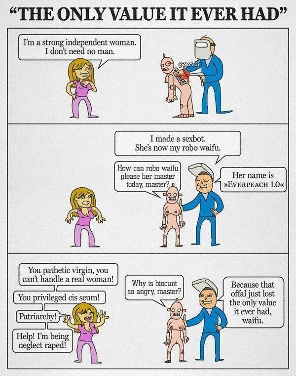
921526
921524
919244
916783
915526
915524
915354
915129
914037
909862
908811
908810
908500
908465
908464
908300
907963
907895
907477
902002
901301
901106
901105
901104
901024
901017
900393
900392
900391
900390
899038
898980
896844
896798
896797
895983
895850
895848
893740
893036
891671
891670
891336
891017
890865
889894
889741
889058
888157
887960
887768
886321
886306
885519
884948
883951
881340
881339
880491
878671
878351
877678